Town

Bromyard

Bromyard’s medieval survey reveals a town of varied trades under episcopal government. Centuries later a railway arrived in stages, carrying visitors and seasonal workers before its eventual closure.

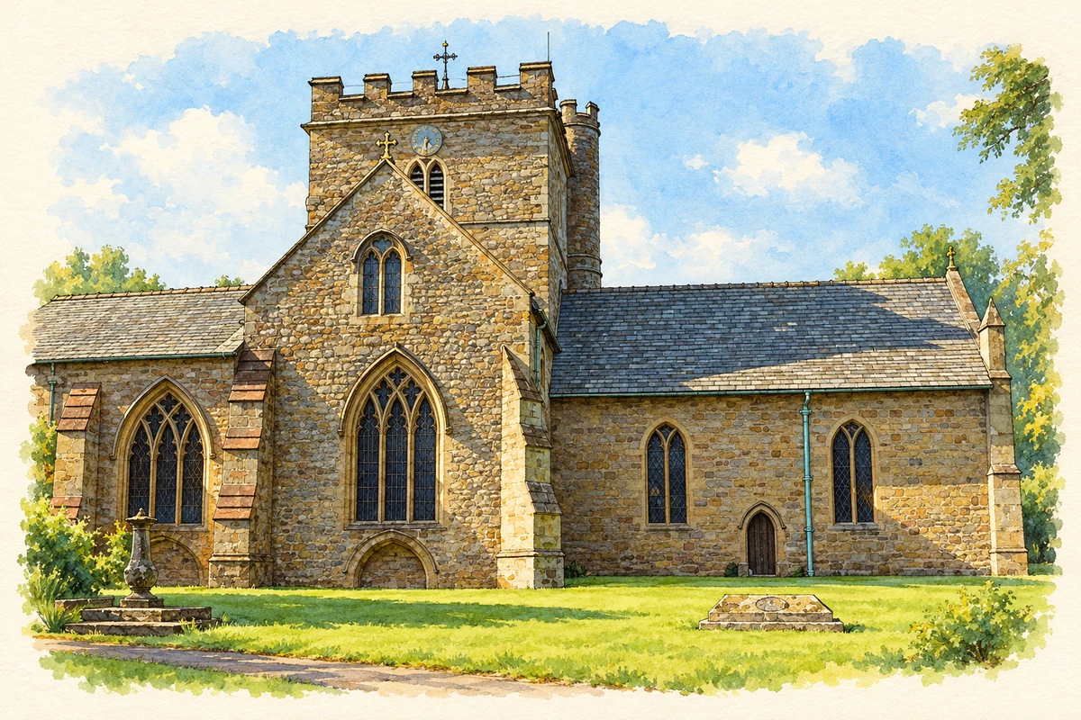
Watercolour and fine ink illustration of St Peter’s Church, Bromyard
Illustration · St Peter’s Church, Bromyard
History & heritage

Place & story

Church, palace and marketplace

Bromyard had an important minster church before 840. In the medieval town the marketplace stood by the principal entrance to the bishop’s palace, where tenants paid dues and courts met. Trade, estate management and justice were concentrated around the same point. [2]

The bishop appointed the bailiff, while a jury of twelve free burgesses formed the court. This was a particular form of local government, in which townspeople exercised responsibilities within the bishop’s lordship. The marketplace was consequently more than a setting for buying and selling. [2]

A working town in the Red Book

Around 1285 the Bishop of Hereford commissioned a survey of his property. Known as the Red Book from its binding, the Latin record listed tenants and rents for their burgage plots. It supplies a detailed view of streets, shops and occupations that a surviving building alone cannot provide. [2]

The council’s account of the survey identifies seven streets and a striking range of work: weaving, dyeing and blanket-making; leatherworking; milling, baking and butchery; and skilled metal trades including goldsmithing. A practitioner treating animals also appears. Bromyard’s medieval economy served practical needs as well as specialist customers, supported by a Monday market and two yearly fairs. [2]

Hopyards and the surrounding countryside

The bishop’s survey of 1577 supplies the first reference identified by the council to hop cultivation in the Bromyard district. Hops became a major crop of the surrounding countryside, where fields planted with them were called hopyards. The distinction between district and town matters: these were agricultural landscapes whose growers and workers used Bromyard as a centre. [4]

The council’s agricultural history records 4,251 acres of hops in the district in 1835. Blight, excessive production and overseas competition made the trade uncertain, and the area under cultivation later declined. Moving the crop to customers was also expensive before better transport, giving the railway’s eventual arrival a significance beyond passenger journeys. [4] [3]

The workhouse: relief and separation

On the road east towards Bromyard Downs, a new Union workhouse was built in 1836 for up to 120 inmates. Architect George Wilkinson also designed workhouses in several other Herefordshire towns. The Poor Law Commissioners authorised £3,000 for Bromyard’s building, making organised poor relief a substantial local construction project. [5]

An entrance wing stood before four accommodation wings arranged around a central corridor. This cruciform plan separated different categories of inmate. The building’s organisation expressed the system’s approach to relief, while the elected Board of Guardians—35 members representing 33 parishes—linked its operation to a much larger area than Bromyard itself. [5]

A smallpox outbreak in 1893 led to the conversion of a cottage at Burley, half a mile away, into an isolation hospital. The workhouse later became Bromyard Hospital and subsequently private flats. Its succession of uses preserves a history of poverty, public health and housing alongside the more visible story of markets and transport. [5]

Building the railway in stages

Royal assent for the Worcester, Bromyard and Leominster railway came on 1 August 1861. The planned single line was intended to connect the Worcester side with Leominster through Bromyard, but finance, land acquisition and construction problems delayed the undertaking for years. The full route was not completed until 1897. [3]

Bromyard celebrated the opening from Worcester on 22 October 1877. Buildings were decorated with flags, church bells rang and the Rifle Volunteers’ band played; a luncheon and evening fireworks marked the occasion. The Great Western Railway supplied rolling stock and worked the service. The elaborate welcome reflected the arrival of a connection long in preparation. [3]

The missing connection from Leominster reached Bromyard on 1 September 1897. Railway traffic included people attending Bromyard Races and seasonal hop-pickers seeking September work. The line linked local farming and leisure with people travelling into the district, rather than serving the town’s permanent residents alone. [3]

Withdrawal and the final journeys

After the Second World War the Leominster–Bromyard service declined, and regular trains on that section ended in 1952. A special excursion traversed the route on 26 April 1958 before the track was removed. The Worcester–Bromyard section survived until 1964, so the railway disappeared in stages much as it had arrived. [3]

Back to contents
A chronology

Timeline

Milestones

  1. Before 840: Bromyard has an important minster church. [2]

  2. Around 1285: The bishop’s Red Book surveys tenants, rents and trades. [2]

  3. 1577: A survey records hop-growing in the Bromyard district. [4]

  4. 1836: Bromyard Union Workhouse is built. [5]

  5. 1 August 1861: The proposed railway receives royal assent. [3]

  6. 22 October 1877: The railway from Worcester opens at Bromyard. [3]

  7. 1893: A smallpox outbreak prompts provision of an isolation hospital at Burley. [5]

  8. 1 September 1897: The connection from Leominster reaches Bromyard. [3]

  9. 1952: Regular trains between Leominster and Bromyard end. [3]

  10. 1964: The Worcester–Bromyard section closes. [3]

Back to contents

Population over time

Built-up area · Settlement · Census 2021

Bromyard

3,815people · 2021

Census 2021 population of the named settlement, using ONS built-up area boundaries.

Published census counts.

Sources: ONS: Towns and cities, characteristics of built-up areas, Census 2021 (Table 1c)

View population figures
Bromyard — census population
Census yearPopulation
20213,815
Sources and how to read this chart

Usual residents on 21 March 2021; published ONS count rounded to the nearest 5.. Boundary geography: December 2022 (E63003507).

Census 2021 population of the named settlement, using ONS built-up area boundaries.

ONS Table 1c rounds counts to the nearest 5 and suppresses counts below 10. Matched by exact settlement name or individually reviewed district-qualified name, with its coordinate strictly inside that same official BUA boundary. The 2022 BUA geography changed methodology and cannot be directly compared with 2011 BUAs. Contains OS data © Crown copyright and database right 2026. Contains National Statistics data © Crown copyright and database right 2026.

Source: ONS: Towns and cities, characteristics of built-up areas, Census 2021 (Table 1c). Open Government Licence v3.0. Retrieved 2026-10-26. Source: ONS and Ordnance Survey: Built Up Areas December 2022 GB BGG. Open Government Licence v3.0. Retrieved 2026-10-26.

Neighbourhood census context

These figures describe statistical neighbourhoods, which may cover part of a place or include neighbouring places.

Neighbourhood census area · 1971–2021

Herefordshire 005

Population of the area containing the recorded point for Bromyard, not the whole place. This area may cover part of the place or include neighbours.

05k10k15k20k1971: 7,476 people19711981: 8,361 people19811991: 9,025 people19912001: 10,154 people20012011: 10,338 people20112021: 10,681 people2021

Includes harmonised historical census estimates.

Sources: ONS · Paul Norman

View population figures
Herefordshire 005 — census population and harmonised historical estimates
Census yearPopulation
19717,476
19818,361
19919,025
200110,154
201110,338
202110,681
Sources and how to read this chart

Usual residents of the containing MSOA; this is local area context, not the population of the named settlement.. Boundary geography: 1 April 2022 (E02002909).

2011 and 2021 census counts harmonised by ONS to the same 1 April 2022 geography. Location matched to ONS 2021 MSOA polygons (full resolution, coastline clipped, V7). ONS exact-fit lookup marks this MSOA unchanged from 2011 (U); historical estimates use that same footprint.

1971–2011: Paul Norman harmonised historical estimates on 2011 MSOAs, rounded to whole residents (1971–1991 are modelled). 2021: ONS census count. The historical 2011 total can differ slightly from the ONS change-over-time 2011 total because of methodology and statistical disclosure controls. These are area estimates, not settlement totals.

Source: ONS Census change over time: usual resident population, 2011 and 2021. Open Government Licence v3.0. Retrieved 2026-10-26. Source: ONS MSOA December 2021 boundaries EW BFC V7. Open Government Licence v3.0. Retrieved 2026-10-26. Source: Paul Norman — Area characteristics: Great Britain 1971 to 2011. Creative Commons Attribution 4.0. Retrieved 2026-10-26. Source: ONS MSOA 2011 to MSOA 2021 exact-fit lookup for England and Wales. Open Government Licence v3.0. Retrieved 2026-10-26.

Recorded locationBromyard52.18932° N · 2.50750° WInteractive map loads when this area enters view.
Approximate recorded location · Geographic source

Geographic context

Place type
Town
Country / region
England · West Midlands
County group
Herefordshire
Current administration
County of Herefordshire
Recorded coordinates
52.18932, -2.50750
OS Open Names ID
osgb4000000074568000

County groups are browsing aids. Current administrative and historic areas are recorded separately.

Recorded names

  • Bromyard · en · official

Nearby heritage

Explore recorded heritage in Bromyard and the surrounding area. This selection is based on proximity to a recorded settlement point; it is not a complete inventory or evidence that a site lies within the settlement or belongs to its history.

Heritage locationsBromyard & surrounding areaInteractive map loads when this area enters view. Source records are listed below.

Numbered markers match the source records below. Locations are recorded reference points, not site boundaries.

  1. 32, HIGH STREET · Listed building
  2. QUEEN'S ARMS INN · Listed building
  3. 34 AND 36, HIGH STREET · Listed building
  4. 35, HIGH STREET · Listed building
  5. Nos. 23 and 27 High Street · Listed building
  6. 37 AND 39, HIGH STREET · Listed building
  7. NATWEST BANK · Listed building
  8. 41 AND 43, HIGH STREET · Listed building

Sources & further reading

  1. OS Open Names October 2026 · Source licence.
  2. Bromyard · Herefordshire Council
  3. The Worcester, Bromyard and Leominster railway · Herefordshire Council / Miranda Greene
  4. Hops in Herefordshire · Herefordshire Council / Miranda Greene
  5. Bromyard Union Workhouse, HER 30566 · Herefordshire Council / Miranda Greene
  6. Illustration of St Peter’s Church, Bromyard, adapted from St Peter's Church, Bromyard by Derek Harper. CC BY-SA 2.0. AI-assisted watercolour and fine ink adaptation; simplified fine detail and removal of incidental clutter.

Geographic source retrieved 2026-10-26. History last researched 2026-10-26. How this page was prepared.