Town

Kington

Kington’s history connects uncertain castle earthworks, livestock journeys, endowed education and the gardens on the slopes towards Hergest Ridge.

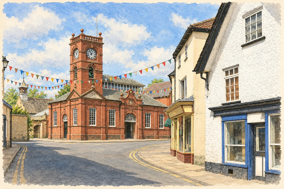
Watercolour and fine ink illustration of Kington town centre
Illustration · Kington town centre
History & heritage

Place & story

A border town and a difficult castle

The River Arrow passes through Kington, a Herefordshire town close to the Welsh border. Its museum connects the town with drovers bringing livestock out of mid Wales towards Birmingham and London. Inns and places to pen animals served travellers whose journeys linked the uplands to distant markets. [3]

On Castle Hill beside Back Brook, artificially steepened slopes and slight earthworks suggest an earlier fortified site. Herefordshire’s archaeological record warns that its poor condition makes identification uncertain. The historical account associates a castle with an honour created for Adam de Port under Henry I; after rebellion, the lordship passed to William de Braose and its centre moved to Huntington. [2]

Land supporting a school

Lady Margaret Hawkins’s bequest provided for a free school at Kington. Her executor Anthony Lewis bought School Farm at Upper Hergest in 1622 to generate income, then contracted John Abel to build in Old Kington. Rural rents supported a purpose-built classroom. [4]

The school opened on 29 September 1632 with 62 pupils. Free admission covered boys from named parishes, including Michaelchurch in Radnorshire; others could pay fees. Its district crossed the county boundary but excluded girls. Foundress’ Day retained a connection with the nearby church. [4]

The surviving sandstone school building is attributed to Abel by Historic England. Its seventeenth-century core was substantially altered in 1907, when the roof was rebuilt, windows raised and an eastern wing added. The building records the expansion of an institution rather than an untouched survival from its foundation. [5]

Banking, collecting and the garden landscape

The Banks family’s landscape west of Kington linked professional wealth with scientific interests. Richard Banks arrived in 1814 to join a legal practice. His son Richard William inherited banking interests and Ridgebourne, planted exotic trees, and pursued geology and archaeology. William Hartland Banks and Dorothy Alford began Hergest Croft in 1895. [6]

The gardens combined formal spaces near the house with woodland planting. Purchases from Veitch’s nursery brought Himalayan and western Chinese introductions; Park Wood became part of the collection after its purchase in 1912. Head gardener George James managed the grounds from 1923 to 1954. This was skilled, sustained work by gardeners as well as a family collecting project. [6]

Collecting the town’s everyday history

Kington Museum opened in June 1986 in the former stables of the King’s Head Inn. Its changing displays cover farming, milling, the school, wartime experience and clocks. Volunteer work, grants and fundraising have expanded the museum, making an old service building a place for preserving the occupations and households of Kington and its surrounding district. [7]

Back to contents
Lives connected to this place

Notable people

Margaret Hawkins: an educational bequest

Margaret Hawkins’s local legacy is the school funded through her will. She was the widow of Sir John Hawkins, whose career included the trafficking of enslaved Africans, as the school’s own history acknowledges. The surviving foundation connects local educational philanthropy with a family whose wealth and national prominence require that wider context. [4] [5]

William and Dorothy Banks: making Hergest Croft

William Hartland Banks and Dorothy Alford jointly began the house and planting at Hergest Croft in 1895. Their connection is to an estate on Kington’s western side, rather than to a public garden originally created by the town. Successive generations and professional gardeners continued its development. [6]

Back to contents
A chronology

Timeline

Kington through time

  1. 1622 — School Farm at Upper Hergest is bought to support the proposed free school. [4]

  2. 29 September 1632 — Lady Hawkins’ School opens. [4]

  3. 1814 — Richard Banks comes to Kington and joins a legal practice. [6]

  4. 1895 — Building and planting begin at Hergest Croft. [6]

  5. 1907 — The old school building is enlarged and remodelled. [5]

  6. June 1986 — Kington Museum opens in the former inn stables. [7]

Back to contents

Population over time

Built-up area · Settlement · Census 2021

Kington

2,425people · 2021

Census 2021 population of the named settlement, using ONS built-up area boundaries.

Published census counts.

Sources: ONS: Towns and cities, characteristics of built-up areas, Census 2021 (Table 1c)

View population figures
Kington — census population
Census yearPopulation
20212,425
Sources and how to read this chart

Usual residents on 21 March 2021; published ONS count rounded to the nearest 5.. Boundary geography: December 2022 (E63003470).

Census 2021 population of the named settlement, using ONS built-up area boundaries.

ONS Table 1c rounds counts to the nearest 5 and suppresses counts below 10. Matched by exact settlement name or individually reviewed district-qualified name, with its coordinate strictly inside that same official BUA boundary. The 2022 BUA geography changed methodology and cannot be directly compared with 2011 BUAs. Contains OS data © Crown copyright and database right 2026. Contains National Statistics data © Crown copyright and database right 2026.

Source: ONS: Towns and cities, characteristics of built-up areas, Census 2021 (Table 1c). Open Government Licence v3.0. Retrieved 2026-10-26. Source: ONS and Ordnance Survey: Built Up Areas December 2022 GB BGG. Open Government Licence v3.0. Retrieved 2026-10-26.

Neighbourhood census context

These figures describe statistical neighbourhoods, which may cover part of a place or include neighbouring places.

Neighbourhood census area · 1971–2021

Herefordshire 006

Population of the area containing the recorded point for Kington, not the whole place. This area may cover part of the place or include neighbours.

02k4k6k8k1971: 6,716 people19711981: 6,893 people19811991: 7,044 people19912001: 7,807 people20012011: 7,875 people20112021: 7,850 people2021

Includes harmonised historical census estimates.

Sources: ONS · Paul Norman

View population figures
Herefordshire 006 — census population and harmonised historical estimates
Census yearPopulation
19716,716
19816,893
19917,044
20017,807
20117,875
20217,850
Sources and how to read this chart

Usual residents of the containing MSOA; this is local area context, not the population of the named settlement.. Boundary geography: 1 April 2022 (E02002910).

2011 and 2021 census counts harmonised by ONS to the same 1 April 2022 geography. Location matched to ONS 2021 MSOA polygons (full resolution, coastline clipped, V7). ONS exact-fit lookup marks this MSOA unchanged from 2011 (U); historical estimates use that same footprint.

1971–2011: Paul Norman harmonised historical estimates on 2011 MSOAs, rounded to whole residents (1971–1991 are modelled). 2021: ONS census count. The historical 2011 total can differ slightly from the ONS change-over-time 2011 total because of methodology and statistical disclosure controls. These are area estimates, not settlement totals.

Source: ONS Census change over time: usual resident population, 2011 and 2021. Open Government Licence v3.0. Retrieved 2026-10-26. Source: ONS MSOA December 2021 boundaries EW BFC V7. Open Government Licence v3.0. Retrieved 2026-10-26. Source: Paul Norman — Area characteristics: Great Britain 1971 to 2011. Creative Commons Attribution 4.0. Retrieved 2026-10-26. Source: ONS MSOA 2011 to MSOA 2021 exact-fit lookup for England and Wales. Open Government Licence v3.0. Retrieved 2026-10-26.

Recorded locationKington52.20378° N · 3.02895° WInteractive map loads when this area enters view.
Approximate recorded location · Geographic source

Geographic context

Place type
Town
Country / region
England · West Midlands
County group
Herefordshire
Current administration
County of Herefordshire
Recorded coordinates
52.20378, -3.02895
OS Open Names ID
osgb4000000074560359

County groups are browsing aids. Current administrative and historic areas are recorded separately.

Recorded names

  • Kington · en · official

Nearby heritage

Distances are from the recorded place point. Proximity does not establish that a site lies within the place boundary or belongs to its history.

Sources & further reading

  1. OS Open Names October 2026 · Source licence.
  2. Kington: mound · Herefordshire Council
  3. Kington’s History · Kington Museum
  4. School History · Lady Hawkins’ School
  5. Lady Hawkins School, list entry 1297585 · Historic England
  6. Hergest Croft, register entry 1000885 · Historic England
  7. Kington Museum · Kington Museum
  8. Illustration of Kington town centre, adapted from Kington Town Centre - geograph.org.uk - 4714641.jpg by Des Blenkinsopp. CC BY-SA 2.0. AI-assisted watercolour and fine ink adaptation; cream paper margins, simplified fine detail and removal of incidental street clutter.

Geographic source retrieved 2026-10-26. History last researched 2026-10-27. How this page was prepared.