Town

Ledbury

Ledbury’s timber buildings record commerce and civic ambition; a former canal route and John Masefield’s writing reveal a town that continued to change.

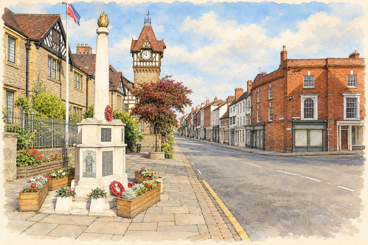
Watercolour and fine ink illustration of Ledbury town centre
Illustration · Ledbury town centre
History & heritage

Place & story

A market town built in long plots

The bishops of Hereford shaped Ledbury’s medieval layout, setting out burgage plots along the High Street and the Homend. Long, narrow holdings accommodated the activities of a trading town; traces remain on the east side of the High Street. St Katharine’s Hospital brought another purpose to the centre, offering care and hospitality to people in need and to travellers. [3]

Cloth and leather working revived in the late sixteenth century, helping to support substantial timber-framed houses. As the wool trade declined in the early eighteenth century, agriculture became more prominent in local commerce. The handsome street frontage belonged to a changing economy, rather than to a town whose work remained fixed across the centuries. [3]

Building the Market House

John Phillips, a local trader, raised subscriptions to clear a row of shops from the marketplace. Work on the replacement Market House began in 1617. Raised on sixteen posts, it provided covered trading space and an upper floor. Completion came only in 1668, after Phillips’s death, when trustees diverted charitable clothing legacies while promising to fund clothing from future profits. [2]

The building continued to change. Its upper rooms stored commodities including corn, wool and hops; Victorian work introduced much of the staircase, flooring and windows seen later. In 2006 repairs required the structure to be lifted while damaged post bases were strengthened. The familiar outline conceals a long history of adaptation and difficult maintenance. [2]

Pictures behind the wallpaper

Restoration at the town council offices in 1988 uncovered painted plaster beneath later wall coverings. Specialists removed the accumulated layers, revealing floral designs resembling knot gardens and biblical texts near the ceiling. The council dates the paintings to the 1560s or 1570s. They offer a glimpse of decorative ambition indoors, complementing the timber frames visible in the streets. [4]

The room’s original function is less certain. The council suggests that the building may have been the New Booth Hall, with an upper court room, but acknowledges that early records have not been found. The paintings can be described confidently without turning that possible identification into an established fact. [4]

Transport and the remembered town

The route now used by the Ledbury Town Trail carried a canal during Masefield’s childhood. In the 1880s it was filled and replaced by the railway towards Newent. The council’s literary project follows this change through his works: the canal appears in The Box of Delights and The Everlasting Mercy, while a railway brings employment in The Widow in the Bye Street. [5]

Back to contents
Lives connected to this place

Notable people

John Masefield: a childhood carried into writing

John Masefield was born in Ledbury on 1 June 1878 and became Poet Laureate in 1930. His later career took him far from Herefordshire, including service at sea and work in America. His local connection is also preserved institutionally: the John Masefield Society, founded in Ledbury in 1992, holds its library and archive in the Master’s House. [6] [7]

John Phillips: organising a civic undertaking

Phillips’s contribution was practical as well as financial. By collecting subscriptions and acquiring the shop row, he began the project that became Ledbury’s most recognisable market building. He died in 1655 with the work unfinished; its eventual completion depended on trustees and the management of charitable resources. [2]

Back to contents
A chronology

Timeline

Ledbury through time

  1. 1617 — Construction begins on the Market House. [2]

  2. 1668 — Trustees complete the Market House. [2]

  3. 1 June 1878 — John Masefield is born in Ledbury. [6]

  4. 1880s — A railway replaces the canal route towards Newent. [5]

  5. 1988 — Restoration reveals the Painted Room’s wall decoration. [4]

  6. 1992 — The John Masefield Society is founded in Ledbury. [7]

  7. 2006 — The Market House is lifted for repairs to its supports. [2]

Back to contents

Population over time

Built-up area · Settlement · Census 2021

Ledbury

8,345people · 2021

Census 2021 population of the named settlement, using ONS built-up area boundaries.

Published census counts.

Sources: ONS: Towns and cities, characteristics of built-up areas, Census 2021 (Table 1c)

View population figures
Ledbury — census population
Census yearPopulation
20218,345
Sources and how to read this chart

Usual residents on 21 March 2021; published ONS count rounded to the nearest 5.. Boundary geography: December 2022 (E63003888).

Census 2021 population of the named settlement, using ONS built-up area boundaries.

ONS Table 1c rounds counts to the nearest 5 and suppresses counts below 10. Matched by exact settlement name or individually reviewed district-qualified name, with its coordinate strictly inside that same official BUA boundary. The 2022 BUA geography changed methodology and cannot be directly compared with 2011 BUAs. Contains OS data © Crown copyright and database right 2026. Contains National Statistics data © Crown copyright and database right 2026.

Source: ONS: Towns and cities, characteristics of built-up areas, Census 2021 (Table 1c). Open Government Licence v3.0. Retrieved 2026-10-26. Source: ONS and Ordnance Survey: Built Up Areas December 2022 GB BGG. Open Government Licence v3.0. Retrieved 2026-10-26.

Neighbourhood census context

These figures describe statistical neighbourhoods, which may cover part of a place or include neighbouring places.

Neighbourhood census area · 1971–2021

Herefordshire 019

Population of the area containing the recorded point for Ledbury, not the whole place. This area may cover part of the place or include neighbours.

02.5k5k7.5k10k1971: 5,001 people19711981: 6,505 people19811991: 6,892 people19912001: 9,209 people20012011: 9,628 people20112021: 9,439 people2021

Includes harmonised historical census estimates.

Sources: ONS · Paul Norman

View population figures
Herefordshire 019 — census population and harmonised historical estimates
Census yearPopulation
19715,001
19816,505
19916,892
20019,209
20119,628
20219,439
Sources and how to read this chart

Usual residents of the containing MSOA; this is local area context, not the population of the named settlement.. Boundary geography: 1 April 2022 (E02002923).

2011 and 2021 census counts harmonised by ONS to the same 1 April 2022 geography. Location matched to ONS 2021 MSOA polygons (full resolution, coastline clipped, V7). ONS exact-fit lookup marks this MSOA unchanged from 2011 (U); historical estimates use that same footprint.

1971–2011: Paul Norman harmonised historical estimates on 2011 MSOAs, rounded to whole residents (1971–1991 are modelled). 2021: ONS census count. The historical 2011 total can differ slightly from the ONS change-over-time 2011 total because of methodology and statistical disclosure controls. These are area estimates, not settlement totals.

Source: ONS Census change over time: usual resident population, 2011 and 2021. Open Government Licence v3.0. Retrieved 2026-10-26. Source: ONS MSOA December 2021 boundaries EW BFC V7. Open Government Licence v3.0. Retrieved 2026-10-26. Source: Paul Norman — Area characteristics: Great Britain 1971 to 2011. Creative Commons Attribution 4.0. Retrieved 2026-10-26. Source: ONS MSOA 2011 to MSOA 2021 exact-fit lookup for England and Wales. Open Government Licence v3.0. Retrieved 2026-10-26.

Recorded locationLedbury52.03581° N · 2.42234° WInteractive map loads when this area enters view.
Approximate recorded location · Geographic source

Geographic context

Place type
Town
Country / region
England · West Midlands
County group
Herefordshire
Current administration
County of Herefordshire
Recorded coordinates
52.03581, -2.42234
OS Open Names ID
osgb4000000074579830

County groups are browsing aids. Current administrative and historic areas are recorded separately.

Recorded names

  • Ledbury · en · official

Nearby heritage

Distances are from the recorded place point. Proximity does not establish that a site lies within the place boundary or belongs to its history.

Sources & further reading

  1. OS Open Names October 2026 · Source licence.
  2. Ledbury Market House · Ledbury Town Council
  3. Ledbury Town Plan, historical introduction · Ledbury Town Council
  4. 16th Century Painted Room · Ledbury Town Council
  5. Masefield Matters Blog: The Ledbury Scene, Part 2 · Ledbury Town Council
  6. John Masefield · Westminster Abbey
  7. John Masefield Society · The Master’s House
  8. Illustration of Ledbury town centre, adapted from Centre of Ledbury - geograph.org.uk - 7301138.jpg by Philip Halling. CC BY-SA 2.0. AI-assisted watercolour and fine ink adaptation; cream paper margins, simplified fine detail and removal of incidental street clutter.

Geographic source retrieved 2026-10-26. History last researched 2026-10-27. How this page was prepared.