Town

Leominster

Leominster grew around a religious estate and a market, drawing wealth from wool, leather and cloth. Its surviving priory church, relocated market house and museum collections reveal changes in worship, trade and the skills of local people.

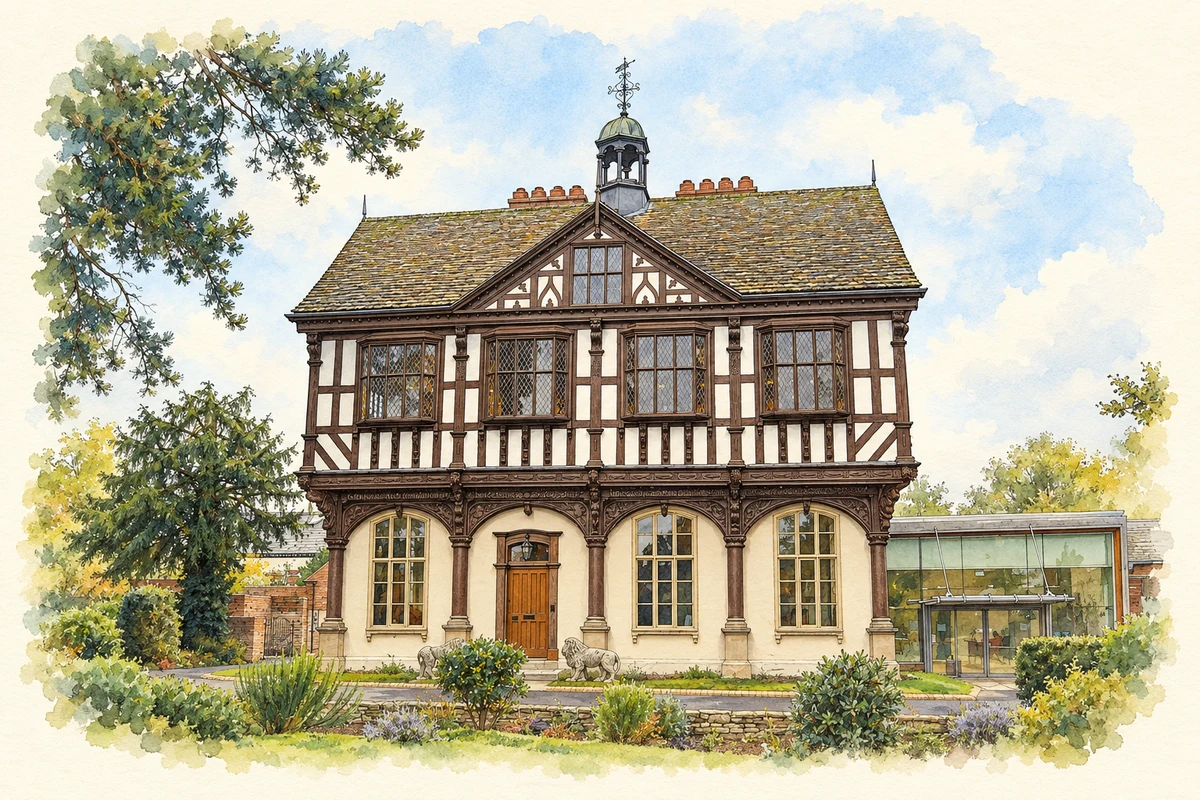
Watercolour and fine ink illustration of Grange Court, Leominster
Illustration · Grange Court, Leominster
History & heritage

Place & story

A religious estate and a new borough

Henry I refounded Leominster’s monastery in 1125 and made it a dependency of Reading Abbey. The town developed beside its precinct, with a market close to the gates. Monastery and market occupied neighbouring sites. [2] [3]

The market’s success created competition with Hereford. The council’s medieval history records a change of market day from Saturday to Friday and the suppression of the Michaelmas fair in 1281 because it challenged Hereford’s own fair. Urban prosperity depended partly on rights that could be contested or withdrawn, as well as on the goods being offered for sale. [3]

Wool, leather and the work behind the market

Leominster became associated with fine wool from Ryeland sheep, known as “Leominster Ore”. That reputation belonged to the surrounding pastoral economy as well as the town’s market. The name Ryelands Road preserves the connection, but the significance lay in a valuable raw material that linked farmers, dealers and the people who prepared fibres for manufacture. [4] [2]

By the early seventeenth century local guilds represented fullers, dyers, glovers, shoemakers and tanners. Wool and cloth were therefore part of a wider group of trades, including leather working. At county level, the council’s industrial history records a later shift towards sending raw wool to manufacturing districts elsewhere. A reputation for fine fleece did not guarantee that every stage of production would remain in Leominster. [5]

One church, different communities

The surviving priory church records the distinction between monastery and parish. Townspeople initially used the Norman nave, but a separate parish nave to its south was consecrated in 1239. When the monastery surrendered in 1539, the monastic buildings were demolished and materials sold, while the parish church survived. Continued local worship helped preserve part of a much larger religious complex. [2]

The church continued to change after the Dissolution. Fire destroyed much of its earlier decoration, and Victorian restoration under George Gilbert Scott removed galleries and introduced a new arcade. Its surviving medieval sculpture and paintings need to be read alongside these later alterations. The building’s continuity rests on repeated decisions about use and repair, rather than on an interior left untouched since the Middle Ages. [2]

A market house that moved

John Abel’s market house of 1633 originally stood at the top of Broad Street. Its open ground floor sheltered trade beneath a jettied upper level; carved brackets, braces and inscriptions made practical timber construction richly decorative. Butter, eggs, fruit and chickens were sold here. The building, now known as Grange Court, gave ordinary produce a conspicuous civic setting. [6] [8]

By the middle of the nineteenth century the market house obstructed traffic. It was dismantled, stored and rebuilt beside the Grange as a family home, with the open trading floor enclosed. Council acquisition in 1939 prevented a further removal from the town. A later restoration and transfer to LARC Development Trust in 2013 gave it a community and enterprise role. Survival meant relocation and adaptation, with visible consequences for the building. [6] [8]

An experiment in mechanisation

The museum’s small wool-carding machine explains a preparatory stage in textile work: fibres were cleaned and untangled into a web ready for spinning. Its interpretation also identifies a local experiment on a larger scale. Daniel Bourn patented a cotton-carding machine in 1748 and probably used it in his Leominster cotton mill, which burned down in 1754. The museum retains that qualification: the patent is documented, while the machine’s actual use at the mill is less certain. [9]

Collecting the evidence of a local artist

Leominster Museum preserves a self-portrait, sketchbook and watercolours by John Scarlett Davis. This is more than a collection of finished pictures: sketches and studies allow visitors to follow an artist trying out subjects and techniques. The museum credits earlier volunteers with bringing together a substantial body of his work in his home town, joining a local childhood to a career pursued largely elsewhere. [10]

Back to contents
Lives connected to this place

Notable people

John Abel: a carpenter’s contribution to civic life

Abel’s connection with Leominster is the market house he built in 1633. Grange Court’s surviving frame and ornament make the skill of a named master carpenter visible in a building designed for communal use. Its later history also shows how his work could survive a change of site and function, rather than remaining dependent on its original market setting. [7] [8]

John Scarlett Davis: from Leominster to European galleries

Davis was born in Leominster in 1804 and moved to London for artistic training. He developed from portrait painting into a particular interest in architectural interiors, travelling through France, Germany, Italy and the Low Countries. He died in London in 1845. Drawings and paintings preserved in the town’s museum maintain a local connection with his wider career. [11] [10]

Mary Rudge: chess learned in a Leominster family

Rudge was born in Leominster in 1842, the daughter of physician Henry Rudge and his wife Eliza. Her father taught chess to her older sisters, who passed it on to her. She later moved to Bristol, where competitive opportunities helped her develop as a player. In 1897 she won the international women’s tournament in London. Her Leominster association belongs to family life and early learning; the achievement itself took place elsewhere. [12]

Back to contents
A chronology

Timeline

Leominster through time

  1. 1125 — Henry I refounds the monastery as a dependency of Reading Abbey. [2]

  2. 1239 — A separate parish nave is consecrated beside the Norman church. [2]

  3. 1281 — Leominster’s Michaelmas fair is suppressed after rivalry with Hereford. [3]

  4. 1539 — The monastery surrenders; parish worship continues in the surviving church. [2]

  5. 1633 — John Abel builds the town’s timber-framed market house. [7] [6]

  6. 1748 — Daniel Bourn patents a cotton-carding machine. [9]

  7. 1754 — Fire destroys Bourn’s Leominster mill. [9]

  8. 1939 — The council acquires Grange Court, preventing its removal from the town. [6]

  9. 2013 — Grange Court reopens with a community, enterprise and heritage role. [6]

Back to contents

Population over time

Built-up area · Settlement · Census 2021

Leominster

11,205people · 2021

Census 2021 population of the named settlement, using ONS built-up area boundaries.

Published census counts.

Sources: ONS: Towns and cities, characteristics of built-up areas, Census 2021 (Table 1c)

View population figures
Leominster — census population
Census yearPopulation
202111,205
Sources and how to read this chart

Usual residents on 21 March 2021; published ONS count rounded to the nearest 5.. Boundary geography: December 2022 (E63003426).

Census 2021 population of the named settlement, using ONS built-up area boundaries.

ONS Table 1c rounds counts to the nearest 5 and suppresses counts below 10. Matched by exact settlement name or individually reviewed district-qualified name, with its coordinate strictly inside that same official BUA boundary. The 2022 BUA geography changed methodology and cannot be directly compared with 2011 BUAs. Contains OS data © Crown copyright and database right 2026. Contains National Statistics data © Crown copyright and database right 2026.

Source: ONS: Towns and cities, characteristics of built-up areas, Census 2021 (Table 1c). Open Government Licence v3.0. Retrieved 2026-10-26. Source: ONS and Ordnance Survey: Built Up Areas December 2022 GB BGG. Open Government Licence v3.0. Retrieved 2026-10-26.

Neighbourhood census context

These figures describe statistical neighbourhoods, which may cover part of a place or include neighbouring places.

Neighbourhood census area · 1971–2021

Herefordshire 003

Population of the area containing the recorded point for Leominster, not the whole place. This area may cover part of the place or include neighbours.

01.8k3.5k5.3k7k1971: 5,382 people19711981: 5,032 people19811991: 5,054 people19912001: 5,449 people20012011: 5,914 people20112021: 6,287 people2021

Includes harmonised historical census estimates.

Sources: ONS · Paul Norman

View population figures
Herefordshire 003 — census population and harmonised historical estimates
Census yearPopulation
19715,382
19815,032
19915,054
20015,449
20115,914
20216,287
Sources and how to read this chart

Usual residents of the containing MSOA; this is local area context, not the population of the named settlement.. Boundary geography: 1 April 2022 (E02002907).

2011 and 2021 census counts harmonised by ONS to the same 1 April 2022 geography. Location matched to ONS 2021 MSOA polygons (full resolution, coastline clipped, V7). ONS exact-fit lookup marks this MSOA unchanged from 2011 (U); historical estimates use that same footprint.

1971–2011: Paul Norman harmonised historical estimates on 2011 MSOAs, rounded to whole residents (1971–1991 are modelled). 2021: ONS census count. The historical 2011 total can differ slightly from the ONS change-over-time 2011 total because of methodology and statistical disclosure controls. These are area estimates, not settlement totals.

Source: ONS Census change over time: usual resident population, 2011 and 2021. Open Government Licence v3.0. Retrieved 2026-10-26. Source: ONS MSOA December 2021 boundaries EW BFC V7. Open Government Licence v3.0. Retrieved 2026-10-26. Source: Paul Norman — Area characteristics: Great Britain 1971 to 2011. Creative Commons Attribution 4.0. Retrieved 2026-10-26. Source: ONS MSOA 2011 to MSOA 2021 exact-fit lookup for England and Wales. Open Government Licence v3.0. Retrieved 2026-10-26.

Recorded locationLeominster52.22720° N · 2.73883° WInteractive map loads when this area enters view.
Approximate recorded location · Geographic source

Geographic context

Place type
Town
Country / region
England · West Midlands
County group
Herefordshire
Current administration
County of Herefordshire
Recorded coordinates
52.22720, -2.73883
OS Open Names ID
osgb4000000074560143

County groups are browsing aids. Current administrative and historic areas are recorded separately.

Recorded names

  • Leominster · en · official

Nearby heritage

Explore recorded heritage in Leominster and the surrounding area. This selection is based on proximity to a recorded settlement point; it is not a complete inventory or evidence that a site lies within the settlement or belongs to its history.

Heritage locationsLeominster & surrounding areaInteractive map loads when this area enters view. Source records are listed below.

Numbered markers match the source records below. Locations are recorded reference points, not site boundaries.

  1. 26, HIGH STREET · Listed building
  2. 28, HIGH STREET · Listed building
  3. 22, HIGH STREET · Listed building
  4. 25 High Street · Listed building
  5. 35, HIGH STREET · Listed building
  6. NUMBER 30 R BRIGHT BUTCHERS AND OUTBUILDING AT REAR · Listed building
  7. 37 High Street · Listed building
  8. 23, 23A and 23B, High Street · Listed building

Sources & further reading

  1. OS Open Names October 2026 · Source licence.
  2. Our History · Leominster Priory
  3. Leominster: medieval borough · Herefordshire Council; Toria Forsyth-Moser
  4. Medieval Herefordshire · Herefordshire Council
  5. Seventeenth- and eighteenth-century Herefordshire · Herefordshire Council
  6. Grange Court Learning Policy · LARC Development Trust / Grange Court
  7. Grange Court · LARC Development Trust / Grange Court
  8. Grange Court: list entry 1077616 · Historic England
  9. Wool Carding Machine · Leominster Museum
  10. John Scarlett Davis · Government Art Collection
  11. Mary Rudge, 1842–1919 · Leominster Museum
  12. Illustration of Grange Court, Leominster, adapted from Grange Court, Leominster - 2013-11-15 - Andy Mabbett - 02.jpg by Andy Mabbett. CC BY-SA 3.0. AI-assisted watercolour and fine ink adaptation; cream paper margins, simplified fine detail and removal of incidental street clutter.

Geographic source retrieved 2026-10-26. History last researched 2026-10-26. How this page was prepared.