Village

Weobley

A former wool town preserves its trading streets in timber and its working lives in museum collections. Castle earthworks and two very different churches give Weobley a history beyond its black-and-white façades.

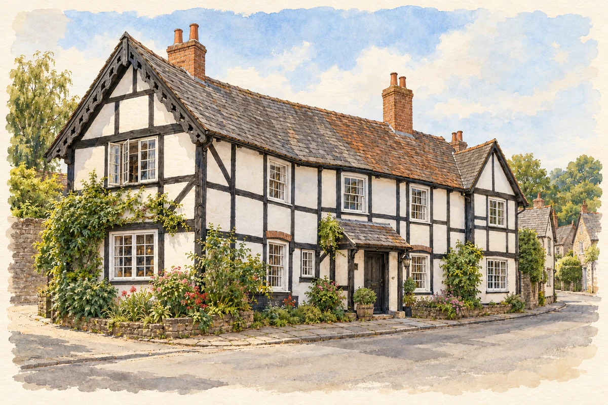
Watercolour and fine ink illustration of Ye Olde Salutation Inn, Weobley
Illustration · Ye Olde Salutation Inn, Weobley
Original illustration; researched sources
Research sources

Original architectural composition based on the cited building descriptions; incidental setting and fine details are interpretive.

Historic England: Salutation Inn; Herefordshire Council: Weobley circular walk

History & heritage

Place & story

A market written into the streets

Weobley’s medieval prosperity survives in the shape of its centre. A wedge-shaped marketplace and long burgage plots organised the town, while wool supported substantial building into the seventeenth century. Merchants’ hall houses, farmhouses and a school survive in different forms of timber construction. They belong to a working settlement, rather than a single episode of picturesque building. [3]

The village heritage trail connects those buildings with trades: wool, ale, glove making and nail making. Its interpretation asks visitors to imagine traders selling through windows onto the street. The surviving houses therefore record both the handling of agricultural products and the smaller crafts and services needed around a market. [4]

The centre has also lost buildings. A market hall stood at the south end of Broad Street until its demolition in the 1860s; another group of timber-framed houses around the marketplace burned in November 1943. The spaces between today’s buildings are part of the historical evidence too. [5]

A castle reduced to earth

South of the village, banks and ditches mark a castle associated with the de Lacy family. Herefordshire’s archaeological account places Geoffrey Talbot there in 1138, during the struggle between Stephen and Matilda, and dates Stephen’s successful siege to 1140. The stronghold tied a small town to a much wider contest for royal authority. [2]

Successive owners included the Verdons and Devereuxs. By the sixteenth century Leland described a castle in decay, and a lease of 1614 named its site without listing castle buildings. Today the damaged earthworks retain an oval bailey and deep defensive ditches; no standing masonry survives. Their irregular form also reflects later disturbance, including a wartime shelter. [2]

Churches and changing religious life

St Peter and St Paul preserves several centuries of building. Much of the church is thirteenth- and fourteenth-century, although its origins are Norman. A tall tower and spire dominate the village; the spire was rebuilt in 1675 and again in 1898. Inside, monuments to Sir William Devereux and Colonel Birch connect parish worship with the families and political figures of the surrounding district. [6]

St Thomas of Hereford represents another religious history. Built around 1834–35, the Catholic church was privately funded by the Monnington family of nearby Sarnesfield, soon after legal restrictions on Catholics had eased. Its modest architecture reflects the caution of early public Catholic worship. A schoolroom followed around 1850, and Belmont Abbey’s Benedictines took responsibility in 1923: church, education and clergy housing formed a compact rural institution. [7]

Keeping evidence of ordinary work

Weobley Museum occupies the former police-station and court site. Its collections bring together timber-framing, farming tools and objects from the workhouse, alongside a hot-water carrier used by servants at Garnstone Castle. Those objects widen the story beyond wealthy households to domestic service, agricultural labour and the administration of poverty. [8]

Garnstone’s vanished mansion is another reminder that preservation is selective. Herefordshire Council identifies the later house as a John Nash design built in 1807 and demolished in 1958. Household objects in the museum preserve evidence of life in a building whose scale and fabric can no longer be read on site. [5] [8]

Back to contents
Lives connected to this place

Notable people

Ella Mary Leather: listening to Herefordshire

Ella Mary Leather (1874–1928) was born near Dilwyn and moved to Weobley after marrying solicitor Francis Leather in 1893. Her connection was residence and research, rather than birth in the village. By 1904 she was recording local songs, supported by a network of informants. Ralph Vaughan Williams helped her obtain a phonograph in 1906, enabling tunes as well as words to be preserved. Their work treated the memories of local singers and storytellers as evidence worth collecting. [9]

Back to contents
A chronology

Timeline

Weobley through time

  1. 1138–40 — Geoffrey Talbot occupies the castle; Stephen subsequently captures it. [2]

  2. 1614 — A lease names the castle site without describing surviving castle buildings. [2]

  3. Around 1834–35 — St Thomas of Hereford’s Catholic church is built. [7]

  4. 1860s — The market hall is demolished. [5]

  5. 1893 — Ella Mary Leather moves to Weobley after her marriage. [9]

  6. November 1943 — Fire destroys timber-framed houses by the marketplace. [5]

  7. 1958 — Garnstone’s Nash-designed mansion is demolished. [5]

Back to contents

Population over time

Built-up area · Settlement · Census 2021

Weobley

1,275people · 2021

Census 2021 population of the named settlement, using ONS built-up area boundaries.

Published census counts.

Sources: ONS: Towns and cities, characteristics of built-up areas, Census 2021 (Table 1c)

View population figures
Weobley — census population
Census yearPopulation
20211,275
Sources and how to read this chart

Usual residents on 21 March 2021; published ONS count rounded to the nearest 5.. Boundary geography: December 2022 (E63003569).

Census 2021 population of the named settlement, using ONS built-up area boundaries.

ONS Table 1c rounds counts to the nearest 5 and suppresses counts below 10. Matched by exact settlement name or individually reviewed district-qualified name, with its coordinate strictly inside that same official BUA boundary. The 2022 BUA geography changed methodology and cannot be directly compared with 2011 BUAs. Contains OS data © Crown copyright and database right 2026. Contains National Statistics data © Crown copyright and database right 2026.

Source: ONS: Towns and cities, characteristics of built-up areas, Census 2021 (Table 1c). Open Government Licence v3.0. Retrieved 2026-10-26. Source: ONS and Ordnance Survey: Built Up Areas December 2022 GB BGG. Open Government Licence v3.0. Retrieved 2026-10-26.

Neighbourhood census context

These figures describe statistical neighbourhoods, which may cover part of a place or include neighbouring places.

Neighbourhood census area · 1971–2021

Herefordshire 007

Population of the area containing the recorded point for Weobley, not the whole place. This area may cover part of the place or include neighbours.

02.5k5k7.5k10k1971: 9,024 people19711981: 8,201 people19811991: 8,065 people19912001: 8,990 people20012011: 9,417 people20112021: 9,585 people2021

Includes harmonised historical census estimates.

Sources: ONS · Paul Norman

View population figures
Herefordshire 007 — census population and harmonised historical estimates
Census yearPopulation
19719,024
19818,201
19918,065
20018,990
20119,417
20219,585
Sources and how to read this chart

Usual residents of the containing MSOA; this is local area context, not the population of the named settlement.. Boundary geography: 1 April 2022 (E02002911).

2011 and 2021 census counts harmonised by ONS to the same 1 April 2022 geography. Location matched to ONS 2021 MSOA polygons (full resolution, coastline clipped, V7). ONS exact-fit lookup marks this MSOA unchanged from 2011 (U); historical estimates use that same footprint.

1971–2011: Paul Norman harmonised historical estimates on 2011 MSOAs, rounded to whole residents (1971–1991 are modelled). 2021: ONS census count. The historical 2011 total can differ slightly from the ONS change-over-time 2011 total because of methodology and statistical disclosure controls. These are area estimates, not settlement totals.

Source: ONS Census change over time: usual resident population, 2011 and 2021. Open Government Licence v3.0. Retrieved 2026-10-26. Source: ONS MSOA December 2021 boundaries EW BFC V7. Open Government Licence v3.0. Retrieved 2026-10-26. Source: Paul Norman — Area characteristics: Great Britain 1971 to 2011. Creative Commons Attribution 4.0. Retrieved 2026-10-26. Source: ONS MSOA 2011 to MSOA 2021 exact-fit lookup for England and Wales. Open Government Licence v3.0. Retrieved 2026-10-26.

Recorded locationWeobley52.15895° N · 2.87450° WInteractive map loads when this area enters view.
Approximate recorded location · Geographic source

Geographic context

Place type
Village
Country / region
England · West Midlands
County group
Herefordshire
Current administration
County of Herefordshire
Recorded coordinates
52.15895, -2.87450
OS Open Names ID
osgb4000000074563166

County groups are browsing aids. Current administrative and historic areas are recorded separately.

Recorded names

  • Weobley · en · official

Nearby heritage

Distances are from the recorded place point. Proximity does not establish that a site lies within the place boundary or belongs to its history.

Sources & further reading

  1. OS Open Names October 2026 · Source licence.
  2. Weobley Castle · Herefordshire Council
  3. Weobley Conservation Area Appraisal, June 2006 · Herefordshire Council
  4. Visiting Weobley: heritage trail · Weobley village website
  5. Weobley circular walk · Herefordshire Council
  6. St Peter & St Paul, Weobley · National Churches Trust / parish contribution
  7. Roman Catholic Church of St Thomas of Hereford and attached Presbytery, 1081906 · Historic England
  8. Weobley Museum · Weobley & District Local History Society
  9. Sharing Our Songs and Stories · Leominster Museum
  10. Original illustration of Ye Olde Salutation Inn, Weobley by PlaceHistory. Researched sources are linked beneath the illustration. Original composition from inspected architectural facts; no source photograph copied or used as an image-edit input. Fine detail is interpretive, not a measured survey.

Geographic source retrieved 2026-10-26. History last researched 2026-10-27. How this page was prepared.