Town

Bishop's Castle

A market town beneath a vanished bishop’s fortress preserves its civic history in streets, public buildings and volunteer museums.

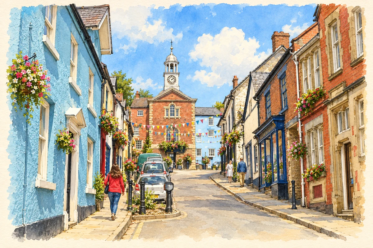
Watercolour and fine ink illustration of Bishop's Castle Town Hall and High Street
Illustration · Bishop's Castle Town Hall and High Street
History & heritage

Place & story

A town shaped by lordship

The steep streets of Bishop’s Castle preserve a medieval relationship between fortress and town. The Bishops of Hereford built their castle in the late eleventh century; the council’s history dates the new town to 1127. Streets descend from the castle site. Although much of the fortress has disappeared, its position still helps explain the settlement’s shape. [2]

King John granted a charter in 1203. A further charter in 1573 provided government by a bailiff and fifteen chief burgesses, with officers responsible for the market, law and records. These arrangements gave a small settlement the institutions of a borough. Markets, courts and public business needed buildings as well as legal privileges. [2]

Replacing the ancient town hall

In August 1745 the burgesses ordered their old civic building replaced, specifying that stone and timber should be reused. A surviving estimate from architect William Baker, dated that November, put the new hall at £410. The precise completion date remains uncertain. The town hall’s own account suggests work in the 1750s; it was a mid-eighteenth-century project whose documentation does not establish an exact opening year. [3]

The new hall also belonged to the politics of a parliamentary borough. Its institutional history describes wealthy contenders spending heavily in elections associated with bribery and corruption. The building combined civic prestige with the practical spaces through which local government and political influence operated. [3]

Accounts bring that story down to ordinary work. Clockmakers were paid for cleaning and repairing the town clock; John Wooton supplied locks in 1785, and Richard Davies provided timber for a reservoir at the hall in 1796. Public timekeeping, security and water provision all required paid labour. [2]

A house carried over an alley

The House on Crutches preserves a different use of street space. Historic England dates it to the sixteenth century, with nineteenth-century alterations. Its timber-framed eastern bay projects over an alley. The structure has served domestic and commercial purposes, and its striking form survives within the town’s historic fabric. [4]

The building houses a volunteer-run museum of local artefacts and memorabilia. Its collections explore domestic life and the arrival of industrial innovations in rural homes. Railway material and a display on agricultural scientist Albert Howard connect the town’s households with transport and farming. [5]

A railway serving the countryside

The railway is remembered under the dates 1865–1935, but its beginning was a process. Railway Society research quotes a January 1866 newspaper notice announcing goods and mineral traffic and a February report of the passenger opening on 1 February. These contemporary reports distinguish successive stages in the line’s working life. [5] [7]

Goods traffic mattered to local farms. In February 1866 the Farmer’s Supply Company advertised lime, coal, building materials, fertiliser and oil cake at Bishop’s Castle, Lydham Heath and Plowden stations. The railway linked agriculture with bulk supplies as well as providing travel. Museum collections help recover that practical role after the line’s closure. [7] [5]

A home for local memory

A heritage resource centre grew from the chance to acquire an early-nineteenth-century chapel that had served as the town library. Lottery and county council support enabled purchase and conversion. Opened on 31 October 2004, it provided museum-standard storage, research facilities and activity space. Volunteer effort gave the town’s records a further shared home. [6]

Back to contents
Lives connected to this place

Notable people

Albert Howard: farming roots and international research

Agricultural scientist Albert Howard was born in 1873 and grew up at The Cottage Farm at Colebatch, in the countryside associated with Bishop’s Castle. He was baptised at St John the Baptist’s Church. Research later took him to the West Indies and India, and he became a major figure in organic agriculture. His local upbringing preceded an international career. [8]

A heritage trail points to the Howard family graves in the churchyard while explicitly noting that Albert himself is buried elsewhere. Their presence offers a precise connection without making the churchyard his burial place. His agricultural work is also interpreted at the House on Crutches Museum. [9] [5]

Back to contents
A chronology

Timeline

Bishop’s Castle through time

  1. 1203 — King John grants the town its first charter. [2]

  2. 1573 — An Elizabethan charter establishes borough self-government. [2]

  3. 1745 — The burgesses resolve to replace the town hall; Baker supplies an estimate. [3]

  4. 1 February 1866 — Newspaper reporting records the railway’s passenger opening. [7]

  5. 1935 — The Bishop’s Castle Railway closes. [5]

  6. 2004 — The Heritage Resource Centre opens in the former chapel. [6]

Back to contents

Population over time

Built-up area · Settlement · Census 2021

Bishop's Castle

1,845people · 2021

Census 2021 population of the named settlement, using ONS built-up area boundaries.

Published census counts.

Sources: ONS: Towns and cities, characteristics of built-up areas, Census 2021 (Table 1c)

View population figures
Bishop's Castle — census population
Census yearPopulation
20211,845
Sources and how to read this chart

Usual residents on 21 March 2021; published ONS count rounded to the nearest 5.. Boundary geography: December 2022 (E63002883).

Census 2021 population of the named settlement, using ONS built-up area boundaries.

ONS Table 1c rounds counts to the nearest 5 and suppresses counts below 10. Matched by exact settlement name or individually reviewed district-qualified name, with its coordinate strictly inside that same official BUA boundary. The 2022 BUA geography changed methodology and cannot be directly compared with 2011 BUAs. Contains OS data © Crown copyright and database right 2026. Contains National Statistics data © Crown copyright and database right 2026.

Source: ONS: Towns and cities, characteristics of built-up areas, Census 2021 (Table 1c). Open Government Licence v3.0. Retrieved 2026-10-26. Source: ONS and Ordnance Survey: Built Up Areas December 2022 GB BGG. Open Government Licence v3.0. Retrieved 2026-10-26.

Neighbourhood census context

These figures describe statistical neighbourhoods, which may cover part of a place or include neighbouring places.

Neighbourhood census area · 1971–2021

Shropshire 030

Population of the area containing the recorded point for Bishop's Castle, not the whole place. This area may cover part of the place or include neighbours.

01.5k3k4.5k6k1971: 4,266 people19711981: 4,912 people19811991: 5,135 people19912001: 5,288 people20012011: 5,875 people20112021: 5,650 people2021

Includes harmonised historical census estimates.

Sources: ONS · Paul Norman

View population figures
Shropshire 030 — census population and harmonised historical estimates
Census yearPopulation
19714,266
19814,912
19915,135
20015,288
20115,875
20215,650
Sources and how to read this chart

Usual residents of the containing MSOA; this is local area context, not the population of the named settlement.. Boundary geography: 1 April 2022 (E02006041).

2011 and 2021 census counts harmonised by ONS to the same 1 April 2022 geography. Location matched to ONS 2021 MSOA polygons (full resolution, coastline clipped, V7). ONS exact-fit lookup marks this MSOA unchanged from 2011 (U); historical estimates use that same footprint.

1971–2011: Paul Norman harmonised historical estimates on 2011 MSOAs, rounded to whole residents (1971–1991 are modelled). 2021: ONS census count. The historical 2011 total can differ slightly from the ONS change-over-time 2011 total because of methodology and statistical disclosure controls. These are area estimates, not settlement totals.

Source: ONS Census change over time: usual resident population, 2011 and 2021. Open Government Licence v3.0. Retrieved 2026-10-26. Source: ONS MSOA December 2021 boundaries EW BFC V7. Open Government Licence v3.0. Retrieved 2026-10-26. Source: Paul Norman — Area characteristics: Great Britain 1971 to 2011. Creative Commons Attribution 4.0. Retrieved 2026-10-26. Source: ONS MSOA 2011 to MSOA 2021 exact-fit lookup for England and Wales. Open Government Licence v3.0. Retrieved 2026-10-26.

Recorded locationBishop's Castle52.49300° N · 2.99782° WInteractive map loads when this area enters view.
Approximate recorded location · Geographic source

Geographic context

Place type
Town
Country / region
England · West Midlands
County group
Shropshire
Current administration
Shropshire
Recorded coordinates
52.49300, -2.99782
OS Open Names ID
osgb4000000074562394

County groups are browsing aids. Current administrative and historic areas are recorded separately.

Recorded names

  • Bishop's Castle · en · official

Nearby heritage

Distances are from the recorded place point. Proximity does not establish that a site lies within the place boundary or belongs to its history.

Sources & further reading

  1. OS Open Names October 2026 · Source licence.
  2. History and Regalia · Bishop’s Castle Town Council / Patricia Theobold
  3. History of the Town Hall · Bishop’s Castle Town Hall
  4. The House on Crutches and No41, 1367214 · Historic England
  5. House on Crutches Museum · Shropshire Council
  6. Our History · Bishop’s Castle Heritage Resource Centre
  7. BCR in the Newspapers 1861–1866 · Bishop’s Castle Railway Society / Jim Trenfield
  8. Bishop’s Castle News, December2016–January2017 · Bishop’s Castle News / Albert Howard Society
  9. Georgians in Stone: adult trail · Bishop’s Castle Heritage Resource Centre
  10. Illustration of Bishop's Castle Town Hall and High Street, adapted from Bishop's Castle by Eirian Evans. CC BY-SA 2.0. AI-assisted watercolour and fine ink adaptation; incidental clutter simplified, warm cream paper margins. Architectural forms follow the inspected reference.

Geographic source retrieved 2026-10-26. History last researched 2026-10-26. How this page was prepared.