Town

Bridgnorth

A sandstone cliff divides High Town from Low Town. Castle, market buildings and two very different railways show how people have defended, governed and negotiated this demanding landscape.

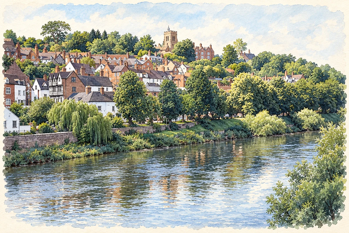
Watercolour and fine ink illustration of Bridgnorth High Town
Illustration · Bridgnorth High Town
History & heritage

Place & story

The landscape sets the problem

Bridgnorth’s High Town and Low Town are separated by a sandstone cliff. Slopes, steps and bridges are part of moving through the settlement, not incidental features of a picturesque view. The cliff railway would eventually address one particular problem: making a short but steep journey between the two levels easier. [5]

A fortress with rooms to live in

Bridgnorth Castle is thought to have been founded in 1101–02 by Robert de Belleme after abandoning the castle and borough at Quatford. It became a royal stronghold, but its role extended beyond defence. Medieval accounts describe a great hall, king’s and queen’s chambers, kitchens and stables. The complex brought royal accommodation and administration to its commanding site above the Severn. [2]

The castle surrendered to Parliamentary forces after a three-week siege in 1646. Its buildings were stripped and walls systematically undermined and blown up, leaving the strikingly leaning keep. A public park was laid out on the inner bailey in 1897. The visible ruin and the buried remains beneath the gardens belong to the same site, now used for public recreation. [2]

A classical church in the castle streets

St Mary Magdalene’s presents a very different kind of monument. Historic England dates the church to 1792 and names Thomas Telford as its architect and describes a pedimented portico with Doric columns, an Ionic interior and a tower with cupola. The building follows a north–south axis to exploit the view along East Castle Street. Its position and orientation were deliberate elements of the townscape. [3]

Ambitions for an indoor market

The New Market Building at the southern end of High Street reflects another period of civic ambition. Robert Griffiths of nearby Quatford designed the Italianate building, constructed in 1855–59. Its intended use as an indoor market proved unsuccessful, and it subsequently accommodated other activities. The joint history published by the two councils shows how a substantial public building could endure after its original commercial purpose failed. [7]

A railway up the cliff

A public meeting in 1890 considered better communication between High Town and Low Town. Construction of the cliff railway began in November 1891, encountering caves and houses built into the cliff face. Engineers had to manage ground support as well as lay track. The line opened on 7 July 1892. [4]

Initially, water supplied the motive weight: filling a tank beneath the upper car made it heavy enough to descend while pulling the lower car upwards. The water was then pumped back to the top. Electric operation replaced that system during rebuilding in 1943–44. The familiar short journey has therefore depended on changing machinery behind its paired cars. [4]

The longer railway and the work of keeping it

Bridgnorth station belongs to the Severn Valley route that opened in 1862. Much of its original station building survives, with later alterations, and the locomotive works gives the site a continuing engineering function. It is a different railway story from the cliff lift: a regional route through the valley rather than a link across the town’s two levels. [5]

Passenger and freight use dwindled as road transport expanded, and regular passenger services at Bridgnorth ended in 1963. Enthusiasts formed a preservation society in 1965. The charitable trust’s history emphasises the practical skills involved in the revival: maintaining track and stations, repairing vehicles and training people to undertake specialised work. Preservation depends on workshops and learned trades alongside running trains. [6] [9]

The town collects its own history

Northgate Museum began in 1951 and occupies rooms above the northern gateway at the end of High Street. Volunteers have gathered objects from Bridgnorth and its surrounding district. Its collections include local pocket watches, a workhouse bell, household objects and images of the river and town. Small artefacts add everyday work and domestic life to a story otherwise dominated by monumental buildings. [8]

Back to contents
Lives connected to this place

Notable people

Thomas Telford: a local architectural commission

Thomas Telford’s direct connection here is the design of St Mary Magdalene’s Church. The building shows his work as an architect, with classical columns and careful attention to the street vista. A later apse by Blomfield, added in 1876, belongs to another phase and should not be credited to Telford. [3]

George Croydon Marks: engineering the short journey

George Croydon Marks helped bring the cliff railway proposal to the town council with George Newnes. An engineer associated with inclined railways, he became the Bridgnorth company’s first managing director, serving from 1891 until 1901. His local tie was the design and management of this transport undertaking, rather than birth in Bridgnorth. [4]

Back to contents
A chronology

Timeline

Bridgnorth through time

  1. 1101–02 — Probable foundation of the castle by Robert de Belleme. [2]

  2. 1646 — The castle surrenders after a siege and is subsequently demolished. [2]

  3. 1792 — Historic England dates St Mary Magdalene’s Church, by Thomas Telford, to this year. [3]

  4. 1855–59 — The New Market Building is constructed. [7]

  5. 1862 — The Severn Valley Railway opens; the surviving station building dates from this period. [5]

  6. 7 July 1892 — The cliff railway opens between the town’s two levels. [4]

  7. 1897 — A public park is laid out on the castle’s inner bailey. [2]

  8. 1943–44 — The cliff railway’s water-balance mechanism is replaced by electric operation. [4]

  9. 1951 — Northgate Museum is founded. [8]

  10. 1963 / 1965 — Regular passenger services at Bridgnorth end; enthusiasts establish its preservation society two years later. [6] [9]

Back to contents

Population over time

Built-up area · Settlement · Census 2021

Bridgnorth

12,175people · 2021

Census 2021 population of the named settlement, using ONS built-up area boundaries.

Published census counts.

Sources: ONS: Towns and cities, characteristics of built-up areas, Census 2021 (Table 1c)

View population figures
Bridgnorth — census population
Census yearPopulation
202112,175
Sources and how to read this chart

Usual residents on 21 March 2021; published ONS count rounded to the nearest 5.. Boundary geography: December 2022 (E63002814).

Census 2021 population of the named settlement, using ONS built-up area boundaries.

ONS Table 1c rounds counts to the nearest 5 and suppresses counts below 10. Matched by exact settlement name or individually reviewed district-qualified name, with its coordinate strictly inside that same official BUA boundary. The 2022 BUA geography changed methodology and cannot be directly compared with 2011 BUAs. Contains OS data © Crown copyright and database right 2026. Contains National Statistics data © Crown copyright and database right 2026.

Source: ONS: Towns and cities, characteristics of built-up areas, Census 2021 (Table 1c). Open Government Licence v3.0. Retrieved 2026-10-26. Source: ONS and Ordnance Survey: Built Up Areas December 2022 GB BGG. Open Government Licence v3.0. Retrieved 2026-10-26.

Neighbourhood census context

These figures describe statistical neighbourhoods, which may cover part of a place or include neighbouring places.

Neighbourhood census area · 1971–2021

Shropshire 033

Population of the area containing the recorded point for Bridgnorth, not the whole place. This area may cover part of the place or include neighbours.

01.8k3.5k5.3k7k1971: 5,183 people19711981: 5,466 people19811991: 5,610 people19912001: 5,801 people20012011: 6,128 people20112021: 6,194 people2021

Includes harmonised historical census estimates.

Sources: ONS · Paul Norman

View population figures
Shropshire 033 — census population and harmonised historical estimates
Census yearPopulation
19715,183
19815,466
19915,610
20015,801
20116,128
20216,194
Sources and how to read this chart

Usual residents of the containing MSOA; this is local area context, not the population of the named settlement.. Boundary geography: 1 April 2022 (E02006012).

2011 and 2021 census counts harmonised by ONS to the same 1 April 2022 geography. Location matched to ONS 2021 MSOA polygons (full resolution, coastline clipped, V7). ONS exact-fit lookup marks this MSOA unchanged from 2011 (U); historical estimates use that same footprint.

1971–2011: Paul Norman harmonised historical estimates on 2011 MSOAs, rounded to whole residents (1971–1991 are modelled). 2021: ONS census count. The historical 2011 total can differ slightly from the ONS change-over-time 2011 total because of methodology and statistical disclosure controls. These are area estimates, not settlement totals.

Source: ONS Census change over time: usual resident population, 2011 and 2021. Open Government Licence v3.0. Retrieved 2026-10-26. Source: ONS MSOA December 2021 boundaries EW BFC V7. Open Government Licence v3.0. Retrieved 2026-10-26. Source: Paul Norman — Area characteristics: Great Britain 1971 to 2011. Creative Commons Attribution 4.0. Retrieved 2026-10-26. Source: ONS MSOA 2011 to MSOA 2021 exact-fit lookup for England and Wales. Open Government Licence v3.0. Retrieved 2026-10-26.

Recorded locationBridgnorth52.53584° N · 2.41982° WInteractive map loads when this area enters view.
Approximate recorded location · Geographic source

Geographic context

Place type
Town
Country / region
England · West Midlands
County group
Shropshire
Current administration
Shropshire
Recorded coordinates
52.53584, -2.41982
OS Open Names ID
osgb4000000074572633

County groups are browsing aids. Current administrative and historic areas are recorded separately.

Recorded names

  • Bridgnorth · en · official

Nearby heritage

Distances are from the recorded place point. Proximity does not establish that a site lies within the place boundary or belongs to its history.

Sources & further reading

  1. OS Open Names October 2026 · Source licence.
  2. Bridgnorth Castle: scheduled monument 1004783 · Historic England
  3. Church of St Mary Magdalene: list entry 1177357 · Historic England
  4. How It All Started · Bridgnorth Cliff Railway
  5. Our Railway: Bridgnorth · Severn Valley Railway
  6. History of the SVR · Severn Valley Railway Charitable Trust
  7. New Market Building: joint statement, 19 May 2026 · Shropshire Council and Bridgnorth Town Council
  8. Northgate Museum · Northgate Museum / Bridgnorth and District Historical Society
  9. Severn Valley Railway commemorates 60 years since closure · Severn Valley Railway
  10. Illustration of Bridgnorth High Town, adapted from High Town, Bridgnorth.jpg by Pam Brophy. CC BY-SA 2.0. AI-assisted watercolour and fine ink adaptation; cream paper margins, simplified fine detail and removal of incidental street clutter.

Geographic source retrieved 2026-10-26. History last researched 2026-10-26. How this page was prepared.