Town

Church Stretton

Church Stretton’s medieval market streets were rebuilt after fire, while railways and visitors changed its nineteenth-century prospects. Carding Mill Valley and women’s voluntary records reveal histories of work and community life beside the better-known hill scenery.

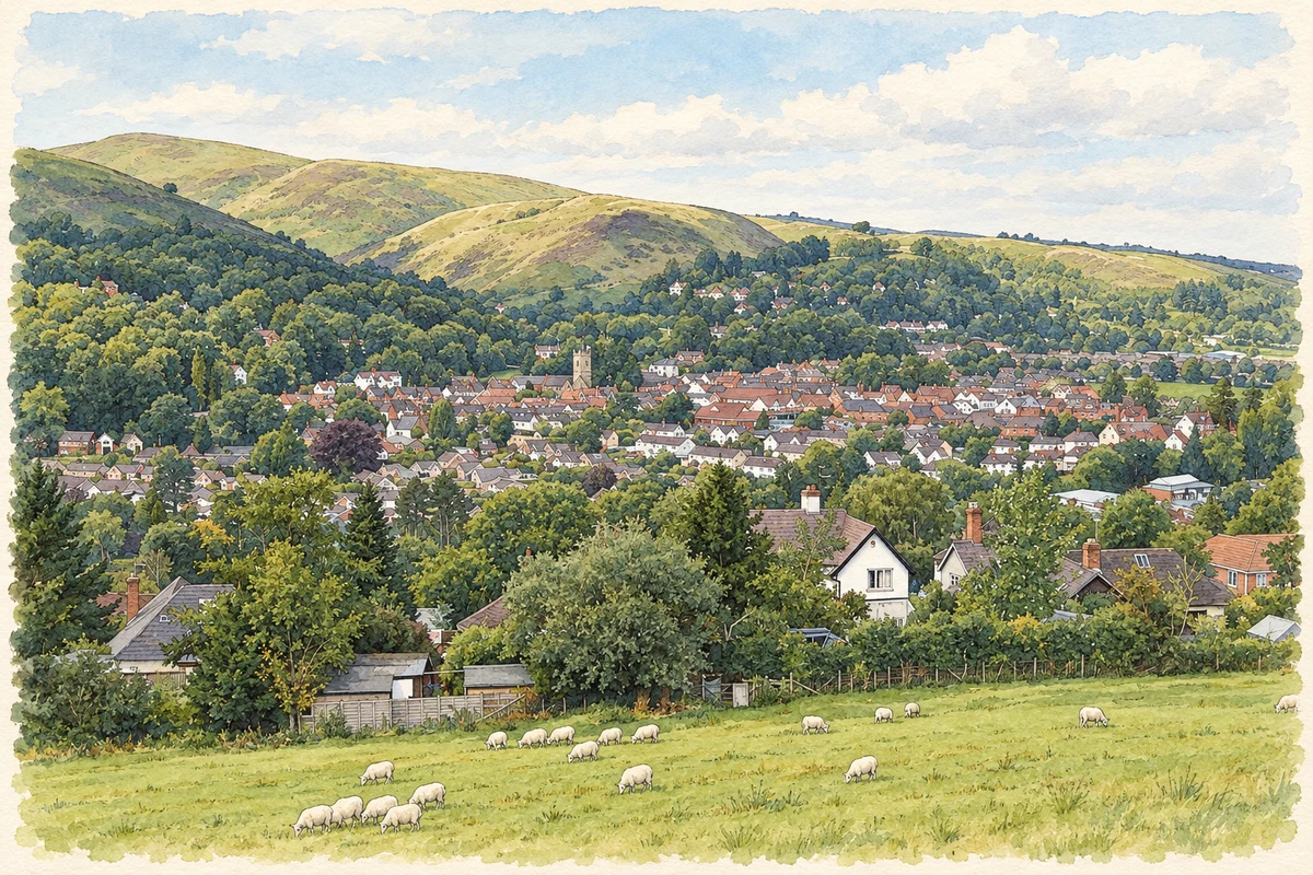
Watercolour and fine ink illustration of Church Stretton townscape
Illustration · Church Stretton townscape
History & heritage

Place & story

A market among older hill landscapes

Bronze Age burial and Iron Age fortifications survive in the hills around the Stretton Gap. The local history group identifies the barrow on Ashlet Hill and the hillforts of Bodbury Ring and Caer Caradoc as parts of this surrounding archaeological landscape. They predate the surviving town and should not be mistaken for evidence that all its present streets were already settled. [2]

King John ordered a weekly market at Church Stretton in 1214. The town’s place within the Strettons also matters: All Stretton and Little Stretton are neighbouring settlements, while the former registration district extended much farther. A history of the town needs those relationships without treating every event or statistic in the wider district as its own. [2]

Fire and rebuilding on High Street

A great fire in 1593 destroyed most of the town’s early buildings. Rebuilding appears to have followed the earlier street plan, with houses, shops and inns along the old Bristol Road, now High Street. The survival of that framework gives continuity to a town whose buildings have changed repeatedly. [2]

St Laurence’s church preserves a nave dating from the twelfth century and is thought to be the town’s oldest building. The Buck’s Head Inn is another early survivor identified by the local history group. These landmarks stand within the town’s repeatedly rebuilt streets. [2]

Carding Mill Valley at work

Carding Mill Valley carries an industrial history into the landscape beside the town. In 1824 George Corfield erected a three-storey factory as an extension to the carding mill. The National Trust records hand looms and spinning jennies in the building, placing textile production within a valley now widely encountered for recreation. [4]

In 1881 the factory was converted to make soda water and ginger beer as the Stretton Hills Aerated Water Company. The business moved to the Cwm Valley in 1910, and the old factory was subsequently adapted as accommodation, known as Carding Mill Court. One building thus connects textile work, bottled drinks and later residential use. [4]

A railway built for passengers and goods

Construction of the Shrewsbury–Hereford railway began at the end of 1850 after its promoters reduced the scheme to contain costs. Thomas Brassey agreed to construct a single-track line, with structures allowing later doubling. The Shrewsbury–Ludlow section opened to passenger traffic on 21 April 1852, including a station at Church Stretton. [3]

The first station stood north of Sandford Avenue. Alongside passenger facilities it had provision for cattle, goods warehouses and a coal wharf, showing that its business extended beyond leisure travel. Doubling reached Church Stretton by February 1862, and that July the route became a joint London and North Western and Great Western line. [3]

Increasing passenger traffic later demanded longer platforms, but the goods-yard entrance and road bridge constrained the original station. A replacement south of the bridge opened on 23 May 1914, with platforms connected by a covered footbridge. Goods traffic ended in 1966; the station became unstaffed in 1967, and its main buildings were demolished in 1970. [3]

Women organising skills and mutual help

Transcribed Women’s Institute committee minutes from 1918 show another side of local life. Members sought teachers for plumbing, cobbling and basket-making, arranged practical demonstrations and alternated meeting days to make attendance possible for people working in shops. Learning domestic and manual skills sat beside the social function of meeting together. [5]

In April 1918 members agreed to purchase a fruit-and-vegetable canner, with several women guaranteeing contributions. Later that year they discussed a rest room for market women; an October report recorded that it had opened on 3 October. In February 1919 the committee arranged a talk on women and the municipal vote. These records show voluntary activity extending into food preservation, everyday facilities and civic participation. [5]

Back to contents
Lives connected to this place

Notable people

A. E. Housman: a documented hotel guest

The poet and classical scholar A. E. Housman stayed at The Hotel in Church Stretton in July 1899. Alan Brisbourne’s study in the Housman Society Journal reproduces his name from the local newspaper’s visitors’ list and identifies a stay of more than three weeks. His local relationship was that of a visitor, rather than a native or permanent resident. [6]

The visit came after publication of A Shropshire Lad in 1896. The recorded stay should therefore not be used to assert that Church Stretton inspired the writing of that collection. The newspaper’s lists instead place Housman within the town’s developing visitor economy, among guests coming from London, provincial towns and farther afield. [6]

Back to contents
A chronology

Timeline

Milestones

  1. 1214: King John orders a weekly market. [2]

  2. 1593: Fire destroys most early town buildings. [2]

  3. 1824: George Corfield builds the factory extension in Carding Mill Valley. [4]

  4. 21 April 1852: Passenger trains begin running on the Shrewsbury–Ludlow section through Church Stretton. [3]

  5. 1881: The valley factory changes to soda-water and ginger-beer production. [4]

  6. July 1899: Housman stays at The Hotel. [6]

  7. 23 May 1914: The replacement station opens south of Sandford Avenue. [3]

  8. 3 October 1918: The WI’s rest room for market women opens. [5]

  9. 1966–70: Goods traffic ends, the station becomes unstaffed and the main station buildings are demolished. [3]

Back to contents

Population over time

Built-up area · Settlement · Census 2021

Church Stretton

3,575people · 2021

Census 2021 population of the named settlement, using ONS built-up area boundaries.

Published census counts.

Sources: ONS: Towns and cities, characteristics of built-up areas, Census 2021 (Table 1c)

View population figures
Church Stretton — census population
Census yearPopulation
20213,575
Sources and how to read this chart

Usual residents on 21 March 2021; published ONS count rounded to the nearest 5.. Boundary geography: December 2022 (E63002806).

Census 2021 population of the named settlement, using ONS built-up area boundaries.

ONS Table 1c rounds counts to the nearest 5 and suppresses counts below 10. Matched by exact settlement name or individually reviewed district-qualified name, with its coordinate strictly inside that same official BUA boundary. The 2022 BUA geography changed methodology and cannot be directly compared with 2011 BUAs. Contains OS data © Crown copyright and database right 2026. Contains National Statistics data © Crown copyright and database right 2026.

Source: ONS: Towns and cities, characteristics of built-up areas, Census 2021 (Table 1c). Open Government Licence v3.0. Retrieved 2026-10-26. Source: ONS and Ordnance Survey: Built Up Areas December 2022 GB BGG. Open Government Licence v3.0. Retrieved 2026-10-26.

Neighbourhood census context

These figures describe statistical neighbourhoods, which may cover part of a place or include neighbouring places.

Neighbourhood census area · 1971–2021

Shropshire 032

Population of the area containing the recorded point for Church Stretton, not the whole place. This area may cover part of the place or include neighbours.

01.5k3k4.5k6k1971: 4,265 people19711981: 4,621 people19811991: 4,958 people19912001: 5,242 people20012011: 5,875 people20112021: 5,752 people2021

Includes harmonised historical census estimates.

Sources: ONS · Paul Norman

View population figures
Shropshire 032 — census population and harmonised historical estimates
Census yearPopulation
19714,265
19814,621
19914,958
20015,242
20115,875
20215,752
Sources and how to read this chart

Usual residents of the containing MSOA; this is local area context, not the population of the named settlement.. Boundary geography: 1 April 2022 (E02006042).

2011 and 2021 census counts harmonised by ONS to the same 1 April 2022 geography. Location matched to ONS 2021 MSOA polygons (full resolution, coastline clipped, V7). ONS exact-fit lookup marks this MSOA unchanged from 2011 (U); historical estimates use that same footprint.

1971–2011: Paul Norman harmonised historical estimates on 2011 MSOAs, rounded to whole residents (1971–1991 are modelled). 2021: ONS census count. The historical 2011 total can differ slightly from the ONS change-over-time 2011 total because of methodology and statistical disclosure controls. These are area estimates, not settlement totals.

Source: ONS Census change over time: usual resident population, 2011 and 2021. Open Government Licence v3.0. Retrieved 2026-10-26. Source: ONS MSOA December 2021 boundaries EW BFC V7. Open Government Licence v3.0. Retrieved 2026-10-26. Source: Paul Norman — Area characteristics: Great Britain 1971 to 2011. Creative Commons Attribution 4.0. Retrieved 2026-10-26. Source: ONS MSOA 2011 to MSOA 2021 exact-fit lookup for England and Wales. Open Government Licence v3.0. Retrieved 2026-10-26.

Recorded locationChurch Stretton52.53792° N · 2.80804° WInteractive map loads when this area enters view.
Approximate recorded location · Geographic source

Geographic context

Place type
Town
Country / region
England · West Midlands
County group
Shropshire
Current administration
Shropshire
Recorded coordinates
52.53792, -2.80804
OS Open Names ID
osgb4000000074561416

County groups are browsing aids. Current administrative and historic areas are recorded separately.

Recorded names

  • Church Stretton · en · official

Nearby heritage

Distances are from the recorded place point. Proximity does not establish that a site lies within the place boundary or belongs to its history.

Sources & further reading

  1. OS Open Names October 2026 · Source licence.
  2. Church Stretton History Overview · Church Stretton Local History Group
  3. History: The Railway through Church Stretton · Church Stretton and District Rail Users Association
  4. The Factory, Cardingmill Valley, MNA143067 · National Trust
  5. Notes from the Minutes of Church Stretton Women’s Institute, 1918–1927 · Judith Randell / Church Stretton Local History Group
  6. A. E. Housman Found in Church Stretton, Shropshire · Alan Brisbourne / The Housman Society Journal 2019
  7. Illustration of Church Stretton townscape, adapted from Church Stretton Ragleth 2010 1.jpg by Dpaajones. CC BY-SA 3.0. AI-assisted watercolour and fine ink adaptation; cream paper margins, simplified fine detail and removal of incidental street clutter.

Geographic source retrieved 2026-10-26. History last researched 2026-10-26. How this page was prepared.