Village

Clun

Clun’s castle and planned streets recall a prosperous medieval wool town. Almshouses and a shopkeeper’s museum show how later generations organised care and preserved local memory.

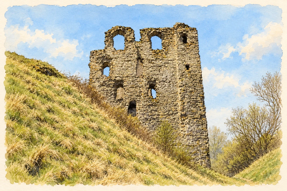
Watercolour and fine ink illustration of Clun Castle keep
Illustration · Clun Castle keep
History & heritage

Place & story

A planned town and a wool economy

A new town was laid out beside Clun Castle in the twelfth century, its grid of streets divided into regular burgage plots. William Fitzalan acquired the castle through marriage in 1155. Under the Fitzalans, Clun became a prosperous wool-trading town by the middle of the thirteenth century, linking aristocratic lordship with the livelihoods of merchants and landholders. [2]

Border conflict repeatedly affected the castle, which was captured and burned in 1196 and withstood a siege in 1233. The family later made Arundel its principal residence, using Clun increasingly as a hunting retreat while retaining its administrative role. By 1539 Leland described it as ruinous. The town’s subsequent limited development helped preserve the medieval street pattern. [2]

Comfort and display above the river

The great tower, built about 1300, was a four-storey accommodation block with grand rooms and smaller private chambers within its walls. English Heritage interprets it as a display of ancestry and wealth: some arrowloops were false, and its dramatic position made it vulnerable to undermining. The tower’s impressive appearance should therefore be read alongside its domestic purpose. [3]

Across the river, the lordly landscape included fishponds and a moated enclosure, with an orchard and dovecote considered probable. These grounds supplied food as well as pleasure. Beyond them, Clun Forest contained woodland and pasture under special forest law, managed for the lord’s hunting. The castle’s household depended on resources and restrictions reaching well outside its walls. [3]

Care arranged around a courtyard

Trinity Hospital was an almshouse institution. Historic England records its foundation by Henry Howard, Earl of Northampton, in 1607 and construction in 1618, followed by alterations in 1857. Dwellings and shared rooms surround a square courtyard. The recorded communal dining hall, hospital furniture and former uniform show how charity once organised daily life as well as providing shelter. [4]

A market hall becomes a museum

The former market hall and lock-up now houses the Museum of Clun. The Town Trust, constituted in 1924 after the old Corporation’s dissolution, took responsibility for its Elizabethan silver maces and seal. Those civic objects survived a change in government and became part of a wider collection documenting life in the Clun Forest district. [5]

Back to contents
Lives connected to this place

Notable people

Tom Hamar: a shopkeeper’s collection

Clun shopkeeper Tom Hamar established the museum in 1931 as a permanent home for objects gathered by himself and fellow enthusiasts. He donated his collection to the Town Trust and became its first curator. Flints associated with the Clun–Clee ridgeway formed an important early component; documents, photographs and everyday objects later broadened the record of this agricultural community. [5]

John Osborne: a later home and burial

The playwright John Osborne lived in the Clun area towards the end of his life and is buried in the churchyard. The Town Council identifies this later residence and burial as his local connection. It is a different relationship from the medieval lords’ ownership or Hamar’s work as a collector, and does not imply that Osborne was born in the town. [6]

Back to contents
A chronology

Timeline

Clun through time

  1. Twelfth century — A planned town develops beside the castle. [2]

  2. 1155 — The castle passes to William Fitzalan through marriage. [2]

  3. Around 1300 — The great tower provides prestigious accommodation. [3]

  4. Around 1450 — The narrow stone bridge serves pedestrians and packhorses. [6]

  5. 1539 — Leland describes the castle as ruinous. [2]

  6. 1607–18 — Foundation and construction of Trinity Hospital provide almshouses. [4]

  7. 1857 — Trinity Hospital is altered. [4]

  8. 1924 — The Town Trust takes responsibility for civic regalia. [5]

  9. 1931 — Tom Hamar establishes the museum. [5]

Back to contents

Population over time

Built-up area · Settlement · Census 2021

Clun

655people · 2021

Census 2021 population of the named settlement, using ONS built-up area boundaries.

Published census counts.

Sources: ONS: Towns and cities, characteristics of built-up areas, Census 2021 (Table 1c)

View population figures
Clun — census population
Census yearPopulation
2021655
Sources and how to read this chart

Usual residents on 21 March 2021; published ONS count rounded to the nearest 5.. Boundary geography: December 2022 (E63002983).

Census 2021 population of the named settlement, using ONS built-up area boundaries.

ONS Table 1c rounds counts to the nearest 5 and suppresses counts below 10. Matched by exact settlement name or individually reviewed district-qualified name, with its coordinate strictly inside that same official BUA boundary. The 2022 BUA geography changed methodology and cannot be directly compared with 2011 BUAs. Contains OS data © Crown copyright and database right 2026. Contains National Statistics data © Crown copyright and database right 2026.

Source: ONS: Towns and cities, characteristics of built-up areas, Census 2021 (Table 1c). Open Government Licence v3.0. Retrieved 2026-10-26. Source: ONS and Ordnance Survey: Built Up Areas December 2022 GB BGG. Open Government Licence v3.0. Retrieved 2026-10-26.

Neighbourhood census context

These figures describe statistical neighbourhoods, which may cover part of a place or include neighbouring places.

Neighbourhood census area · 1971–2021

Shropshire 037

Population of the area containing the recorded point for Clun, not the whole place. This area may cover part of the place or include neighbours.

01.8k3.5k5.3k7k1971: 4,856 people19711981: 4,734 people19811991: 5,463 people19912001: 5,611 people20012011: 6,245 people20112021: 6,106 people2021

Includes harmonised historical census estimates.

Sources: ONS · Paul Norman

View population figures
Shropshire 037 — census population and harmonised historical estimates
Census yearPopulation
19714,856
19814,734
19915,463
20015,611
20116,245
20216,106
Sources and how to read this chart

Usual residents of the containing MSOA; this is local area context, not the population of the named settlement.. Boundary geography: 1 April 2022 (E02006044).

2011 and 2021 census counts harmonised by ONS to the same 1 April 2022 geography. Location matched to ONS 2021 MSOA polygons (full resolution, coastline clipped, V7). ONS exact-fit lookup marks this MSOA unchanged from 2011 (U); historical estimates use that same footprint.

1971–2011: Paul Norman harmonised historical estimates on 2011 MSOAs, rounded to whole residents (1971–1991 are modelled). 2021: ONS census count. The historical 2011 total can differ slightly from the ONS change-over-time 2011 total because of methodology and statistical disclosure controls. These are area estimates, not settlement totals.

Source: ONS Census change over time: usual resident population, 2011 and 2021. Open Government Licence v3.0. Retrieved 2026-10-26. Source: ONS MSOA December 2021 boundaries EW BFC V7. Open Government Licence v3.0. Retrieved 2026-10-26. Source: Paul Norman — Area characteristics: Great Britain 1971 to 2011. Creative Commons Attribution 4.0. Retrieved 2026-10-26. Source: ONS MSOA 2011 to MSOA 2021 exact-fit lookup for England and Wales. Open Government Licence v3.0. Retrieved 2026-10-26.

Recorded locationClun52.42149° N · 3.02666° WInteractive map loads when this area enters view.
Approximate recorded location · Geographic source

Geographic context

Place type
Village
Country / region
England · West Midlands
County group
Shropshire
Current administration
Shropshire
Recorded coordinates
52.42149, -3.02666
OS Open Names ID
osgb4000000074560568

County groups are browsing aids. Current administrative and historic areas are recorded separately.

Recorded names

  • Clun · en · official

Nearby heritage

Distances are from the recorded place point. Proximity does not establish that a site lies within the place boundary or belongs to its history.

Sources & further reading

  1. OS Open Names October 2026 · Source licence.
  2. History of Clun Castle · English Heritage
  3. Description of Clun Castle · English Heritage
  4. Trinity Hospital, list entry 1054455 · Historic England
  5. Clun Town Hall & Museum · Clun Town Council
  6. About the Parish · Clun Town Council
  7. Illustration of Clun Castle keep, adapted from Clun Castle (Keep) by Fabian Musto. CC BY-SA 2.0. AI-assisted watercolour and fine ink adaptation; simplified fine detail and removal of incidental clutter.

Geographic source retrieved 2026-10-26. History last researched 2026-10-26. How this page was prepared.