Suburban Area

Ironbridge

A cast-iron bridge gave a new town its name. Shops, furnaces and a hillside church reveal how the crossing belonged to a larger landscape of work along the Severn.

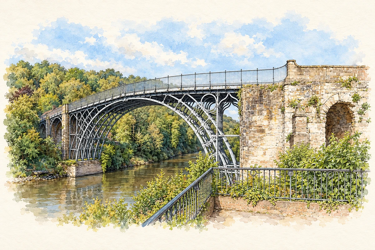
Watercolour and fine ink illustration of The Iron Bridge over the River Severn
Illustration · The Iron Bridge over the River Severn
History & heritage

Place & story

A town within an industrial valley

Ironbridge is both a particular town and a name often used for a much larger industrial landscape. The World Heritage Site follows the Severn to Coalport and includes valleys reaching towards Coalbrookdale and Madeley. Its surviving factories, housing and transport routes belong to several communities. Keeping those places distinct makes the connections between them easier to understand. [3]

The town itself developed rapidly after the bridge was completed in 1779, as part of Madeley. Along the Wharfage, its commercial street beside the river, shops and arcaded market buildings served the growing settlement. The Tontine Hotel and St Luke’s Church became prominent landmarks; larger Victorian villas occupied higher ground. Industry produced a town of traders, worshippers and professional households as well as a celebrated monument. [4]

Iron before the bridge

The crossing was a product of an established manufacturing district. At nearby Coalbrookdale in 1709, Abraham Darby I used coke rather than charcoal to smelt iron. This was a change in the fuel used in a blast furnace, with consequences for the amount of iron that could be made. His grandson’s bridge would give the material a conspicuous architectural use. [4] [2]

At Ironbridge’s eastern end, the Bedlam Furnaces preserve another part of that landscape. The surviving masonry gives the industrial story a different scale from the elegant river arch: Historic England describes a brick-lined furnace chamber, partly blocked openings and substantial stone buttresses. Its list entry cautiously associates the furnace with the scene in Philip James de Loutherbourg’s painting Coalbrookdale by Night, rather than treating the identification as certain. [3] [6]

Reading the crossing

The bridge spans roughly thirty metres in a single arch, with five main semicircular ribs. Its geometry allowed a crossing without a central river pier. The ironwork also borrowed the language of timber construction: a new material was being assembled through techniques familiar from carpentry. Historic England places the bridge at a turning point in engineering, while observing that later designers could exploit cast iron in lighter structures. [5]

The approaches have changed considerably. Shops and houses once crowded the northern end; their eventual demolition in the 1950s opened up a view that earlier travellers would not have seen. On the southern bank, movement and flooding damaged the original abutment. Its replacement first carried a timber roadway, later superseded by the iron side arches. The surviving bridge records repeated alteration as well as its original experiment. [5]

A church supplied by the river

St Luke’s makes the relationship between town, terrain and industry particularly tangible. Its church guide explains that the tower stands at the east end because ground at the west could not support its weight. Inside, iron pillars carry a gallery running around three sides. The Coalbrookdale Company and Walton of Ironbridge supplied ironwork, while timber travelled from the Baltic through Bristol and up the Severn by barge. [7]

The same guide records a clock paid for by public subscription in 1838 and made at Shifnal. Later changes rearranged the congregation’s space: pews gave way for an organ in 1900 and a war memorial in 1920, and more were removed in subsequent alterations. Such additions connect the building’s industrial materials with shared timekeeping, music and remembrance. [7]

From working structure to conserved monument

In 1934 the bridge closed to vehicles and became an Ancient Monument. Preservation did not mean leaving it untouched. A concrete strut installed across the river bed in 1973 helped brace the abutments. The difficulties of ground movement and stressed ironwork made continued engineering part of the monument’s survival. [2]

The major conservation campaign begun in 2017 repaired cast-iron components and masonry, renewed the deck surface and cleaned and repainted the structure. Its red-brown colour followed research into the original finish. A temporary walkway allowed visitors to see the work, while donations and a public crowdfunding campaign helped finance it. Conservation became something the public could witness and support. [8]

The wider gorge gained World Heritage status in 1986. Its importance rests on relationships among mines, furnaces, factories, workers’ homes and transport systems. Woodland surrounds much of that inheritance, but the valley remains a place where people live and work. Its history extends beyond the famous arch. [3]

Back to contents
Lives connected to this place

Notable people

Thomas Farnolls Pritchard: an architect’s proposal

Thomas Farnolls Pritchard was a Shrewsbury architect whose connection with Ironbridge was a design project. In 1773 he proposed an iron crossing of the Severn. He died in 1777, before the completed structure could demonstrate the idea. His local significance lies in initiating the bridge design, rather than in being an Ironbridge-born engineer. [2]

Abraham Darby III: making the design stand

Abraham Darby III oversaw the bridge’s construction after Pritchard’s death, drawing on the ironmaking business developed by earlier generations at Coalbrookdale. The structure was completed in 1779 and opened formally on 1 January 1781. His connection is to building the crossing at the centre of the new town, within the wider family manufacturing district. [2]

Back to contents
A chronology

Timeline

Ironbridge through time

  1. 1709 — At nearby Coalbrookdale, Abraham Darby I develops coke-fuelled iron smelting. [3]

  2. 1773 — Pritchard proposes an iron bridge across the Severn. [5]

  3. 1779 — The bridge is completed; a town develops around the new crossing. [4]

  4. 1 January 1781 — The bridge formally opens. [2]

  5. 1838 — Public subscription provides St Luke’s Church with its clock. [7]

  6. 1934 — The bridge closes to vehicles and is designated an Ancient Monument. [5]

  7. 1986 — Ironbridge Gorge is inscribed on the World Heritage List. [4]

  8. 2017–18 — A major conservation project repairs and repaints the bridge. [8] [2]

Back to contents

Population over time

A verified population series for Ironbridge as a settlement has not yet been added. Neighbourhood census figures are available below.

Neighbourhood census context

These figures describe statistical neighbourhoods, which may cover part of a place or include neighbouring places.

Neighbourhood census area · 1971–2021

Telford and Wrekin 010

Population of the area containing the recorded point for Ironbridge, not the whole place. This area may cover part of the place or include neighbours.

05k10k15k20k1971: 8,254 people19711981: 6,719 people19811991: 7,430 people19912001: 8,946 people20012011: 10,106 people20112021: 10,745 people2021

Includes harmonised historical census estimates.

Sources: ONS · Paul Norman

View population figures
Telford and Wrekin 010 — census population and harmonised historical estimates
Census yearPopulation
19718,254
19816,719
19917,430
20018,946
201110,106
202110,745
Sources and how to read this chart

Usual residents of the containing MSOA; this is local area context, not the population of the named settlement.. Boundary geography: 1 April 2022 (E02002937).

2011 and 2021 census counts harmonised by ONS to the same 1 April 2022 geography. Location matched to ONS 2021 MSOA polygons (full resolution, coastline clipped, V7). ONS exact-fit lookup marks this MSOA unchanged from 2011 (U); historical estimates use that same footprint.

1971–2011: Paul Norman harmonised historical estimates on 2011 MSOAs, rounded to whole residents (1971–1991 are modelled). 2021: ONS census count. The historical 2011 total can differ slightly from the ONS change-over-time 2011 total because of methodology and statistical disclosure controls. These are area estimates, not settlement totals.

Source: ONS Census change over time: usual resident population, 2011 and 2021. Open Government Licence v3.0. Retrieved 2026-10-26. Source: ONS MSOA December 2021 boundaries EW BFC V7. Open Government Licence v3.0. Retrieved 2026-10-26. Source: Paul Norman — Area characteristics: Great Britain 1971 to 2011. Creative Commons Attribution 4.0. Retrieved 2026-10-26. Source: ONS MSOA 2011 to MSOA 2021 exact-fit lookup for England and Wales. Open Government Licence v3.0. Retrieved 2026-10-26.

Recorded locationIronbridge52.62788° N · 2.47984° WInteractive map loads when this area enters view.
Approximate recorded location · Geographic source

Geographic context

Place type
Suburban Area
Country / region
England · West Midlands
County group
Shropshire
Current administration
Telford and Wrekin
Recorded coordinates
52.62788, -2.47984
OS Open Names ID
osgb4000000074561449

County groups are browsing aids. Current administrative and historic areas are recorded separately.

Recorded names

  • Ironbridge · en · official

Nearby heritage

Distances are from the recorded place point. Proximity does not establish that a site lies within the place boundary or belongs to its history.

Sources & further reading

  1. OS Open Names October 2026 · Source licence.
  2. History of Iron Bridge · English Heritage
  3. Ironbridge Gorge: Outstanding Universal Value · UNESCO World Heritage Centre
  4. Ironbridge Gorge World Heritage Site Management Plan · Ironbridge Gorge World Heritage Site Steering Group / Telford & Wrekin Council
  5. The Iron Bridge: scheduled monument 1015325 · Historic England
  6. The Bedlam Furnace: list entry 1207904 · Historic England
  7. St Luke’s, Ironbridge: Church Guide · United Benefice of Coalbrookdale, Ironbridge and Little Wenlock
  8. Project Iron Bridge: Saving an Industrial Icon · English Heritage
  9. Illustration of The Iron Bridge over the River Severn, adapted from Ironbridge 2014.jpg by Colin. CC BY-SA 4.0. AI-assisted watercolour and fine ink adaptation; cream paper margins, simplified fine detail and removal of incidental street clutter.

Geographic source retrieved 2026-10-26. History last researched 2026-10-26. How this page was prepared.