Town

Ludlow

Ludlow’s castle made it a centre of border government, but its streets, church and museum also tell a history of cloth, charity, gloves and civic life.

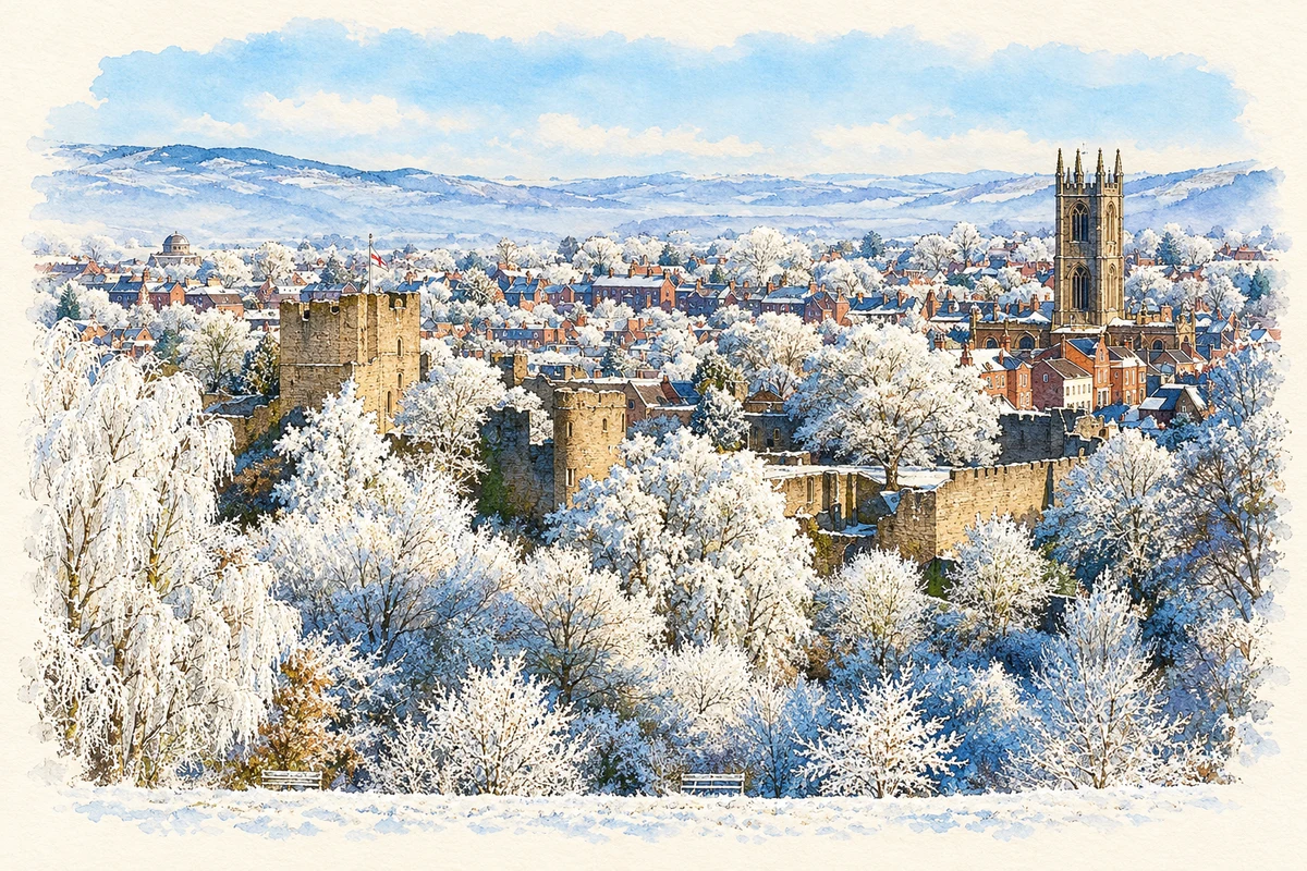
Watercolour and fine ink illustration of Ludlow townscape in snow
Illustration · Ludlow townscape in snow
History & heritage

Place & story

A planned town below the castle

Ludlow developed beside a Norman stronghold overlooking the Teme and Corve. Historic England’s parish-church study describes a planned grid of streets established after the de Lacys built the castle, with much of the medieval layout surviving. The town brought together defence, administration, a market and parish worship; those functions occupied neighbouring spaces rather than separate settlements. [4] [3] [7]

The castle’s early construction is not a securely dated single event. Historic England places its probable foundation around 1075, while the surviving buildings developed through successive campaigns. The de Lacy, de Geneville, Mortimer and Yorkist inheritances made it a seat of aristocratic power before its better-known royal and administrative roles. [3]

Royal households and border courts

Prince Edward lived at Ludlow between 1473 and 1483, before becoming Edward V. Prince Arthur and Catherine of Aragon later established their household here; Arthur died at the castle on 2 April 1502. Their presence brought the royal succession into a town already closely connected to the border lordships. [2]

The Council in the Marches acquired statutory judicial powers in 1534. Ludlow became its headquarters, and courts and accommodation for officials transformed the castle into a place of legal work as well as residence. Its role was interrupted in 1641, revived after the Restoration, and ended with the council’s abolition in 1689. [3] [2]

Wool wealth and collective provision

St Laurence’s expanded with the medieval wool and cloth trades. Major work between 1433 and 1471 remade much of its nave, chancel and tower. The church’s scale is a material record of urban prosperity, while later repairs and reordering show that the building continued to change after the wool town’s medieval high point. [4]

The Palmers’ Guild connected religion with property and welfare. It recruited members far beyond Ludlow, maintained priests and singers, and acquired land and buildings through purchases and bequests. A priests’ college was built in 1394 and the Mill Street Guildhall was rebuilt in 1411. Its responsibilities included the grammar school and almshouses. [5]

The guild helped furnish St Laurence’s, purchasing wood for choir stalls in 1447 and supplying windows and music. It was dissolved in 1551; the next year its assets and many duties passed to the borough corporation. Schools, charity and urban government thus inherited resources accumulated through a religious association. [5]

Work preserved in ordinary objects

Ludlow Museum’s objects reveal trades beyond the castle walls. A Company of Stitchmen barrel collected business fees for an organisation regulating textile work and assisting members. Glovers’ shears represent an important early-nineteenth-century industry using animal skins as well as silk and satin. These objects show work being organised, financed and performed. [6]

The museum also holds part of a nineteenth-century tug-of-war rope. An 1811 account describes a Shrove Tuesday contest supplied with a rope at civic expense and begun from the Market Hall. The object preserves a link between public authority, the market place and collective recreation, alongside the museum’s evidence of trades. [6]

The Buttercross and civic reform

William Baker designed the Buttercross, built in 1743–46, with upper rooms intended for corporation business. It later accommodated a charity school, other organisations and the museum. The council dates the Blue Coat School’s occupation from 1785 to 1855. A civic landmark could serve education and collecting as well as trade. [7]

In 1835 municipal reform replaced Ludlow’s self-electing corporation with an elected borough council, although the electorate was limited to male ratepayers. The first mayor under the new arrangement was elected in 1836. The change altered who could participate in local government; it did not establish universal suffrage. [7]

A ruin becomes a visitor destination

After the Council of the Marches disappeared, useful materials were removed from the castle and its buildings declined. In 1771 it was leased to the Earl of Powis, and it was purchased for the estate in 1811. Walks around the ruins helped turn a former centre of government into a destination for picturesque tourism. [2]

Back to contents
Lives connected to this place

Notable people

Prince Arthur: the heir’s final household

Arthur’s Ludlow connection was brief but consequential. The heir to Henry VII came with Catherine of Aragon after their marriage and died here in April 1502. Catherine subsequently married his younger brother, Henry VIII. Arthur belongs in Ludlow’s story because of that resident royal household, rather than because he was born in the town. [2]

A. E. Housman: poetry and commemoration

Housman’s relationship with Ludlow was literary and commemorative. His poetry made the town’s streets, bells and market part of an imagined Shropshire landscape, although he scarcely visited the county. His ashes rest beside St Laurence’s; the Housman Society’s account describes the memorial against the north wall and the church’s continuing commemoration of him. [9] [8]

Back to contents
A chronology

Timeline

Ludlow through time

  1. About 1075 — Historic England dates the castle’s probable foundation to this period. [3]

  2. 1394 — The Palmers’ Guild builds a residential college for priests. [5]

  3. 1473–83 — Prince Edward lives at Ludlow Castle. [2]

  4. 2 April 1502 — Prince Arthur dies at the castle. [2]

  5. 1534 — The Council in the Marches receives statutory judicial powers. [3]

  6. 1551–52 — The Palmers’ Guild is dissolved and assets pass to the corporation. [5]

  7. 1689 — The Council of the Marches is finally abolished. [3]

  8. 1743–46 — The Buttercross is built. [7]

  9. 1771 — The Earl of Powis leases the castle. [2]

  10. 1835 — Municipal reform changes borough government. [7]

Back to contents

Population over time

Built-up area · Settlement · Census 2021

Ludlow

10,040people · 2021

Census 2021 population of the named settlement, using ONS built-up area boundaries.

Published census counts.

Sources: ONS: Towns and cities, characteristics of built-up areas, Census 2021 (Table 1c)

View population figures
Ludlow — census population
Census yearPopulation
202110,040
Sources and how to read this chart

Usual residents on 21 March 2021; published ONS count rounded to the nearest 5.. Boundary geography: December 2022 (E63003087).

Census 2021 population of the named settlement, using ONS built-up area boundaries.

ONS Table 1c rounds counts to the nearest 5 and suppresses counts below 10. Matched by exact settlement name or individually reviewed district-qualified name, with its coordinate strictly inside that same official BUA boundary. The 2022 BUA geography changed methodology and cannot be directly compared with 2011 BUAs. Contains OS data © Crown copyright and database right 2026. Contains National Statistics data © Crown copyright and database right 2026.

Source: ONS: Towns and cities, characteristics of built-up areas, Census 2021 (Table 1c). Open Government Licence v3.0. Retrieved 2026-10-26. Source: ONS and Ordnance Survey: Built Up Areas December 2022 GB BGG. Open Government Licence v3.0. Retrieved 2026-10-26.

Neighbourhood census context

These figures describe statistical neighbourhoods, which may cover part of a place or include neighbouring places.

Neighbourhood census area · 1971–2021

Shropshire 038

Population of the area containing the recorded point for Ludlow, not the whole place. This area may cover part of the place or include neighbours.

05k10k15k20k1971: 7,712 people19711981: 8,037 people19811991: 9,368 people19912001: 10,006 people20012011: 10,954 people20112021: 10,714 people2021

Includes harmonised historical census estimates.

Sources: ONS · Paul Norman

View population figures
Shropshire 038 — census population and harmonised historical estimates
Census yearPopulation
19717,712
19818,037
19919,368
200110,006
201110,954
202110,714
Sources and how to read this chart

Usual residents of the containing MSOA; this is local area context, not the population of the named settlement.. Boundary geography: 1 April 2022 (E02006045).

2011 and 2021 census counts harmonised by ONS to the same 1 April 2022 geography. Location matched to ONS 2021 MSOA polygons (full resolution, coastline clipped, V7). ONS exact-fit lookup marks this MSOA unchanged from 2011 (U); historical estimates use that same footprint.

1971–2011: Paul Norman harmonised historical estimates on 2011 MSOAs, rounded to whole residents (1971–1991 are modelled). 2021: ONS census count. The historical 2011 total can differ slightly from the ONS change-over-time 2011 total because of methodology and statistical disclosure controls. These are area estimates, not settlement totals.

Source: ONS Census change over time: usual resident population, 2011 and 2021. Open Government Licence v3.0. Retrieved 2026-10-26. Source: ONS MSOA December 2021 boundaries EW BFC V7. Open Government Licence v3.0. Retrieved 2026-10-26. Source: Paul Norman — Area characteristics: Great Britain 1971 to 2011. Creative Commons Attribution 4.0. Retrieved 2026-10-26. Source: ONS MSOA 2011 to MSOA 2021 exact-fit lookup for England and Wales. Open Government Licence v3.0. Retrieved 2026-10-26.

Recorded locationLudlow52.36765° N · 2.71901° WInteractive map loads when this area enters view.
Approximate recorded location · Geographic source

Geographic context

Place type
Town
Country / region
England · West Midlands
County group
Shropshire
Current administration
Shropshire
Recorded coordinates
52.36765, -2.71901
OS Open Names ID
osgb4000000074570916

County groups are browsing aids. Current administrative and historic areas are recorded separately.

Recorded names

  • Ludlow · en · official

Nearby heritage

Distances are from the recorded place point. Proximity does not establish that a site lies within the place boundary or belongs to its history.

Sources & further reading

  1. OS Open Names October 2026 · Source licence.
  2. History of Ludlow Castle · Ludlow Castle
  3. Ludlow Castle: 1004778 · Historic England
  4. Sustaining Major Parish Churches: Ludlow, St Laurence · Historic England
  5. History: The Palmers’ Guild · St Laurence’s Church
  6. Timeline online museum display · Ludlow Museum / Shropshire Museums Service
  7. History of Ludlow Town Council · Ludlow Town Council
  8. Housman Society Newsletter, September 2013 · Housman Society
  9. Ludlow English Song Weekend 2025 programme · Ludlow English Song Weekend
  10. Illustration of Ludlow townscape in snow, adapted from A frosty Ludlow.jpg by Shropshire&TelfordTSB. CC BY 2.0. AI-assisted watercolour and fine ink adaptation; cream paper margins, simplified fine detail and removal of incidental street clutter.

Geographic source retrieved 2026-10-26. History last researched 2026-10-26. How this page was prepared.