Town

Much Wenlock

A monastery helped shape Much Wenlock; courts, markets, quarries and a railway sustained its later life. Its celebrated Games grew from an ambition to widen access to learning and physical recreation.

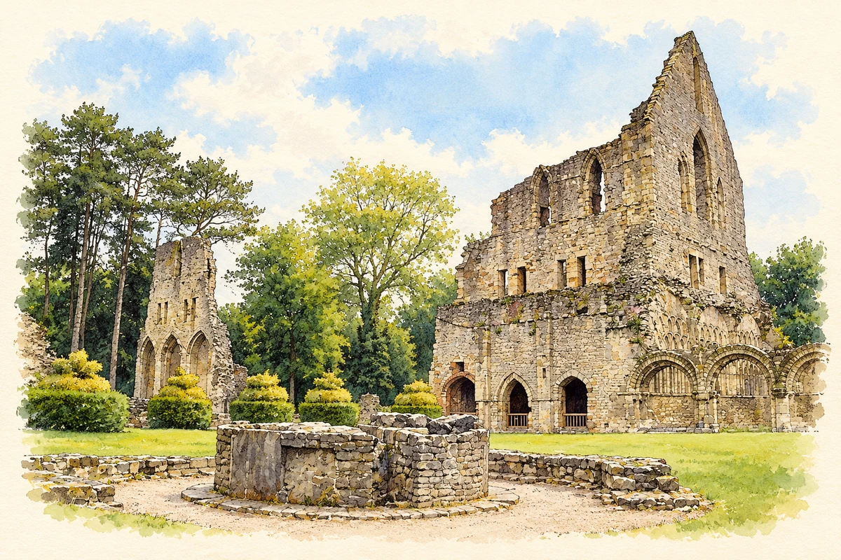
Watercolour and fine ink illustration of Wenlock Priory
Illustration · Wenlock Priory
History & heritage

Place & story

A monastery with connections beyond Shropshire

Merewalh, ruler of the Mercian subkingdom of Magonsaete, founded a monastery at Wenlock between 670 and 680. It housed both monks and nuns under an abbess. After the Norman Conquest, Roger Montgomery refounded the community in 1080–82 for Cluniac monks from La Charité-sur-Loire. Wenlock was therefore part of a religious network extending into France, with a much larger stone church replacing its early predecessor. [2]

After the surrender of the monastery on 26 January 1540, lead was stripped from roofs and much of the complex deteriorated. The prior’s lodging and infirmary survived through conversion into a private home. Their different fate helps explain why a domestic building stands beside the exposed remains of the monastic church. [2]

Government, justice and the market

Wenlock received a borough charter in 1468, but the priory continued to dominate local affairs until its dissolution. The burgesses then assumed direct responsibility for law and order. A courthouse was built in 1540; the council chamber followed in 1577, partly above the older stone prison. Civic authority took physical form beside the former religious precinct. [4]

The Guildhall combined functions that are now often separated. Its upper rooms housed courts and government while the open ground floor served as a corn market until the Corn Exchange opened in 1852. Petty Sessions dealt with minor offences and Quarter Sessions with more serious cases. Magistrates continued sitting here until 1985. The building remains the Town Council’s meeting place. [4]

Limestone, rails and wartime journeys

Much Wenlock’s surroundings supplied limestone to iron furnaces in the Severn district and the Black Country. Quarrying left a transport landscape of its own: tramways carried stone from workings such as Farley, while Shadwell had a railway siding. The railway to Craven Arms opened in 1867 and linked the town with the extensive workings at Presthope. [5]

By 1914 the railway moved livestock and agricultural produce as well as stone. It also carried soldiers away and wounded men back to the Lady Forester Hospital, which had opened in 1903. Demand for local furnace stone was already declining; wartime calls on men and horses deepened the difficulties. Some quarries reopened later, but their commercial peak had passed. [5]

The town’s later buildings and spaces carry these changes into everyday life. The market hall of 1878 became a memorial hall after the First World War and subsequently housed the museum. The town brook was culverted in 1882 as part of sanitary improvements. The last locomotive left Wenlock station in 1962, leaving the former transport route as another layer in a town increasingly read through its surviving buildings and landscape. [8]

Learning, exercise and public spectacle

The Olympian Games emerged from a broader programme of education. William Penny Brookes founded the Agricultural Reading Society in 1841, an early lending library which developed art, music and botany classes. The Olympian Class followed in 1850. Physical recreation sat alongside books and practical knowledge in his efforts to extend opportunities within the town. [6]

The first Games mixed athletics with cricket, football and quoits. Arts competitions included painting, poetry and music, while children could receive prizes for school attainments. Processions of competitors, officials and a band carried the occasion through the streets to the sports field. Wenlock’s Olympian culture was both competitive and communal, with entertainment and learning sharing the programme. [7]

Brookes helped establish the National Olympian Association in 1865 with John Hulley and Ernst Ravenstein. Pierre de Coubertin came to Wenlock in October 1890 to see the Games and discuss an international Olympic revival. Wenlock’s importance lies in that documented exchange and its long-running experiment in participation, alongside the other influences on the modern Olympic movement. [7]

Back to contents
Lives connected to this place

Notable people

Milburga: an abbess building an estate

Milburga was Wenlock’s second abbess and the daughter of its founder, Merewalh. Her community included men and women, with separate churches and living quarters. Her testament describes the expansion of the monastery’s property through gifts and land purchases. Remembered as a saint, she was also a religious leader whose work helped establish the material resources of the institution. [3]

William Penny Brookes: the town doctor

Born in Much Wenlock in 1809, Brookes studied medicine in London and abroad before returning in 1831 to take over his father’s practice. His family home stood in Wilmore Street opposite the parish church. He became a magistrate in 1841. These connections place the founder of the Games within the town’s working institutions, as a doctor, civic figure and organiser of education. [6]

The Milnes Gaskells: a home within the ruins

James Milnes Gaskell bought the priory in 1856. His son Charles and daughter-in-law Lady Catherine developed its house and gardens. Catherine, an author, hosted Henry James and Thomas Hardy: a later literary life within the monastic site. [2]

Back to contents
A chronology

Timeline

Much Wenlock through time

  1. 670–80 — Merewalh establishes the first monastery. [2]

  2. 1080–82 — Wenlock is refounded for Cluniac monks. [2]

  3. 1468 — Edward IV grants borough status. [4]

  4. 1540 — The priory closes; the courthouse is erected. [2] [4]

  5. 1577 — The council chamber is raised above the prison. [4]

  6. 1850 — The first Wenlock Olympian Games are held. [7]

  7. 1867 — The railway to Craven Arms opens. [5]

  8. 1890 — Coubertin visits Brookes and the Wenlock Games. [7]

  9. 1962 — The last locomotive leaves Wenlock station. [8]

  10. 1985 — The Guildhall ceases to serve as a magistrates’ court. [4]

Back to contents

Population over time

Built-up area · Settlement · Census 2021

Much Wenlock

1,765people · 2021

Census 2021 population of the named settlement, using ONS built-up area boundaries.

Published census counts.

Sources: ONS: Towns and cities, characteristics of built-up areas, Census 2021 (Table 1c)

View population figures
Much Wenlock — census population
Census yearPopulation
20211,765
Sources and how to read this chart

Usual residents on 21 March 2021; published ONS count rounded to the nearest 5.. Boundary geography: December 2022 (E63002694).

Census 2021 population of the named settlement, using ONS built-up area boundaries.

ONS Table 1c rounds counts to the nearest 5 and suppresses counts below 10. Matched by exact settlement name or individually reviewed district-qualified name, with its coordinate strictly inside that same official BUA boundary. The 2022 BUA geography changed methodology and cannot be directly compared with 2011 BUAs. Contains OS data © Crown copyright and database right 2026. Contains National Statistics data © Crown copyright and database right 2026.

Source: ONS: Towns and cities, characteristics of built-up areas, Census 2021 (Table 1c). Open Government Licence v3.0. Retrieved 2026-10-26. Source: ONS and Ordnance Survey: Built Up Areas December 2022 GB BGG. Open Government Licence v3.0. Retrieved 2026-10-26.

Neighbourhood census context

These figures describe statistical neighbourhoods, which may cover part of a place or include neighbouring places.

Neighbourhood census area · 1971–2021

Shropshire 029

Population of the area containing the recorded point for Much Wenlock, not the whole place. This area may cover part of the place or include neighbours.

05k10k15k20k1971: 9,091 people19711981: 9,613 people19811991: 9,844 people19912001: 10,005 people20012011: 11,189 people20112021: 11,877 people2021

Includes harmonised historical census estimates.

Sources: ONS · Paul Norman

View population figures
Shropshire 029 — census population and harmonised historical estimates
Census yearPopulation
19719,091
19819,613
19919,844
200110,005
201111,189
202111,877
Sources and how to read this chart

Usual residents of the containing MSOA; this is local area context, not the population of the named settlement.. Boundary geography: 1 April 2022 (E02006010).

2011 and 2021 census counts harmonised by ONS to the same 1 April 2022 geography. Location matched to ONS 2021 MSOA polygons (full resolution, coastline clipped, V7). ONS exact-fit lookup marks this MSOA unchanged from 2011 (U); historical estimates use that same footprint.

1971–2011: Paul Norman harmonised historical estimates on 2011 MSOAs, rounded to whole residents (1971–1991 are modelled). 2021: ONS census count. The historical 2011 total can differ slightly from the ONS change-over-time 2011 total because of methodology and statistical disclosure controls. These are area estimates, not settlement totals.

Source: ONS Census change over time: usual resident population, 2011 and 2021. Open Government Licence v3.0. Retrieved 2026-10-26. Source: ONS MSOA December 2021 boundaries EW BFC V7. Open Government Licence v3.0. Retrieved 2026-10-26. Source: Paul Norman — Area characteristics: Great Britain 1971 to 2011. Creative Commons Attribution 4.0. Retrieved 2026-10-26. Source: ONS MSOA 2011 to MSOA 2021 exact-fit lookup for England and Wales. Open Government Licence v3.0. Retrieved 2026-10-26.

Recorded locationMuch Wenlock52.59512° N · 2.55887° WInteractive map loads when this area enters view.
Approximate recorded location · Geographic source

Geographic context

Place type
Town
Country / region
England · West Midlands
County group
Shropshire
Current administration
Shropshire
Recorded coordinates
52.59512, -2.55887
OS Open Names ID
osgb4000000074562630

County groups are browsing aids. Current administrative and historic areas are recorded separately.

Recorded names

  • Much Wenlock · en · official

Nearby heritage

Distances are from the recorded place point. Proximity does not establish that a site lies within the place boundary or belongs to its history.

Sources & further reading

  1. OS Open Names October 2026 · Source licence.
  2. History of Wenlock Priory · English Heritage
  3. St Milburga · English Heritage
  4. The Guildhall · Much Wenlock Town Council
  5. War Walks on the Home Front: Much Wenlock · Shropshire Council
  6. William Penny Brookes · Wenlock Olympian Society
  7. Starting an Olympic Movement · Wenlock Olympian Society
  8. Much Wenlock Timeline · Visit Much Wenlock
  9. Illustration of Wenlock Priory, adapted from Wenlock Priory, Much Wenlock, Shropshire by Robert Edwards. CC BY-SA 2.0. AI-assisted watercolour and fine ink adaptation; simplified fine detail and removal of incidental clutter.

Geographic source retrieved 2026-10-26. History last researched 2026-10-27. How this page was prepared.