Town

Newport

Newport in Shropshire grew around a market street and the Strine crossing. Fire, philanthropy and new transport altered its buildings while the older street framework endured.

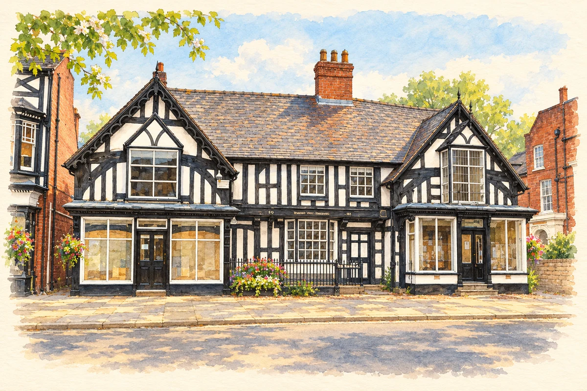
Watercolour and fine ink illustration of Newport Guildhall, Shropshire
Illustration · Newport Guildhall, Shropshire
History & heritage

Place & story

Planning a market town

Newport’s north–south route, mill and bridge over the Strine, church and marketplace shaped a deliberately planned settlement. The Victoria County History scoping study leaves its precise origin open: Roger de Montgomery may have founded it before royal development, or Henry I may have established a new town. The evidence supports planned growth more securely than a single foundation date. [2]

Burgage plots organised the land along High Street. These long street-frontage holdings made the market street a framework for building behind it as well as a place of exchange. Later canals, railway development and suburban housing changed the town’s extent, while that older arrangement remained central to its history. [2]

Worship, teaching and relief

Newport’s institutions combined functions now often separated. The town plan records that Thomas Draper’s fifteenth-century St Mary’s Guild or College supported prayers, schooling and the poor. After its dissolution in 1545, teaching continued as the Royal Free English School until its property and endowments were sold in 1879. St Mary Street preserves the college’s name. [3]

William Adams created another educational foundation in 1656, during the Interregnum. A merchant haberdasher, he obtained Oliver Cromwell’s permission and placed the school under the Master and Wardens of the Haberdashers’ Company. Money and estates supported its future, and an Act of Parliament confirmed the foundation after the Restoration. The arrangement connected a Shropshire town with a London institution. [4]

Fire and rebuilding

The 1665 fire destroyed homes as well as the buildings and stores of trade. The town plan records 162 families left homeless, damage to malthouses, barns and stables, and destruction at the markets. Rebuilding followed the medieval town pattern. The age of a street layout therefore does not establish the age of the buildings standing along it. [3]

The Old Guildhall helps reveal the complexity behind a familiar façade. Historic England identifies a possible guildhall dating from around 1400, later extended and used domestically. Its left crosswing preserves evidence of an open hall, with central bays once open to the roof. An inscription dated 1615 is specifically cautioned against as a building date. Later shopfronts and windows add further layers. [5]

A late canal and an early rival

The Newport Branch opened in 1835 between Norbury Junction and Wappenshall Junction. It connected with the older Shrewsbury Canal, whose western section was altered to accommodate conventional narrowboats. The Canal & River Trust distinguishes these two waterways: the Newport route was a later branch, rather than part of the original tub-boat canal opened towards Shrewsbury in 1797. [6]

The parallel railway opened in 1848, reducing canal trade. Iron ore and limestone nevertheless continued to move by water during the later nineteenth century, before closure came in stages in the twentieth. Newport’s transport history was a period of overlapping systems, with established traffic continuing after railway competition arrived. [6]

An educational institution expands

Adams’ school expanded its teaching facilities through the twentieth century and into the twenty-first. Girls entered the sixth form in 1993; girls joined Year 7 in September 2024 as the school moved to full coeducation. Those changes give the long-lived foundation a social history beyond its seventeenth-century benefactor and buildings. [4]

Back to contents
Lives connected to this place

Notable people

William Adams: a London merchant’s local legacy

William Adams founded Newport’s school in 1656. Its own account describes his family connections in the area and his profession as a merchant haberdasher. His endowment and governors allowed the institution to continue beyond his lifetime. [4]

Back to contents
A chronology

Timeline

Newport through time

  1. Around 1400 — Historic England dates the earliest Old Guildhall fabric to this period. [5]

  2. 1545 — St Mary’s College is dissolved; its educational role continues. [3]

  3. 1656 — William Adams founds his school. [4]

  4. 1665 — Fire destroys homes and commercial property; rebuilding retains the town’s older pattern. [3]

  5. 1835 — The Newport Branch canal opens. [6]

  6. 1848 — A parallel railway adds competition for canal traffic. [6]

  7. 1993 / 2024 — Girls enter Adams’ sixth form and, later, Year 7. [4]

Back to contents

Population over time

Built-up area · Settlement · Census 2021

Newport (Telford and Wrekin)

14,190people · 2021

Census 2021 population of the named settlement, using ONS built-up area boundaries.

Published census counts.

Sources: ONS: Towns and cities, characteristics of built-up areas, Census 2021 (Table 1c)

View population figures
Newport (Telford and Wrekin) — census population
Census yearPopulation
202114,190
Sources and how to read this chart

Usual residents on 21 March 2021; published ONS count rounded to the nearest 5.. Boundary geography: December 2022 (E63002320).

Census 2021 population of the named settlement, using ONS built-up area boundaries.

ONS Table 1c rounds counts to the nearest 5 and suppresses counts below 10. Matched by exact settlement name or individually reviewed district-qualified name, with its coordinate strictly inside that same official BUA boundary. The 2022 BUA geography changed methodology and cannot be directly compared with 2011 BUAs. Contains OS data © Crown copyright and database right 2026. Contains National Statistics data © Crown copyright and database right 2026.

Source: ONS: Towns and cities, characteristics of built-up areas, Census 2021 (Table 1c). Open Government Licence v3.0. Retrieved 2026-10-26. Source: ONS and Ordnance Survey: Built Up Areas December 2022 GB BGG. Open Government Licence v3.0. Retrieved 2026-10-26.

Neighbourhood census context

These figures describe statistical neighbourhoods, which may cover part of a place or include neighbouring places.

Neighbourhood census area · 1971–2021

Telford and Wrekin 003

Population of the area containing the recorded point for Newport, not the whole place. This area may cover part of the place or include neighbours.

01.8k3.5k5.3k7k1971: 3,645 people19711981: 4,777 people19811991: 5,121 people19912001: 5,274 people20012011: 5,521 people20112021: 6,994 people2021

Includes harmonised historical census estimates.

Sources: ONS · Paul Norman

View population figures
Telford and Wrekin 003 — census population and harmonised historical estimates
Census yearPopulation
19713,645
19814,777
19915,121
20015,274
20115,521
20216,994
Sources and how to read this chart

Usual residents of the containing MSOA; this is local area context, not the population of the named settlement.. Boundary geography: 1 April 2022 (E02002930).

2011 and 2021 census counts harmonised by ONS to the same 1 April 2022 geography. Location matched to ONS 2021 MSOA polygons (full resolution, coastline clipped, V7). ONS exact-fit lookup marks this MSOA unchanged from 2011 (U); historical estimates use that same footprint.

1971–2011: Paul Norman harmonised historical estimates on 2011 MSOAs, rounded to whole residents (1971–1991 are modelled). 2021: ONS census count. The historical 2011 total can differ slightly from the ONS change-over-time 2011 total because of methodology and statistical disclosure controls. These are area estimates, not settlement totals.

Source: ONS Census change over time: usual resident population, 2011 and 2021. Open Government Licence v3.0. Retrieved 2026-10-26. Source: ONS MSOA December 2021 boundaries EW BFC V7. Open Government Licence v3.0. Retrieved 2026-10-26. Source: Paul Norman — Area characteristics: Great Britain 1971 to 2011. Creative Commons Attribution 4.0. Retrieved 2026-10-26. Source: ONS MSOA 2011 to MSOA 2021 exact-fit lookup for England and Wales. Open Government Licence v3.0. Retrieved 2026-10-26.

Recorded locationNewport52.76882° N · 2.37848° WInteractive map loads when this area enters view.
Approximate recorded location · Geographic source

Geographic context

Place type
Town
Country / region
England · West Midlands
County group
Shropshire
Current administration
Telford and Wrekin
Recorded coordinates
52.76882, -2.37848
OS Open Names ID
osgb4000000074563224

County groups are browsing aids. Current administrative and historic areas are recorded separately.

Recorded names

  • Newport · en · official

Nearby heritage

Distances are from the recorded place point. Proximity does not establish that a site lies within the place boundary or belongs to its history.

Sources & further reading

  1. OS Open Names October 2026 · Source licence.
  2. A scoping study for a new history of Newport: Appendices, pp. 35–39 · Victoria County History Shropshire · 2019
  3. Newport Town Plan: historical account · Newport Town Council
  4. About Haberdashers’ Adams: Our History · Haberdashers’ Adams
  5. Old Guildhall, list entry 1177807 · Historic England
  6. History of the Shrewsbury & Newport Canal · Canal & River Trust
  7. Illustration of Newport Guildhall, Shropshire, adapted from The Guildhall, Newport, Shropshire by Jeremy Bolwell. CC BY-SA 2.0. AI-assisted watercolour and fine ink adaptation; incidental clutter simplified, warm cream paper margins. Architectural forms follow the inspected reference.

Geographic source retrieved 2026-10-26. History last researched 2026-10-27. How this page was prepared.