Town

Oswestry

An ancient hillfort stands north of a later market town, whose Welsh connections, railway workshops and nearby medical institutions tell distinct but connected stories.

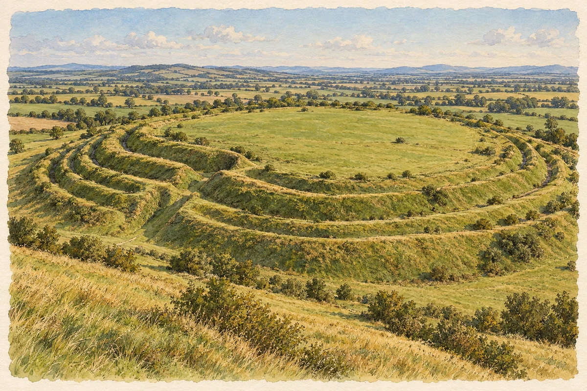
Watercolour and fine ink researched interpretation of Old Oswestry hillfort
Original illustration · Old Oswestry hillfort · researched interpretation
Original illustration; researched sources
Research sources

Researched interpretation; fine detail and surroundings simplified.

English Heritage: description of Old Oswestry; English Heritage: history of Old Oswestry

History & heritage

Place & story

The hill before the town

Old Oswestry’s massive banks belong to a settlement north of the modern town. Excavation identified four phases of rampart construction. Roundhouses, hearths and a crucible for bronze working show that the enclosure was a place of domestic and productive activity as well as defence. Its earthworks grew over time, rather than appearing as one completed design. [2]

Early Iron Age pottery from Wiltshire and salt containers from Cheshire indicate trading links beyond the immediate district. Nearby farms may have supplied food and labour; English Heritage presents that relationship as a possibility. The hillfort’s archaeology should be kept distinct from the much later traditions about King Oswald that became attached to Oswestry’s name. [2] [3]

Castle, streets and markets

A castle was recorded at Oswestry in Domesday Book. The town developed within the contested border landscape, and the castle was rendered uninhabitable after a Civil War siege in 1644. The 2022 Future Oswestry plan places this military history alongside the town’s schools and markets, showing the range of institutions that shaped its centre. [3]

Nineteenth-century improvements changed how the market town operated. The town museum records an 1809 Act for paving and lighting, the purchase of the lord’s market tolls by public subscription in 1833, and new Smithfield and Horsemarkets in 1849. Welsh religious life was also visible in its chapels, including the Hermon Welsh Congregationalist chapel opened in 1842. [4]

Engineering a railway town

The first railway arrived in 1848 on a branch from Gobowen. The Oswestry and Newtown line followed in 1860, and amalgamation created Cambrian Railways in 1864. In 1866 Oswestry became the company’s administrative and engineering headquarters. A town connected to the farming border country now also organised a rail network linking Wales with the West Midlands. [5] [4]

The works constructed, repaired and maintained locomotives and rolling stock. Offices, washhouses, carriage sheds, wagon shops, a foundry and a footbridge formed a substantial working complex. Its later history was one of contraction and reuse: passenger trains ceased in November 1966, the locomotive repair shops closed that December, and goods traffic ended in 1988. The buildings subsequently accommodated other commercial activities. [5]

Care beyond the town centre

The orthopaedic hospital near Oswestry grew from a children’s convalescent home at Baschurch, opened in 1900 by Agnes Hunt and Emily Goodford. Patients began moving to Park Hall in 1920, and the Shropshire Orthopaedic Hospital formally opened in August 1921. The institution belongs to the wider Oswestry area, rather than to the medieval town centre. [6]

Renamed for Robert Jones and Agnes Hunt in 1933, the hospital entered the NHS in 1948. That year also brought a destructive fire and a typhoid outbreak. Later developments included a research centre and specialist spinal services. The hospital’s own chronology describes sustained rebuilding and professional development, adding a medical history to the area’s commercial and railway identities. [6]

Back to contents
Lives connected to this place

Notable people

Wilfred Owen: a brief childhood in Oswestry

Wilfred Owen was born at Plas Wilmot in Oswestry on 18 March 1893 and lived in the town until he was four. His family’s local connections were longer: his grandfather Edward Shaw ran an ironmongery business and became mayor. Owen’s later poetry emerged from his experience of the First World War; the town’s trail uses his family history to explore buildings and streets he and his relatives knew. [7]

Agnes Hunt: nursing and training

Hunt qualified as a nurse in 1891 and developed the Baschurch home with Goodford before the institution moved near Oswestry. In 1927 she founded the Derwen training college. Her local significance extends across treatment and the possibilities of training after illness or disability, with her work rooted in several distinct sites in the surrounding district. [6]

Back to contents
A chronology

Timeline

Oswestry through time

  1. Iron Age — Old Oswestry’s ramparts develop in successive phases. [2]

  2. 1644 — A Civil War siege leaves the castle uninhabitable. [3]

  3. 1849 — Smithfield and Horsemarkets open. [4]

  4. 1866 — Oswestry becomes Cambrian Railways’ administrative and engineering headquarters. [5]

  5. 18 March 1893 — Wilfred Owen is born at Plas Wilmot. [7]

  6. 5 August 1921 — The Shropshire Orthopaedic Hospital officially opens near Oswestry. [6]

  7. 1966 — Passenger trains and locomotive repairs cease. [5]

Back to contents

Population over time

Built-up area · Settlement · Census 2021

Oswestry

17,510people · 2021

Census 2021 population of the named settlement, using ONS built-up area boundaries.

Published census counts.

Sources: ONS: Towns and cities, characteristics of built-up areas, Census 2021 (Table 1c)

View population figures
Oswestry — census population
Census yearPopulation
202117,510
Sources and how to read this chart

Usual residents on 21 March 2021; published ONS count rounded to the nearest 5.. Boundary geography: December 2022 (E63002164).

Census 2021 population of the named settlement, using ONS built-up area boundaries.

ONS Table 1c rounds counts to the nearest 5 and suppresses counts below 10. Matched by exact settlement name or individually reviewed district-qualified name, with its coordinate strictly inside that same official BUA boundary. The 2022 BUA geography changed methodology and cannot be directly compared with 2011 BUAs. Contains OS data © Crown copyright and database right 2026. Contains National Statistics data © Crown copyright and database right 2026.

Source: ONS: Towns and cities, characteristics of built-up areas, Census 2021 (Table 1c). Open Government Licence v3.0. Retrieved 2026-10-26. Source: ONS and Ordnance Survey: Built Up Areas December 2022 GB BGG. Open Government Licence v3.0. Retrieved 2026-10-26.

Neighbourhood census context

These figures describe statistical neighbourhoods, which may cover part of a place or include neighbouring places.

Neighbourhood census area · 1971–2021

Shropshire 007

Population of the area containing the recorded point for Oswestry, not the whole place. This area may cover part of the place or include neighbours.

02.5k5k7.5k10k1971: 6,717 people19711981: 9,433 people19811991: 7,209 people19912001: 7,687 people20012011: 9,200 people20112021: 9,568 people2021

Includes harmonised historical census estimates.

Sources: ONS · Paul Norman

View population figures
Shropshire 007 — census population and harmonised historical estimates
Census yearPopulation
19716,717
19819,433
19917,209
20017,687
20119,200
20219,568
Sources and how to read this chart

Usual residents of the containing MSOA; this is local area context, not the population of the named settlement.. Boundary geography: 1 April 2022 (E02006025).

2011 and 2021 census counts harmonised by ONS to the same 1 April 2022 geography. Location matched to ONS 2021 MSOA polygons (full resolution, coastline clipped, V7). ONS exact-fit lookup marks this MSOA unchanged from 2011 (U); historical estimates use that same footprint.

1971–2011: Paul Norman harmonised historical estimates on 2011 MSOAs, rounded to whole residents (1971–1991 are modelled). 2021: ONS census count. The historical 2011 total can differ slightly from the ONS change-over-time 2011 total because of methodology and statistical disclosure controls. These are area estimates, not settlement totals.

Source: ONS Census change over time: usual resident population, 2011 and 2021. Open Government Licence v3.0. Retrieved 2026-10-26. Source: ONS MSOA December 2021 boundaries EW BFC V7. Open Government Licence v3.0. Retrieved 2026-10-26. Source: Paul Norman — Area characteristics: Great Britain 1971 to 2011. Creative Commons Attribution 4.0. Retrieved 2026-10-26. Source: ONS MSOA 2011 to MSOA 2021 exact-fit lookup for England and Wales. Open Government Licence v3.0. Retrieved 2026-10-26.

Recorded locationOswestry52.86061° N · 3.05553° WInteractive map loads when this area enters view.
Approximate recorded location · Geographic source

Geographic context

Place type
Town
Country / region
England · West Midlands
County group
Shropshire
Current administration
Shropshire
Recorded coordinates
52.86061, -3.05553
OS Open Names ID
osgb4000000074559842

County groups are browsing aids. Current administrative and historic areas are recorded separately.

Recorded names

  • Oswestry · en · official

Nearby heritage

Distances are from the recorded place point. Proximity does not establish that a site lies within the place boundary or belongs to its history.

Sources & further reading

  1. OS Open Names October 2026 · Source licence.
  2. History of Old Oswestry Hillfort · English Heritage
  3. Future Oswestry Plan (November 2022) · Future Oswestry / Shropshire Council
  4. Oswestry Timeline · Oswestry Town Museum
  5. Former Railway Works and Attached Footbridge, list entry 1054302 · Historic England
  6. Historical Factsheet 3: Dates in the History of the Hospital and its Founders · Robert Jones and Agnes Hunt Orthopaedic Hospital NHS Trust
  7. The Oswestry Wilfred Owen Trail · Visit Oswestry
  8. Original illustration of Old Oswestry hillfort by PlaceHistory. Researched sources are linked beneath the illustration. AI-assisted original composition from documentary research; no photograph used as image input.

Geographic source retrieved 2026-10-26. History last researched 2026-10-27. How this page was prepared.