Village

Shifnal

Markets, medieval St Andrew’s and transport links shaped Shifnal’s work and wider connections.

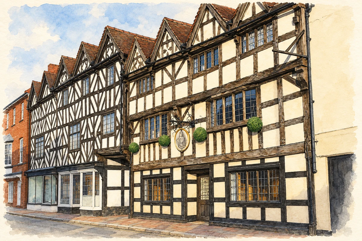
Watercolour and fine ink illustration of Market Place and Park Street, Shifnal
Illustration · Market Place and Park Street, Shifnal
History & heritage

Place & story

Market rights in a farming community

Domesday records Shifnal as Idsall. In 1245 Walter de Dunstanville obtained a charter for a weekly market and yearly fair, with the profits belonging to the lord. Agriculture remained central: even craftspeople and innkeepers kept cattle and grew grain. Trading, service work and farming could coexist within the same household economy. [2]

A church rebuilt across centuries

St Andrew’s combines twelfth- and thirteenth-century work with later medieval changes. A serious fire in 1591 brought another phase of rebuilding; Historic England dates the double hammer-beam roofs of nave and chancel to around that time. Surviving fabric records recovery from disaster as well as successive alterations to medieval fabric. [3]

The building’s fittings and monuments also show how generations used the church. A seventeenth-century wooden pulpit received nineteenth-century enrichment, while memorials to members of the Brigges family occupy the south chapel. Victorian glass came from makers including Hardman and Powell. The interior gathers successive acts of worship, patronage and commemoration. [3]

Coaches give way to trains

Shifnal prospered by serving coaching traffic, but the trade was already shrinking before the railway. When the Wolverhampton–Shrewsbury line opened in 1849, the remaining coaching business rapidly disappeared. Nineteenth-century community buildings offered other forms of connection: schools, chapels and an institute with lectures, a library and reading rooms. [2]

The local history exhibition preserves a model of the Wonder coach, which changed horses at Shifnal on its journey towards London. It also holds examples of Victorian clockmaking and a fragment of charred wood associated with the 1591 fire. These objects connect the broad story of transport and rebuilding with particular things kept in the town. [4]

A changing centre and wider working world

Around 1970, buildings occupying the old marketplace were cleared to create the broader shopping spaces of Bradford Street and Cheapside. Post-war housing expansion brought residents working in Telford and farther afield, while facilities including the cattle market and magistrates’ court disappeared. The town’s outward connections increasingly shaped its daily economy. [2]

Keeping ordinary working lives visible

The exhibition gives space to people whose work left few permanent memorials, including sugar-beet hoers employed on local farms in the 1950s. Indexed photographs, newspapers, parish registers and directories support its research. The collection places agricultural labour alongside coaches and clockmakers, preserving a broader account of the town than its prominent buildings alone could supply. [4]

Back to contents
Lives connected to this place

Notable people

Hannah Cullwick: a Shifnal-born diarist

Hannah Cullwick was born in Shifnal in 1833. Her diaries and letters survive in the Munby collection at Trinity College, Cambridge, providing an unusually extensive record of a domestic servant’s life. She married Arthur Munby in 1873 and continued working in service. Her local connection is birth; the surviving papers document a life extending well beyond the town. [5] [6]

George Gilbert Scott: restoring St Andrew’s

Scott’s connection to Shifnal was professional: he restored St Andrew’s in 1876–79. The church’s appearance therefore reflects Victorian decisions as well as medieval building and the work after the fire. Identifying that intervention helps distinguish a long-used parish building from an unchanged survival of one period. [3]

Back to contents
A chronology

Timeline

Shifnal through time

  1. 1245 — Walter de Dunstanville obtains market and fair rights. [2]

  2. 1591 — Fire destroys buildings and severely damages the church. [2]

  3. 1849 — The Wolverhampton–Shrewsbury railway opens through Shifnal. [2]

  4. 1876–79 — Scott restores St Andrew’s. [3]

  5. Around 1970 — Clearance opens out the old marketplace. [2]

Back to contents

Population over time

Built-up area · Settlement · Census 2021

Shifnal

8,980people · 2021

Census 2021 population of the named settlement, using ONS built-up area boundaries.

Published census counts.

Sources: ONS: Towns and cities, characteristics of built-up areas, Census 2021 (Table 1c)

View population figures
Shifnal — census population
Census yearPopulation
20218,980
Sources and how to read this chart

Usual residents on 21 March 2021; published ONS count rounded to the nearest 5.. Boundary geography: December 2022 (E63002551).

Census 2021 population of the named settlement, using ONS built-up area boundaries.

ONS Table 1c rounds counts to the nearest 5 and suppresses counts below 10. Matched by exact settlement name or individually reviewed district-qualified name, with its coordinate strictly inside that same official BUA boundary. The 2022 BUA geography changed methodology and cannot be directly compared with 2011 BUAs. Contains OS data © Crown copyright and database right 2026. Contains National Statistics data © Crown copyright and database right 2026.

Source: ONS: Towns and cities, characteristics of built-up areas, Census 2021 (Table 1c). Open Government Licence v3.0. Retrieved 2026-10-26. Source: ONS and Ordnance Survey: Built Up Areas December 2022 GB BGG. Open Government Licence v3.0. Retrieved 2026-10-26.

Neighbourhood census context

These figures describe statistical neighbourhoods, which may cover part of a place or include neighbouring places.

Neighbourhood census area · 1971–2021

Shropshire 025

Population of the area containing the recorded point for Shifnal, not the whole place. This area may cover part of the place or include neighbours.

05k10k15k20k1971: 6,112 people19711981: 7,398 people19811991: 7,204 people19912001: 7,039 people20012011: 7,497 people20112021: 10,459 people2021

Includes harmonised historical census estimates.

Sources: ONS · Paul Norman

View population figures
Shropshire 025 — census population and harmonised historical estimates
Census yearPopulation
19716,112
19817,398
19917,204
20017,039
20117,497
202110,459
Sources and how to read this chart

Usual residents of the containing MSOA; this is local area context, not the population of the named settlement.. Boundary geography: 1 April 2022 (E02006008).

2011 and 2021 census counts harmonised by ONS to the same 1 April 2022 geography. Location matched to ONS 2021 MSOA polygons (full resolution, coastline clipped, V7). ONS exact-fit lookup marks this MSOA unchanged from 2011 (U); historical estimates use that same footprint.

1971–2011: Paul Norman harmonised historical estimates on 2011 MSOAs, rounded to whole residents (1971–1991 are modelled). 2021: ONS census count. The historical 2011 total can differ slightly from the ONS change-over-time 2011 total because of methodology and statistical disclosure controls. These are area estimates, not settlement totals.

Source: ONS Census change over time: usual resident population, 2011 and 2021. Open Government Licence v3.0. Retrieved 2026-10-26. Source: ONS MSOA December 2021 boundaries EW BFC V7. Open Government Licence v3.0. Retrieved 2026-10-26. Source: Paul Norman — Area characteristics: Great Britain 1971 to 2011. Creative Commons Attribution 4.0. Retrieved 2026-10-26. Source: ONS MSOA 2011 to MSOA 2021 exact-fit lookup for England and Wales. Open Government Licence v3.0. Retrieved 2026-10-26.

Recorded locationShifnal52.67038° N · 2.37253° WInteractive map loads when this area enters view.
Approximate recorded location · Geographic source

Geographic context

Place type
Village
Country / region
England · West Midlands
County group
Shropshire
Current administration
Shropshire
Recorded coordinates
52.67038, -2.37253
OS Open Names ID
osgb4000000074560602

County groups are browsing aids. Current administrative and historic areas are recorded separately.

Recorded names

  • Shifnal · en · official

Nearby heritage

Distances are from the recorded place point. Proximity does not establish that a site lies within the place boundary or belongs to its history.

Sources & further reading

  1. OS Open Names October 2026 · Source licence.
  2. Shifnal Neighbourhood Plan2014–2026,December2016 · Shifnal Town Council
  3. Church of St Andrew,listentry1367657 · Historic England
  4. The Local History Exhibition · Shifnal History Society
  5. Hannah Cullwick,authoritative entity · OCLC / WorldCat Entities
  6. Papers of A.J.Munby and Hannah Cullwick,MUNB · Trinity College Library,Cambridge
  7. Illustration of Market Place and Park Street, Shifnal, adapted from Market Place and Park Street Shifnal.jpg by Shropman. CC BY-SA 2.5. AI-assisted watercolour and fine ink adaptation; cream paper margins, simplified fine detail and removal of incidental street clutter.

Geographic source retrieved 2026-10-26. History last researched 2026-10-27. How this page was prepared.