Within the Severn’s great loop, Shrewsbury grew as a defended town and a centre of the Welsh cloth trade. Its market buildings, abbey, riverside walks and pioneering flaxmill connect commerce, public life and engineering.
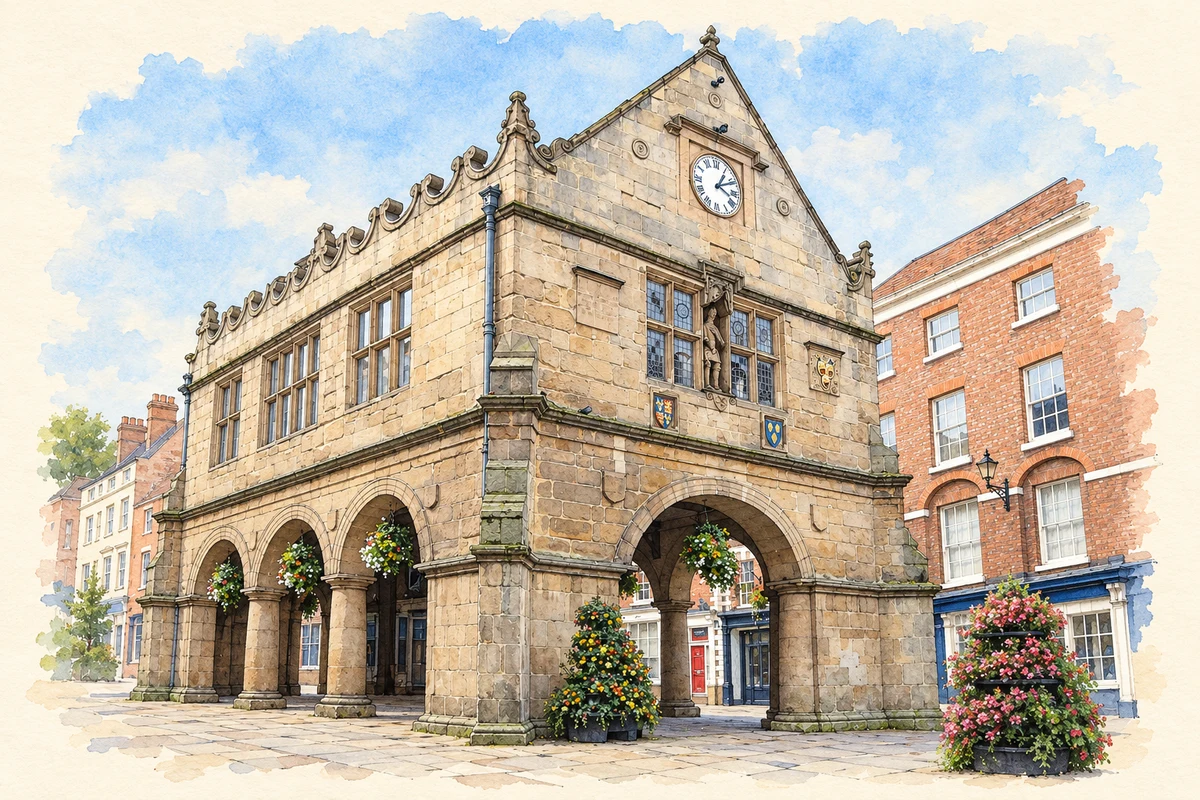
Illustration · The Old Market Hall, Shrewsbury
History & heritage
Place & story
A castle imposed on an older town
Shrewsbury was a substantial settlement before the Norman Conquest, with a sheriff and tax-paying houses. Excavation at the castle in 2019 established domestic occupation on the site between about 900 and 1066. An earlier defensive stronghold there remains unproven. The distinction matters: evidence of people living on the hill does not by itself establish the form of their buildings or the authority exercised from them.[2]
A Norman castle stood here by 1069. Domesday recorded that its construction had destroyed 51 tax-paying houses and left another 50 “wasted”. Its position allowed military control of the northern approaches and the river, as well as housing a garrison. The castle’s commanding setting can therefore be read as an instrument of conquest that displaced part of the existing town.[2]
An abbey beyond the town centre
Roger de Montgomery founded Shrewsbury Abbey in 1083 on the site of an existing Saxon church. The Benedictine monastery became a separate religious centre on the east side of the town. After the Dissolution, the surviving part of the abbey church continued as the parish church of Holy Cross. Continued parish use helps explain why a substantial church remains while the larger monastic institution disappeared.[3]
Cloth, merchants and the market square
Shrewsbury’s cloth trade connected Welsh producers with finishers and distant buyers. The Drapers Company bought unfinished cloth, put it out to shearmen for finishing, and sent it by packhorse towards London’s Blackwell Hall. From there it entered overseas trade. The official trading centre moved from Oswestry to Shrewsbury in 1620, strengthening a commercial relationship that reached far beyond the town’s own manufacturers.[5]
The Old Market Hall, built by the corporation in 1596, gave trade a conspicuous architectural setting. Grinshill stone distinguished it from the timber buildings common in the town. Corn sellers used the lower level, while the upper space served the cloth trade. Major repairs in 1804–18 included iron brackets supplied by William Hazledine, an example of newer engineering helping an older commercial building remain useful.[4]
The power of the cloth merchants extended into government and property. The Drapers’ own history describes their influence over civic office and their fine town houses; Thomas Jones, a leading member, became the first mayor in 1638. This wealth depended on a chain of work that included Welsh weavers and local finishers as well as the merchants who handled the sales.[5]
Working ground becomes a riverside walk
The Quarry had practical uses before it became a public pleasure ground. Common land supported grazing, textile drying and stone extraction. Lime-tree walks planted in 1719 helped turn the riverside into a promenade; the corporation purchased the Quarry for recreation in 1875. The Dingle, now a sunken garden, occupies a former wet quarry. Leisure grew out of a landscape already shaped by common rights and work.[6]
A flaxmill designed around the danger of fire
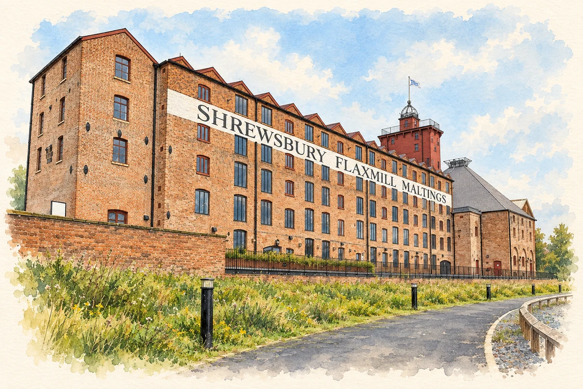
At Ditherington, north of the town centre, the Benyon brothers and John Marshall chose a site beside the Shrewsbury Canal for a new flaxmill. Production began in 1797. The canal supplied coal for steam power, while machinery spun flax into thread for linen. This was a different scale and organisation of textile work from the merchants’ earlier system of buying and finishing cloth.[7]
Charles Bage’s mill used iron columns and beams with shallow brick arches in place of conventional timber floor supports. The outer brick walls also carried part of the load. Its importance lies in an early practical attempt to reduce fire risk using an iron internal frame, developed through experiment and specialist foundry work.[8][7]
The workforce included men, women and children, with some early child workers supplied through parish apprenticeships and housed on the site. Innovation did not remove hard working conditions or the demands imposed by machinery and long hours. After flax production ended, conversion into a maltings in 1897–98 altered the windows and added new structures, adapting the same buildings to produce a brewing ingredient from barley.[7]
Charles Bage: a local merchant becomes a structural designer
Bage was living in Shrewsbury by 1776 and worked as a wine merchant and surveyor. His interest in engineering brought him into contact with Thomas Telford and ironfounder William Hazledine; correspondence with William Strutt also records his investigation of iron construction. Designing the Ditherington mill gave those interests a demanding local application. The building emerged from a network of practical knowledge rather than a single isolated invention.[12][9]
Charles Darwin: curiosity at The Mount
Darwin was born at The Mount, above the Severn, on 12 February 1809. His childhood in Shrewsbury included collecting, reading and observing plants and insects, and helping his brother Erasmus with experiments in a home laboratory. These are specific early connections with the town. His later scientific work ranged far beyond it, but the birthplace preserves the setting of an inquisitive household in which natural history and experiment were part of growing up.[10]
Wilfred Owen: a family home in Monkmoor Road
Owen was born near Oswestry, not in Shrewsbury. His family rented the house now numbered 69 Monkmoor Road from 1910, and it became his last permanent family home. Early poetry and his later visits connect him with this suburban setting. He was killed in France on 4 November 1918; the news reached his parents on Armistice Day. The house’s significance rests on that domestic association, alongside the war poetry written elsewhere.[11]
Shropshire 019 — census population and harmonised historical estimates
Census year
Population
1971
5,914
1981
5,617
1991
5,926
2001
6,601
2011
8,104
2021
8,485
Sources and how to read this chart
Usual residents of the containing MSOA; this is local area context, not the population of the named settlement.. Boundary geography: 1 April 2022 (E02006033).
2011 and 2021 census counts harmonised by ONS to the same 1 April 2022 geography. Location matched to ONS 2021 MSOA polygons (full resolution, coastline clipped, V7). ONS exact-fit lookup marks this MSOA unchanged from 2011 (U); historical estimates use that same footprint.
1971–2011: Paul Norman harmonised historical estimates on 2011 MSOAs, rounded to whole residents (1971–1991 are modelled). 2021: ONS census count. The historical 2011 total can differ slightly from the ONS change-over-time 2011 total because of methodology and statistical disclosure controls. These are area estimates, not settlement totals.
Illustration of The Old Market Hall, Shrewsbury, adapted from Shrewsbury Market Hall 06.JPG by Richard Symonds. CC BY-SA 3.0. AI-assisted watercolour and fine ink adaptation; cream paper margins, simplified fine detail and removal of incidental street clutter.
Illustration of Shrewsbury Flaxmill Maltings, adapted from Shrewsbury Flaxmill Maltings — Restored building in 2023 by TCExplorer. CC BY-SA 2.0. AI-assisted watercolour and fine ink adaptation; fine architectural detail and planting simplified. Incidental cafe furniture simplified; adaptation shared under CC BY-SA 2.0.
 place