Town

Wem

A medieval market town rebuilt after fire became a centre of schooling and sweet-pea cultivation. Its history runs from agricultural trade to new uses for a much-tested town hall.

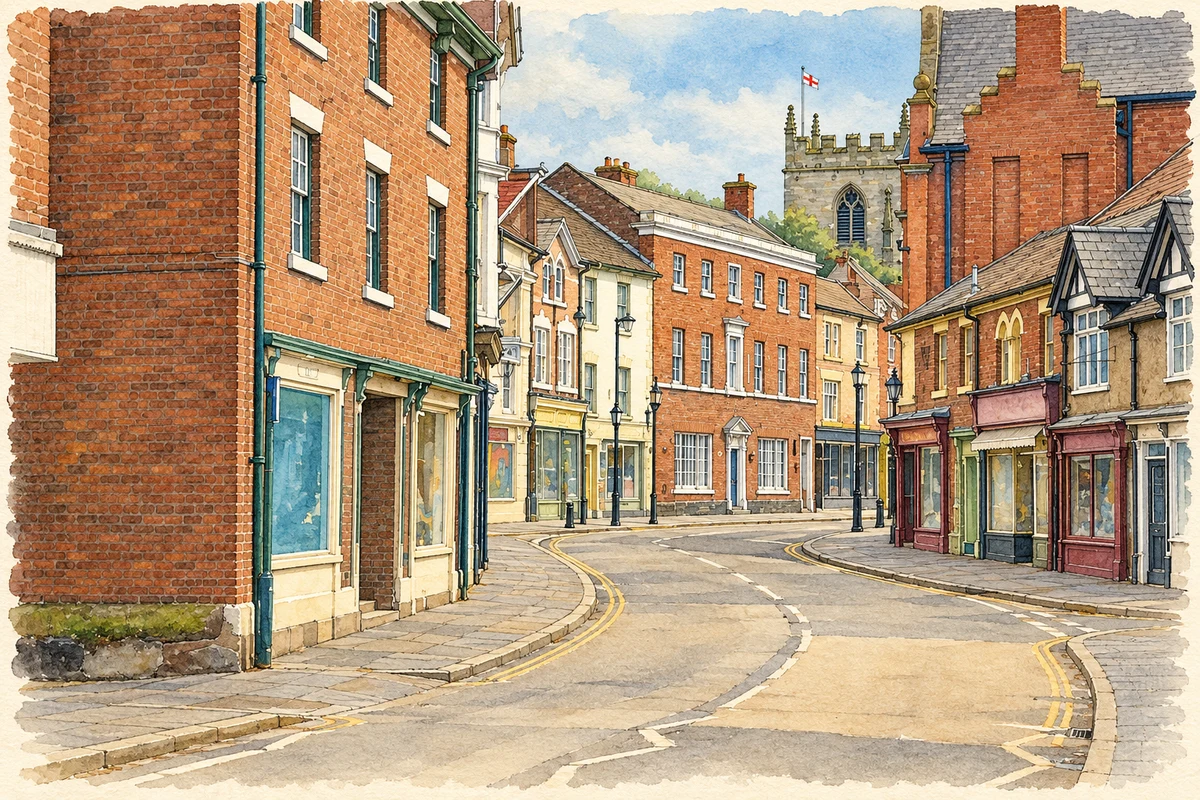
Watercolour and fine ink illustration of Wem High Street
Illustration · Wem High Street
History & heritage

Place & story

A town for a rural district

Wem developed after the Norman Conquest around a castle, church, market and watermill. The Victoria County History distinguishes the urban township ‘within the bars’ from its rural hinterland ‘without the bars’. Burgage holdings gave the settlement an urban structure, although the borough never became a corporation. Its role lay in serving a large surrounding manor and parish. [3]

King John granted a market in 1202. Originally a Sunday market, it moved to Thursday after Sunday markets were prohibited in 1351. Trading rights helped give the town a recurring purpose for people living beyond its streets. [2]

Agricultural produce, particularly cheese, was central to Wem’s economy. Its distance from major regional routes limited its development, but the railway later gave residents access to employment elsewhere. The town’s history combines the provision of rural services with changing ways of travelling to work. [3]

War and rebuilding

Wem declared for Parliament in 1643, and Colonel Mytton organised its defences. Lord Capel’s attack was resisted by the town’s defenders. A later verse celebrating ‘the women of Wem’ preserves the episode in local memory, although a commemorative rhyme cannot by itself tell us exactly who fought. [2]

The fire of 1677 destroyed many central buildings. Rebuilding helps explain the Georgian and Victorian appearance of streets whose layout is much older. The apparent age of the façades therefore gives only part of the settlement’s history: a medieval town survives beneath a later architectural surface. [3]

A school sustained and changed

Sir Thomas Adams, a Wem native who became Lord Mayor of London, founded the Free School of Wem in 1650. He endowed it with property, including his own house. The foundation connected success outside Shropshire with educational provision in the founder’s hometown. [4]

The institution changed with national expectations of schooling. In 1976 the grammar school merged with Wem Secondary Modern School to form a comprehensive school for pupils aged eleven to eighteen. That change widened the form of provision while retaining the older foundation’s name and local identity. [4]

Restoring the town hall’s purpose

Fire returned to the civic centre in 1995, destroying the original town hall. A rebuilt hall reopened in 2000 but closed again in 2005 apart from the weekly market. The difficulty was maintaining a viable public building as well as replacing its fabric. [5]

Community meetings led to the creation of Wem Town Hall Community Trust. The trust joined forces with Thomas Adams School in 2006, and the building reopened in 2009 with public-sector support. In 2014 the trust assumed full operational responsibility. Education, arts activity and local organisation thus became part of the hall’s recovery. [5]

Back to contents
Lives connected to this place

Notable people

Henry Eckford: breeding becomes a business

Henry Eckford was born in Midlothian in 1823 and developed his horticultural career in Scotland and England before establishing a nursery at Wem in 1888. His sweet-pea breeding had begun earlier in Gloucestershire, so Wem should be understood as the home of his later nursery business rather than the birthplace of every stage of his work. [6]

From a house at Noble and Market Streets, Eckford ran a ten-acre nursery on Soulton Road. Expansion brought the purchase of adjoining Market Street houses for storing and packing seeds. This was cultivation connected to distribution: new flower varieties supported land-based work and commercial premises in the town. [6]

Wem’s sweet-pea show commemorates that horticultural inheritance, with a separate division for older varieties dating from before 1910. The flower’s local significance continues through organised growing and exhibiting, rather than resting solely on a famous breeder’s name. [7]

William Hazlitt: a childhood in Wem

William Hazlitt (1778–1830) was born in Maidstone and spent much of his childhood in Wem. His father was a Unitarian minister, and in 1793 the younger Hazlitt went to New College, Hackney. He later became an essayist, literary and art critic, and political journalist. His local connection belongs to his formative years in a Dissenting household, not to a claim that his mature writing career was based entirely here. [8]

Back to contents
A chronology

Timeline

Wem through time

  1. 1202 — King John grants a market. [2]

  2. 1351 — The market changes from Sunday to Thursday. [2]

  3. 1643 — Wem declares for Parliament and resists Lord Capel’s attack. [2]

  4. 1650 — Sir Thomas Adams founds the Free School of Wem. [4]

  5. 1677 — Fire destroys many buildings in the town centre. [3]

  6. 1888 — Henry Eckford establishes his nursery in Wem. [6]

  7. 1976 — Grammar and secondary modern schools merge into a comprehensive school. [4]

  8. 1995–2009 — Fire, rebuilding and closure precede the town hall’s reopening under a community partnership. [5]

Back to contents

Population over time

Built-up area · Settlement · Census 2021

Wem

6,280people · 2021

Census 2021 population of the named settlement, using ONS built-up area boundaries.

Published census counts.

Sources: ONS: Towns and cities, characteristics of built-up areas, Census 2021 (Table 1c)

View population figures
Wem — census population
Census yearPopulation
20216,280
Sources and how to read this chart

Usual residents on 21 March 2021; published ONS count rounded to the nearest 5.. Boundary geography: December 2022 (E63002167).

Census 2021 population of the named settlement, using ONS built-up area boundaries.

ONS Table 1c rounds counts to the nearest 5 and suppresses counts below 10. Matched by exact settlement name or individually reviewed district-qualified name, with its coordinate strictly inside that same official BUA boundary. The 2022 BUA geography changed methodology and cannot be directly compared with 2011 BUAs. Contains OS data © Crown copyright and database right 2026. Contains National Statistics data © Crown copyright and database right 2026.

Source: ONS: Towns and cities, characteristics of built-up areas, Census 2021 (Table 1c). Open Government Licence v3.0. Retrieved 2026-10-26. Source: ONS and Ordnance Survey: Built Up Areas December 2022 GB BGG. Open Government Licence v3.0. Retrieved 2026-10-26.

Neighbourhood census context

These figures describe statistical neighbourhoods, which may cover part of a place or include neighbouring places.

Neighbourhood census area · 1971–2021

Shropshire 008

Population of the area containing the recorded point for Wem, not the whole place. This area may cover part of the place or include neighbours.

01.8k3.5k5.3k7k1971: 3,188 people19711981: 3,997 people19811991: 4,893 people19912001: 5,108 people20012011: 5,873 people20112021: 6,282 people2021

Includes harmonised historical census estimates.

Sources: ONS · Paul Norman

View population figures
Shropshire 008 — census population and harmonised historical estimates
Census yearPopulation
19713,188
19813,997
19914,893
20015,108
20115,873
20216,282
Sources and how to read this chart

Usual residents of the containing MSOA; this is local area context, not the population of the named settlement.. Boundary geography: 1 April 2022 (E02006019).

2011 and 2021 census counts harmonised by ONS to the same 1 April 2022 geography. Location matched to ONS 2021 MSOA polygons (full resolution, coastline clipped, V7). ONS exact-fit lookup marks this MSOA unchanged from 2011 (U); historical estimates use that same footprint.

1971–2011: Paul Norman harmonised historical estimates on 2011 MSOAs, rounded to whole residents (1971–1991 are modelled). 2021: ONS census count. The historical 2011 total can differ slightly from the ONS change-over-time 2011 total because of methodology and statistical disclosure controls. These are area estimates, not settlement totals.

Source: ONS Census change over time: usual resident population, 2011 and 2021. Open Government Licence v3.0. Retrieved 2026-10-26. Source: ONS MSOA December 2021 boundaries EW BFC V7. Open Government Licence v3.0. Retrieved 2026-10-26. Source: Paul Norman — Area characteristics: Great Britain 1971 to 2011. Creative Commons Attribution 4.0. Retrieved 2026-10-26. Source: ONS MSOA 2011 to MSOA 2021 exact-fit lookup for England and Wales. Open Government Licence v3.0. Retrieved 2026-10-26.

Recorded locationWem52.85570° N · 2.72378° WInteractive map loads when this area enters view.
Approximate recorded location · Geographic source

Geographic context

Place type
Town
Country / region
England · West Midlands
County group
Shropshire
Current administration
Shropshire
Recorded coordinates
52.85570, -2.72378
OS Open Names ID
osgb4000000074562248

County groups are browsing aids. Current administrative and historic areas are recorded separately.

Recorded names

  • Wem · en · official

Nearby heritage

Distances are from the recorded place point. Proximity does not establish that a site lies within the place boundary or belongs to its history.

Sources & further reading

  1. OS Open Names October 2026 · Source licence.
  2. History of Wem · Wem Town Council
  3. Wem: Victoria County History Short · Institute of Historical Research / Victoria County History
  4. Our History · Thomas Adams School
  5. History · Wem Town Hall Community Trust
  6. Henry Eckford · Parks & Gardens / Hestercombe
  7. Wem Sweet Pea Show · Wem Town Hall
  8. About William Hazlitt · Hazlitt Society / University College London
  9. Illustration of Wem High Street, adapted from Wem Shropshire High Street.jpg by Thxapproved. CC BY-SA 4.0. AI-assisted watercolour and fine ink adaptation; cream paper margins, simplified fine detail and removal of incidental street clutter.

Geographic source retrieved 2026-10-26. History last researched 2026-10-27. How this page was prepared.