Village

Brewood

Brewood’s medieval market plan survives beneath Georgian frontages, while a canal, schools and two substantial churches tell of changing work and patronage.

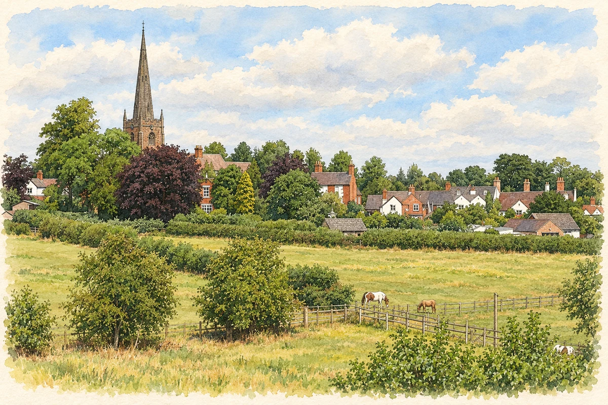
Watercolour and fine ink illustration of Brewood church tower seen from the Shropshire Union Canal
Illustration · Brewood church tower seen from the Shropshire Union Canal
History & heritage

Place & story

Reading a market town beneath the village

Brewood’s historic core retains the plan of a small medieval market town. Long plots on Dean Street and the shape of the market square preserve evidence of urban organisation. The county’s historic environment assessment suggests that this planning may be associated with the bishop’s early-thirteenth-century market grant; a survey of 1298 already mentions burgage plots. The surviving streets are evidence of commercial ambition as well as picturesque buildings. [4]

Archaeology east of The Pavement has revealed tanning and other industrial activities between the thirteenth and early sixteenth centuries. The town’s working history therefore extended beyond its market stalls. The urban survey notes that the loss of industry there and the market’s later decline may indicate contraction, while nineteenth-century directories still show varied local trades. [3]

Old structures and new frontages

Georgian-looking streets do not necessarily contain Georgian buildings throughout. The urban survey describes earlier houses altered and given brick fronts during the eighteenth and nineteenth centuries. More conspicuous is Speedwell Castle, a mid-eighteenth-century red-brick house at the former market place’s corner, designed in an irregular Gothic style. Historic England carefully calls its funding from bets on a horse named Speedwell a reputation rather than a documented certainty. [3] [9]

A canal beside an older commercial centre

The Birmingham and Liverpool Junction Canal, now part of the Shropshire Union, opened in March 1835. It brought a new transport route to Brewood’s western edge. The conservation appraisal records wharves and warehouses by 1851 and connects better transport with agricultural machinery manufacture, lock making and clock making. Heavy goods and locally made products gained a route beyond the town’s roads. [10] [5]

Improved transport did not restore the old market’s position. The same appraisal links its final discontinuance by 1851 with Wolverhampton’s growing importance. Private boarding schools expanded during the nineteenth century, and Brewood acquired a more rural village character. Its changing economy was a combination of manufacturing connections, education and service to the surrounding countryside. [5]

Schools and opportunities to read

The grammar school’s early origins remain uncertain. Staffordshire Past Track says a fifteenth-century foundation is possible but records a refoundation around 1560 involving Sir John Giffard, Thomas Giffard and Matthew Knightley. Its earlier buildings were replaced in the nineteenth century, and the grammar school closed in 1977. Schooling was an enduring institution even as buildings and organisation changed. [6]

Education also reached beyond the grammar school. The urban survey records a National School, private academies and a reading room built by T W Giffard in 1857. A clergy-founded library was held by the Working Men’s Institute by 1874. These institutions connect patronage with children’s schooling and adults’ access to books. [3]

Two churches and nineteenth-century choices

St Mary and St Chad’s parish church contains thirteenth- and sixteenth-century fabric. Its long chancel, aisled nave and west tower and spire retain the scale of a substantial medieval institution. George Edmund Street thoroughly restored it between 1878 and 1880. The building records Victorian decisions about the presentation of medieval worship as well as the earlier fabric itself. [2]

The Catholic church of St Mary represents a different nineteenth-century project. Built in 1843–44 to Augustus Welby Northmore Pugin’s design, it uses local sandstone and a thirteenth-century pointed architectural language. The parish records that the Giffards gave the land and supported the early priests, and that the church opened in June 1844. The village’s religious landscape was sustained by patrons as well as architects. [7] [8]

Back to contents
Lives connected to this place

Notable people

A W N Pugin: designing for a Catholic parish

Pugin’s connection with Brewood was his design of St Mary’s Catholic church. It was a local expression of his commitment to Gothic architecture, with aisles, chapels and a west tower and spire arranged for parish worship. Historic England also records his design of two memorials in the chancel floor, made by Hardman, extending his contribution from the building to its fittings. [7]

Back to contents
A chronology

Timeline

Brewood through time

  1. 1298 — A bishop’s survey records burgage plots in Brewood. [4]

  2. Around 1560 — The grammar school is refounded. [6]

  3. Mid-eighteenth century — Speedwell Castle is built beside the former market place. [9]

  4. March 1835 — The canal opens. [10]

  5. June 1844 — St Mary’s Catholic church opens. [8]

  6. 1878–80 — Street restores St Mary and St Chad’s. [2]

  7. 1977 — Brewood Grammar School closes. [6]

Back to contents

Population over time

Built-up area · Settlement · Census 2021

Brewood

2,550people · 2021

Census 2021 population of the named settlement, using ONS built-up area boundaries.

Published census counts.

Sources: ONS: Towns and cities, characteristics of built-up areas, Census 2021 (Table 1c)

View population figures
Brewood — census population
Census yearPopulation
20212,550
Sources and how to read this chart

Usual residents on 21 March 2021; published ONS count rounded to the nearest 5.. Boundary geography: December 2022 (E63002535).

Census 2021 population of the named settlement, using ONS built-up area boundaries.

ONS Table 1c rounds counts to the nearest 5 and suppresses counts below 10. Matched by exact settlement name or individually reviewed district-qualified name, with its coordinate strictly inside that same official BUA boundary. The 2022 BUA geography changed methodology and cannot be directly compared with 2011 BUAs. Contains OS data © Crown copyright and database right 2026. Contains National Statistics data © Crown copyright and database right 2026.

Source: ONS: Towns and cities, characteristics of built-up areas, Census 2021 (Table 1c). Open Government Licence v3.0. Retrieved 2026-10-26. Source: ONS and Ordnance Survey: Built Up Areas December 2022 GB BGG. Open Government Licence v3.0. Retrieved 2026-10-26.

Neighbourhood census context

These figures describe statistical neighbourhoods, which may cover part of a place or include neighbouring places.

Neighbourhood census area · 1971–2021

South Staffordshire 003

Population of the area containing the recorded point for Brewood, not the whole place. This area may cover part of the place or include neighbours.

02k4k6k8k1971: 6,488 people19711981: 6,986 people19811991: 7,142 people19912001: 7,025 people20012011: 7,333 people20112021: 7,328 people2021

Includes harmonised historical census estimates.

Sources: ONS · Paul Norman

View population figures
South Staffordshire 003 — census population and harmonised historical estimates
Census yearPopulation
19716,488
19816,986
19917,142
20017,025
20117,333
20217,328
Sources and how to read this chart

Usual residents of the containing MSOA; this is local area context, not the population of the named settlement.. Boundary geography: 1 April 2022 (E02006176).

2011 and 2021 census counts harmonised by ONS to the same 1 April 2022 geography. Location matched to ONS 2021 MSOA polygons (full resolution, coastline clipped, V7). ONS exact-fit lookup marks this MSOA unchanged from 2011 (U); historical estimates use that same footprint.

1971–2011: Paul Norman harmonised historical estimates on 2011 MSOAs, rounded to whole residents (1971–1991 are modelled). 2021: ONS census count. The historical 2011 total can differ slightly from the ONS change-over-time 2011 total because of methodology and statistical disclosure controls. These are area estimates, not settlement totals.

Source: ONS Census change over time: usual resident population, 2011 and 2021. Open Government Licence v3.0. Retrieved 2026-10-26. Source: ONS MSOA December 2021 boundaries EW BFC V7. Open Government Licence v3.0. Retrieved 2026-10-26. Source: Paul Norman — Area characteristics: Great Britain 1971 to 2011. Creative Commons Attribution 4.0. Retrieved 2026-10-26. Source: ONS MSOA 2011 to MSOA 2021 exact-fit lookup for England and Wales. Open Government Licence v3.0. Retrieved 2026-10-26.

Recorded locationBrewood52.67690° N · 2.17383° WInteractive map loads when this area enters view.
Approximate recorded location · Geographic source

Geographic context

Place type
Village
Country / region
England · West Midlands
County group
Staffordshire
Current administration
South Staffordshire
Current administration
Staffordshire
Recorded coordinates
52.67690, -2.17383
OS Open Names ID
osgb4000000074563016

County groups are browsing aids. Current administrative and historic areas are recorded separately.

Recorded names

  • Brewood · en · official

Nearby heritage

Distances are from the recorded place point. Proximity does not establish that a site lies within the place boundary or belongs to its history.

Sources & further reading

  1. OS Open Names October 2026 · Source licence.
  2. Church of St Mary and St Chad, 1060197 · Historic England
  3. Brewood Extensive Urban Survey · Staffordshire County Council
  4. South Staffordshire Historic Environment Character Assessment · Staffordshire County Council / South Staffordshire Council
  5. Brewood Conservation Area Management Plan · South Staffordshire Council / The Conservation Studio
  6. Grammar School Brewood · Staffordshire Past Track
  7. Roman Catholic Church of St Mary, 1039334 · Historic England
  8. History · St Mary’s Catholic Parish, Brewood
  9. Speedwell Castle, Bargate Street · Historic England Archive
  10. Brewood Wharf · Staffordshire Past Track / Staffordshire Record Office
  11. Illustration of Brewood church tower seen from the Shropshire Union Canal, adapted from Brewood.jpg by Oosoom at English Wikipedia. CC BY-SA 3.0. AI-assisted watercolour and fine ink adaptation; cream paper margins, simplified fine detail and removal of incidental street clutter.

Geographic source retrieved 2026-10-26. History last researched 2026-10-26. How this page was prepared.