Town

Burton upon Trent

A wealthy abbey grew beside the Trent crossing. Brewing later joined local water to canals, railways and skilled labour, leaving towers, warehouses and records of work across Burton.

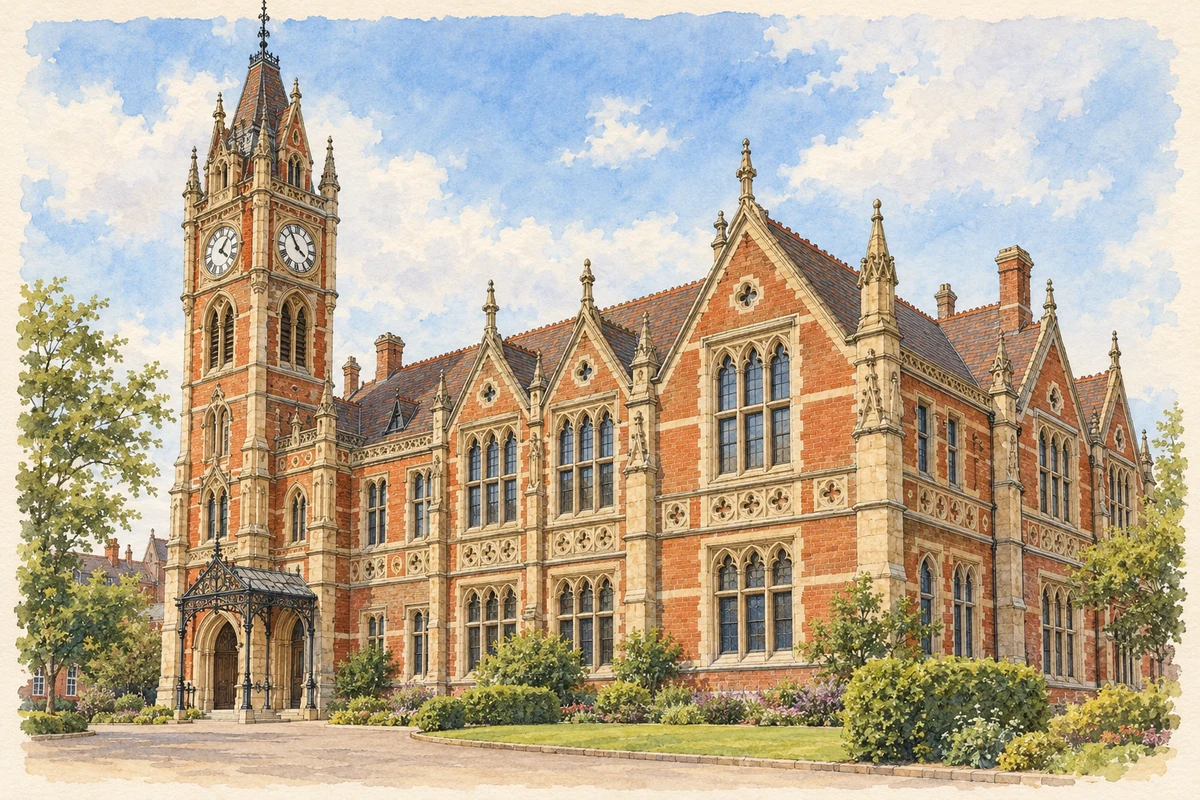
Watercolour and fine ink illustration of Burton upon Trent Town Hall
Illustration · Burton upon Trent Town Hall
Original illustration; researched sources
Research sources

Original architectural composition based on the cited building descriptions; incidental setting and fine details are interpretive.

Historic England: Burton Town Hall; Sika: Burton Town Hall conservation project

History & heritage

Place & story

A religious house beside the crossing

Historic England dates Burton’s Benedictine abbey to 1002 and names its founder as Wulfric Spot. Though its community was relatively small, it became Staffordshire’s wealthiest religious house. Its position beside a river crossing and important road helped sustain that influence. The medieval story therefore belongs to movement and exchange as well as religious observance. [2]

The abbey contained more than a church. A cloister linked accommodation for the abbot with a refectory and chapter house, while a detached infirmary and chapel stood to the south-east. After the Dissolution the site passed to the Pagets and much of it decayed. Part of the infirmary survives within the building called The Abbey; standing cloister walling and buried remains preserve other evidence. [2]

A new parish church in the old religious centre

St Modwen’s presents an eighteenth-century building in the area of the former abbey church. Historic England dates it to 1719–26, by William and Richard Smith of Tettenhall and completed by Francis Smith. Its Palladian design has an eastern apse, a substantial west tower and galleries inside. A fifteenth-century font survives alongside the later work, and the organ case dates from 1771. Rebuilding left older fittings within a new architectural setting. [3] [2]

Water that could be brewed, routes that could sell it

Burton’s wells supplied mineral-rich water filtered through gypsum deposits, particularly useful to brewers. A reputation for ale was insufficient without a way to reach distant customers. The Civic Society’s history identifies the opening of Trent navigation from 1712, completion of the Trent and Mersey Canal in 1777 and the railway’s arrival in 1839 as successive changes in the town’s trading connections. [4]

Water transport carried inputs as well as beer. Ray Shill’s study of the town’s river and canal trade emphasises barley, coal and timber: grain for malting, fuel for heating and power, and wood for casks. Making beer required a supply chain of different materials and occupations. The outgoing barrel was only one stage of the work supported by the waterways. [5]

A landscape of brewing buildings

Architectural records explain some of that system. Historic England’s photographic records identify Pickford’s grain warehouse as evidence of the close connection between brewing and rail transport. An office building in Station Street dates from 1865, while the central brewing tower at the Shobnall Road brewery dates from 1875. Storage, administration and production each left a different building type. [6]

The industry also required movement between its buildings. Bottles and casks had to be packed, loaded and transferred, while grain and fuel arrived in bulk. Warehouses, brewery yards and transport connections make more sense as related parts of an undertaking than as isolated picturesque factories. [6] [5] [7] [8]

Workers behind the brewery names

Coopers made the many wooden casks required by brewing. Their skill is remembered in the Burton Cooper, a bronze statue commissioned by the Civic Society in 1977. The monument broadens public memory beyond the names of brewery owners, recognising a specialist craft on which storing and moving beer depended. [4]

Photographs in the National Brewery Centre collection, catalogued by Staffordshire Past Track, record women undertaking heavy and repetitive work. One image, dated approximately 1914–18, records women rolling casks between Bass buildings. Another, dated approximately 1914–25, records bottle packing at Shobnall Ale Stores, using wooden crates and straw. These particular records document tasks and workplaces; they do not establish how every brewery organised its workforce. [7] [8]

A brewing by-product becomes another industry

Brewing supplied a raw material for food manufacture too. Unilever’s report for 2018 describes the Burton factory receiving brewers’ yeast to make Marmite. It also records waste from that process entering an on-site digester, producing gas for boilers that supplied factory steam. The report offers a dated example of one industry’s residual material supporting another, rather than a claim about every stage of the plant’s present operation. [9]

The Civic Society records former brewery buildings and sidings giving way to housing, shops and business space. Surviving structures and archival records preserve evidence where the industrial landscape has changed. [4]

Back to contents
Lives connected to this place

Notable people

William Bass: a carrier becomes a brewer

William Bass established his brewery on Burton’s High Street in 1777 after working in the carriage of beer. That connection joins transport with manufacture in a single career. His significance here is the business he founded in the town; the later company’s growth should be distinguished from the scale of his original undertaking. [10]

William Henry Worthington: brewing and civic office

William Henry Worthington, the brewer who became Burton’s first mayor in 1878, also served as mayor in 1884. Staffordshire Past Track preserves a lantern-slide copy of his official portrait and records his life dates as 1826–94. His public role shows how brewing families participated in government as well as commerce. [11]

Back to contents
A chronology

Timeline

Burton upon Trent through time

  1. 1002 — Historic England dates the foundation of Wulfric Spot’s abbey to this year. [2]

  2. Sixteenth century — Following the Dissolution, the abbey buildings pass to the Pagets. [2]

  3. 1712 — Trent navigation opens wider markets to the town. [4]

  4. 1719–26 — The present St Modwen’s Church is built. [3]

  5. 1777 — The Trent and Mersey Canal is completed; William Bass founds his brewery in High Street. [4] [10]

  6. 1839 — The railway reaches Burton. [4]

  7. 1875 — The central brewing tower at the Shobnall Road brewery is built. [6]

  8. 1878 — William Henry Worthington becomes Burton’s first mayor. [11]

  9. c.1914–25 — Archival photographs record women moving casks and packing bottles at Bass. [7] [8]

  10. 1977 — The Civic Society commissions the Burton Cooper statue. [4]

Back to contents

Population over time

Built-up area · Settlement · Census 2021

Burton upon Trent

76,255people · 2021

Census 2021 population of the named settlement, using ONS built-up area boundaries.

Published census counts.

Sources: ONS: Towns and cities, characteristics of built-up areas, Census 2021 (Table 1c)

View population figures
Burton upon Trent — census population
Census yearPopulation
202176,255
Sources and how to read this chart

Usual residents on 21 March 2021; published ONS count rounded to the nearest 5.. Boundary geography: December 2022 (E63002256).

Census 2021 population of the named settlement, using ONS built-up area boundaries.

ONS Table 1c rounds counts to the nearest 5 and suppresses counts below 10. Matched by exact settlement name or individually reviewed district-qualified name, with its coordinate strictly inside that same official BUA boundary. The 2022 BUA geography changed methodology and cannot be directly compared with 2011 BUAs. Contains OS data © Crown copyright and database right 2026. Contains National Statistics data © Crown copyright and database right 2026.

Source: ONS: Towns and cities, characteristics of built-up areas, Census 2021 (Table 1c). Open Government Licence v3.0. Retrieved 2026-10-26. Source: ONS and Ordnance Survey: Built Up Areas December 2022 GB BGG. Open Government Licence v3.0. Retrieved 2026-10-26.

Neighbourhood census context

These figures describe statistical neighbourhoods, which may cover part of a place or include neighbouring places.

Neighbourhood census area · 1971–2021

East Staffordshire 009

Population of the area containing the recorded point for Burton upon Trent, not the whole place. This area may cover part of the place or include neighbours.

02.3k4.5k6.8k9k1971: 5,361 people19711981: 6,177 people19811991: 6,154 people19912001: 6,134 people20012011: 7,117 people20112021: 8,470 people2021

Includes harmonised historical census estimates.

Sources: ONS · Paul Norman

View population figures
East Staffordshire 009 — census population and harmonised historical estimates
Census yearPopulation
19715,361
19816,177
19916,154
20016,134
20117,117
20218,470
Sources and how to read this chart

Usual residents of the containing MSOA; this is local area context, not the population of the named settlement.. Boundary geography: 1 April 2022 (E02006139).

2011 and 2021 census counts harmonised by ONS to the same 1 April 2022 geography. Location matched to ONS 2021 MSOA polygons (full resolution, coastline clipped, V7). ONS exact-fit lookup marks this MSOA unchanged from 2011 (U); historical estimates use that same footprint.

1971–2011: Paul Norman harmonised historical estimates on 2011 MSOAs, rounded to whole residents (1971–1991 are modelled). 2021: ONS census count. The historical 2011 total can differ slightly from the ONS change-over-time 2011 total because of methodology and statistical disclosure controls. These are area estimates, not settlement totals.

Source: ONS Census change over time: usual resident population, 2011 and 2021. Open Government Licence v3.0. Retrieved 2026-10-26. Source: ONS MSOA December 2021 boundaries EW BFC V7. Open Government Licence v3.0. Retrieved 2026-10-26. Source: Paul Norman — Area characteristics: Great Britain 1971 to 2011. Creative Commons Attribution 4.0. Retrieved 2026-10-26. Source: ONS MSOA 2011 to MSOA 2021 exact-fit lookup for England and Wales. Open Government Licence v3.0. Retrieved 2026-10-26.

Recorded locationBurton upon Trent52.80738° N · 1.64479° WInteractive map loads when this area enters view.
Approximate recorded location · Geographic source

Geographic context

Place type
Town
Country / region
England · West Midlands
County group
Staffordshire
Current administration
East Staffordshire
Current administration
Staffordshire
Recorded coordinates
52.80738, -1.64479
OS Open Names ID
osgb4000000074552364

County groups are browsing aids. Current administrative and historic areas are recorded separately.

Recorded names

  • Burton upon Trent · en · official

Nearby heritage

Distances are from the recorded place point. Proximity does not establish that a site lies within the place boundary or belongs to its history.

Sources & further reading

  1. OS Open Names October 2026 · Source licence.
  2. Burton upon Trent Abbey: scheduled monument 1006084 · Historic England
  3. Church of St Modwen: list entry 1214046 · Historic England
  4. History of Burton upon Trent · Burton upon Trent Civic Society
  5. Burton on Trent Canal and River Trade, Journal 210 (March 2011) · Ray Shill / Railway & Canal Historical Society
  6. Burton upon Trent: Local Heritage Hub · Historic England
  7. Women ale loaders, Bass: resource 5012 · Staffordshire Past Track / National Brewery Centre collection
  8. Women packing Bass bottles: resource 5011 · Staffordshire Past Track / National Brewery Centre collection
  9. Food waste inventory, 1 January–31 December 2018 · Unilever UK & Ireland; hosted by Tesco PLC
  10. Celebration of Burton’s Heritage: Bass Day · East Staffordshire Borough Council Tourism Department
  11. William Henry Worthington: resource 23865 · Staffordshire Past Track / Burton Library
  12. Original illustration of Burton upon Trent Town Hall by PlaceHistory. Researched sources are linked beneath the illustration. Original composition from inspected architectural facts; no source photograph copied or used as an image-edit input. Fine detail is interpretive, not a measured survey.

Geographic source retrieved 2026-10-26. History last researched 2026-10-26. How this page was prepared.