Town

Eccleshall

Eccleshall’s bishops lived beside a moat, while coaching inns and small workshops sustained a market town. A modest Church Street cottage preserves a different scale of life from the castle.

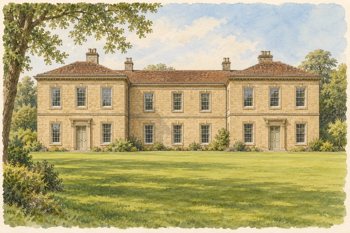
Watercolour and fine ink researched interpretation of Eccleshall Castle house
Original illustration · Eccleshall Castle house · researched interpretation
Original illustration; researched sources
Research sources

Researched interpretation; fine detail and surroundings simplified.

Historic England: Eccleshall Castle house; Historic England: Eccleshall Castle monument

History & heritage

Place & story

A market serving an episcopal estate

Eccleshall’s manor belonged to the bishops of Coventry and Lichfield by 1086. The town later gained a weekly market in 1153 and an annual fair in 1259. These institutions served an agricultural district while supporting local crafts. Long gardens behind High Street and the name Burgage preserve traces of the medieval town’s division into plots. [3] [4]

A castle shaped by water and rebuilding

The castle’s enclosure was bounded by a moat and a mere created by damming the River Sow. A fourteenth-century stone bridge crossed the defences; infill at its southern end marks the former drawbridge. Bishop Langton enlarged and repaired the castle during his episcopate of 1297–1321, and much of the surviving medieval fabric belongs to that period. [3]

Parliamentarian forces besieged the castle during the Civil War and had demolished it by 1646. Bishop Lloyd rebuilt the house around 1695, incorporating medieval remains. It continued as an episcopal residence until 1867. The surviving complex therefore joins fortified enclosure, later domestic architecture and fragments whose significance has been clarified by excavation. [3]

Coaches brought business to the street

Turnpike roads brought Eccleshall into the network of eighteenth-century coach travel. Inns such as the King’s Arms and Royal Oak served travellers, while the trade required stables, grooms, wheelwrights, coach makers and food suppliers. The benefits spread beyond accommodation. Later road changes and railways diverted journeys, and Eccleshall itself did not acquire a railway line. [4]

Shoemaking at home

Eccleshall’s leather trade was often conducted in homes and small workshops rather than large factories. The county’s urban survey describes shoemakers sewing footwear from uppers cut out in Stafford and Stone. Work clustered around Kerry Lane and Gaol Butts, with workshops also behind High Street properties. Local households were thus connected to production organised in neighbouring towns. [5]

Mechanisation progressively weakened that arrangement. The survey records only two shoemakers in the 1900 trade directory and identifies a surviving workshop behind 32 High Street. These rear spaces give the town’s commercial frontages another meaning: a house could accommodate family life and manufacturing, while changes elsewhere in the industry could remove its source of income. [5]

A cottage and the record of relief

At 9 Church Street, the first evidence for the cottage comes from the 1851 census, which records Elizabeth Plant receiving parish relief. The site had been part of another house’s garden in 1839. Historic England interprets the building as a modest worker’s cottage, contrasting with the larger domestic buildings of High Street. It provides an individual trace of poverty within the market town. [2]

A two-storey extension added around 1983 followed the earlier cottage’s materials and character, while the interior was substantially renovated. Conservation also operated at town scale: a conservation area was designated in 1969 and expanded in 2001 to include Town Meadow and the castle grounds. These changes brought the spaces around historic buildings into the account of what should be protected. [2] [4]

Back to contents
Lives connected to this place

Notable people

Bishop Lloyd: rebuilding a local residence

Bishop Lloyd rebuilt Eccleshall’s castle house around 1695. His campaign restored a residence after Civil War destruction, extending the bishops’ local presence into the eighteenth century. [3]

Back to contents
A chronology

Timeline

Eccleshall through time

  1. 1086 — The manor is recorded as episcopal property. [3]

  2. 1153 — Eccleshall gains a weekly market. [4]

  3. 1259 — An annual fair is authorised. [4]

  4. 1297–1321 — Bishop Langton’s episcopate sees enlargement and repair of the castle. [3]

  5. By 1646 — Parliamentarian forces have demolished the besieged castle. [3]

  6. Around 1695 — Bishop Lloyd rebuilds the house. [3]

  7. 1851 — Elizabeth Plant is recorded at 9 Church Street receiving parish relief. [2]

  8. 1867 — The castle’s use as an episcopal residence ends. [3]

  9. 1900 — A trade directory records two shoemakers. [5]

  10. 1969 and 2001 — Conservation-area designation and enlargement recognise the historic town and surrounding spaces. [4]

Back to contents

Population over time

Built-up area · Settlement · Census 2021

Eccleshall

3,230people · 2021

Census 2021 population of the named settlement, using ONS built-up area boundaries.

Published census counts.

Sources: ONS: Towns and cities, characteristics of built-up areas, Census 2021 (Table 1c)

View population figures
Eccleshall — census population
Census yearPopulation
20213,230
Sources and how to read this chart

Usual residents on 21 March 2021; published ONS count rounded to the nearest 5.. Boundary geography: December 2022 (E63002168).

Census 2021 population of the named settlement, using ONS built-up area boundaries.

ONS Table 1c rounds counts to the nearest 5 and suppresses counts below 10. Matched by exact settlement name or individually reviewed district-qualified name, with its coordinate strictly inside that same official BUA boundary. The 2022 BUA geography changed methodology and cannot be directly compared with 2011 BUAs. Contains OS data © Crown copyright and database right 2026. Contains National Statistics data © Crown copyright and database right 2026.

Source: ONS: Towns and cities, characteristics of built-up areas, Census 2021 (Table 1c). Open Government Licence v3.0. Retrieved 2026-10-26. Source: ONS and Ordnance Survey: Built Up Areas December 2022 GB BGG. Open Government Licence v3.0. Retrieved 2026-10-26.

Neighbourhood census context

These figures describe statistical neighbourhoods, which may cover part of a place or include neighbouring places.

Neighbourhood census area · 1971–2021

Stafford 005

Population of the area containing the recorded point for Eccleshall, not the whole place. This area may cover part of the place or include neighbours.

02.5k5k7.5k10k1971: 8,236 people19711981: 8,176 people19811991: 7,861 people19912001: 7,765 people20012011: 8,104 people20112021: 9,192 people2021

Includes harmonised historical census estimates.

Sources: ONS · Paul Norman

View population figures
Stafford 005 — census population and harmonised historical estimates
Census yearPopulation
19718,236
19818,176
19917,861
20017,765
20118,104
20219,192
Sources and how to read this chart

Usual residents of the containing MSOA; this is local area context, not the population of the named settlement.. Boundary geography: 1 April 2022 (E02006192).

2011 and 2021 census counts harmonised by ONS to the same 1 April 2022 geography. Location matched to ONS 2021 MSOA polygons (full resolution, coastline clipped, V7). ONS exact-fit lookup marks this MSOA unchanged from 2011 (U); historical estimates use that same footprint.

1971–2011: Paul Norman harmonised historical estimates on 2011 MSOAs, rounded to whole residents (1971–1991 are modelled). 2021: ONS census count. The historical 2011 total can differ slightly from the ONS change-over-time 2011 total because of methodology and statistical disclosure controls. These are area estimates, not settlement totals.

Source: ONS Census change over time: usual resident population, 2011 and 2021. Open Government Licence v3.0. Retrieved 2026-10-26. Source: ONS MSOA December 2021 boundaries EW BFC V7. Open Government Licence v3.0. Retrieved 2026-10-26. Source: Paul Norman — Area characteristics: Great Britain 1971 to 2011. Creative Commons Attribution 4.0. Retrieved 2026-10-26. Source: ONS MSOA 2011 to MSOA 2021 exact-fit lookup for England and Wales. Open Government Licence v3.0. Retrieved 2026-10-26.

Recorded locationEccleshall52.85961° N · 2.25313° WInteractive map loads when this area enters view.
Approximate recorded location · Geographic source

Geographic context

Place type
Town
Country / region
England · West Midlands
County group
Staffordshire
Current administration
Stafford
Current administration
Staffordshire
Recorded coordinates
52.85961, -2.25313
OS Open Names ID
osgb4000000074560637

County groups are browsing aids. Current administrative and historic areas are recorded separately.

Recorded names

  • Eccleshall · en · official

Nearby heritage

Distances are from the recorded place point. Proximity does not establish that a site lies within the place boundary or belongs to its history.

Sources & further reading

  1. OS Open Names October 2026 · Source licence.
  2. 9 Church Street, list entry 1039069 · Historic England
  3. Eccleshall Castle, scheduled monument 1008801 · Historic England
  4. Eccleshall Town Design Statement · Eccleshall Town Design Statement Group / Eccleshall Parish Council
  5. Eccleshall Extensive Urban Survey: Draft Report · Staffordshire County Council
  6. Original illustration of Eccleshall Castle house by PlaceHistory. Researched sources are linked beneath the illustration. AI-assisted original composition from documentary research; no photograph used as image input.

Geographic source retrieved 2026-10-26. History last researched 2026-10-26. How this page was prepared.