Town

Leek

Leek’s silk mills depended on skilled hands, fuel and transport. Its streets and public buildings also show how textile manufacture became connected with architecture, education and embroidery.

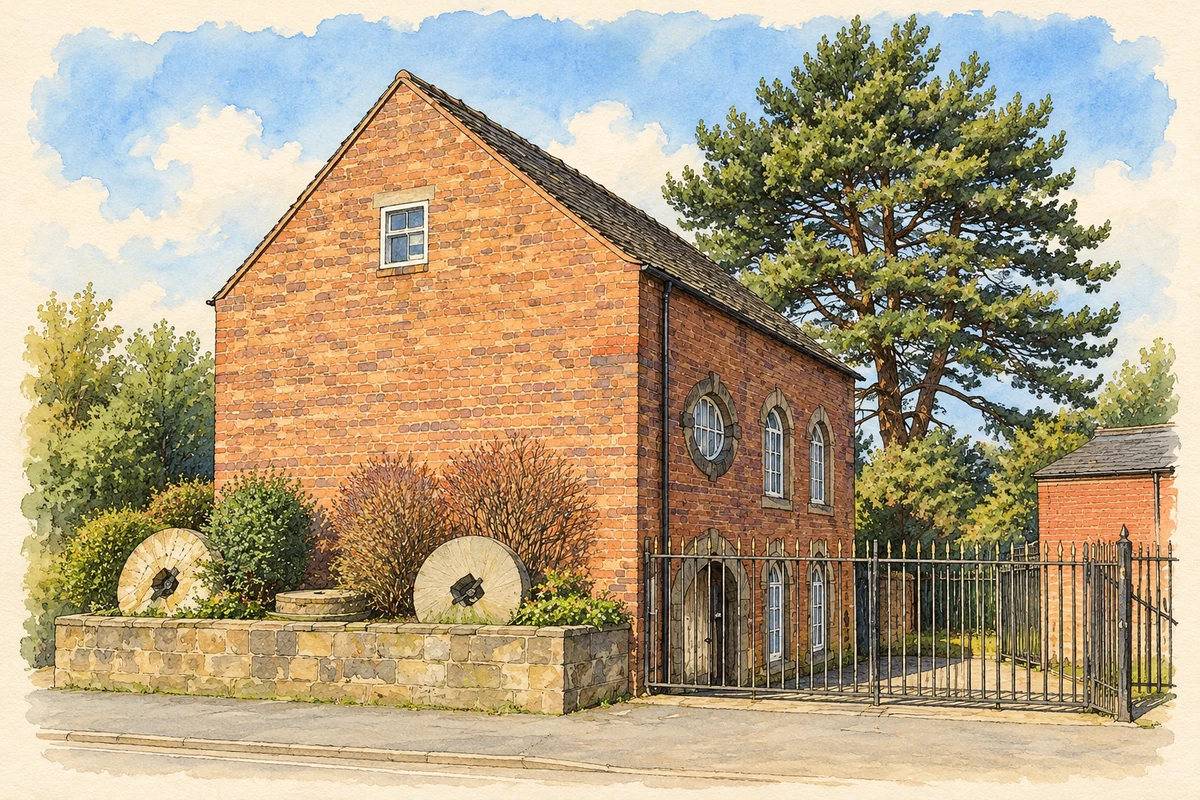
Watercolour and fine ink illustration of Brindley's Mill, Leek
Illustration · Brindley's Mill, Leek
History & heritage

Place & story

Making silk into work

Leek’s textile history was part of the Churnet valley’s concentration of water-powered industry. Within Staffordshire it became especially important for silk weaving and dyeing. Raw silk first had to be processed and twisted into usable thread; dyeing and weaving followed. The finished products included sewing thread, ribbons, handkerchiefs and shawls. [2]

This sequence divided work among specialised tasks. Staffordshire’s archive exhibition describes boys carrying empty and full bobbins in silk sheds, linking the finished luxury fabric with less visible workshop labour. Its displayed records include an 1816 survey of poverty in Leek and an 1831 theft deposition from a silk workshop. Industrial success did not remove insecurity from workers’ lives. [2]

Roads, fuel and larger mills

Turnpike improvements encouraged the trade in the mid-eighteenth century. A branch of the Cauldon Canal later made fuel from the Potteries easier to obtain for steam-powered mills. The town’s manufacturing history therefore depended on changing sources of power and connections outside Leek as well as on the river valley. [2]

The Cross Street buildings of Brough, Nicholson and Hall gave manufacture an architectural presence. The council’s trail dates William Sugden’s curved façades to 1860, with later extensions by his son Larner. The date 1815 on the corner refers to the firm’s foundation, rather than the construction of that building: dates on industrial premises require interpretation. [3]

A town built and rebuilt

The county’s urban survey traces a changing palette of materials. Timber gave way to stone from the seventeenth century, and brick became more prominent in the eighteenth. In the later nineteenth and early twentieth centuries, Arts and Crafts interests brought renewed attention to stone and timber. Leek’s industrial growth and its concern with craftsmanship were intertwined. [4]

William Sugden and William Larner Sugden designed many of the town’s surviving nineteenth-century buildings. Their work extended beyond mills: the former Alsop Memorial Hospital opened in 1870, commemorating James Alsop through a gift from his wife. Decorative brickwork, shaped windows and roof details made provision for care part of the town’s distinctive architectural landscape. [3] [4]

Art, books and a public collection

The Nicholson Institute was constructed in 1882–84 as a school of art, museum, gallery and public library. Joshua Nicholson gave it to the town, and W. Sugden & Son designed it. Its red brick, revival architecture and domed tower turned the provision of learning and culture into a prominent public gesture. [5]

The museum’s collections retain direct connections with textile work: the council identifies Leek Embroidery Society pieces and silk moths presented by Thomas Wardle. Objects relating to everyday life stand beside paintings and textiles. The building and its collections together preserve the relationship between local manufacture and the town’s artistic ambitions. [6]

An embroidery made to travel

In 1885, thirty-five women began a full-size embroidered copy of the Bayeux Tapestry under Elizabeth Wardle’s direction. Thomas Wardle supplied wool dyed to match the medieval work. Photographic records supplied by the South Kensington Museum helped transfer the design to cloth. The project combined collective needlework with the colour knowledge of a textile town. [7]

The completed work was first exhibited at the Nicholson Institute in 1886. It subsequently travelled in Britain and abroad before Arthur Hill bought it for Reading in 1895. Its present home is Reading Museum, but its making remains part of Leek’s history: the embroiderers signed the lower border, leaving named evidence of their contribution. [8]

Back to contents
Lives connected to this place

Notable people

Elizabeth Wardle: organising the needlework

Elizabeth Wardle was the skilled embroiderer behind the replica project. Reading Museum records her visit to Bayeux in 1885 and her role in the Leek Embroidery Society. Her significance lies in organising and contributing to a demanding collaborative work whose journey carried Leek’s craft well beyond the town. [8]

Thomas Wardle: manufacture and design

Thomas Wardle worked as a textile manufacturer in Leek and collaborated with William Morris during Morris’s visits. The county survey connects their friendship with the Arts and Crafts influence visible in the town; Morris & Co. supplied glass for St Edward’s and All Saints. Wardle’s local legacy connects dyeing, design and the buildings in which art was encountered. [6] [4]

Back to contents
A chronology

Timeline

Leek through time

  1. Mid-eighteenth century — Turnpike improvements encourage Leek’s textile trade. [2]

  2. 1860 — William Sugden designs the Cross Street mill façades. [3]

  3. 1870 — The Alsop Memorial Hospital opens. [3]

  4. 1882–84 — The Nicholson Institute is built for education and culture. [5]

  5. 1885 — The Leek embroiderers begin their Bayeux replica. [7]

  6. 1886 — The replica is first exhibited in Leek. [8]

  7. 1895 — Arthur Hill purchases the embroidery for Reading. [8]

Back to contents

Population over time

Built-up area · Settlement · Census 2021

Leek

19,385people · 2021

Census 2021 population of the named settlement, using ONS built-up area boundaries.

Published census counts.

Sources: ONS: Towns and cities, characteristics of built-up areas, Census 2021 (Table 1c)

View population figures
Leek — census population
Census yearPopulation
202119,385
Sources and how to read this chart

Usual residents on 21 March 2021; published ONS count rounded to the nearest 5.. Boundary geography: December 2022 (E63001792).

Census 2021 population of the named settlement, using ONS built-up area boundaries.

ONS Table 1c rounds counts to the nearest 5 and suppresses counts below 10. Matched by exact settlement name or individually reviewed district-qualified name, with its coordinate strictly inside that same official BUA boundary. The 2022 BUA geography changed methodology and cannot be directly compared with 2011 BUAs. Contains OS data © Crown copyright and database right 2026. Contains National Statistics data © Crown copyright and database right 2026.

Source: ONS: Towns and cities, characteristics of built-up areas, Census 2021 (Table 1c). Open Government Licence v3.0. Retrieved 2026-10-26. Source: ONS and Ordnance Survey: Built Up Areas December 2022 GB BGG. Open Government Licence v3.0. Retrieved 2026-10-26.

Neighbourhood census context

These figures describe statistical neighbourhoods, which may cover part of a place or include neighbouring places.

Neighbourhood census area · 1971–2021

Staffordshire Moorlands 006

Population of the area containing the recorded point for Leek, not the whole place. This area may cover part of the place or include neighbours.

05k10k15k20k1971: 9,891 people19711981: 10,079 people19811991: 10,014 people19912001: 9,655 people20012011: 10,899 people20112021: 10,620 people2021

Includes harmonised historical census estimates.

Sources: ONS · Paul Norman

View population figures
Staffordshire Moorlands 006 — census population and harmonised historical estimates
Census yearPopulation
19719,891
198110,079
199110,014
20019,655
201110,899
202110,620
Sources and how to read this chart

Usual residents of the containing MSOA; this is local area context, not the population of the named settlement.. Boundary geography: 1 April 2022 (E02006209).

2011 and 2021 census counts harmonised by ONS to the same 1 April 2022 geography. Location matched to ONS 2021 MSOA polygons (full resolution, coastline clipped, V7). ONS exact-fit lookup marks this MSOA unchanged from 2011 (U); historical estimates use that same footprint.

1971–2011: Paul Norman harmonised historical estimates on 2011 MSOAs, rounded to whole residents (1971–1991 are modelled). 2021: ONS census count. The historical 2011 total can differ slightly from the ONS change-over-time 2011 total because of methodology and statistical disclosure controls. These are area estimates, not settlement totals.

Source: ONS Census change over time: usual resident population, 2011 and 2021. Open Government Licence v3.0. Retrieved 2026-10-26. Source: ONS MSOA December 2021 boundaries EW BFC V7. Open Government Licence v3.0. Retrieved 2026-10-26. Source: Paul Norman — Area characteristics: Great Britain 1971 to 2011. Creative Commons Attribution 4.0. Retrieved 2026-10-26. Source: ONS MSOA 2011 to MSOA 2021 exact-fit lookup for England and Wales. Open Government Licence v3.0. Retrieved 2026-10-26.

Recorded locationLeek53.10568° N · 2.02144° WInteractive map loads when this area enters view.
Approximate recorded location · Geographic source

Geographic context

Place type
Town
Country / region
England · West Midlands
County group
Staffordshire
Current administration
Staffordshire Moorlands
Current administration
Staffordshire
Recorded coordinates
53.10568, -2.02144
OS Open Names ID
osgb4000000074578075

County groups are browsing aids. Current administrative and historic areas are recorded separately.

Recorded names

  • Leek · en · official

Nearby heritage

Explore recorded heritage in Leek and the surrounding area. This selection is based on proximity to a recorded settlement point; it is not a complete inventory or evidence that a site lies within the settlement or belongs to its history.

Heritage locationsLeek & surrounding areaInteractive map loads when this area enters view. Source records are listed below.

Numbered markers match the source records below. Locations are recorded reference points, not site boundaries.

  1. WAR MEMORIAL · Listed building
  2. COTTAGES TO REAR OF NUMBERS 53 AND 55 SOUTHERN RANGE · Listed building
  3. COTTAGES TO REAR OF NUMBERS 53 AND 55 NORTHERN RANGE · Listed building
  4. 33 AND 35, BATH STREET · Listed building
  5. NATIONAL WESTMINSTER BANK · Listed building
  6. 23 AND 25, DERBY STREET · Listed building
  7. POLICE STATION AND SUPERINTENDENTS HOUSE INCLUDING STABLES AND BOUNDARY WALL · Listed building
  8. NUMBERS 2, 3 AND 4 GAUNT BUILDINGS · Listed building

Sources & further reading

  1. OS Open Names October 2026 · Source licence.
  2. Staffordshire Working Lives — Manufacturing: Textiles · Staffordshire County Council
  3. Leek Architectural Trail · Staffordshire Moorlands District Council
  4. Leek Extensive Urban Survey · Staffordshire County Council
  5. Planning committee report, Nicholson Institute, 17 July 2025 · Staffordshire Moorlands District Council
  6. The Nicholson Museum & Art Gallery · Staffordshire Moorlands District Council
  7. Britain's Bayeux Tapestry: collection topic · Reading Museum
  8. Britain's Bayeux Tapestry: Halley's Comet, object REDMG 1995.108.1/54 · Reading Museum
  9. Illustration of Brindley's Mill, Leek, adapted from Brindley Mill 2019.jpg by AtticTapestry. CC BY-SA 4.0. AI-assisted watercolour and fine ink adaptation; incidental clutter simplified, warm cream paper margins. Architectural forms follow the inspected reference.

Geographic source retrieved 2026-10-26. History last researched 2026-10-26. How this page was prepared.