City

Lichfield

Chad’s shrine helped shape a city whose streets, almshouses and Guildhall preserve more than cathedral history. Eighteenth-century writers and a physician added another layer of learning and debate.

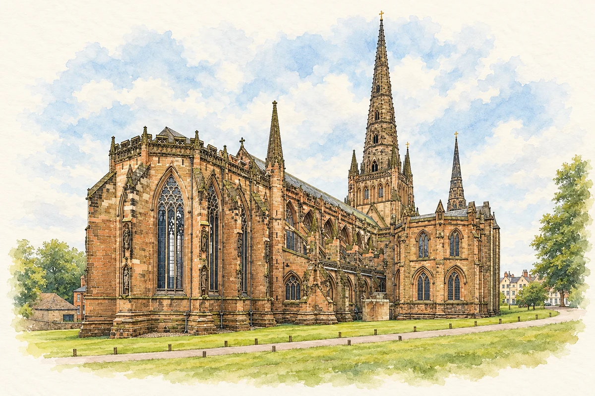
Watercolour and fine ink illustration of Lichfield Cathedral
Illustration · Lichfield Cathedral
History & heritage

Place & story

A shrine and a planned city

Chad established his episcopal seat at Lichfield in 669. After his death, his remains became a focus of pilgrimage, and the first cathedral was consecrated in 700. That sacred association gave the settlement a continuing purpose: people travelled here to a shrine, and later generations built increasingly ambitious churches around it. [5]

Bishop Roger de Clinton consolidated the city in the twelfth century, fortifying the Cathedral Close and laying out a ladder-shaped pattern of streets. The council’s history observes that town rents were payable to the bishop. Pilgrimage, planned streets and property income were therefore closely connected in the growth of medieval Lichfield. [4] [7]

Building, damaging and remaking the cathedral

The present cathedral was built in stages rather than conceived as a single finished object. The choir dates from around 1200, the transepts from 1220–40 and the nave was begun in 1260. The octagonal Chapter House was completed in 1249; the Lady Chapel followed in the early fourteenth century. These spaces preserve successive investments in worship and the care of Chad’s shrine. [3]

The Close’s defences later made it a military stronghold. Three Civil War sieges devastated the cathedral; bombardment brought down its central spire in 1646. Repair followed the Restoration, with Bishop Hacket leading renewed rebuilding. The same enclosure that had protected a religious community had exposed its buildings to sustained warfare. [4] [5]

Nineteenth-century restoration added another visible layer. George Gilbert Scott and his son Oldrid Scott directed work that renewed the exterior sculpture. Inside, the metal choir screen, choir stalls and Minton tiles form a Victorian composition within medieval walls. The building’s appearance is the result of rebuilding and artistic decisions across centuries. [5] [3]

Hospitality outside the gates

St John’s began as accommodation for pilgrims and travellers arriving after Lichfield’s gates had shut. The foundation’s history dates the hospital to 1135 and places it outside Culstubbe Gate. In this setting, hospital meant hospitality and lodging: its position made sense in a town receiving strangers who might need somewhere to sleep. [7]

In 1495 Bishop William Smythe refounded it for thirteen poor older men. Lodging came with a weekly allowance, coal and clothing, and attendance at daily prayers. The distinctive chimneyed range on St John Street gave each resident a room and fireplace. Tree-ring analysis supplies independent evidence for this rebuilding: sampled timbers were felled between spring 1494 and spring 1495. [7] [8]

Governing from the Guildhall

Religious institutions also helped produce secular government. The Guild of St Mary and St John the Baptist obtained ordinances in 1387 and became increasingly involved in running the city. The first corporation followed in 1548. Lichfield’s separate county status and office of sheriff date from Mary’s charter of 1553; these historical arrangements should be distinguished from the modern city’s place within Staffordshire. [2] [6] [4]

The Guildhall in Bore Street makes government tangible. Historic England records extensive early eighteenth-century rebuilding and a hall reconstructed in 1846–48 by Joseph Potter junior. Behind the Gothic frontage are a panelled hall, benches used by quarter sessions and barred cells with their doors, benches and latrines. Civic ceremony and the confinement of prisoners occupied the same institution. [6]

Coaches, conversation and practical improvement

Eighteenth-century Lichfield prospered as a coaching stop on routes towards north-western England and Ireland, supported by the wealth of clergy and gentry. The arrival of railways ended that transport role in the following century. Its intellectual life developed in this provincial setting, where writers, physicians and visitors could meet around the cathedral city. [4]

The city also belongs to a history of public infrastructure. Sandfields Pumping Station retains an 1873 Cornish beam engine within a nineteenth-century complex. The Waterworks Trust was formed in 2015 to rescue the neglected station; after obtaining access in 2017, volunteers cleaned, maintained and researched its machinery and buildings. The surviving engine brings engineering work into a history often told through churches and books. [13]

Houses become places of public learning

The house where Samuel Johnson was born stands in Breadmarket Street facing the market square. It is now a museum about his life and work. In 2009 the city marked his tercentenary with events including an outdoor sound-and-light display projected onto the building. A private birthplace had become a setting for collective commemoration. [10]

Erasmus Darwin’s former home near the Close required a different act of rescue. In poor condition in 1994, it became the subject of a restoration project involving doctors, cathedral officials and scholars. The museum opened on 9 April 1999. Medieval fabric survives behind its Georgian appearance, making the house itself evidence of the city’s repeated adaptation of old buildings. [11]

Back to contents
Lives connected to this place

Notable people

Samuel Johnson: growing up among books

Samuel Johnson was born in Lichfield in 1709 above his parents’ bookshop. Education at Lichfield and Stourbridge introduced him to classical literature; financial difficulties curtailed his Oxford studies. His later school at Edial, near Lichfield, attracted too few pupils, and he moved to London with his former pupil David Garrick. The author of the Dictionary of the English Language of 1755 thus had several different local connections: birthplace, schooling, family trade and an unsuccessful venture in education. [9]

Erasmus Darwin: a physician’s working home

Erasmus Darwin used the house on Beacon Street as both home and workplace. He moved into it in 1758, added its Georgian front and turned it to face the street rather than the Close. His identity as physician, inventor and poet helps explain why the building now interprets several kinds of knowledge together. The house gives his association with Lichfield a specific domestic and professional setting. [11]

Anna Seward: a literary life in the Close

Anna Seward came to Lichfield in 1750 when her father became a cathedral canon, and the Bishop’s Palace became her long-term home. A poet, correspondent and supporter of younger writers, she achieved national attention with her Elegy on Captain Cook in 1780. Her connections with Erasmus Darwin included contributing to The Botanic Garden and writing his biography. Seward’s literary circle places the Close within the city’s intellectual life as well as its religious history. [12]

Back to contents
A chronology

Timeline

Lichfield through time

  1. 669 — Chad establishes his episcopal seat at Lichfield. [5]

  2. Twelfth century — Bishop de Clinton fortifies the Close and lays out the city’s ladder-shaped street pattern. [4]

  3. 1249 — The cathedral’s Chapter House is completed. [3]

  4. 1495 — St John’s is refounded as an almshouse for thirteen older men. [7]

  5. 1548 — Lichfield’s first corporation is incorporated. [6] [4]

  6. 1646 — Bombardment during the Civil War brings down the cathedral’s central spire. [4]

  7. 1709 — Samuel Johnson is born in Breadmarket Street. [10]

  8. 1758 — Erasmus Darwin moves into the house now preserved as his museum. [11]

  9. 1846–48 — Joseph Potter junior rebuilds the Guildhall’s main hall. [6]

  10. 1873 — The surviving Cornish beam engine dates from this year. [13]

  11. 9 April 1999 — Erasmus Darwin House opens as a museum. [11]

Back to contents

Population over time

Built-up area · Settlement · Census 2021

Lichfield

32,580people · 2021

Census 2021 population of the named settlement, using ONS built-up area boundaries.

Published census counts.

Sources: ONS: Towns and cities, characteristics of built-up areas, Census 2021 (Table 1c)

View population figures
Lichfield — census population
Census yearPopulation
202132,580
Sources and how to read this chart

Usual residents on 21 March 2021; published ONS count rounded to the nearest 5.. Boundary geography: December 2022 (E63002522).

Census 2021 population of the named settlement, using ONS built-up area boundaries.

ONS Table 1c rounds counts to the nearest 5 and suppresses counts below 10. Matched by exact settlement name or individually reviewed district-qualified name, with its coordinate strictly inside that same official BUA boundary. The 2022 BUA geography changed methodology and cannot be directly compared with 2011 BUAs. Contains OS data © Crown copyright and database right 2026. Contains National Statistics data © Crown copyright and database right 2026.

Source: ONS: Towns and cities, characteristics of built-up areas, Census 2021 (Table 1c). Open Government Licence v3.0. Retrieved 2026-10-26. Source: ONS and Ordnance Survey: Built Up Areas December 2022 GB BGG. Open Government Licence v3.0. Retrieved 2026-10-26.

Neighbourhood census context

These figures describe statistical neighbourhoods, which may cover part of a place or include neighbouring places.

Neighbourhood census area · 1971–2021

Lichfield 004

Population of the area containing the recorded point for Lichfield, not the whole place. This area may cover part of the place or include neighbours.

05k10k15k20k1971: 7,676 people19711981: 8,537 people19811991: 8,401 people19912001: 8,102 people20012011: 10,528 people20112021: 10,724 people2021

Includes harmonised historical census estimates.

Sources: ONS · Paul Norman

View population figures
Lichfield 004 — census population and harmonised historical estimates
Census yearPopulation
19717,676
19818,537
19918,401
20018,102
201110,528
202110,724
Sources and how to read this chart

Usual residents of the containing MSOA; this is local area context, not the population of the named settlement.. Boundary geography: 1 April 2022 (E02006149).

2011 and 2021 census counts harmonised by ONS to the same 1 April 2022 geography. Location matched to ONS 2021 MSOA polygons (full resolution, coastline clipped, V7). ONS exact-fit lookup marks this MSOA unchanged from 2011 (U); historical estimates use that same footprint.

1971–2011: Paul Norman harmonised historical estimates on 2011 MSOAs, rounded to whole residents (1971–1991 are modelled). 2021: ONS census count. The historical 2011 total can differ slightly from the ONS change-over-time 2011 total because of methodology and statistical disclosure controls. These are area estimates, not settlement totals.

Source: ONS Census change over time: usual resident population, 2011 and 2021. Open Government Licence v3.0. Retrieved 2026-10-26. Source: ONS MSOA December 2021 boundaries EW BFC V7. Open Government Licence v3.0. Retrieved 2026-10-26. Source: Paul Norman — Area characteristics: Great Britain 1971 to 2011. Creative Commons Attribution 4.0. Retrieved 2026-10-26. Source: ONS MSOA 2011 to MSOA 2021 exact-fit lookup for England and Wales. Open Government Licence v3.0. Retrieved 2026-10-26.

Recorded locationLichfield52.68308° N · 1.82729° WInteractive map loads when this area enters view.
Approximate recorded location · Geographic source

Geographic context

Place type
City
Country / region
England · West Midlands
County group
Staffordshire
Current administration
Lichfield
Current administration
Staffordshire
Recorded coordinates
52.68308, -1.82729
OS Open Names ID
osgb4000000074549374

County groups are browsing aids. Current administrative and historic areas are recorded separately.

Recorded names

  • Lichfield · en · official

Nearby heritage

Distances are from the recorded place point. Proximity does not establish that a site lies within the place boundary or belongs to its history.

Sources & further reading

  1. OS Open Names October 2026 · Source licence.
  2. Council History · Lichfield City Council
  3. Lichfield Cathedral · Lichfield City Council
  4. History of Lichfield · Lichfield City Council
  5. Our History · Lichfield Cathedral
  6. The Guildhall: list entry 1187740 · Historic England
  7. History of St John’s Lichfield · St John’s Lichfield
  8. The Tree-Ring Dating of the Hospital of St John the Baptist: report 62/2002 · Daniel Miles and Michael Worthington / Historic England
  9. Dr Samuel Johnson · Samuel Johnson Museum
  10. Samuel Johnson Museum · Lichfield City Council
  11. History of the Museum · Erasmus Darwin House
  12. Famous Lichfeldians · Lichfield City Council
  13. Sandfields Pumping Station · Lichfield City Council
  14. Illustration of Lichfield Cathedral, adapted from Lichfield Cathedral Exterior from NE, Staffordshire, UK - Diliff.jpg by Diliff. CC BY-SA 3.0. AI-assisted watercolour and fine ink adaptation; cream paper margins, simplified fine detail and removal of incidental street clutter.

Geographic source retrieved 2026-10-26. History last researched 2026-10-26. How this page was prepared.