Town

Penkridge

A powerful collegiate church and a busy trading settlement developed beside the Penk. Inns, canal buildings and the railway reveal how local farming and exchange connected Penkridge with a wider economy.

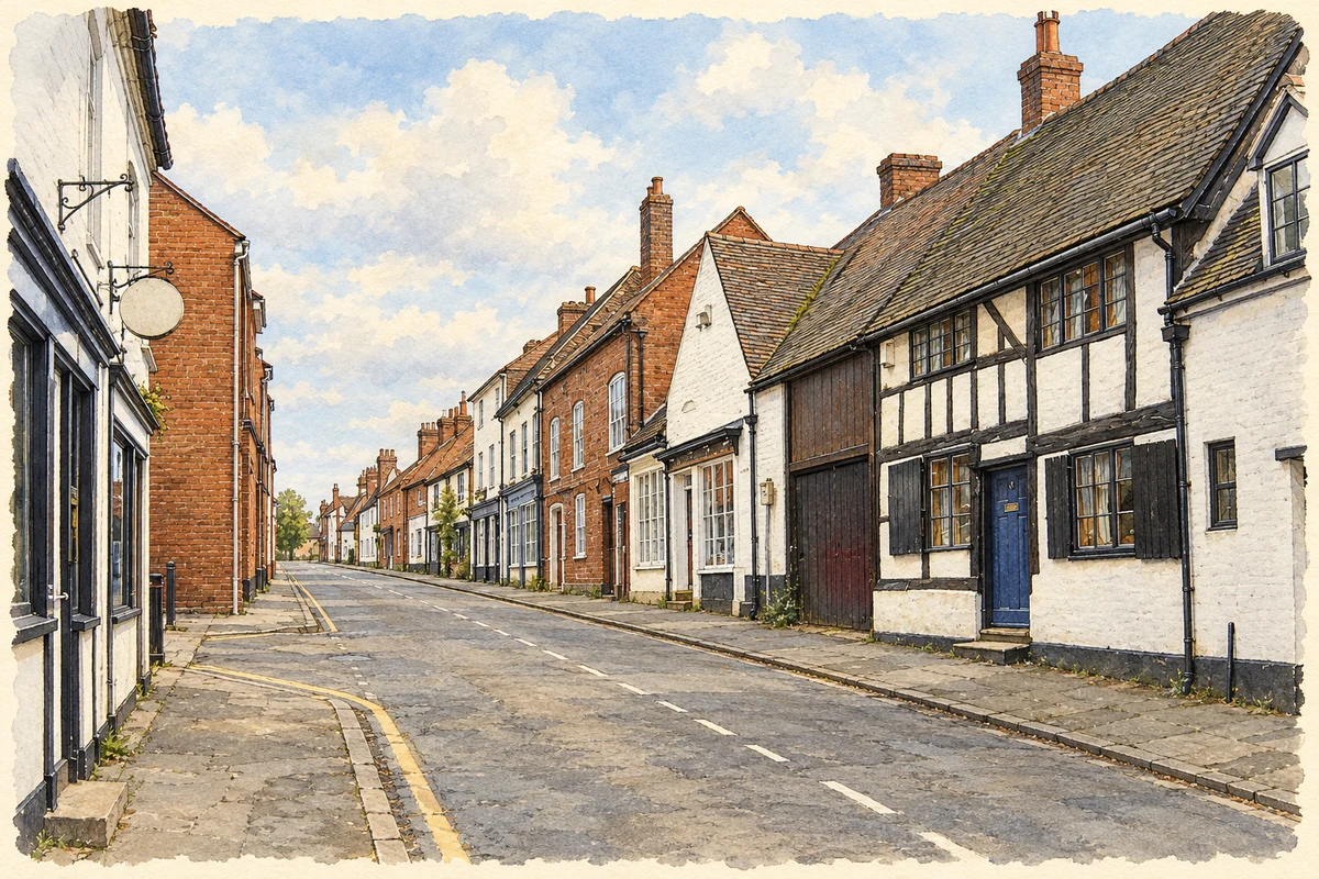
Watercolour and fine ink illustration of Penkridge village centre
Illustration · Penkridge village centre
History & heritage

Place & story

A college with unusual authority

St Michael’s was a royal free chapel, probably founded under King Eadred in the tenth century. It was served by a college of clergy rather than a monastic community. King John granted the right of appointment to the deanery to the Archbishop of Dublin in 1215; from 1259 until the Reformation, the archbishop and dean were the same person. Penkridge’s religious organisation consequently reached well beyond the local diocese. [3]

The college was dissolved in 1548, but its separate ecclesiastical jurisdiction survived until 1858. The present parish church is itself a record of repeated change: red sandstone construction of the thirteenth century, fourteenth-century additions and extensive sixteenth-century alterations. J. A. Chatwin restored it in 1881. Its medieval institution and its surviving masonry therefore have different chronologies. [3] [4]

The market was never a simple continuous story

A fair is recorded before September 1215. Henry III granted Andrew le Blund a Thursday market on 23 May 1244, and later confirmations show the value attached to trading rights. Competition could produce conflict: in 1377 the market was challenged as detrimental to the burgesses of Stafford. Although it survived into the sixteenth century, it had fallen out of use by 1584. [5]

Horse trading gave Penkridge a different commercial reputation. Horsefair and the Horse and Jockey preserve its memory in the townscape. The parish history recalls the annual arrival of dealers, jockeys and owners and Daniel Defoe’s enthusiastic notice in 1724. The later cattle auction and the present stall markets belong to changing forms of exchange, rather than proof that one identical market operated without interruption. [2] [8]

Work beside the river and canal

Agriculture was fundamental, but Penkridge also made iron. By the seventeenth century it had a foundry, and forges occupied former mill sites along the Penk. The conservation appraisal identifies iron manufacture as its principal industry until the early nineteenth century. Water powered work as well as shaping the valley through which routes converged. [7]

The Staffordshire and Worcestershire Canal opened in 1772. Sir Edward Littleton encouraged its passage through his estates and used it to move goods including wheat. A wharf existed beside Cannock Road by 1831; boats were reported calling several times daily in 1834. This was a working waterfront serving local produce and longer-distance freight. [6]

Canal buildings preserve the division of labour around the waterway. A lock keeper’s cottage survives at Penkridge Bridge, together with the wharfinger’s house. The Boat Inn and Cross Keys served the boating community; cottages north of the bridge, historically reached only from the canal, probably housed canal workers. The waterway supported homes and hospitality as well as traffic. [6]

Inns, railways and a road through the centre

The eighteenth-century Littleton Arms stood on former church land. It hosted estate rent days, tax payments, magistrates and social gatherings, alongside its coaching trade. Travellers, tenants and local government met in a building associated with the family that dominated Penkridge for centuries. [2]

The Grand Junction Railway opened on 4 July 1837, with a station behind the church. A surviving goods shed north of the centre recalls its commercial traffic. The railway added another route beside the north–south road and canal. [6]

Road improvement had a more destructive effect on the old centre. In the 1930s, widening and straightening Clay Street removed older buildings and intensified the division between the church side and the trading streets. Around Crown Bridge, the former triangular group of shops and houses gave way to open road space. Movement through Penkridge changed the place it served. [7]

Back to contents
Lives connected to this place

Notable people

John Phillipes: a trader’s small change

A halfpenny token dated 1665 bears the name Iohn Phillipes and the Mercers’ Arms. The parish council identifies him as a Penkridge textile and silk trader. Such a personal piece of currency gives a named connection to everyday commerce: its issuer was expected to accept it back in exchange for silver. [2]

Thomas Brassey: building the railway crossing

Thomas Brassey won the contract for a ten-mile section of the Grand Junction Railway, including the Penk valley viaduct at Levedale. The conservation appraisal identifies this as an early project in the career of a contractor who later built railways on a much larger scale. [7]

Back to contents
A chronology

Timeline

Penkridge through time

  1. 1215 — King John grants the deanery’s patronage to the Archbishop of Dublin. [3]

  2. 1244 — Andrew le Blund receives a charter for a Thursday market. [5]

  3. 1548 — St Michael’s college is dissolved. [3]

  4. 1665 — John Phillipes issues a halfpenny trading token. [2]

  5. 1772 — The Staffordshire and Worcestershire Canal opens. [6]

  6. 1837 — The Grand Junction Railway opens through Penkridge. [6]

  7. 1858 — The separate ecclesiastical jurisdiction ends. [3]

  8. 1881 — Chatwin restores St Michael’s Church. [4]

  9. 1930s — Road widening removes buildings from the old centre. [7]

Back to contents

Population over time

Built-up area · Settlement · Census 2021

Penkridge

8,370people · 2021

Census 2021 population of the named settlement, using ONS built-up area boundaries.

Published census counts.

Sources: ONS: Towns and cities, characteristics of built-up areas, Census 2021 (Table 1c)

View population figures
Penkridge — census population
Census yearPopulation
20218,370
Sources and how to read this chart

Usual residents on 21 March 2021; published ONS count rounded to the nearest 5.. Boundary geography: December 2022 (E63002425).

Census 2021 population of the named settlement, using ONS built-up area boundaries.

ONS Table 1c rounds counts to the nearest 5 and suppresses counts below 10. Matched by exact settlement name or individually reviewed district-qualified name, with its coordinate strictly inside that same official BUA boundary. The 2022 BUA geography changed methodology and cannot be directly compared with 2011 BUAs. Contains OS data © Crown copyright and database right 2026. Contains National Statistics data © Crown copyright and database right 2026.

Source: ONS: Towns and cities, characteristics of built-up areas, Census 2021 (Table 1c). Open Government Licence v3.0. Retrieved 2026-10-26. Source: ONS and Ordnance Survey: Built Up Areas December 2022 GB BGG. Open Government Licence v3.0. Retrieved 2026-10-26.

Neighbourhood census context

These figures describe statistical neighbourhoods, which may cover part of a place or include neighbouring places.

Neighbourhood census area · 1971–2021

South Staffordshire 001

Population of the area containing the recorded point for Penkridge, not the whole place. This area may cover part of the place or include neighbours.

05k10k15k20k1971: 6,486 people19711981: 9,395 people19811991: 10,343 people19912001: 10,218 people20012011: 10,382 people20112021: 10,921 people2021

Includes harmonised historical census estimates.

Sources: ONS · Paul Norman

View population figures
South Staffordshire 001 — census population and harmonised historical estimates
Census yearPopulation
19716,486
19819,395
199110,343
200110,218
201110,382
202110,921
Sources and how to read this chart

Usual residents of the containing MSOA; this is local area context, not the population of the named settlement.. Boundary geography: 1 April 2022 (E02006174).

2011 and 2021 census counts harmonised by ONS to the same 1 April 2022 geography. Location matched to ONS 2021 MSOA polygons (full resolution, coastline clipped, V7). ONS exact-fit lookup marks this MSOA unchanged from 2011 (U); historical estimates use that same footprint.

1971–2011: Paul Norman harmonised historical estimates on 2011 MSOAs, rounded to whole residents (1971–1991 are modelled). 2021: ONS census count. The historical 2011 total can differ slightly from the ONS change-over-time 2011 total because of methodology and statistical disclosure controls. These are area estimates, not settlement totals.

Source: ONS Census change over time: usual resident population, 2011 and 2021. Open Government Licence v3.0. Retrieved 2026-10-26. Source: ONS MSOA December 2021 boundaries EW BFC V7. Open Government Licence v3.0. Retrieved 2026-10-26. Source: Paul Norman — Area characteristics: Great Britain 1971 to 2011. Creative Commons Attribution 4.0. Retrieved 2026-10-26. Source: ONS MSOA 2011 to MSOA 2021 exact-fit lookup for England and Wales. Open Government Licence v3.0. Retrieved 2026-10-26.

Recorded locationPenkridge52.72470° N · 2.11300° WInteractive map loads when this area enters view.
Approximate recorded location · Geographic source

Geographic context

Place type
Town
Country / region
England · West Midlands
County group
Staffordshire
Current administration
South Staffordshire
Current administration
Staffordshire
Recorded coordinates
52.72470, -2.11300
OS Open Names ID
osgb4000000074561026

County groups are browsing aids. Current administrative and historic areas are recorded separately.

Recorded names

  • Penkridge · en · official

Nearby heritage

Distances are from the recorded place point. Proximity does not establish that a site lies within the place boundary or belongs to its history.

Sources & further reading

  1. OS Open Names October 2026 · Source licence.
  2. Brief History of Penkridge · Penkridge Parish Council
  3. Lichfield and Coventry: History and description · Clergy of the Church of England Database
  4. Church of St Michael and All Angels, list entry 1039195 · Historic England
  5. Gazetteer of Markets and Fairs to 1516: Staffordshire · Institute of Historical Research, University of London
  6. Penkridge Extensive Urban Survey · Staffordshire County Council
  7. Penkridge Conservation Area Management Plan, adopted 11 November 2010 · South Staffordshire Council
  8. Penkridge Markets · Penkridge Markets
  9. Illustration of Penkridge village centre, adapted from Penkridge - 2009-02-23.jpg by Voice of Clam. Public domain. AI-assisted watercolour and fine ink adaptation; cream paper margins, simplified fine detail and removal of incidental street clutter.

Geographic source retrieved 2026-10-26. History last researched 2026-10-27. How this page was prepared.