Town

Rugeley

Rugeley’s markets and workshops grew beside routes through the Trent valley. Coal and electricity later transformed its edge, leaving a different landscape after the power stations closed.

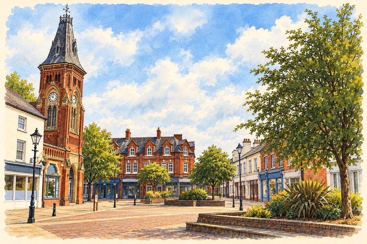
Watercolour and fine ink illustration of Rugeley Clock Tower and Market Square
Illustration · Rugeley Clock Tower and Market Square
History & heritage

Place & story

A market in the forest

Richard I sold Rugeley to the Bishop of Lichfield and Coventry in 1189, when the settlement lay within the Royal Forest of Cannock. A weekly market grant followed in 1259. Farming remained central to the town’s exchange with its surroundings: sheep and horse fairs brought rural producers into Rugeley, and cattle trading continued behind the Shrew until 1967. [2]

The 1259 charter also permitted an annual fair around St Augustine’s feast. The town council traces a later shift in the fair’s date to the calendar change of 1752. The surviving tradition joins a medieval trading privilege to later changes in the way national time was reckoned. [3]

A church altered by a growing town

The Old Chancel is the surviving portion of Rugeley’s medieval St Augustine’s. The district council identifies a church here by 1189 and traces later additions to the original nave and chancel. The surviving priest’s doorway, windows and memorials preserve different periods of worship and commemoration within the same structure. [4]

As the old church deteriorated and became too small, a replacement was built opposite. Much of the original church was demolished, leaving the tower, arcade, chapel and chancel. Bells cast by the Rudhall family in 1706 were transferred to the new church. In 1974 the churchyard was landscaped, with displaced gravestones paving former parts of the building’s footprint. [4]

Leather, metal and improved routes

The Phoenix Tannery exemplifies the physical demands of Rugeley’s trades. Hides were treated in lime, scraped and layered with oak bark in open pits; a small factory in Bryan’s Lane ground the bark. The district council records the tannery before 1851 and its continuation into the late 1950s. Turning animal hides into leather required processing space, water and associated machinery. [5]

Metalworking also reached beyond a shop counter. Harris’s ironmongery business opened in Market Square in 1855, moved to Anson Street and established the Phoenix Iron Works nearby. The foundry produced garden equipment including rollers. Retailing and manufacture could form parts of the same local business. [5]

The Trent and Mersey Canal gave these activities access to a wider transport network. Fully opened in 1777, it was part of James Brindley’s ambition to connect major English rivers. Josiah Wedgwood attended the planning meeting at Wolseley Bridge, outside Rugeley, in 1765: a water route promised smoother carriage for fragile pottery as well as movement of industrial materials. [6]

Coal goes directly to the power station

The twentieth-century energy complex joined Lea Hall Colliery with Rugeley A power station beside the Trent. Coal travelled directly from mine to station by conveyor. Construction began in the 1950s; the mine closed in 1990 and A station in the following decade. Their physical connection made local coal part of a national electricity supply system. [7]

The Staffordshire History Centre’s research into the two stations also records their working cultures. Former employees remembered distinctions between the older, smaller A station and the more powerful B station. An exhibition at the Museum of Cannock Chase brought workers and families together, preserving experiences that cannot be read from the demolished machinery alone. [8]

After generation

Rugeley B ceased generation in 2016. On 6 June 2021 its four cooling towers were brought down in a controlled demolition, watched through a public livestream. Removing these conspicuous structures marked a visible break in the town’s energy history, but preparing the ground for another use required a longer programme. [9]

In August 2025 former operator ENGIE announced completion of remediation and sale of the site to Vistry Group. Its account described planning consent for housing, employment space and an all-through school. These were the terms of redevelopment reported at the transfer, rather than evidence that an entire new neighbourhood had already been built. [10]

Back to contents
Lives connected to this place

Notable people

William Palmer: a doctor and a murder conviction

William Palmer was born and practised in Rugeley. In 1856 he was convicted of murdering his associate John Parsons Cook by poisoning. The local heritage trail records the killing at the Shrew opposite his house. His notoriety rests on that conviction; suspicions about other deaths should not be presented as proved murders. [2]

Josiah Wedgwood: a meeting outside the town

Josiah Wedgwood’s connection here is specific: he attended the 1765 canal-planning meeting at nearby Wolseley Bridge. The pottery manufacturer’s interest in safe transport helped the canal project gather support. This association belongs to the surrounding district and does not make him a Rugeley resident or manufacturer. [6]

Back to contents
A chronology

Timeline

Rugeley through time

  1. 1189 — Richard I sells Rugeley to the bishop. [2]

  2. 1259 — Market and annual fair rights are granted. [3]

  3. 1706 — The Rudhalls cast bells later moved to the replacement parish church. [4]

  4. 1765 / 1777 — The canal is planned at Wolseley Bridge and later opens throughout. [6]

  5. 1855 — Harris opens his ironmongery business. [5]

  6. 1990 — Lea Hall Colliery closes. [7]

  7. 2016 — Rugeley B ceases generation. [9]

  8. 6 June 2021 — The B station’s cooling towers are demolished. [9]

  9. 2025 — ENGIE announces remediation completion and the site’s transfer to Vistry. [10]

Back to contents

Population over time

Built-up area · Settlement · Census 2021

Rugeley

26,145people · 2021

Census 2021 population of the named settlement, using ONS built-up area boundaries.

Published census counts.

Sources: ONS: Towns and cities, characteristics of built-up areas, Census 2021 (Table 1c)

View population figures
Rugeley — census population
Census yearPopulation
202126,145
Sources and how to read this chart

Usual residents on 21 March 2021; published ONS count rounded to the nearest 5.. Boundary geography: December 2022 (E63002336).

Census 2021 population of the named settlement, using ONS built-up area boundaries.

ONS Table 1c rounds counts to the nearest 5 and suppresses counts below 10. Matched by exact settlement name or individually reviewed district-qualified name, with its coordinate strictly inside that same official BUA boundary. The 2022 BUA geography changed methodology and cannot be directly compared with 2011 BUAs. Contains OS data © Crown copyright and database right 2026. Contains National Statistics data © Crown copyright and database right 2026.

Source: ONS: Towns and cities, characteristics of built-up areas, Census 2021 (Table 1c). Open Government Licence v3.0. Retrieved 2026-10-26. Source: ONS and Ordnance Survey: Built Up Areas December 2022 GB BGG. Open Government Licence v3.0. Retrieved 2026-10-26.

Neighbourhood census context

These figures describe statistical neighbourhoods, which may cover part of a place or include neighbouring places.

Neighbourhood census area · 1971–2021

Cannock Chase 002

Population of the area containing the recorded point for Rugeley, not the whole place. This area may cover part of the place or include neighbours.

02.3k4.5k6.8k9k1971: 7,677 people19711981: 8,035 people19811991: 7,790 people19912001: 7,688 people20012011: 8,278 people20112021: 8,188 people2021

Includes harmonised historical census estimates.

Sources: ONS · Paul Norman

View population figures
Cannock Chase 002 — census population and harmonised historical estimates
Census yearPopulation
19717,677
19818,035
19917,790
20017,688
20118,278
20218,188
Sources and how to read this chart

Usual residents of the containing MSOA; this is local area context, not the population of the named settlement.. Boundary geography: 1 April 2022 (E02006119).

2011 and 2021 census counts harmonised by ONS to the same 1 April 2022 geography. Location matched to ONS 2021 MSOA polygons (full resolution, coastline clipped, V7). ONS exact-fit lookup marks this MSOA unchanged from 2011 (U); historical estimates use that same footprint.

1971–2011: Paul Norman harmonised historical estimates on 2011 MSOAs, rounded to whole residents (1971–1991 are modelled). 2021: ONS census count. The historical 2011 total can differ slightly from the ONS change-over-time 2011 total because of methodology and statistical disclosure controls. These are area estimates, not settlement totals.

Source: ONS Census change over time: usual resident population, 2011 and 2021. Open Government Licence v3.0. Retrieved 2026-10-26. Source: ONS MSOA December 2021 boundaries EW BFC V7. Open Government Licence v3.0. Retrieved 2026-10-26. Source: Paul Norman — Area characteristics: Great Britain 1971 to 2011. Creative Commons Attribution 4.0. Retrieved 2026-10-26. Source: ONS MSOA 2011 to MSOA 2021 exact-fit lookup for England and Wales. Open Government Licence v3.0. Retrieved 2026-10-26.

Recorded locationRugeley52.76141° N · 1.93604° WInteractive map loads when this area enters view.
Approximate recorded location · Geographic source

Geographic context

Place type
Town
Country / region
England · West Midlands
County group
Staffordshire
Current administration
Cannock Chase
Current administration
Staffordshire
Recorded coordinates
52.76141, -1.93604
OS Open Names ID
osgb4000000074550869

County groups are browsing aids. Current administrative and historic areas are recorded separately.

Recorded names

  • Rugeley · en · official

Nearby heritage

Distances are from the recorded place point. Proximity does not establish that a site lies within the place boundary or belongs to its history.

Sources & further reading

  1. OS Open Names October 2026 · Source licence.
  2. Rugeley Town Centre Heritage Trail · Cannock Chase District Council
  3. What We Do: The Charter Fair · Rugeley Town Council
  4. The Old Chancel · Cannock Chase District Council
  5. In and around Market Square · Cannock Chase District Council
  6. The Trent and Mersey Canal · Cannock Chase District Council
  7. Construction of Rugeley A Power Station, resource 24759 · Staffordshire Past Track / Staffordshire heritage services
  8. Rugeley Power Station · Staffordshire History Centre
  9. End of coal power sparks new horizons for Rugeley · Cannock Chase District Council / ENGIE
  10. From Coal to Clean: Remediation and Sale of Rugeley Power Station Site · ENGIE UK
  11. Illustration of Rugeley Clock Tower and Market Square, adapted from Rugeley Town Centre and Clock Tower by John Parkes. CC BY-SA 2.0. AI-assisted watercolour and fine ink adaptation; incidental clutter simplified, warm cream paper margins. Architectural forms follow the inspected reference.

Geographic source retrieved 2026-10-26. History last researched 2026-10-27. How this page was prepared.