Town

Stafford

Stafford’s history joins a fortified Mercian town and county administration with shoemaking and engineering. The Ancient High House, castle earthworks and riverside park preserve different settings for the people who lived and worked here.

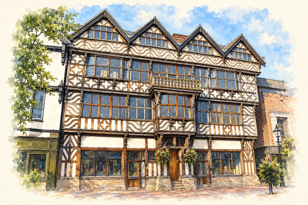
Watercolour and fine ink illustration of The Ancient High House, Stafford
Illustration · The Ancient High House, Stafford
History & heritage

Place & story

A fortified borough and a trading town

Æthelflæd established Stafford’s fortified borough in 913 as part of a chain of Mercian defences. A mint and a local pottery industry followed; Staffordware has been found across the Midlands. These activities place the town within networks of authority, money and exchange before the Norman Conquest, rather than making its story begin with the castle whose remains overlook it. [2]

King John’s charter of 1 May 1206 gave Stafford borough liberties, including rights of inheritance. Cloth and wool became important to its medieval market economy. The charter and the market represent different but connected foundations of urban life: a legal community with recognised privileges and a place in which producers and buyers met. [2]

A castle with medieval foundations and a later silhouette

The castle west of the town developed from a Norman timber fortress established by about 1100. Ralph Stafford commissioned a stone keep in 1347 and obtained a licence for its battlements the following year. The site’s great earthworks preserve the organisation of a stronghold into mound and enclosures, while successive building campaigns reflect changes in the family’s power and resources. [4]

The Civil War brought demolition, but the visible ruin is also a product of later ambition. The Jerningham family rebuilt on the medieval foundations in the early nineteenth century in Gothic style. The work was never completed, and unsafe towers and upper walls were largely taken down in 1963. The surviving lower remains should therefore be read as part of a layered site, not as an untouched medieval keep. [4] [5]

Wealth displayed in a timber-framed household

The Dorrington family built the Ancient High House around 1595 on Greengate Street. Its elaborate timber framing offered a conspicuous expression of prosperity in the town centre. Charles I and Prince Rupert stayed there in 1642. Opened as a museum in 1986, it now uses period room settings to explore different eras of domestic and commercial life; those displays interpret the past rather than preserving one household exactly as it was. [3]

From a shoemaker’s home to a manufacturing town

Shoemaking had medieval roots around Broad Eye. Bespoke makers worked at home, but ready-made shoes were being produced from the seventeenth century. A more divided system developed: early processes took place in warehouses behind a master’s house, while workers assembled the shoes in their own homes. A trade could grow larger without all its workers immediately moving into a factory. [6]

By the middle of the nineteenth century boots and shoes were Stafford’s principal industry. William Horton’s warehouse, built behind Chetwynd House around 1812, was one important stage in this development. His business provides a link between the town’s domestic streets and organised manufacture, in which access to materials, storage and a network of workers could matter as much as the size of a single building. [6]

Railways and engineering beyond the shoe trade

The arrival of the railway in the nineteenth century widened Stafford’s industrial connections. The council’s history names Bagnall, Dorman and Siemens among its engineering firms. Surviving machines show what those connections meant: Statfold Museum’s Bagnall locomotive Isaac was built at Stafford in 1953 and sent to South Africa to haul platinum ore. A county town’s engineering could serve workplaces far beyond Britain. [2] [12]

Government in the town centre

The Shire Hall was built in 1795–98 as a courthouse and enlarged in 1854 with another courtroom, cells and guard rooms. Its relationship with the Judges’ Residence and County Buildings formed a connected setting for administration and justice. The formal public frontage belonged to a working complex: court proceedings depended on offices, accommodation and places of confinement as well as the courtroom itself. [9]

Making room beside the Sow

Victoria Park opened beside the River Sow in 1908. The corporation had bought marshy land in 1903 and raised its level; the bandstand was moved there from the Market Square. An extension across the river in 1911 added a bowling green and Coronation Bridge. This was an engineered leisure landscape, creating shared space near the station and linking recreation with improvements to ground previously vulnerable to flooding. [11] [10]

Back to contents
Lives connected to this place

Notable people

Izaak Walton: a Stafford childhood and a wider life

Walton was born in Stafford in 1593 and baptised at St Mary’s. The county archive identifies his childhood home in Eastgate Street. Best known as the author of The Compleat Angler, he also owned a cottage at Shallowford. That cottage belongs to the surrounding district rather than the town centre; the birth and baptism establish his distinct connection with Stafford itself. [8]

William Horton: a manufacturer recorded on a token

Born in Stafford in 1750, Horton organised shoemaking on a large scale from Chetwynd House and premises behind it. A copper halfpenny issued in 1797 survives in the county museum collection, bearing his initials and a Stafford castle design. It joins the history of manufacture to everyday payments, showing a business name circulating on money as well as appearing on buildings and commercial records. [7]

Richard Brinsley Sheridan: an MP and a manufacturer’s guest

The playwright Sheridan represented Stafford in Parliament and was a friend of Horton, staying at Chetwynd House during visits. His relationship with the town was therefore political and social, rather than one of birth. The association offers a specific link between national public life and a local manufacturing household, without assuming that his famous plays were written there. [7] [2]

Back to contents
A chronology

Timeline

Stafford through time

  1. 913 — Æthelflæd establishes Stafford’s fortified borough. [2]

  2. 1206 — King John grants the charter of borough liberties. [2]

  3. 1347–48 — Work on a stone keep and a licence to crenellate mark a new phase at the castle. [4]

  4. c.1595 — The Dorrington family builds the Ancient High House. [3]

  5. 1642 — Charles I and Prince Rupert stay at the house. [3]

  6. 1797 — William Horton issues a copper halfpenny token. [7]

  7. 1798 — The new Shire Hall is completed. [9]

  8. 1908 — Victoria Park opens beside the Sow. [10] [11]

  9. 1963 — Unsafe upper parts of the nineteenth-century castle ruin are largely removed. [5]

  10. 1986 — The Ancient High House opens as a museum. [3]

Back to contents

Population over time

Built-up area · Settlement · Census 2021

Stafford

71,690people · 2021

Census 2021 population of the named settlement, using ONS built-up area boundaries.

Published census counts.

Sources: ONS: Towns and cities, characteristics of built-up areas, Census 2021 (Table 1c)

View population figures
Stafford — census population
Census yearPopulation
202171,690
Sources and how to read this chart

Usual residents on 21 March 2021; published ONS count rounded to the nearest 5.. Boundary geography: December 2022 (E63002259).

Census 2021 population of the named settlement, using ONS built-up area boundaries.

ONS Table 1c rounds counts to the nearest 5 and suppresses counts below 10. Matched by exact settlement name or individually reviewed district-qualified name, with its coordinate strictly inside that same official BUA boundary. The 2022 BUA geography changed methodology and cannot be directly compared with 2011 BUAs. Contains OS data © Crown copyright and database right 2026. Contains National Statistics data © Crown copyright and database right 2026.

Source: ONS: Towns and cities, characteristics of built-up areas, Census 2021 (Table 1c). Open Government Licence v3.0. Retrieved 2026-10-26. Source: ONS and Ordnance Survey: Built Up Areas December 2022 GB BGG. Open Government Licence v3.0. Retrieved 2026-10-26.

Neighbourhood census context

These figures describe statistical neighbourhoods, which may cover part of a place or include neighbouring places.

Neighbourhood census area · 1971–2021

Stafford 010

Population of the area containing the recorded point for Stafford, not the whole place. This area may cover part of the place or include neighbours.

02.5k5k7.5k10k1971: 8,153 people19711981: 6,987 people19811991: 6,980 people19912001: 6,793 people20012011: 8,251 people20112021: 9,443 people2021

Includes harmonised historical census estimates.

Sources: ONS · Paul Norman

View population figures
Stafford 010 — census population and harmonised historical estimates
Census yearPopulation
19718,153
19816,987
19916,980
20016,793
20118,251
20219,443
Sources and how to read this chart

Usual residents of the containing MSOA; this is local area context, not the population of the named settlement.. Boundary geography: 1 April 2022 (E02006197).

2011 and 2021 census counts harmonised by ONS to the same 1 April 2022 geography. Location matched to ONS 2021 MSOA polygons (full resolution, coastline clipped, V7). ONS exact-fit lookup marks this MSOA unchanged from 2011 (U); historical estimates use that same footprint.

1971–2011: Paul Norman harmonised historical estimates on 2011 MSOAs, rounded to whole residents (1971–1991 are modelled). 2021: ONS census count. The historical 2011 total can differ slightly from the ONS change-over-time 2011 total because of methodology and statistical disclosure controls. These are area estimates, not settlement totals.

Source: ONS Census change over time: usual resident population, 2011 and 2021. Open Government Licence v3.0. Retrieved 2026-10-26. Source: ONS MSOA December 2021 boundaries EW BFC V7. Open Government Licence v3.0. Retrieved 2026-10-26. Source: Paul Norman — Area characteristics: Great Britain 1971 to 2011. Creative Commons Attribution 4.0. Retrieved 2026-10-26. Source: ONS MSOA 2011 to MSOA 2021 exact-fit lookup for England and Wales. Open Government Licence v3.0. Retrieved 2026-10-26.

Recorded locationStafford52.80580° N · 2.11666° WInteractive map loads when this area enters view.
Approximate recorded location · Geographic source

Geographic context

Place type
Town
Country / region
England · West Midlands
County group
Staffordshire
Current administration
Stafford
Current administration
Staffordshire
Recorded coordinates
52.80580, -2.11666
OS Open Names ID
osgb4000000074560217

County groups are browsing aids. Current administrative and historic areas are recorded separately.

Recorded names

  • Stafford · en · official

Nearby heritage

Distances are from the recorded place point. Proximity does not establish that a site lies within the place boundary or belongs to its history.

Sources & further reading

  1. OS Open Names October 2026 · Source licence.
  2. History of Stafford and Stafford Borough Council · Stafford Borough Council
  3. The Ancient High House · Stafford Borough Council
  4. Stafford Castle and Visitor Centre · Stafford Borough Council
  5. Stafford Castle remains: list entry 1116695 · Historic England
  6. Stafford Extensive Urban Survey: historic character assessment · Staffordshire County Council
  7. Halfpenny token, Stafford: 66.136.0008 · Staffordshire Museum Service / Staffordshire Past Track
  8. Distinctive Staffordshire: Izaak Walton baptism · Staffordshire and Stoke on Trent Archive Service
  9. Alternative Uses for Shire Hall, Stafford · Staffordshire County Council
  10. Victoria Park · Stafford Borough Council
  11. Victoria Park, Stafford: 1908 postcard · Staffordshire Past Track
  12. Railway Museum: Bagnall collection · Statfold Country Park / Statfold Museum
  13. Illustration of The Ancient High House, Stafford, adapted from Stafford-ancient-high-house.jpg by Stocksy. Public domain. AI-assisted watercolour and fine ink adaptation; cream paper margins, simplified fine detail and removal of incidental street clutter.

Geographic source retrieved 2026-10-26. History last researched 2026-10-26. How this page was prepared.