Town

Stone

Stone in Staffordshire grew through the movement of travellers and goods. Its canal warehouses, coaching inns and religious institutions connect a market town with much wider networks.

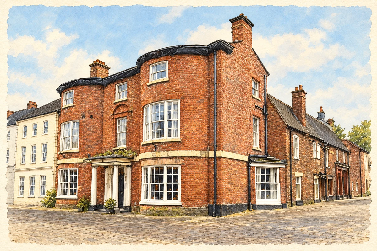
Watercolour and fine ink illustration of The Crown Hotel, Stone
Illustration · The Crown Hotel, Stone
History & heritage

Place & story

A road town and its priory

Medieval Stone stood on the route between London and Chester, with connections towards Holyhead and Ireland. Travellers needed food and accommodation, making the road an economic resource. At Walton, a bridge carrying the road from Eccleshall had replaced a ford by 1317. Movement through the town mattered long before the canal arrived. [3]

The priory participated in that economy through land, wool and waterpower. The Crown bought wool from it in 1339; mills on the Scotch Brook supplied income and employment. When the priory was dissolved in 1536, its assets included mills at the later Stubbs Mill site and at Stone Mills. Religious property was also productive infrastructure. [3]

The Crown Inn and the canal

On 10 June 1766 the Grand Trunk Canal Company held its first meeting at the Crown Inn. James Brindley became surveyor-general and Josiah Wedgwood treasurer; the company chose Stone for its headquarters in 1767. The town acquired an administrative role in the waterway as well as a position beside it. [2]

Road traffic continued to support inns and services. The council records 38 coaches a day at the height of the coaching era, stopping at several inns. Henry Holland designed the present Crown Hotel to replace an earlier Crown Inn. The same High Street address therefore connects coaching hospitality with the organisation of canal transport. [2]

Beer, horses and distant markets

Joule’s ale stores and stables were built beside the Trent and Mersey Canal in 1881. The position allowed beer to move into national and export markets. Forty horses and twenty drays served local deliveries until lorries took over in the twentieth century. Canal traffic and horse transport belonged to the same distribution system. [4]

The surviving buildings advertised as well as stored the beer: red crosses ornament the gables and roof finials, while the canal frontage bears the words Joule’s Stone Ales. Bottling facilities were added in the 1930s. After shares changed hands in 1968 and 1970, brewing ended in 1974. The stores preserve evidence of a business whose production site did not survive intact. [4]

A Catholic community takes shape

Dominic Barberi lived at Aston-by-Stone and travelled into Stone to celebrate Mass in a room at the Crown Inn. In 1843–44 A. W. Pugin’s small school chapel of St Anne provided a dedicated building. The movement from an inn room to a chapel links the religious revival to education and to the town’s existing places of assembly. [5]

A larger church, convent and school followed. Mother Margaret Hallahan commissioned the group, and St Dominic’s became the mother house of her Dominican congregation. Bishop Ullathorne laid the church foundation stone in 1853 and opened it in 1854. Charles Hansom’s work was extended by Gilbert Blount in 1861–63, giving the institution a growing architectural presence. [5]

Back to contents
Lives connected to this place

Notable people

Mother Margaret Hallahan: building a mother house

Margaret Hallahan (1803–1868) founded the Dominican Congregation of St Catherine of Siena and drew up its rule. Her particular connection with Stone was the creation of its convent, school and church. She conceived the church’s imagery as a means of teaching faith, making the building part of the congregation’s educational work. [5]

Richard Smith: a mill and a new flour

Richard, or Stoney, Smith was born at the mill in Mill Street in 1836. He developed the flour known as Hovis. The council’s account connects a nationally familiar food product with a specific working site in Stone, rather than merely including its inventor among people associated with the wider county. [2]

Back to contents
A chronology

Timeline

Stone through time

  1. 1317 — A bridge at Walton carries the road from Eccleshall towards Stone. [3]

  2. 1536 — Stone Priory is dissolved; its recorded assets include watermills. [3]

  3. 1766–67 — The canal company meets at the Crown Inn and chooses Stone for its headquarters. [2]

  4. 1854 — The new Catholic church opens. [5]

  5. 1881 — Joule’s builds its canalside ale stores and stables. [4]

  6. 1974 — Brewing at the Joule’s brewery closes. [4]

Back to contents

Population over time

Built-up area · Settlement · Census 2021

Stone (Stafford)

17,280people · 2021

Census 2021 population of the named settlement, using ONS built-up area boundaries.

Published census counts.

Sources: ONS: Towns and cities, characteristics of built-up areas, Census 2021 (Table 1c)

View population figures
Stone (Stafford) — census population
Census yearPopulation
202117,280
Sources and how to read this chart

Usual residents on 21 March 2021; published ONS count rounded to the nearest 5.. Boundary geography: December 2022 (E63002109).

Census 2021 population of the named settlement, using ONS built-up area boundaries.

ONS Table 1c rounds counts to the nearest 5 and suppresses counts below 10. Matched by exact settlement name or individually reviewed district-qualified name, with its coordinate strictly inside that same official BUA boundary. The 2022 BUA geography changed methodology and cannot be directly compared with 2011 BUAs. Contains OS data © Crown copyright and database right 2026. Contains National Statistics data © Crown copyright and database right 2026.

Source: ONS: Towns and cities, characteristics of built-up areas, Census 2021 (Table 1c). Open Government Licence v3.0. Retrieved 2026-10-26. Source: ONS and Ordnance Survey: Built Up Areas December 2022 GB BGG. Open Government Licence v3.0. Retrieved 2026-10-26.

Neighbourhood census context

These figures describe statistical neighbourhoods, which may cover part of a place or include neighbouring places.

Neighbourhood census area · 1971–2021

Stafford 003

Population of the area containing the recorded point for Stone, not the whole place. This area may cover part of the place or include neighbours.

05k10k15k20k1971: 6,878 people19711981: 7,985 people19811991: 8,287 people19912001: 8,700 people20012011: 10,346 people20112021: 11,079 people2021

Includes harmonised historical census estimates.

Sources: ONS · Paul Norman

View population figures
Stafford 003 — census population and harmonised historical estimates
Census yearPopulation
19716,878
19817,985
19918,287
20018,700
201110,346
202111,079
Sources and how to read this chart

Usual residents of the containing MSOA; this is local area context, not the population of the named settlement.. Boundary geography: 1 April 2022 (E02006190).

2011 and 2021 census counts harmonised by ONS to the same 1 April 2022 geography. Location matched to ONS 2021 MSOA polygons (full resolution, coastline clipped, V7). ONS exact-fit lookup marks this MSOA unchanged from 2011 (U); historical estimates use that same footprint.

1971–2011: Paul Norman harmonised historical estimates on 2011 MSOAs, rounded to whole residents (1971–1991 are modelled). 2021: ONS census count. The historical 2011 total can differ slightly from the ONS change-over-time 2011 total because of methodology and statistical disclosure controls. These are area estimates, not settlement totals.

Source: ONS Census change over time: usual resident population, 2011 and 2021. Open Government Licence v3.0. Retrieved 2026-10-26. Source: ONS MSOA December 2021 boundaries EW BFC V7. Open Government Licence v3.0. Retrieved 2026-10-26. Source: Paul Norman — Area characteristics: Great Britain 1971 to 2011. Creative Commons Attribution 4.0. Retrieved 2026-10-26. Source: ONS MSOA 2011 to MSOA 2021 exact-fit lookup for England and Wales. Open Government Licence v3.0. Retrieved 2026-10-26.

Recorded locationStone52.90141° N · 2.14516° WInteractive map loads when this area enters view.
Approximate recorded location · Geographic source

Geographic context

Place type
Town
Country / region
England · West Midlands
County group
Staffordshire
Current administration
Stafford
Current administration
Staffordshire
Recorded coordinates
52.90141, -2.14516
OS Open Names ID
osgb4000000074560221

County groups are browsing aids. Current administrative and historic areas are recorded separately.

Recorded names

  • Stone · en · official

Nearby heritage

Distances are from the recorded place point. Proximity does not establish that a site lies within the place boundary or belongs to its history.

Sources & further reading

  1. OS Open Names October 2026 · Source licence.
  2. History of Stone · Stone Town Council
  3. Stone Historic Character Assessment, May 2012 · Staffordshire County Council
  4. Former Ale Stores, Stables and Nos.29A and29B, list1392638 · Historic England
  5. Stone – Immaculate Conception and St Dominic · Catholic Bishops’ Conference of England and Wales / Taking Stock
  6. Illustration of The Crown Hotel, Stone, adapted from Crown Hotel, Stone by Andrew Abbott. CC BY-SA 2.0. AI-assisted watercolour and fine ink adaptation; simplified fine detail and removal of incidental clutter.

Geographic source retrieved 2026-10-26. History last researched 2026-10-27. How this page was prepared.