Town

Tamworth

Mercian rulers and a much-altered castle established Tamworth’s place in history; markets, manufacturing and housing later changed the town around them.

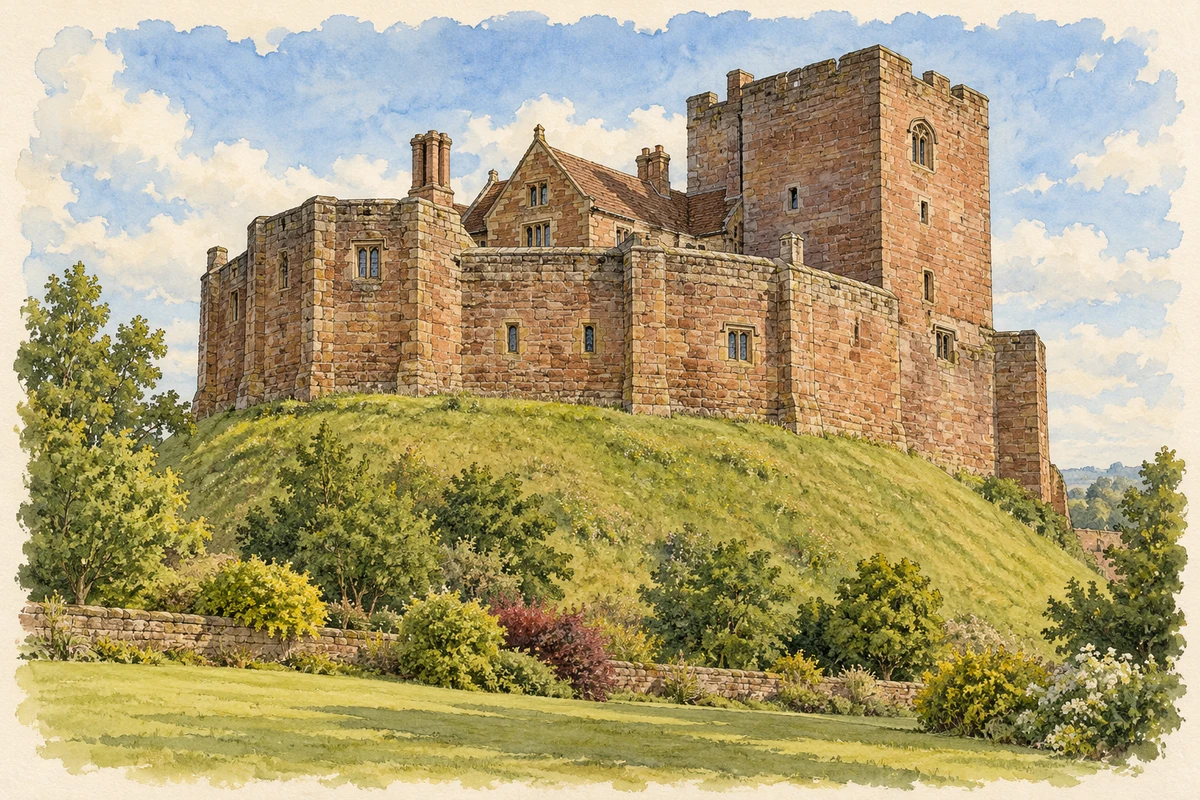
Watercolour and fine ink illustration of Tamworth Castle
Illustration · Tamworth Castle
Original illustration; researched sources
Research sources

Original architectural composition based on the cited building descriptions; incidental setting and fine details are interpretive.

Historic England: Tamworth Castle; Tamworth Castle: access

History & heritage

Place & story

Power beside the Anker

Between the seventh and ninth centuries, Tamworth was a royal and administrative centre of Mercia. Charters locate royal households here at Easter and Christmas between 751 and 857. Written evidence for rulers is complemented by evidence of work: excavations in the 1970s revealed two watermills beside the Anker, one dated to the middle of the ninth century. Grinding grain formed part of the settlement’s life alongside ceremony and government. [2]

Fortifying a frontier

In 913 Æthelflæd refortified Tamworth. The defensive settlement belonged to a wider campaign to secure Mercia against Scandinavian rule. Its strategic role preceded the Norman castle: the visible fortress should not be mistaken for the building in which earlier Mercian rulers lived. The castle museum distinguishes the Saxon enclosure and its archaeology from the later stronghold. [2] [3]

A fortress becomes a household

The Ferrers family acquired the castle in 1423 and made it a more imposing residence. Thomas Ferrers built a timber great hall around 1437. During the Elizabethan period Humphrey Ferrers altered medieval structures to create rooms and approaches suited to a wealthy household. Bay windows admitted light to the northern reception rooms, and a new stair turret connected the hall with the first floor. [4]

A three-storey southern wing, a storeyed porch and elaborate gables helped present the castle as a great house. James I visited in 1619, 1621 and 1624. These changes made room for hospitality and display within a defensive structure. The building’s history is therefore one of repeated adaptation, rather than the survival of a single unaltered Norman interior. [4]

Markets and the industrial district

Tamworth remained a market centre through the medieval and early modern periods. A royal charter established its corporation in 1560, embracing both sides of a town divided between Staffordshire and Warwickshire. The county boundary ran through the centre. [5]

Manufacturing connected Tamworth with its neighbours. Robert Peel, the Lancashire cotton manufacturer, opened works in the town and Fazeley. Coal and clay encouraged mining villages in the wider parish. These settlements belonged to a connected district with several distinct centres. [5]

Expansion and public inheritance

From the mid-1950s, Tamworth accommodated Birmingham overspill. Large housing estates developed east of the old centre, around former mining villages. The Victoria County History connects this expansion with town-centre redevelopment. [5]

The borough bought the castle in 1897, turning a former private residence into a civic inheritance. Public ownership also brought the continuing obligation to maintain a complicated structure. The museum’s conservation account describes trapped water in the mound, drainage failures and movement affecting the walls and interior. The castle entered the Heritage at Risk Register in 2023; repairs are part of the history of how the town uses and protects it. [6]

Back to contents
Lives connected to this place

Notable people

Æthelflæd: a ruler in Tamworth

Æthelflæd was Alfred the Great’s daughter and ruled Mercia with her husband Æthelred before becoming sole ruler after his death in 911. Her programme of fortified settlements included Tamworth, where she died on 12 June 918. She was buried at Gloucester beside her husband. Tamworth’s connection is to her rule, fortification and death, rather than a claim that she was born here. [3]

The two Robert Peels

The elder Robert Peel established cotton works in Tamworth and Fazeley. His son, the future prime minister, built a mansion at nearby Drayton in the 1830s. Their industrial and political careers belong to different generations. [5]

The younger Sir Robert Peel served as prime minister in 1834–35 and 1841–46. As home secretary he established London’s Metropolitan Police in 1829; his second ministry ended after the repeal of the Corn Laws in 1846. [7]

Back to contents
A chronology

Timeline

Tamworth through time

  1. 751–857 — Charters record Mercian royal households celebrating major festivals at Tamworth. [2]

  2. 913 — Æthelflæd refortifies the settlement. [2]

  3. 918 — Æthelflæd dies at Tamworth on 12 June. [3]

  4. 1423 — The Ferrers family acquires the castle. [4]

  5. 1560 — A royal charter establishes the borough corporation. [5]

  6. 1897 — The castle is purchased for the borough. [6]

  7. Mid-1950s onward — Housing expansion accommodates Birmingham overspill. [5]

  8. 2023 — The castle enters the Heritage at Risk Register. [6]

Back to contents

Population over time

Built-up area · Settlement · Census 2021

Tamworth

76,090people · 2021

Census 2021 population of the named settlement, using ONS built-up area boundaries.

Published census counts.

Sources: ONS: Towns and cities, characteristics of built-up areas, Census 2021 (Table 1c)

View population figures
Tamworth — census population
Census yearPopulation
202176,090
Sources and how to read this chart

Usual residents on 21 March 2021; published ONS count rounded to the nearest 5.. Boundary geography: December 2022 (E63002644).

Census 2021 population of the named settlement, using ONS built-up area boundaries.

ONS Table 1c rounds counts to the nearest 5 and suppresses counts below 10. Matched by exact settlement name or individually reviewed district-qualified name, with its coordinate strictly inside that same official BUA boundary. The 2022 BUA geography changed methodology and cannot be directly compared with 2011 BUAs. Contains OS data © Crown copyright and database right 2026. Contains National Statistics data © Crown copyright and database right 2026.

Source: ONS: Towns and cities, characteristics of built-up areas, Census 2021 (Table 1c). Open Government Licence v3.0. Retrieved 2026-10-26. Source: ONS and Ordnance Survey: Built Up Areas December 2022 GB BGG. Open Government Licence v3.0. Retrieved 2026-10-26.

Neighbourhood census context

These figures describe statistical neighbourhoods, which may cover part of a place or include neighbouring places.

Neighbourhood census area · 1971–2021

Tamworth 002

Population of the area containing the recorded point for Tamworth, not the whole place. This area may cover part of the place or include neighbours.

02.3k4.5k6.8k9k1971: 6,022 people19711981: 6,437 people19811991: 6,050 people19912001: 6,993 people20012011: 7,857 people20112021: 8,449 people2021

Includes harmonised historical census estimates.

Sources: ONS · Paul Norman

View population figures
Tamworth 002 — census population and harmonised historical estimates
Census yearPopulation
19716,022
19816,437
19916,050
20016,993
20117,857
20218,449
Sources and how to read this chart

Usual residents of the containing MSOA; this is local area context, not the population of the named settlement.. Boundary geography: 1 April 2022 (E02006218).

2011 and 2021 census counts harmonised by ONS to the same 1 April 2022 geography. Location matched to ONS 2021 MSOA polygons (full resolution, coastline clipped, V7). ONS exact-fit lookup marks this MSOA unchanged from 2011 (U); historical estimates use that same footprint.

1971–2011: Paul Norman harmonised historical estimates on 2011 MSOAs, rounded to whole residents (1971–1991 are modelled). 2021: ONS census count. The historical 2011 total can differ slightly from the ONS change-over-time 2011 total because of methodology and statistical disclosure controls. These are area estimates, not settlement totals.

Source: ONS Census change over time: usual resident population, 2011 and 2021. Open Government Licence v3.0. Retrieved 2026-10-26. Source: ONS MSOA December 2021 boundaries EW BFC V7. Open Government Licence v3.0. Retrieved 2026-10-26. Source: Paul Norman — Area characteristics: Great Britain 1971 to 2011. Creative Commons Attribution 4.0. Retrieved 2026-10-26. Source: ONS MSOA 2011 to MSOA 2021 exact-fit lookup for England and Wales. Open Government Licence v3.0. Retrieved 2026-10-26.

Recorded locationTamworth52.63343° N · 1.69245° WInteractive map loads when this area enters view.
Approximate recorded location · Geographic source

Geographic context

Place type
Town
Country / region
England · West Midlands
County group
Staffordshire
Current administration
Tamworth
Current administration
Staffordshire
Recorded coordinates
52.63343, -1.69245
OS Open Names ID
osgb4000000074551591

County groups are browsing aids. Current administrative and historic areas are recorded separately.

Recorded names

  • Tamworth · en · official

Nearby heritage

Distances are from the recorded place point. Proximity does not establish that a site lies within the place boundary or belongs to its history.

Sources & further reading

  1. OS Open Names October 2026 · Source licence.
  2. Saxon Tamworth · Tamworth Castle
  3. Aethelflaed · Tamworth Castle
  4. Tudor Tamworth Castle · Tamworth Castle
  5. Launching Tamworth: Victoria County History · Institute of Historical Research
  6. Caring for the Castle · Tamworth Castle
  7. Sir Robert Peel, 2nd Baronet · Prime Minister’s Office
  8. Original illustration of Tamworth Castle by PlaceHistory. Researched sources are linked beneath the illustration. Original composition from inspected architectural facts; no source photograph copied or used as an image-edit input. Fine detail is interpretive, not a measured survey.

Geographic source retrieved 2026-10-26. History last researched 2026-10-27. How this page was prepared.