Town

Uttoxeter

Dairying, machinery and biscuit making connect Uttoxeter’s market with the work of its surrounding countryside. A cooper’s cottage preserves another kind of production: the writing of the town’s history.

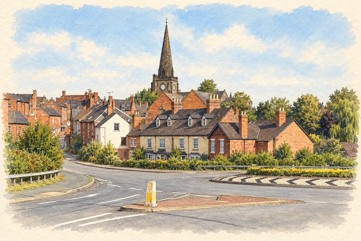
Watercolour and fine ink illustration of Uttoxeter townscape with St Mary’s church spire
Illustration · Uttoxeter townscape with St Mary’s church spire
History & heritage

Place & story

A town sustained by its meadows

Uttoxeter’s centre stands above the River Dove, close to a crossing and the grasslands that supported its agricultural economy. Henry III granted a Wednesday market and annual fair in December 1251; a town charter followed in August 1252. Trading rights helped establish the market as a lasting institution. [3]

Staffordshire’s historic character assessment links the economy with the surrounding river meadows. Dairying was especially important by the seventeenth century, when the town was known for butter and cheese. Its market connected producers in the countryside with buyers in town, giving food production a role in shaping settlement and employment. [4]

Routes into the market

Turnpike roads supported coaching inns such as the Cross Keys and White Hart. A canal branch arrived in 1811 but stopped at Uttoxeter. Railways offered wider connections: the Crewe–Derby line opened in 1848, the Churnet Valley line followed in 1849, and the Stafford route in 1867. The junction served passengers and market trade. [3]

The North Staffordshire Railway promoted cheap market-day returns and supported horse racing. These initiatives treated the town as a destination as well as a place through which goods passed. Transport companies had an interest in the regular gatherings that brought buyers and visitors into its streets. [3]

Agricultural machinery and changing neighbourhoods

Bamfords’ ironworks south of the centre began in the 1870s. The agricultural machinery business connected manufacturing with the needs of farms. Alongside it, the later arrival of Elkes’ biscuit factory north of the town gave twentieth-century Uttoxeter a substantial food-manufacturing industry as well as its continuing market functions. [4]

Different kinds of housing record the town’s growth. At the Heath, piecemeal encroachment and surviving squatters’ cottages contrast with planned late nineteenth-century streets between Stone Road and Hockley Road. Much more extensive suburban development followed in the mid twentieth century. The historic town includes these neighbourhoods alongside its central market streets. [4]

From a confectioner’s shop to a factory

Charles Henry Elkes opened a High Street confectionery business in 1908. His son Samuel began making biscuits after visiting a factory in 1924, then installed machinery to meet demand. Land purchased in 1927 became Dove Valley Bakeries, where production began in 1928 with thirty employees. [5]

The company’s account places the factory only half a mile from the original shop. Its expansion shows a local retail business becoming a mechanised manufacturer without leaving the town. The sequence from shop counter to production machinery helps explain how new factory employment developed within an established market community. [5]

A working home becomes a museum

The timber-framed cottages now housing Redfern’s Cottage appear on a town map of 1658. By 1851 they had been divided into three dwellings. The buildings were bought by the town council in 1987 and opened as a heritage centre; Uttoxeter Heritage Trust took responsibility in 2010 and reopened the redeveloped museum in 2019. [2]

The museum collects local archives, objects, art and evidence of social history. Its position on Carter Street gives a former domestic building a public role in preserving Uttoxeter’s past. That use continues the historical work of the resident whose name the museum carries. [6] [2]

Back to contents
Lives connected to this place

Notable people

Francis Redfern: history after the working day

Francis Redfern was a cooper from Fenny Bentley who lived in one of the cottages from 1851 until his death in 1895. He devoted evenings and spare time to learning and local research. His history took eight years to compile; he also produced poems and watercolours recording Uttoxeter and its surroundings. [2]

Joseph Cyril Bamford: an Uttoxeter beginning

Joseph Cyril Bamford founded JCB in a rented Uttoxeter lock-up garage on 23 October 1945. His first product was a tipping farm trailer made using wartime scrap. His beginnings lay in equipment for farms, giving Uttoxeter a place in the early history of a business later associated with construction machinery. [7]

JCB moved to a stable block at nearby Crakemarsh Hall in 1947 and then to a former cheese factory at Rocester in 1950. These locations should remain distinct: Uttoxeter was the business’s starting place, while its later headquarters developed in a neighbouring settlement. [7]

Back to contents
A chronology

Timeline

Uttoxeter through time

  1. 1251–52 — A market charter is followed by a town charter. [3]

  2. 1811 — A canal branch reaches Uttoxeter. [3]

  3. 1851 — Francis Redfern begins living in the Carter Street cottage. [2]

  4. 1908 — Charles Henry Elkes opens his High Street confectionery business. [5]

  5. 1928 — Dove Valley Bakeries starts factory production. [5]

  6. 1945 — Joseph Cyril Bamford founds JCB in Uttoxeter. [7]

  7. 2019 — Redfern’s Cottage reopens after redevelopment. [2]

Back to contents

Population over time

Built-up area · Settlement · Census 2021

Uttoxeter

14,020people · 2021

Census 2021 population of the named settlement, using ONS built-up area boundaries.

Published census counts.

Sources: ONS: Towns and cities, characteristics of built-up areas, Census 2021 (Table 1c)

View population figures
Uttoxeter — census population
Census yearPopulation
202114,020
Sources and how to read this chart

Usual residents on 21 March 2021; published ONS count rounded to the nearest 5.. Boundary geography: December 2022 (E63002100).

Census 2021 population of the named settlement, using ONS built-up area boundaries.

ONS Table 1c rounds counts to the nearest 5 and suppresses counts below 10. Matched by exact settlement name or individually reviewed district-qualified name, with its coordinate strictly inside that same official BUA boundary. The 2022 BUA geography changed methodology and cannot be directly compared with 2011 BUAs. Contains OS data © Crown copyright and database right 2026. Contains National Statistics data © Crown copyright and database right 2026.

Source: ONS: Towns and cities, characteristics of built-up areas, Census 2021 (Table 1c). Open Government Licence v3.0. Retrieved 2026-10-26. Source: ONS and Ordnance Survey: Built Up Areas December 2022 GB BGG. Open Government Licence v3.0. Retrieved 2026-10-26.

Neighbourhood census context

These figures describe statistical neighbourhoods, which may cover part of a place or include neighbouring places.

Neighbourhood census area · 1971–2021

East Staffordshire 003

Population of the area containing the recorded point for Uttoxeter, not the whole place. This area may cover part of the place or include neighbours.

01.8k3.5k5.3k7k1971: 4,361 people19711981: 4,051 people19811991: 4,331 people19912001: 5,980 people20012011: 6,896 people20112021: 6,937 people2021

Includes harmonised historical census estimates.

Sources: ONS · Paul Norman

View population figures
East Staffordshire 003 — census population and harmonised historical estimates
Census yearPopulation
19714,361
19814,051
19914,331
20015,980
20116,896
20216,937
Sources and how to read this chart

Usual residents of the containing MSOA; this is local area context, not the population of the named settlement.. Boundary geography: 1 April 2022 (E02006133).

2011 and 2021 census counts harmonised by ONS to the same 1 April 2022 geography. Location matched to ONS 2021 MSOA polygons (full resolution, coastline clipped, V7). ONS exact-fit lookup marks this MSOA unchanged from 2011 (U); historical estimates use that same footprint.

1971–2011: Paul Norman harmonised historical estimates on 2011 MSOAs, rounded to whole residents (1971–1991 are modelled). 2021: ONS census count. The historical 2011 total can differ slightly from the ONS change-over-time 2011 total because of methodology and statistical disclosure controls. These are area estimates, not settlement totals.

Source: ONS Census change over time: usual resident population, 2011 and 2021. Open Government Licence v3.0. Retrieved 2026-10-26. Source: ONS MSOA December 2021 boundaries EW BFC V7. Open Government Licence v3.0. Retrieved 2026-10-26. Source: Paul Norman — Area characteristics: Great Britain 1971 to 2011. Creative Commons Attribution 4.0. Retrieved 2026-10-26. Source: ONS MSOA 2011 to MSOA 2021 exact-fit lookup for England and Wales. Open Government Licence v3.0. Retrieved 2026-10-26.

Recorded locationUttoxeter52.89840° N · 1.86480° WInteractive map loads when this area enters view.
Approximate recorded location · Geographic source

Geographic context

Place type
Town
Country / region
England · West Midlands
County group
Staffordshire
Current administration
East Staffordshire
Current administration
Staffordshire
Recorded coordinates
52.89840, -1.86480
OS Open Names ID
osgb4000000074549395

County groups are browsing aids. Current administrative and historic areas are recorded separately.

Recorded names

  • Uttoxeter · en · official

Nearby heritage

Explore recorded heritage in Uttoxeter and the surrounding area. This selection is based on proximity to a recorded settlement point; it is not a complete inventory or evidence that a site lies within the settlement or belongs to its history.

Heritage locationsUttoxeter & surrounding areaInteractive map loads when this area enters view. Source records are listed below.

Numbered markers match the source records below. Locations are recorded reference points, not site boundaries.

  1. 10, HIGH STREET · Listed building
  2. THE OLD TALBOT INN · Listed building
  3. CONDUIT OR MARKET CROSS · Listed building
  4. CARTWRIGHT, CHEMIST · Listed building
  5. CONGREGATIONAL CHURCH · Listed building
  6. THE VAULTS PUBLIC HOUSE · Listed building
  7. 33 AND 35, MARKET PLACE · Listed building
  8. 21, MARKET PLACE (See details for further address information) · Listed building

Sources & further reading

  1. OS Open Names October 2026 · Source licence.
  2. Redfern’s Cottage: Museum of Uttoxeter Life · Derbyshire Family History Society / museum volunteer contribution
  3. Local History · Uttoxeter Town Council
  4. Uttoxeter Extensive Urban Survey: Historic Character Assessment · Staffordshire County Council
  5. Where it all began · Elkes Biscuits
  6. Museum of Uttoxeter Life · Uttoxeter Heritage Trust
  7. 80th Anniversary History · JCB
  8. Illustration of Uttoxeter townscape with St Mary’s church spire, adapted from Uttoxeter 534277.jpg by Geoff Pick. CC BY-SA 2.0. AI-assisted watercolour and fine ink adaptation; cream paper margins, simplified fine detail and removal of incidental street clutter.

Geographic source retrieved 2026-10-26. History last researched 2026-10-27. How this page was prepared.