Town

Alcester

Roman archaeology beneath Alcester’s streets connects a town of trade and manufacture with later market halls, educational charity and needle factories.

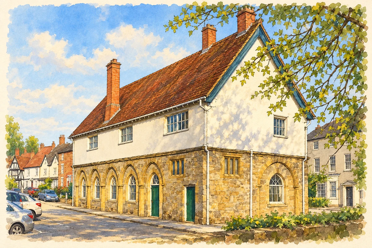
Watercolour and fine ink illustration of Alcester Town Hall
Illustration · Alcester Town Hall
History & heritage

Place & story

The town beneath the town

Alcester developed at the meeting of the Alne and Arrow, close to the Roman routes known as Ryknild Street and the Salt Way. Military activity helped establish the settlement, which expanded during the second century. Archaeology distinguishes an industrial area around Birch Abbey, residential areas and cemeteries. The Roman town was a varied working settlement rather than simply a fort beneath the later High Street. [2]

The museum’s account places a rampart around the north-eastern part of the town about AD 200, with a stone wall added in the later fourth century. Settlement also continued outside the defended area. Imported pottery and containers for wine and olive oil connect Alcester with imperial trade, while leather and metalworking supplied local and wider customers. Defence enclosed only part of this commercial landscape. [4]

Small discoveries continue to reveal its buildings. Salvage recording at 27 High Street in 1987 identified a stone-filled foundation trench, two corners and one side of a Roman structure. Painted plaster, waterproof mortar and a single mosaic tessera were also recovered. These fragments establish substantial construction below a later town-centre property without requiring an imagined reconstruction of the entire building. [3]

Between Roman settlement and medieval borough

The end of Roman Alcester remains poorly understood. Its museum stresses the small number of Anglo-Saxon objects found in the town and treats continued occupation by a local British population as a possibility. An abbey founded by Ralph de Boteler in 1140 provides a firmer medieval reference. Excavation at School Road has also established pottery production in the twelfth and thirteenth centuries; by the thirteenth century Alcester was a borough. [4]

A market hall with rooms for civic memory

The town hall developed in stages: Fulke Greville contributed to the market hall built in 1618, and an upper floor followed in 1641. These are distinct moments in the history of one structure. The building still accommodates civic functions, meetings, exhibitions and celebrations, continuing its role as a place where the town gathers. [5]

Its rooms preserve objects associated with local authority. The Juror’s Room contains a prison-cell door and stocks; upstairs, the Bailiff’s Room has boards recording bailiffs and a roof beam carved with 1641. Such survivals make the hall a record of justice, office-holding and commemoration as well as an architectural landmark. [6]

Needle making: households and factory floors

The Allwood family’s earlier Henley Street business relied partly on outworkers for stages such as spitting and packeting, while scouring was done elsewhere. Around 1880–85 Alfred Allwood transferred production to the purpose-built Minerva works in Station Road. Historic England considers that all the manufacturing processes may have been brought together there. A distributed trade was being reorganised within a conspicuous factory. [7]

The three-storey works has a long red-brick front with terracotta ornament and repeated round-headed, cast-iron-framed windows. Its scale makes the industrial change visible. Terry’s Springs bought the premises in 1912. Later owners and restoration gave it further working lives; the industrial archaeology society records its conversion into small business units as Minerva Mill. [7] [8]

A charitable route into education

Walter Newport left an endowment to support teaching for poor children in Alcester. His foundation’s history records property provided by Nicholas Fortescue in 1605 and says the school was operating by 1610, while acknowledging that its opening date is unknown. The surviving institution grew through further gifts, tying schooling to land, rents and charitable administration. [9]

A 1912 scheme discontinued the old school and redirected its resources towards assistance connected with the new grammar school. Later arrangements broadened the foundation’s educational support, including help for young people entering trades or professions. The history of education here includes the changing purposes of charitable money as well as the succession of school buildings. [9]

Back to contents
Lives connected to this place

Notable people

Fulke Greville: an Alcester-born writer and patron

Fulke Greville (1554–1628) was born in Alcester and became a courtier, statesman and writer of sonnets, philosophical poems and drama. His later restoration of Warwick Castle belongs to another place, but his contribution to Alcester’s market hall gives his hometown connection a tangible civic expression. His literary and political career reached far beyond the town of his birth. [10] [5]

Alfred Allwood: concentrating a local trade

Alfred Allwood was the needlemaker for whom Minerva’s large factory was built. His place in Alcester’s story is tied to that specific industrial investment and to a family business previously operating in Henley Street. The surviving works gives a physical scale to the change from partly dispersed production to a purpose-built manufacturing site. [7]

Back to contents
A chronology

Timeline

Alcester through time

  1. About AD 200 — A defensive rampart encloses part of Roman Alcester. [4]

  2. 1140 — Ralph de Boteler founds Alcester Abbey. [4]

  3. By 1610 — Newport’s charitable school is operating. [9]

  4. 1618 — The market hall is built; its upper floor follows in 1641. [5]

  5. Around 1880–85 — Alfred Allwood moves production to Minerva’s new factory. [7]

  6. 1912 — Terry’s Springs buys the Minerva premises. [7]

  7. 1987 — Recording at 27 High Street exposes a Roman stone building. [3]

Back to contents

Population over time

Built-up area · Settlement · Census 2021

Alcester

6,425people · 2021

Census 2021 population of the named settlement, using ONS built-up area boundaries.

Published census counts.

Sources: ONS: Towns and cities, characteristics of built-up areas, Census 2021 (Table 1c)

View population figures
Alcester — census population
Census yearPopulation
20216,425
Sources and how to read this chart

Usual residents on 21 March 2021; published ONS count rounded to the nearest 5.. Boundary geography: December 2022 (E63003447).

Census 2021 population of the named settlement, using ONS built-up area boundaries.

ONS Table 1c rounds counts to the nearest 5 and suppresses counts below 10. Matched by exact settlement name or individually reviewed district-qualified name, with its coordinate strictly inside that same official BUA boundary. The 2022 BUA geography changed methodology and cannot be directly compared with 2011 BUAs. Contains OS data © Crown copyright and database right 2026. Contains National Statistics data © Crown copyright and database right 2026.

Source: ONS: Towns and cities, characteristics of built-up areas, Census 2021 (Table 1c). Open Government Licence v3.0. Retrieved 2026-10-26. Source: ONS and Ordnance Survey: Built Up Areas December 2022 GB BGG. Open Government Licence v3.0. Retrieved 2026-10-26.

Neighbourhood census context

These figures describe statistical neighbourhoods, which may cover part of a place or include neighbouring places.

Neighbourhood census area · 1971–2021

Stratford-on-Avon 006

Population of the area containing the recorded point for Alcester, not the whole place. This area may cover part of the place or include neighbours.

01.8k3.5k5.3k7k1971: 3,553 people19711981: 5,207 people19811991: 5,632 people19912001: 6,119 people20012011: 6,095 people20112021: 5,869 people2021

Includes harmonised historical census estimates.

Sources: ONS · Paul Norman

View population figures
Stratford-on-Avon 006 — census population and harmonised historical estimates
Census yearPopulation
19713,553
19815,207
19915,632
20016,119
20116,095
20215,869
Sources and how to read this chart

Usual residents of the containing MSOA; this is local area context, not the population of the named settlement.. Boundary geography: 1 April 2022 (E02006509).

2011 and 2021 census counts harmonised by ONS to the same 1 April 2022 geography. Location matched to ONS 2021 MSOA polygons (full resolution, coastline clipped, V7). ONS exact-fit lookup marks this MSOA unchanged from 2011 (U); historical estimates use that same footprint.

1971–2011: Paul Norman harmonised historical estimates on 2011 MSOAs, rounded to whole residents (1971–1991 are modelled). 2021: ONS census count. The historical 2011 total can differ slightly from the ONS change-over-time 2011 total because of methodology and statistical disclosure controls. These are area estimates, not settlement totals.

Source: ONS Census change over time: usual resident population, 2011 and 2021. Open Government Licence v3.0. Retrieved 2026-10-26. Source: ONS MSOA December 2021 boundaries EW BFC V7. Open Government Licence v3.0. Retrieved 2026-10-26. Source: Paul Norman — Area characteristics: Great Britain 1971 to 2011. Creative Commons Attribution 4.0. Retrieved 2026-10-26. Source: ONS MSOA 2011 to MSOA 2021 exact-fit lookup for England and Wales. Open Government Licence v3.0. Retrieved 2026-10-26.

Recorded locationAlcester52.21365° N · 1.87098° WInteractive map loads when this area enters view.
Approximate recorded location · Geographic source

Geographic context

Place type
Town
Country / region
England · West Midlands
County group
Warwickshire
Current administration
Stratford-on-Avon
Current administration
Warwickshire
Recorded coordinates
52.21365, -1.87098
OS Open Names ID
osgb4000000074545167

County groups are browsing aids. Current administrative and historic areas are recorded separately.

Recorded names

  • Alcester · en · official

Nearby heritage

Distances are from the recorded place point. Proximity does not establish that a site lies within the place boundary or belongs to its history.

Sources & further reading

  1. OS Open Names October 2026 · Source licence.
  2. Alcester Roman Town · Warwickshire Historic Environment Record / Our Warwickshire
  3. Roman Building at 27 High Street · Warwickshire Historic Environment Record
  4. Alcester History · Roman Alcester Museum
  5. Alcester Town Hall · Alcester Town Hall
  6. Alcester Town Hall Events · Alcester Town Hall
  7. Minerva Needle Works,1250089 · Historic England
  8. WIAS Database · Warwickshire Industrial Archaeology Society
  9. History of Newport’s School Foundation · Newport’s School Foundation
  10. Fulke Greville · Our Warwickshire
  11. Illustration of Alcester Town Hall, adapted from Alcester Town Hall - geograph.org.uk - 670199.jpg by Stephen McKay. CC BY-SA 2.0. AI-assisted watercolour and fine ink adaptation; incidental clutter simplified, warm cream paper margins. Architectural forms follow the inspected reference.

Geographic source retrieved 2026-10-26. History last researched 2026-10-26. How this page was prepared.