Town

Bedworth

Weaving and mining shaped Bedworth’s working life; coal beneath a rector’s land helped sustain schools and almshouses at its centre.

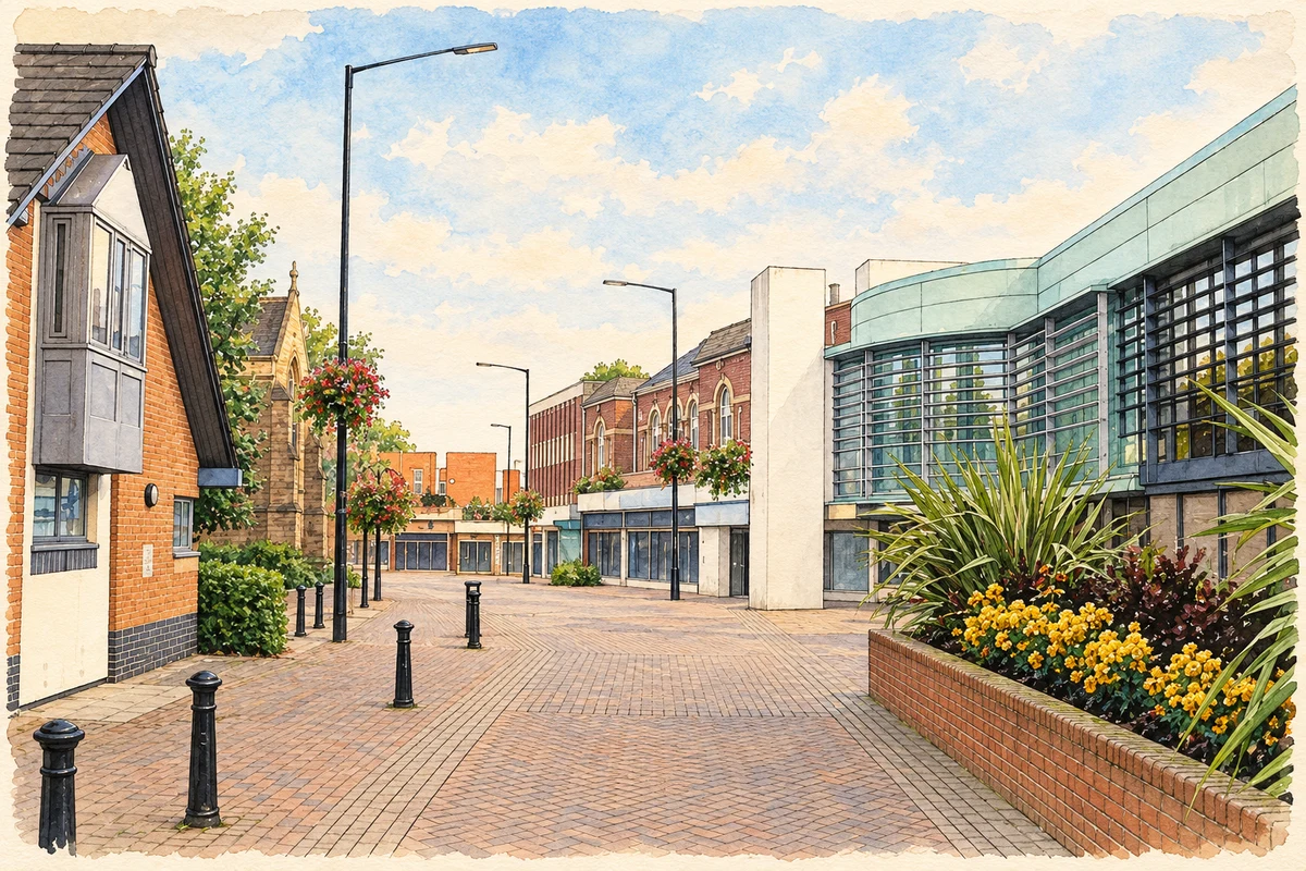
Watercolour and fine ink illustration of Bedworth town centre and Civic Hall
Illustration · Bedworth town centre and Civic Hall
History & heritage

Place & story

Work at the loom and underground

Ribbon weaving, hat making and coal mining gave Bedworth overlapping identities. The coalfield reached close to the surface here, while domestic looms brought textile work into households. Work was vulnerable to changes beyond the town: the 1860 trade treaty with France removed duties on French silks, intensifying the ribbon trade’s collapse. [3]

Some unemployed weaving families left for Canada, Australia and New Zealand. Others turned to decorative beadwork. Hat factories subsequently supplied another source of employment; Pickerings and Woottons were important local employers. Industrial change could mean changing craft, changing workplace or leaving the town altogether. [3]

Coal supports charity

At Collycroft, mining and philanthropy were directly connected. The Northern Mine Research Society records Charity Colliery as sunk in 1830 on land belonging to Nicholas Chamberlaine’s charity, during a depression in the silk trade, to provide employment for ribbon weavers. Lease income helped pay for a school and almshouses. The pit closed on 13 September 1924. [4]

Coal therefore mattered both as a source of wages and as an asset belonging to a local institution. Chamberlaine’s land purchases in 1682 and 1686 had created an estate whose mineral wealth later supported his educational and charitable legacy. [5]

A foundation older than its famous buildings

The original almshouses stood south of All Saints Church, in the grounds associated with Bedworth Hall. The county Historic Environment Record says they were already in use by 1715, when Chamberlaine left money for their improvement. The familiar buildings are their successors: completed in 1840 on a new site to the north, rather than surviving from the early eighteenth century. [7] [5]

A place in the hospital, as almshouses were then called, brought lodging, money, clothing and fuel. It also imposed obligations. Residents had to attend church and prayers, and the original Bedworth birth requirement was eventually relaxed. Charity offered material security within a closely supervised religious community. [2]

Water, rooms and shared life

The 1840 courtyard contained two different water supplies. One hand pump reached groundwater for drinking; another drew stored rainwater from an underground tank for washing. Roof water was collected through a system of pipes. This small building makes the daily labour of carrying water and washing clothes part of the almshouses’ architectural story. [6]

The Trust now provides self-contained accommodation for older people, with shared facilities and support. A Bedworth connection remains important, but admission no longer requires membership of the Church of England. The institution has adapted its rules as well as its rooms. [6]

Back to contents
Lives connected to this place

Notable people

Nicholas Chamberlaine: rector and landowner

Born at Whitnash in 1632, Nicholas Chamberlaine became Bedworth’s rector in 1664 and served for 51 years. His local importance rests on property and institutions rather than birthplace. His 1715 will provided for boys’ and girls’ schooling, with different curricula, and for the almshouses. The Trust notes that no portrait of him is known. [5]

Back to contents
A chronology

Timeline

Bedworth through time

  1. 1664 — Nicholas Chamberlaine becomes rector of Bedworth. [5]

  2. 1715 — Chamberlaine’s will supports schools and the improvement of existing almshouses. [5] [7]

  3. 1830 — The mining society dates the sinking of Charity Colliery at Collycroft to this year. [4]

  4. 1840 — Replacement almshouses are completed north of the earlier site. [7]

  5. 1860 — The French trade treaty contributes to the ribbon industry’s crisis. [3]

  6. 13 September 1924 — Charity Colliery closes. [4]

Back to contents

Population over time

Built-up area · Settlement · Census 2021

Bedworth

31,090people · 2021

Census 2021 population of the named settlement, using ONS built-up area boundaries.

Published census counts.

Sources: ONS: Towns and cities, characteristics of built-up areas, Census 2021 (Table 1c)

View population figures
Bedworth — census population
Census yearPopulation
202131,090
Sources and how to read this chart

Usual residents on 21 March 2021; published ONS count rounded to the nearest 5.. Boundary geography: December 2022 (E63002915).

Census 2021 population of the named settlement, using ONS built-up area boundaries.

ONS Table 1c rounds counts to the nearest 5 and suppresses counts below 10. Matched by exact settlement name or individually reviewed district-qualified name, with its coordinate strictly inside that same official BUA boundary. The 2022 BUA geography changed methodology and cannot be directly compared with 2011 BUAs. Contains OS data © Crown copyright and database right 2026. Contains National Statistics data © Crown copyright and database right 2026.

Source: ONS: Towns and cities, characteristics of built-up areas, Census 2021 (Table 1c). Open Government Licence v3.0. Retrieved 2026-10-26. Source: ONS and Ordnance Survey: Built Up Areas December 2022 GB BGG. Open Government Licence v3.0. Retrieved 2026-10-26.

Neighbourhood census context

These figures describe statistical neighbourhoods, which may cover part of a place or include neighbouring places.

Neighbourhood census area · 1971–2021

Nuneaton and Bedworth 013

Population of the area containing the recorded point for Bedworth, not the whole place. This area may cover part of the place or include neighbours.

02k4k6k8k1971: 7,051 people19711981: 7,236 people19811991: 7,082 people19912001: 6,720 people20012011: 6,658 people20112021: 6,947 people2021

Includes harmonised historical census estimates.

Sources: ONS · Paul Norman

View population figures
Nuneaton and Bedworth 013 — census population and harmonised historical estimates
Census yearPopulation
19717,051
19817,236
19917,082
20016,720
20116,658
20216,947
Sources and how to read this chart

Usual residents of the containing MSOA; this is local area context, not the population of the named settlement.. Boundary geography: 1 April 2022 (E02006487).

2011 and 2021 census counts harmonised by ONS to the same 1 April 2022 geography. Location matched to ONS 2021 MSOA polygons (full resolution, coastline clipped, V7). ONS exact-fit lookup marks this MSOA unchanged from 2011 (U); historical estimates use that same footprint.

1971–2011: Paul Norman harmonised historical estimates on 2011 MSOAs, rounded to whole residents (1971–1991 are modelled). 2021: ONS census count. The historical 2011 total can differ slightly from the ONS change-over-time 2011 total because of methodology and statistical disclosure controls. These are area estimates, not settlement totals.

Source: ONS Census change over time: usual resident population, 2011 and 2021. Open Government Licence v3.0. Retrieved 2026-10-26. Source: ONS MSOA December 2021 boundaries EW BFC V7. Open Government Licence v3.0. Retrieved 2026-10-26. Source: Paul Norman — Area characteristics: Great Britain 1971 to 2011. Creative Commons Attribution 4.0. Retrieved 2026-10-26. Source: ONS MSOA 2011 to MSOA 2021 exact-fit lookup for England and Wales. Open Government Licence v3.0. Retrieved 2026-10-26.

Recorded locationBedworth52.47852° N · 1.47192° WInteractive map loads when this area enters view.
Approximate recorded location · Geographic source

Geographic context

Place type
Town
Country / region
England · West Midlands
County group
Warwickshire
Current administration
Nuneaton and Bedworth
Current administration
Warwickshire
Recorded coordinates
52.47852, -1.47192
OS Open Names ID
osgb4000000074571798

County groups are browsing aids. Current administrative and historic areas are recorded separately.

Recorded names

  • Bedworth · en · official

Nearby heritage

Distances are from the recorded place point. Proximity does not establish that a site lies within the place boundary or belongs to its history.

Sources & further reading

  1. OS Open Names October 2026 · Source licence.
  2. Nicholas Chamberlaine’s Hospital in Bedworth · Anne Langley / Our Warwickshire
  3. History and Information · The Bedworth Society
  4. Bedworth Charity Colliery (1830–1924) · Northern Mine Research Society
  5. Who was Nicholas Chamberlaine? · Nicholas Chamberlaine Trusts
  6. Bedworth Almshouses Today · Nicholas Chamberlaine Trusts
  7. Site of Old Almshouses/Hospital: MWA7419 · Warwickshire Historic Environment Record / Our Warwickshire
  8. Illustration of Bedworth town centre and Civic Hall, adapted from Bedworth civic hall 30s07.JPG by Snowmanradio. CC BY-SA 3.0. AI-assisted watercolour and fine ink adaptation; cream paper margins, simplified fine detail and removal of incidental street clutter.

Geographic source retrieved 2026-10-26. History last researched 2026-10-26. How this page was prepared.