Town

Coleshill

Coleshill’s hilltop church and coaching streets grew around routes through north Warwickshire. Markets, local benefactors and institutions of care gave the town a life beyond passing traffic.

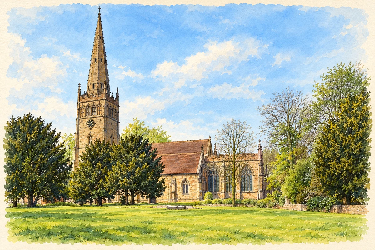
Watercolour and fine ink illustration of St Peter and St Paul’s Church, Coleshill
Illustration · St Peter and St Paul’s Church, Coleshill
History & heritage

Place & story

A centre above the Cole

Coleshill’s early importance came partly from its position above the River Cole. Warwickshire Museum’s historic environment record identifies it as an Anglo-Saxon administrative centre, close to the Mercian centres of Tamworth and Lichfield. Domesday recorded a royal manor here in 1086, at the centre of a large hundred. The town’s role in organising its surrounding country preceded its later coaching trade. [3]

King John granted a market charter in 1207. Trade and hospitality developed in a settlement occupying high ground between the Cole and Blythe. Inns surviving along the High Street and Coventry Road preserve the physical setting of the coaching economy: travellers required beds, food and services as well as a road through the town. [2]

A church of successive generations

The church of St Peter and St Paul contains fourteenth- and fifteenth-century work, with extensive Victorian restoration. Historic England dates the rebuilding of its recessed stone spire to 1888. Its long nave, aisles and chancel show that the prominent landmark was made and remade over generations rather than completed in one campaign. [4]

Inside is an older survivor, a finely carved twelfth-century font. The parish’s heritage account also draws attention to two contrasting priestly brasses: William Abell, who died in 1500, appears in Mass vestments, while the post-Reformation vicar John Fenton carries a Bible. These memorials make religious change visible through objects connected with named local clergy. [5]

The Digby monuments record another enduring relationship. Simon Digby received the lordship of Coleshill in 1495, and his family’s sixteenth- and seventeenth-century memorials occupy the chancel. Their dress, architectural surrounds and surviving traces of paint make family patronage tangible within the parish church. [5]

Roads, railways and expansion

The neighbourhood plan dates the opening of the Coleshill–Lichfield turnpike to 1743 and describes eighteenth-century Coleshill as a Georgian market town and stagecoach stop. In the nineteenth century the railway bypassed the town. Its later transport story took a different form: post-war residential and industrial expansion was followed by Coleshill Parkway station in 2007. [6]

Building for the community

The town hall was completed in November 1925 and officially opened by Edward Iliffe on 17 June 1926. John Sumner was a major contributor, with Alfred Fifield also supporting the building fund. Public rooms were created through a combination of local giving and individual wealth rather than municipal identity alone. [7]

Coleshill also became a centre for Catholic residential care. The Birmingham Diocesan Rescue Society was formed in 1902; its developments included St Edward’s Home in 1906 and St Gerard’s Hospital in 1913. The organisation’s own history records a later shift towards adoption, fostering, family support and community projects. These changes altered the relationship between care and institutional residence. [8]

Back to contents
Lives connected to this place

Notable people

John Sumner: tea wealth and local giving

John Sumner’s family fortune was associated with Typhoo tea, and he helped finance Coleshill Town Hall. In 1930 he established a trust under which ten houses were built for women in reduced circumstances. Sumner Road, beside the hall, preserves the family name within the streetscape of these local benefactions. [7]

George Vincent Hudson: a Coleshill ministry

Father Hudson’s organisation dates his appointment as Coleshill’s priest to 1898 and his retirement to 1935. He became the first secretary of the Rescue Society established in 1902. The diocesan archive identifies Coleshill as the location of the society’s own records, including records concerning adoption and children sent to Canada and Australia: his legacy reaches beyond the buildings of the former homes. [8] [9]

Back to contents
A chronology

Timeline

Coleshill through time

  1. 1086 — Domesday records Coleshill as a royal manor. [3]

  2. 1207 — King John grants the market charter. [2]

  3. 1495 — Simon Digby receives the lordship. [5]

  4. 1743 — The Coleshill–Lichfield turnpike opens. [6]

  5. 1888 — The church spire is rebuilt. [4]

  6. 1902 — The Birmingham Diocesan Rescue Society is formed. [8]

  7. 17 June 1926 — The town hall is officially opened. [7]

  8. 2007 — Coleshill Parkway station opens. [6]

Back to contents

Population over time

Built-up area · Settlement · Census 2021

Coleshill (North Warwickshire)

6,745people · 2021

Census 2021 population of the named settlement, using ONS built-up area boundaries.

Published census counts.

Sources: ONS: Towns and cities, characteristics of built-up areas, Census 2021 (Table 1c)

View population figures
Coleshill (North Warwickshire) — census population
Census yearPopulation
20216,745
Sources and how to read this chart

Usual residents on 21 March 2021; published ONS count rounded to the nearest 5.. Boundary geography: December 2022 (E63002831).

Census 2021 population of the named settlement, using ONS built-up area boundaries.

ONS Table 1c rounds counts to the nearest 5 and suppresses counts below 10. Matched by exact settlement name or individually reviewed district-qualified name, with its coordinate strictly inside that same official BUA boundary. The 2022 BUA geography changed methodology and cannot be directly compared with 2011 BUAs. Contains OS data © Crown copyright and database right 2026. Contains National Statistics data © Crown copyright and database right 2026.

Source: ONS: Towns and cities, characteristics of built-up areas, Census 2021 (Table 1c). Open Government Licence v3.0. Retrieved 2026-10-26. Source: ONS and Ordnance Survey: Built Up Areas December 2022 GB BGG. Open Government Licence v3.0. Retrieved 2026-10-26.

Neighbourhood census context

These figures describe statistical neighbourhoods, which may cover part of a place or include neighbouring places.

Neighbourhood census area · 1971–2021

North Warwickshire 006

Population of the area containing the recorded point for Coleshill, not the whole place. This area may cover part of the place or include neighbours.

05k10k15k20k1971: 9,502 people19711981: 9,843 people19811991: 9,859 people19912001: 9,829 people20012011: 9,927 people20112021: 10,380 people2021

Includes harmonised historical census estimates.

Sources: ONS · Paul Norman

View population figures
North Warwickshire 006 — census population and harmonised historical estimates
Census yearPopulation
19719,502
19819,843
19919,859
20019,829
20119,927
202110,380
Sources and how to read this chart

Usual residents of the containing MSOA; this is local area context, not the population of the named settlement.. Boundary geography: 1 April 2022 (E02006473).

2011 and 2021 census counts harmonised by ONS to the same 1 April 2022 geography. Location matched to ONS 2021 MSOA polygons (full resolution, coastline clipped, V7). ONS exact-fit lookup marks this MSOA unchanged from 2011 (U); historical estimates use that same footprint.

1971–2011: Paul Norman harmonised historical estimates on 2011 MSOAs, rounded to whole residents (1971–1991 are modelled). 2021: ONS census count. The historical 2011 total can differ slightly from the ONS change-over-time 2011 total because of methodology and statistical disclosure controls. These are area estimates, not settlement totals.

Source: ONS Census change over time: usual resident population, 2011 and 2021. Open Government Licence v3.0. Retrieved 2026-10-26. Source: ONS MSOA December 2021 boundaries EW BFC V7. Open Government Licence v3.0. Retrieved 2026-10-26. Source: Paul Norman — Area characteristics: Great Britain 1971 to 2011. Creative Commons Attribution 4.0. Retrieved 2026-10-26. Source: ONS MSOA 2011 to MSOA 2021 exact-fit lookup for England and Wales. Open Government Licence v3.0. Retrieved 2026-10-26.

Recorded locationColeshill52.49734° N · 1.70552° WInteractive map loads when this area enters view.
Approximate recorded location · Geographic source

Geographic context

Place type
Town
Country / region
England · West Midlands
County group
Warwickshire
Current administration
North Warwickshire
Current administration
Warwickshire
Recorded coordinates
52.49734, -1.70552
OS Open Names ID
osgb4000000074577522

County groups are browsing aids. Current administrative and historic areas are recorded separately.

Recorded names

  • Coleshill · en · official

Nearby heritage

Distances are from the recorded place point. Proximity does not establish that a site lies within the place boundary or belongs to its history.

Sources & further reading

  1. OS Open Names October 2026 · Source licence.
  2. Coleshill · Warwickshire County Council
  3. Site of Anglo-Saxon settlement at Coleshill, MWA13140 · Warwickshire Museum
  4. Church of St Peter and St Paul: list entry 1034697 · Historic England
  5. Our History & Heritage · Coleshill Parish Church
  6. Coleshill Neighbourhood Plan, adopted June 2017 · Coleshill Town Council / North Warwickshire Borough Council
  7. Coleshill Town Hall: a brief history · Our Warwickshire
  8. Our History · Father Hudson's Caritas
  9. Collection RS: Rescue Society · Birmingham Archdiocesan Archives
  10. Illustration of St Peter and St Paul’s Church, Coleshill, adapted from Coleshill Church.jpg by Mark Walton. CC BY-SA 2.0. AI-assisted watercolour and fine ink adaptation; cream paper margins, simplified fine detail and removal of incidental street clutter.

Geographic source retrieved 2026-10-26. History last researched 2026-10-26. How this page was prepared.