Town

Henley-in-Arden

A medieval court, a restored guildhall and a public hall turned hospital connect Henley’s trading history with the institutions of everyday life.

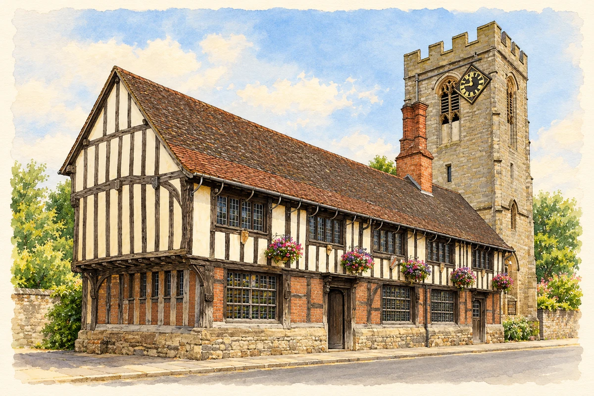
Watercolour and fine ink illustration of The Guild Hall, Henley-in-Arden
Illustration · The Guild Hall, Henley-in-Arden
History & heritage

Place & story

The court and the goods on sale

Henley’s manorial court appears in a document of 1240, when Brice of Henley promised rent and attendance at court three times each year. Detailed records survive from 1546, while the names of High Bailiffs are recorded from 1477. These are separate starting points in the surviving evidence, rather than interchangeable dates for the institution’s foundation. [2]

The court’s authority reached into everyday commerce. It checked measures and the quality of goods, including the strength of ale, as well as dealing with offences under the lord of the manor. Present-day ale tasting, bread and butter weighing and other ceremonies recall those duties. Officers are elected annually by resident jurors at the Guild Hall; these remembered practices should be understood as civic traditions. [2]

Buildings for collective life

The timber-framed Guildhall was built in the fifteenth century for the Guild of the Holy Trinity and St John. Historic England records extensive restoration in 1915 by W. J. Fieldhouse. Its medieval origin and modern repair are equally part of its story: the building through which older customs are represented is itself a product of deliberate preservation. [3]

Henley’s heritage trail places the Guild Hall beside a wider group of public landmarks. The fifteenth-century Market Cross served proclamations and public activities, while St John the Baptist’s Church combines a fifteenth-century building with later additions. Beyond the High Street, the earthworks of Beaudesert Castle remain on the Mount. Keeping the castle’s Beaudesert identity visible helps explain the town’s linked but distinct historic places. [4]

Road, railway and a new hall

The road through Henley formed part of the Birmingham–Stratford turnpike, whose trust first met in 1726. The town’s museum records the removal of Henley’s tollhouse in 1894 to improve access to the new railway station. A railway link from Kingswood opened that June, followed by the North Warwickshire route in July 1908. Successive transport systems changed the approaches to the town. [5]

In April 1908 a company was formed to build a working men’s club. The Oddfellows sold land behind the High Street and the Great Western Railway permitted access from Station Road. Difficult foundations and furnishing costs helped push the price above the original estimate. Opened on New Year’s Eve, the hall supplied space for public entertainment and association. [6]

From recreation to wartime care

During the First World War the public hall became an auxiliary hospital. Its own history records 1,576 patients and a closure in April 1919. Afterwards the reading room, billiards tables, rifle range and stage returned to civilian use. The same building could support leisure in peace and organised medical care in wartime. [6]

After the Second World War the hall passed to a memorial trust, connecting its continued community use with remembrance. The hall’s own history dates this to 1946; the museum gives a town purchase and renaming in 1947. The precise sequence needs further investigation, but both accounts place the change in the immediate post-war years. [6] [5]

Back to contents
Lives connected to this place

Notable people

William James: a local connection to transport

William James was born in Henley in 1771 and became a railway engineer, land agent to the Earl of Warwick and deputy chairman of the Birmingham and Stratford Canal. He also served as Henley’s High Bailiff. The museum connects his work with the Stratford Canal and Moreton tramway, giving him a relationship to both local civic office and the wider transport landscape. [5]

Back to contents
A chronology

Timeline

Henley through time

  1. 1240 — A surviving document refers to the manorial court. [2]

  2. Fifteenth century — The Guildhall is built for a religious fraternity. [3]

  3. 1546 — The surviving detailed court records begin. [2]

  4. 1771 — William James is born in Henley. [5]

  5. 1894 — The Kingswood railway link opens. [5]

  6. 31 December 1908 — The Public Hall opens. [6]

  7. 1915 — The Guildhall undergoes extensive restoration. [3]

  8. April 1919 — The auxiliary hospital closes. [6]

Back to contents

Population over time

Built-up area · Settlement · Census 2021

Henley-in-Arden

3,000people · 2021

Census 2021 population of the named settlement, using ONS built-up area boundaries.

Published census counts.

Sources: ONS: Towns and cities, characteristics of built-up areas, Census 2021 (Table 1c)

View population figures
Henley-in-Arden — census population
Census yearPopulation
20213,000
Sources and how to read this chart

Usual residents on 21 March 2021; published ONS count rounded to the nearest 5.. Boundary geography: December 2022 (E63003284).

Census 2021 population of the named settlement, using ONS built-up area boundaries.

ONS Table 1c rounds counts to the nearest 5 and suppresses counts below 10. Matched by exact settlement name or individually reviewed district-qualified name, with its coordinate strictly inside that same official BUA boundary. The 2022 BUA geography changed methodology and cannot be directly compared with 2011 BUAs. Contains OS data © Crown copyright and database right 2026. Contains National Statistics data © Crown copyright and database right 2026.

Source: ONS: Towns and cities, characteristics of built-up areas, Census 2021 (Table 1c). Open Government Licence v3.0. Retrieved 2026-10-26. Source: ONS and Ordnance Survey: Built Up Areas December 2022 GB BGG. Open Government Licence v3.0. Retrieved 2026-10-26.

Neighbourhood census context

These figures describe statistical neighbourhoods, which may cover part of a place or include neighbouring places.

Neighbourhood census area · 1971–2021

Stratford-on-Avon 002

Population of the area containing the recorded point for Henley-in-Arden, not the whole place. This area may cover part of the place or include neighbours.

01.8k3.5k5.3k7k1971: 5,820 people19711981: 6,358 people19811991: 6,414 people19912001: 6,423 people20012011: 6,672 people20112021: 6,962 people2021

Includes harmonised historical census estimates.

Sources: ONS · Paul Norman

View population figures
Stratford-on-Avon 002 — census population and harmonised historical estimates
Census yearPopulation
19715,820
19816,358
19916,414
20016,423
20116,672
20216,962
Sources and how to read this chart

Usual residents of the containing MSOA; this is local area context, not the population of the named settlement.. Boundary geography: 1 April 2022 (E02006505).

2011 and 2021 census counts harmonised by ONS to the same 1 April 2022 geography. Location matched to ONS 2021 MSOA polygons (full resolution, coastline clipped, V7). ONS exact-fit lookup marks this MSOA unchanged from 2011 (U); historical estimates use that same footprint.

1971–2011: Paul Norman harmonised historical estimates on 2011 MSOAs, rounded to whole residents (1971–1991 are modelled). 2021: ONS census count. The historical 2011 total can differ slightly from the ONS change-over-time 2011 total because of methodology and statistical disclosure controls. These are area estimates, not settlement totals.

Source: ONS Census change over time: usual resident population, 2011 and 2021. Open Government Licence v3.0. Retrieved 2026-10-26. Source: ONS MSOA December 2021 boundaries EW BFC V7. Open Government Licence v3.0. Retrieved 2026-10-26. Source: Paul Norman — Area characteristics: Great Britain 1971 to 2011. Creative Commons Attribution 4.0. Retrieved 2026-10-26. Source: ONS MSOA 2011 to MSOA 2021 exact-fit lookup for England and Wales. Open Government Licence v3.0. Retrieved 2026-10-26.

Recorded locationHenley-in-Arden52.29201° N · 1.78013° WInteractive map loads when this area enters view.
Approximate recorded location · Geographic source

Geographic context

Place type
Town
Country / region
England · West Midlands
County group
Warwickshire
Current administration
Stratford-on-Avon
Current administration
Warwickshire
Recorded coordinates
52.29201, -1.78013
OS Open Names ID
osgb4000000074547405

County groups are browsing aids. Current administrative and historic areas are recorded separately.

Recorded names

  • Henley-in-Arden · en · official

Nearby heritage

Distances are from the recorded place point. Proximity does not establish that a site lies within the place boundary or belongs to its history.

Sources & further reading

  1. OS Open Names October 2026 · Source licence.
  2. Henley-in-Arden Court Leet and Court Baron · Henley-in-Arden Museum and Heritage Centre
  3. The Guildhall, Henley in Arden · Historic England
  4. Henley-in-Arden Heritage Trail · Beaudesert and Henley-in-Arden Joint Parish Council
  5. Weeks in history · Henley-in-Arden Museum and Heritage Centre
  6. Henley Memorial Hall: a brief history · Henley War Memorial Trust
  7. Illustration of The Guild Hall, Henley-in-Arden, adapted from Henley-in-Arden Guild Hall by David Dixon. CC BY-SA 2.0. AI-assisted watercolour and fine ink adaptation; simplified fine detail and removal of incidental clutter.

Geographic source retrieved 2026-10-26. History last researched 2026-10-26. How this page was prepared.