Town

Nuneaton

A medieval religious community helped shape Nuneaton’s streets. Ribbon weaving, mining and manufacturing changed its working life, while parks, collections and George Eliot’s writing preserve different views of the town and its surroundings.

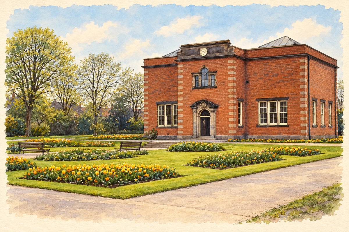
Watercolour and fine ink illustration of Nuneaton Museum and Art Gallery
Illustration · Nuneaton Museum and Art Gallery · circa 1960–61 reference view
History & heritage

Place & story

A religious community makes a town

The priory founded in the mid-twelfth century gave Nuneaton its name and helped organise its growth. The borough’s Abbey conservation appraisal describes a community of nuns and monks led by a prioress, attached to Fontevrault in France. It was an economic institution as well as a religious household, with extensive land supporting its life. [3]

The appraisal connects the priory with the laying out of the market square and regular burgage plots along Abbey Street. A planned street pattern thus linked trading space with the religious precinct. After the Dissolution, the priory buildings became a manor house, before that residence too fell out of use. Successive institutions occupied and reshaped the same ground. [3]

From fields to ribbons

Agriculture remained an important part of Nuneaton’s economy into the seventeenth century. Enclosure of open fields in 1733 and commons in 1801 accompanied a changing balance of work. The town-centre conservation appraisal describes the pressure on people who lost rights in land to find other livelihoods. By the middle of the nineteenth century silk ribbon weaving dominated local employment. [4]

Ribbon weaving had spread from Coventry and developed a substantial skilled workforce. Its dependence on fashion and trade made prosperity insecure: nineteenth-century slumps culminated in severe contraction as cheap foreign imports arrived in the 1860s. The resulting hardship affected Nuneaton alongside Bedworth, Bulkington and Coventry. Industrial growth was neither uninterrupted nor experienced equally by all trades. [4]

Skills and industries change places

Warwickshire’s Working Lives project traces the movement of textile skills into larger factories and into hosiery work in neighbouring Hinckley. During and after the Second World War, engineering companies serving motor and aircraft production relocated from Coventry to the Nuneaton and Bedworth area. Work changed through the movement of businesses as well as through the opening of local enterprises. [5]

The same project records the later disappearance of brickyards and clothing factories and the closure or relocation of engineering firms, while quarrying continued with fewer workers. This is a history of Nuneaton and Bedworth together; the borough-wide account should not be turned into a claim that every named activity occupied Nuneaton’s centre. In Nuneaton itself, decorative terracotta on older buildings still makes manufactured clay part of the streetscape. [5] [2]

Public space from industrial wealth

Edward Ferdinand Melly’s gifts connected the mining economy with recreation. The museum records his involvement in miners’ housing at Bermuda, allotments, playgrounds and sports grounds, as well as the land that became Riversley Park. These provisions addressed life away from the workplace: housing, reading, play and time outdoors belonged to the same programme of improvement. [6]

Riversley Park opened in 1907. The museum’s account describes Melly offering the deeds to fields and money towards landscaping. The Museum and Art Gallery followed, opening in 1917 through his generosity. Collections brought together paintings, ceramics and other objects, while the museum’s present programme includes local history and George Eliot. Civic collecting gave the town another means of interpreting its own changes. [6] [7] [8]

War recorded in photographs

Police photographs now held by Nuneaton Museum document air-raid damage in May 1941 and June 1942. They record damaged houses, bomb craters and the remains of Coton Church, attaching wartime destruction to recognisable streets. The museum’s 2013 account of their acquisition shows why preserving photographs and location information matters: parts of the changed town can be reconstructed from records rather than surviving buildings alone. [9]

George Eliot’s district

Mary Ann Evans, who wrote as George Eliot, was born at South Farm on the Arbury estate on 22 November 1819. She moved as a baby to Griff House and later attended schools at Attleborough and in Nuneaton. These are distinct places within her childhood district, rather than a single town-centre birthplace. [10] [11]

Her fiction transformed familiar surroundings. Warwickshire’s archive guide identifies Nuneaton as Milby in Scenes of Clerical Life and St Nicolas as Milby Church in Janet’s Repentance. Arbury Hall became Cheverel Manor. Those literary settings provide an imaginative record of relationships among town, parish and estate, while later bombing and rebuilding removed parts of the physical world she knew. [10]

Back to contents
Lives connected to this place

Notable people

George Eliot: local experience and fiction

George Eliot’s connection was both biographical and literary: childhood around Arbury, Griff and Nuneaton supplied places she later reworked in fiction. The surviving South Farmhouse bears an inscription recording her birth. Its probably seventeenth-century crosswing and eighteenth-century main range also remind visitors that the writer was born into an already established working rural landscape. [11] [10]

Edward Ferdinand Melly: a colliery manager’s civic work

Melly came to Nuneaton in 1882 to manage Griff Colliery. The museum identifies his gifts to parks and its own foundation, his hospital fundraising and his service as mayor from 1908. His connection with the town joined industrial management to practical civic philanthropy; the museum preserves his photograph receiving the Freedom of the Borough. [12]

Back to contents
A chronology

Timeline

Nuneaton through time

  1. Mid-twelfth century — The Fontevrault community establishes the priory that helps shape the town. [3]

  2. 1733 / 1801 — Open fields and later commons are enclosed. [4]

  3. 22 November 1819 — Mary Ann Evans is born at South Farm, Arbury. [11]

  4. 1860s — Cheap imports bring severe contraction in silk ribbon weaving. [4]

  5. 1882 — Melly comes to manage Griff Colliery. [12]

  6. 1907 — Riversley Park opens. [6]

  7. 1917 — The Museum and Art Gallery opens. [7]

  8. 1941–42 — Police photographs record bomb damage across Nuneaton. [9]

Back to contents

Population over time

Built-up area · Settlement · Census 2021

Nuneaton

88,815people · 2021

Census 2021 population of the named settlement, using ONS built-up area boundaries.

Published census counts.

Sources: ONS: Towns and cities, characteristics of built-up areas, Census 2021 (Table 1c)

View population figures
Nuneaton — census population
Census yearPopulation
202188,815
Sources and how to read this chart

Usual residents on 21 March 2021; published ONS count rounded to the nearest 5.. Boundary geography: December 2022 (E63002833).

Census 2021 population of the named settlement, using ONS built-up area boundaries.

ONS Table 1c rounds counts to the nearest 5 and suppresses counts below 10. Matched by exact settlement name or individually reviewed district-qualified name, with its coordinate strictly inside that same official BUA boundary. The 2022 BUA geography changed methodology and cannot be directly compared with 2011 BUAs. Contains OS data © Crown copyright and database right 2026. Contains National Statistics data © Crown copyright and database right 2026.

Source: ONS: Towns and cities, characteristics of built-up areas, Census 2021 (Table 1c). Open Government Licence v3.0. Retrieved 2026-10-26. Source: ONS and Ordnance Survey: Built Up Areas December 2022 GB BGG. Open Government Licence v3.0. Retrieved 2026-10-26.

Neighbourhood census context

These figures describe statistical neighbourhoods, which may cover part of a place or include neighbouring places.

Neighbourhood census area · 1971–2021

Nuneaton and Bedworth 005

Population of the area containing the recorded point for Nuneaton, not the whole place. This area may cover part of the place or include neighbours.

02.5k5k7.5k10k1971: 8,553 people19711981: 7,934 people19811991: 7,422 people19912001: 7,274 people20012011: 8,772 people20112021: 9,145 people2021

Includes harmonised historical census estimates.

Sources: ONS · Paul Norman

View population figures
Nuneaton and Bedworth 005 — census population and harmonised historical estimates
Census yearPopulation
19718,553
19817,934
19917,422
20017,274
20118,772
20219,145
Sources and how to read this chart

Usual residents of the containing MSOA; this is local area context, not the population of the named settlement.. Boundary geography: 1 April 2022 (E02006479).

2011 and 2021 census counts harmonised by ONS to the same 1 April 2022 geography. Location matched to ONS 2021 MSOA polygons (full resolution, coastline clipped, V7). ONS exact-fit lookup marks this MSOA unchanged from 2011 (U); historical estimates use that same footprint.

1971–2011: Paul Norman harmonised historical estimates on 2011 MSOAs, rounded to whole residents (1971–1991 are modelled). 2021: ONS census count. The historical 2011 total can differ slightly from the ONS change-over-time 2011 total because of methodology and statistical disclosure controls. These are area estimates, not settlement totals.

Source: ONS Census change over time: usual resident population, 2011 and 2021. Open Government Licence v3.0. Retrieved 2026-10-26. Source: ONS MSOA December 2021 boundaries EW BFC V7. Open Government Licence v3.0. Retrieved 2026-10-26. Source: Paul Norman — Area characteristics: Great Britain 1971 to 2011. Creative Commons Attribution 4.0. Retrieved 2026-10-26. Source: ONS MSOA 2011 to MSOA 2021 exact-fit lookup for England and Wales. Open Government Licence v3.0. Retrieved 2026-10-26.

Recorded locationNuneaton52.52214° N · 1.46773° WInteractive map loads when this area enters view.
Approximate recorded location · Geographic source

Geographic context

Place type
Town
Country / region
England · West Midlands
County group
Warwickshire
Current administration
Nuneaton and Bedworth
Current administration
Warwickshire
Recorded coordinates
52.52214, -1.46773
OS Open Names ID
osgb4000000074568651

County groups are browsing aids. Current administrative and historic areas are recorded separately.

Recorded names

  • Nuneaton · en · official

Nearby heritage

Distances are from the recorded place point. Proximity does not establish that a site lies within the place boundary or belongs to its history.

Sources & further reading

  1. OS Open Names October 2026 · Source licence.
  2. Nuneaton · Warwickshire County Council
  3. Abbey Conservation Area Appraisal and Management Plan, Historic Development · Nuneaton and Bedworth Borough Council
  4. Nuneaton Town Centre Conservation Area Appraisal and Management Plan, historical development · Nuneaton and Bedworth Borough Council
  5. Working Lives · Warwickshire County Council
  6. Edward Ferdinand Melly and the Parks of the Borough · Nuneaton Museum & Art Gallery
  7. Nuneaton Museum and Art Gallery: venue collection statement · Nuneaton Museum and Art Gallery / Art UK
  8. Nuneaton Museum & Art Gallery · Nuneaton and Bedworth Borough Council
  9. Collections News: New Donations · Nuneaton Museum & Art Gallery
  10. George Eliot links to Nuneaton and Warwickshire · Warwickshire County Council
  11. South Farmhouse, list entry 1034972 · Historic England
  12. Unknown Heroes of the Borough · Nuneaton Museum & Art Gallery
  13. Illustration of Nuneaton Museum and Art Gallery, adapted from Nuneaton Museum and Art Gallery by Martin Haddock. CC BY-SA 2.0. AI-assisted watercolour and fine ink adaptation; simplified fine detail and removal of incidental clutter.

Geographic source retrieved 2026-10-26. History last researched 2026-10-27. How this page was prepared.