Village

Polesworth

Beside the Anker, an abbey’s market rights, a charitable school and a former colliery reveal different ways that institutions shaped village life.

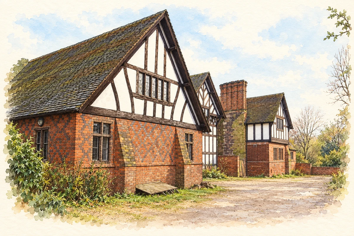
Watercolour and fine ink illustration of Polesworth Vicarage
Illustration · Polesworth Vicarage
History & heritage

Place & story

An abbey beside the Anker

Polesworth grew around a religious house beside the River Anker. Its beginnings are less secure than some neat foundation stories suggest: the county Historic Environment Record lists traditions placing the nunnery’s foundation at different dates. The documented medieval community was governed by an abbess, whose authority extended into the village’s trading life. [2]

On 14 April 1242 Henry III granted Abbess Margery and the nuns a Thursday market and a fair around St Margaret’s feast. These rights brought organised exchange into the orbit of the abbey. Its closure in 1539 changed ownership, but the church and gatehouse survived while the former abbess’s lodgings became the site of a manor house. [2]

A household of literary patrons

After the Dissolution, Polesworth Hall became associated with the Goodere family’s patronage. Michael Drayton served the family around 1580, and Polesworth and the Anker entered his writing. The literary connection was rooted in a particular household: the village offered a place of service and patronage from which a poet could address a wider world. [3]

Schooling with rules attached

Education acquired another institutional centre through Sir Francis Nethersole’s seventeenth-century free school. An eighteenth-century copy of its orders, held by Warwickshire County Record Office, specified places for 12 boys and 12 girls from Polesworth Trent, with more from neighbouring communities. Its reach therefore extended beyond the village. [4]

The rules also expose the limits and expectations of charity. Boys could learn reading, writing and accounts; girls learned English and needlework. Both received Christian instruction and attended church with the schoolmaster. The red-brick building of 1818 replaced the original school, leaving a later architectural marker of a much older educational undertaking. [4]

Mining changes the waterside

The Coventry Canal brought a different working landscape alongside the older village. At Pooley, colliery workings connected underground with those at Alvecote and Amington in 1951, forming North Warwickshire Colliery. Pithead baths had opened in 1928. These are reminders that mining history includes changing facilities for workers as well as machinery and output. [5]

Pooley Country Park now occupies 62.5 hectares beside the canal. Pools formed by mining subsidence and woodland habitats are part of the site, a third of which is designated a Site of Special Scientific Interest. Former miners donated memorabilia to its visitor centre. Industrial traces survive both in the altered ground and in objects kept by the people who worked there. [5]

Back to contents
Lives connected to this place

Notable people

Francis Nethersole: a local benefactor

Nethersole’s connection came through marriage to Lucy, daughter of Sir Henry Goodyer of Polesworth, by 1620. He later spent much of his time in the village and founded its free school. His importance here lies in that enduring educational provision, rather than simply in his earlier parliamentary career elsewhere. [4]

Michael Drayton: service and poetry

Drayton’s local tie was service to the Goodere household, rather than birth in Polesworth. The family’s support and his writing about the Anker connect literary achievement to the village’s post-monastic history. [3]

Back to contents
A chronology

Timeline

Polesworth through time

  1. 1242 — Henry III grants market and fair rights to the abbess and nuns. [2]

  2. 1539 — The nunnery is dissolved. [2]

  3. Around 1580 — Michael Drayton serves the Goodere family. [3]

  4. 1818 — The Nethersole school is rebuilt in red brick. [4]

  5. 1928 — Pithead baths open at Pooley. [5]

  6. 1951 — Linked workings form North Warwickshire Colliery. [5]

Back to contents

Population over time

A verified population series for Polesworth as a settlement has not yet been added. Neighbourhood census figures are available below.

Neighbourhood census context

These figures describe statistical neighbourhoods, which may cover part of a place or include neighbouring places.

Neighbourhood census area · 1971–2021

North Warwickshire 001

Population of the area containing the recorded point for Polesworth, not the whole place. This area may cover part of the place or include neighbours.

05k10k15k20k1971: 9,136 people19711981: 10,042 people19811991: 10,068 people19912001: 10,570 people20012011: 10,479 people20112021: 10,956 people2021

Includes harmonised historical census estimates.

Sources: ONS · Paul Norman

View population figures
North Warwickshire 001 — census population and harmonised historical estimates
Census yearPopulation
19719,136
198110,042
199110,068
200110,570
201110,479
202110,956
Sources and how to read this chart

Usual residents of the containing MSOA; this is local area context, not the population of the named settlement.. Boundary geography: 1 April 2022 (E02006468).

2011 and 2021 census counts harmonised by ONS to the same 1 April 2022 geography. Location matched to ONS 2021 MSOA polygons (full resolution, coastline clipped, V7). ONS exact-fit lookup marks this MSOA unchanged from 2011 (U); historical estimates use that same footprint.

1971–2011: Paul Norman harmonised historical estimates on 2011 MSOAs, rounded to whole residents (1971–1991 are modelled). 2021: ONS census count. The historical 2011 total can differ slightly from the ONS change-over-time 2011 total because of methodology and statistical disclosure controls. These are area estimates, not settlement totals.

Source: ONS Census change over time: usual resident population, 2011 and 2021. Open Government Licence v3.0. Retrieved 2026-10-26. Source: ONS MSOA December 2021 boundaries EW BFC V7. Open Government Licence v3.0. Retrieved 2026-10-26. Source: Paul Norman — Area characteristics: Great Britain 1971 to 2011. Creative Commons Attribution 4.0. Retrieved 2026-10-26. Source: ONS MSOA 2011 to MSOA 2021 exact-fit lookup for England and Wales. Open Government Licence v3.0. Retrieved 2026-10-26.

Recorded locationPolesworth52.61740° N · 1.61646° WInteractive map loads when this area enters view.
Approximate recorded location · Geographic source

Geographic context

Place type
Village
Country / region
England · West Midlands
County group
Warwickshire
Current administration
North Warwickshire
Current administration
Warwickshire
Recorded coordinates
52.61740, -1.61646
OS Open Names ID
osgb4000000074550481

County groups are browsing aids. Current administrative and historic areas are recorded separately.

Recorded names

  • Polesworth · en · official

Nearby heritage

Distances are from the recorded place point. Proximity does not establish that a site lies within the place boundary or belongs to its history.

Sources & further reading

  1. OS Open Names October 2026 · Source licence.
  2. Polesworth Abbey · Warwickshire Historic Environment Record / Our Warwickshire
  3. Polesworth · Warwickshire County Council / Visit Warwickshire
  4. Nethersole’s School for the Poor in Polesworth · Warwickshire County Record Office / Our Warwickshire
  5. Pooley Country Park · Warwickshire County Council
  6. Illustration of Polesworth Vicarage, adapted from Polesworth Vicarage.jpg by David Rogers. CC BY-SA 2.0. AI-assisted watercolour and fine ink adaptation; cream paper margins, simplified fine detail and removal of incidental street clutter.

Geographic source retrieved 2026-10-26. History last researched 2026-10-27. How this page was prepared.