Town

Royal Leamington Spa

Mineral water drew visitors to Leamington. Public gardens, bathing facilities and canalside manufacturing reveal how the resort became a town with varied work and shared institutions.

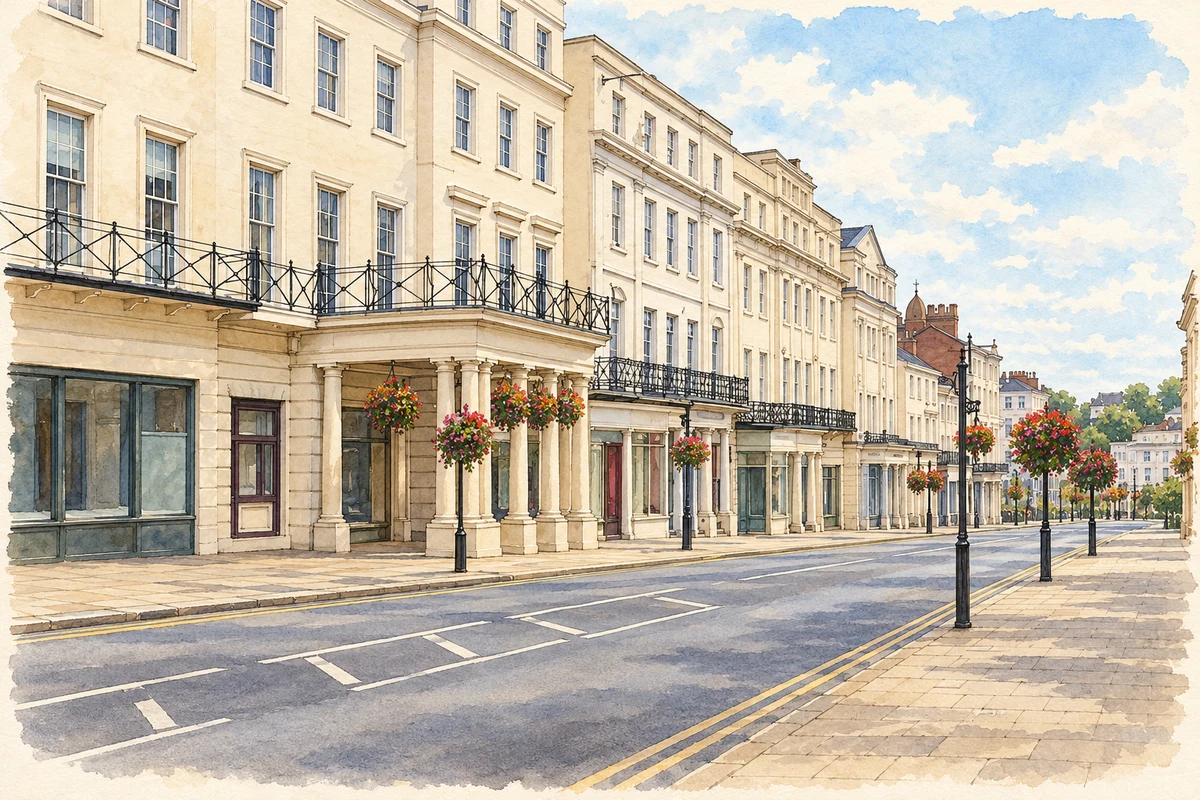
Watercolour and fine ink illustration of The Parade, Royal Leamington Spa
Illustration · The Parade, Royal Leamington Spa
History & heritage

Place & story

The making of a resort

The Royal Pump Rooms opened in June 1814, the fifth of six Leamington bath houses and the only one north of the River Leam. Building had begun in 1812 on land owned by Bertie Greatheed, whose family wealth came from a St Kitts sugar plantation worked by enslaved people. Investment in a fashionable English resort was connected with wealth made far beyond Warwickshire. [2]

Bathing was only part of the attraction. Doctors prescribed saline water, plain food, exercise and a stay lasting several weeks; the assembly room provided music and balls. These historical treatments offer no proof that the water cured disease. [2]

Gardens for a spa town

Around 1831 a meadow beside the Leam was enclosed and laid out as Newbold Gardens, a commercial pleasure ground designed by J. G. Jackson with planting by John Cullis. Subscriptions in 1846 transferred the lease to trustees, and the improved grounds opened publicly in 1847 as Jephson Gardens. The landscape changed with the organisation paying for it. [3]

Paths, the lake and ornamental planting made a setting for the resort’s outdoor life. Memorials later commemorated people involved in its development, including Edward Willes, Dr Hitchman and Dr Jephson. The garden thus became both a place of recreation and a record of who the town chose to honour. [3]

Industry along the canal

South of the resort’s better-known streets, the canal supported a different mixture of work and housing. The council’s conservation study describes seasonal lodgings alongside workers’ houses around Eagle Street, associated with Flavel’s. Ranelagh Gardens combined pleasure grounds, botanical collections and nursery activity before foundry use expanded on the waterside. The industrial town and the resort developed beside one another. [4]

Sidney Flavel expanded into the canalside foundry in April 1856. A contemporary illustration shows cranes, the kitchener works and boats bringing materials. By the mid-1930s the firm employed nearly a thousand people. Manufacturing cooking equipment made Leamington a place of production as well as consumption, with the canal carrying supplies for a large local employer. [4]

From private baths to public culture

Local businessmen rescued the Pump Rooms in 1861; the corporation acquired them in 1875. NHS treatments became available in 1948. After swimming and treatment departments closed in 1989–90, restoration in 1997–99 created a cultural centre with the art gallery, museum and library. A commercial bathing establishment became successive forms of public service. [2]

Back to contents
Lives connected to this place

Notable people

Henry Jephson: a doctor remembered in the landscape

Henry Jephson established his practice in Leamington in 1828. He promoted taking the waters alongside moderate diet and exercise, attracting visitors to the town. The gardens were named for him and a statue placed in a domed memorial pavilion in 1848–49. His local influence can be read in both medical practice and the commemorative landscape. [3]

Gem and Perera: a local lawn-tennis partnership

Harry Gem and Augurio Perera moved to Leamington in 1872 after experimenting with an outdoor racket game in Birmingham. In Leamington they played on the Manor House lawns with local hospital doctors Frederick Haynes and Arthur Wellesley Tomkins. Printed tournament rules survive from 1874. Their connection is to a particular local club and playing ground within a wider, disputed history of lawn tennis’s origins. [5]

Back to contents
A chronology

Timeline

Leamington through time

  1. 1814 — The Royal Pump Rooms open north of the Leam. [2]

  2. 1847 — The improved Jephson Gardens open to the public. [3]

  3. 1856 — Sidney Flavel expands into the canalside foundry. [4]

  4. 1872 — Gem and Perera move to Leamington and develop local lawn-tennis play. [5]

  5. 1948 — NHS treatment becomes available at the Pump Rooms. [2]

  6. 1997–99 — Restoration converts the Pump Rooms into a cultural centre. [2]

Back to contents

Population over time

Built-up area · Settlement · Census 2021

Royal Leamington Spa

51,310people · 2021

Census 2021 population of the named settlement, using ONS built-up area boundaries.

Published census counts.

Sources: ONS: Towns and cities, characteristics of built-up areas, Census 2021 (Table 1c)

View population figures
Royal Leamington Spa — census population
Census yearPopulation
202151,310
Sources and how to read this chart

Usual residents on 21 March 2021; published ONS count rounded to the nearest 5.. Boundary geography: December 2022 (E63003278).

Census 2021 population of the named settlement, using ONS built-up area boundaries.

ONS Table 1c rounds counts to the nearest 5 and suppresses counts below 10. Matched by exact settlement name or individually reviewed district-qualified name, with its coordinate strictly inside that same official BUA boundary. The 2022 BUA geography changed methodology and cannot be directly compared with 2011 BUAs. Contains OS data © Crown copyright and database right 2026. Contains National Statistics data © Crown copyright and database right 2026.

Source: ONS: Towns and cities, characteristics of built-up areas, Census 2021 (Table 1c). Open Government Licence v3.0. Retrieved 2026-10-26. Source: ONS and Ordnance Survey: Built Up Areas December 2022 GB BGG. Open Government Licence v3.0. Retrieved 2026-10-26.

Neighbourhood census context

These figures describe statistical neighbourhoods, which may cover part of a place or include neighbouring places.

Neighbourhood census area · 1971–2021

Warwick 007

Population of the area containing the recorded point for Royal Leamington Spa, not the whole place. This area may cover part of the place or include neighbours.

05k10k15k20k1971: 11,620 people19711981: 11,657 people19811991: 11,011 people19912001: 11,467 people20012011: 12,872 people20112021: 13,033 people2021

Includes harmonised historical census estimates.

Sources: ONS · Paul Norman

View population figures
Warwick 007 — census population and harmonised historical estimates
Census yearPopulation
197111,620
198111,657
199111,011
200111,467
201112,872
202113,033
Sources and how to read this chart

Usual residents of the containing MSOA; this is local area context, not the population of the named settlement.. Boundary geography: 1 April 2022 (E02006525).

2011 and 2021 census counts harmonised by ONS to the same 1 April 2022 geography. Location matched to ONS 2021 MSOA polygons (full resolution, coastline clipped, V7). ONS exact-fit lookup marks this MSOA unchanged from 2011 (U); historical estimates use that same footprint.

1971–2011: Paul Norman harmonised historical estimates on 2011 MSOAs, rounded to whole residents (1971–1991 are modelled). 2021: ONS census count. The historical 2011 total can differ slightly from the ONS change-over-time 2011 total because of methodology and statistical disclosure controls. These are area estimates, not settlement totals.

Source: ONS Census change over time: usual resident population, 2011 and 2021. Open Government Licence v3.0. Retrieved 2026-10-26. Source: ONS MSOA December 2021 boundaries EW BFC V7. Open Government Licence v3.0. Retrieved 2026-10-26. Source: Paul Norman — Area characteristics: Great Britain 1971 to 2011. Creative Commons Attribution 4.0. Retrieved 2026-10-26. Source: ONS MSOA 2011 to MSOA 2021 exact-fit lookup for England and Wales. Open Government Licence v3.0. Retrieved 2026-10-26.

Recorded locationRoyal Leamington Spa52.29196° N · 1.53581° WInteractive map loads when this area enters view.
Approximate recorded location · Geographic source

Geographic context

Place type
Town
Country / region
England · West Midlands
County group
Warwickshire
Current administration
Warwick
Current administration
Warwickshire
Recorded coordinates
52.29196, -1.53581
OS Open Names ID
osgb4000000074554428

County groups are browsing aids. Current administrative and historic areas are recorded separately.

Recorded names

  • Royal Leamington Spa · en · official

Nearby heritage

Distances are from the recorded place point. Proximity does not establish that a site lies within the place boundary or belongs to its history.

Sources & further reading

  1. OS Open Names October 2026 · Source licence.
  2. History of the Royal Pump Rooms · Warwick District Council
  3. Spa Gardens, Royal Leamington Spa, register1000498 · Historic England
  4. Canal Conservation Area: Old Town Leamington · Warwick District Council
  5. Leamington’s Role in the Origins of Lawn Tennis · Our Warwickshire / Warwickshire heritage services
  6. Illustration of The Parade, Royal Leamington Spa, adapted from The Parade, Leamington Spa (2).jpg by Vauxford. CC BY-SA 4.0. AI-assisted watercolour and fine ink adaptation; cream paper margins, simplified fine detail and removal of incidental street clutter.

Geographic source retrieved 2026-10-26. History last researched 2026-10-27. How this page was prepared.