Town

Shipston-on-Stour

A marketplace, textile work and transport links shaped Shipston’s trading life. Parish minutes and an adapted Quaker meeting house reveal how its people also organised care, learning and public services.

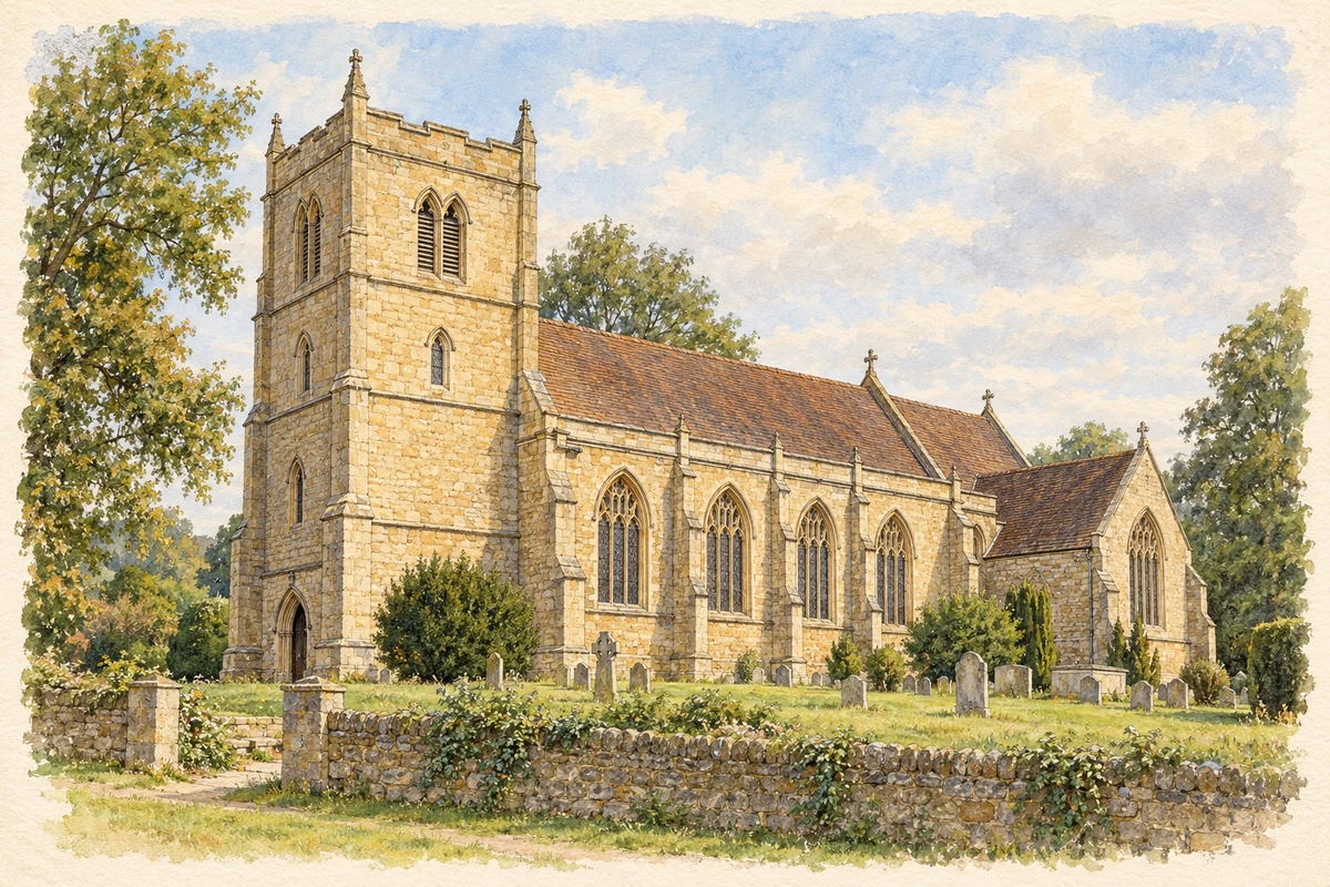
Watercolour and fine ink illustration of St Edmund’s Church, Shipston-on-Stour
Illustration · St Edmund’s Church, Shipston-on-Stour
Original illustration; researched sources
Research sources

Original architectural composition based on the cited building descriptions; incidental setting and fine details are interpretive.

Historic England: St Edmund, Shipston; Warwickshire Museum TimeTrail: St Edmund

History & heritage

Place & story

A market beside the Stour

Shipston’s medieval identity was closely tied to Worcester. Domesday recorded it under Worcestershire as a possession of the church of Worcester; its present Warwickshire location should not be projected backwards onto medieval records. The county’s archaeological record documents a Saturday market granted by Henry III in June 1268, with later royal confirmations. [3]

The medieval street pattern still frames the town centre, but fires and rebuilding gave much of the High Street a Georgian appearance. Former coaching inns record the importance of through traffic between Oxford and Birmingham. Courtyards, passages and the marketplace belong to a settlement organised around exchange as well as residence. [4]

Textiles and the limits of prosperity

An eighteenth-century description by the engraver Thomas Sanders remembered John Hart’s substantial manufacture of shag cloth, but stated that the trade had disappeared after Hart’s death. It also described numerous poor residents, thatched houses and a heavy poor-rate burden. This is a contemporary observer’s account of uneven prosperity, rather than evidence that every household shared equally in the town’s trading success. [5]

Hart’s memorial in St Edmund’s provides another kind of evidence. Its inscription celebrates him as an improver of manufacture in his native town, records his service as High Sheriff of Worcestershire in 1739, and dates his death to 1747. Public commemoration preserved a favourable industrial reputation where Sanders stressed the loss of the trade. [6] [5]

The parish confronts smallpox

On 26 April 1772 Shipston’s vestry agreed to fund inoculation for willing poor parishioners. Subscriptions were to pay, with any shortfall met from the poor levy. The apothecaries were to receive a list of 157 people and six shillings per head. The surviving minute links a medical intervention to local taxation and organised charitable giving. [2]

This was inoculation against smallpox, preceding Jenner’s later vaccination method. The record office’s interpretation places the decision alongside fear of epidemics and the cost of supporting people disabled by disease. The agreement establishes what the vestry authorised; it does not by itself prove that every person listed received the procedure. [2]

Worship, learning and a library

St Edmund’s combines a fifteenth-century west tower with a church rebuilt by G. E. Street in 1855 in a fourteenth-century style. Its medieval appearance therefore includes Victorian design. The building’s monuments and later fabric make parish history legible through commemoration and reconstruction together. [6]

In Church Street, Friends leased cottages for worship in 1685 and replaced them with a purpose-built meeting house in 1690–92. An upper room for an Adult School followed in 1887–88, requiring changes to the roof and internal arrangement. In the 1920s the premises also accommodated vocational training for young men. [7]

The Quaker meeting ceased in 1956. After extension work, the building was leased to Warwickshire County Council for library use in 1995–96. Its successive uses connect a minority religious community’s investment in education with a later public service, while retaining a recognisable historic building in the town centre. [7]

A branch line and its evidence

Shipston’s horse tramway branch opened in 1836, connecting it with the Stratford–Moreton route. The southern section became a conventional steam railway in 1889, but passenger services ended in 1929. Goods traffic continued thereafter. This changing railway served a rural market town without turning it into a main-line junction. [8]

The town council’s account of Shipston Museum describes a substantial photographic record of the tramway and railway, alongside posters, catalogues and local inventions. Such material connects transport history with the Railway Crescent and Tilemans Lane area and helps recover workplaces that later development has obscured. [9]

Back to contents
Lives connected to this place

Notable people

John Hart: manufacture and memory

John Hart was a Shipston native associated with the town’s shag-cloth industry. His nephew commissioned the memorial in St Edmund’s after his death in 1747. Hart’s significance is local and specific: a manufacturer remembered both for promoting work and for holding county office, rather than a name added simply because he owned property nearby. [6] [5]

Back to contents
A chronology

Timeline

Shipston through time

  1. 1268 — Henry III grants a Saturday market. [3]

  2. 1739 — John Hart serves as High Sheriff of Worcestershire. [6]

  3. 26 April 1772 — The vestry authorises funded smallpox inoculation for willing poor parishioners. [2]

  4. 1836 — A horse tramway branch reaches Shipston. [8]

  5. 1855 — G. E. Street rebuilds St Edmund’s, retaining its medieval tower. [6]

  6. 1889 — The southern tramway becomes a steam railway. [8]

  7. 1929 — Branch passenger services end. [8]

  8. 1995–96 — The former Friends’ meeting house becomes a public library. [7]

Back to contents

Population over time

Built-up area · Settlement · Census 2021

Shipston-on-Stour

5,850people · 2021

Census 2021 population of the named settlement, using ONS built-up area boundaries.

Published census counts.

Sources: ONS: Towns and cities, characteristics of built-up areas, Census 2021 (Table 1c)

View population figures
Shipston-on-Stour — census population
Census yearPopulation
20215,850
Sources and how to read this chart

Usual residents on 21 March 2021; published ONS count rounded to the nearest 5.. Boundary geography: December 2022 (E63003822).

Census 2021 population of the named settlement, using ONS built-up area boundaries.

ONS Table 1c rounds counts to the nearest 5 and suppresses counts below 10. Matched by exact settlement name or individually reviewed district-qualified name, with its coordinate strictly inside that same official BUA boundary. The 2022 BUA geography changed methodology and cannot be directly compared with 2011 BUAs. Contains OS data © Crown copyright and database right 2026. Contains National Statistics data © Crown copyright and database right 2026.

Source: ONS: Towns and cities, characteristics of built-up areas, Census 2021 (Table 1c). Open Government Licence v3.0. Retrieved 2026-10-26. Source: ONS and Ordnance Survey: Built Up Areas December 2022 GB BGG. Open Government Licence v3.0. Retrieved 2026-10-26.

Neighbourhood census context

These figures describe statistical neighbourhoods, which may cover part of a place or include neighbouring places.

Neighbourhood census area · 1971–2021

Stratford-on-Avon 015

Population of the area containing the recorded point for Shipston-on-Stour, not the whole place. This area may cover part of the place or include neighbours.

05k10k15k20k1971: 6,518 people19711981: 6,983 people19811991: 7,770 people19912001: 8,543 people20012011: 9,328 people20112021: 10,194 people2021

Includes harmonised historical census estimates.

Sources: ONS · Paul Norman

View population figures
Stratford-on-Avon 015 — census population and harmonised historical estimates
Census yearPopulation
19716,518
19816,983
19917,770
20018,543
20119,328
202110,194
Sources and how to read this chart

Usual residents of the containing MSOA; this is local area context, not the population of the named settlement.. Boundary geography: 1 April 2022 (E02006518).

2011 and 2021 census counts harmonised by ONS to the same 1 April 2022 geography. Location matched to ONS 2021 MSOA polygons (full resolution, coastline clipped, V7). ONS exact-fit lookup marks this MSOA unchanged from 2011 (U); historical estimates use that same footprint.

1971–2011: Paul Norman harmonised historical estimates on 2011 MSOAs, rounded to whole residents (1971–1991 are modelled). 2021: ONS census count. The historical 2011 total can differ slightly from the ONS change-over-time 2011 total because of methodology and statistical disclosure controls. These are area estimates, not settlement totals.

Source: ONS Census change over time: usual resident population, 2011 and 2021. Open Government Licence v3.0. Retrieved 2026-10-26. Source: ONS MSOA December 2021 boundaries EW BFC V7. Open Government Licence v3.0. Retrieved 2026-10-26. Source: Paul Norman — Area characteristics: Great Britain 1971 to 2011. Creative Commons Attribution 4.0. Retrieved 2026-10-26. Source: ONS MSOA 2011 to MSOA 2021 exact-fit lookup for England and Wales. Open Government Licence v3.0. Retrieved 2026-10-26.

Recorded locationShipston-on-Stour52.06260° N · 1.62438° WInteractive map loads when this area enters view.
Approximate recorded location · Geographic source

Geographic context

Place type
Town
Country / region
England · West Midlands
County group
Warwickshire
Current administration
Stratford-on-Avon
Current administration
Warwickshire
Recorded coordinates
52.06260, -1.62438
OS Open Names ID
osgb4000000074564678

County groups are browsing aids. Current administrative and historic areas are recorded separately.

Recorded names

  • Shipston-on-Stour · en · official

Nearby heritage

Distances are from the recorded place point. Proximity does not establish that a site lies within the place boundary or belongs to its history.

Sources & further reading

  1. OS Open Names October 2026 · Source licence.
  2. Inoculating the Poor in Shipston-on-Stour, DR446/50 · Warwickshire County Record Office / Our Warwickshire
  3. Medieval settlement at Shipston on Stour, MWA6460 · Warwickshire County Council / Warwickshire Museum
  4. Shipston-on-Stour · Warwickshire County Council / Visit Warwickshire
  5. A View of Shipston Upon Stower · Thomas Sanders / Birmingham Central Library / Revolutionary Players
  6. Church of St Edmund, 1024091 · Historic England
  7. Friends’ Meeting House, MWA2110 · Warwickshire County Council / Warwickshire Museum
  8. The Shipston-on-Stour Branch by Stanley C Jenkins and Roger Carpenter · Warwickshire Railways
  9. Introducing the Shipston Museum · Shipston Town Council
  10. Original illustration of St Edmund’s Church, Shipston-on-Stour by PlaceHistory. Researched sources are linked beneath the illustration. Original composition from inspected architectural facts; no source photograph copied or used as an image-edit input. Fine detail is interpretive, not a measured survey.

Geographic source retrieved 2026-10-26. History last researched 2026-10-27. How this page was prepared.