Town

Southam

Southam’s market roads brought people together, while its well, allotments and medical institutions reveal practical concerns about water, food and health. Local collections and embroidery keep those histories visible.

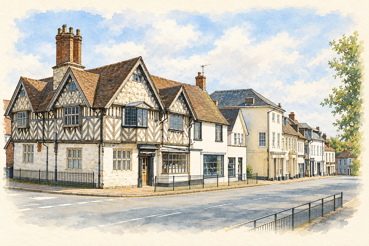
Watercolour and fine ink illustration of Market Hill, Southam
Illustration · Market Hill, Southam
History & heritage

Place & story

A market at the meeting of roads

Henry III granted Coventry’s prior and monks a Wednesday market at Southam in February 1227. The trading day later moved to Monday and continued into the early twentieth century. A fair charter followed in 1256. These rights placed organised exchange at the centre of the settlement’s relationship with its surrounding farms. [2]

The Historic Environment Record describes dense occupation at the centre and along Coventry Street, with back lanes enclosing gardens, small fields and orchards. Several roads met here, including the Welsh Road used by livestock drovers. Surviving ridge and furrow around the settlement connects its commercial streets with cultivated land. [2]

The well as a shared resource

The Holy Well stands west of the church, near the River Stowe. Its medieval history should be distinguished from the surviving stone enclosure, which the county record considers probably late eighteenth- or nineteenth-century. The record documents a decision in 1761 to fence the well while securing access for Southam’s inhabitants. [3]

The water passed through carved stone heads towards the river and was traditionally used for eye complaints. Such beliefs do not establish medical efficacy, but they help explain the well’s place in local life. It supplied water and carried a reputation for healing, making access a matter of communal concern. [3]

A later account by Southam Heritage Collection describes the well’s declining flow after water was diverted to a reservoir in 1925. Repairs did not immediately solve the problem: it was sometimes dry. Work in 2005–07 restored the site with seating and a carved palisade fence designed by Will Glanfield. [4]

Providing care in a country town

In 1818 Henry Lilley Smith established an infirmary for diseases of the eye and ear at Southam, offering his professional services without charge. In 1823 he opened a provident dispensary for local working people and their families. The institutions addressed the difficulty of paying for medical treatment within a small-town economy. [5]

The Southam Heritage Collection’s account stresses professional opposition to Smith’s schemes and their principle of self-sufficiency. The dispensary belongs to a history of attempts to organise affordable care before a national health service. Its intended beneficiaries were working households seeking care through an institution based in their own town. [5]

Land for growing and learning

Southam Produce Association preserves a history of charitable land and allotment administration. Surviving documents include a vellum lease of 1690 and a terrier identifying strips, tenants and boundaries in the common fields. These records show land supporting local institutions and poor relief through rents as well as cultivation. [6]

In the 1830s Smith provided boys with twelve garden plots. They were expected to grow flowers and at least six kinds of vegetables, and could borrow books from a library. The scheme connected gardening with learning and household provision; it expanded but ended after about a decade. [6]

Management also changed. Southam Produce Association took over the day-to-day running of the allotments in 1967. A 1974 agreement made it trustee, and in 1990 it arranged to lease directly from Southam United Charities. The continuing land use depended on changing arrangements between charity, council and growers. [6]

Stitching a public history

In 2001 twelve women began a series of embroidered panels for the Grange Hall. Three and a half years later they had completed six large works depicting subjects including the market, the Holy Well, medical care, the Civil War and the final drovers’ journey. Needlework turned historical research into a shared public display. [7]

Back to contents
Lives connected to this place

Notable people

Henry Lilley Smith: medicine rooted in Southam

Henry Lilley Smith, born in Southam in 1788, trained through apprenticeship and at Guy’s Hospital before qualifying in 1810. He returned to spend his professional career in his home town. His local connection encompasses daily medical practice, the infirmary and dispensary, rather than a single commemorative visit. [5]

Back to contents
A chronology

Timeline

Southam through time

  1. 1227 — A Wednesday market charter is granted to Coventry’s prior and monks. [2]

  2. 1690 — A surviving lease records charitable land in the parish’s common fields. [6]

  3. 1761 — A decision protects access to the Holy Well for local inhabitants. [3]

  4. 1818 — Henry Lilley Smith establishes an eye and ear infirmary. [5]

  5. 1823 — Smith opens a provident dispensary. [5]

  6. 1967 — Southam Produce Association takes over daily management of the allotments. [6]

  7. 2001 — Work begins on six embroidered history panels for the Grange Hall. [7]

  8. 2005–07 — The Holy Well site is restored with seating and carved fencing. [4]

Back to contents

Population over time

Built-up area · Settlement · Census 2021

Southam (Stratford-on-Avon)

8,110people · 2021

Census 2021 population of the named settlement, using ONS built-up area boundaries.

Published census counts.

Sources: ONS: Towns and cities, characteristics of built-up areas, Census 2021 (Table 1c)

View population figures
Southam (Stratford-on-Avon) — census population
Census yearPopulation
20218,110
Sources and how to read this chart

Usual residents on 21 March 2021; published ONS count rounded to the nearest 5.. Boundary geography: December 2022 (E63003369).

Census 2021 population of the named settlement, using ONS built-up area boundaries.

ONS Table 1c rounds counts to the nearest 5 and suppresses counts below 10. Matched by exact settlement name or individually reviewed district-qualified name, with its coordinate strictly inside that same official BUA boundary. The 2022 BUA geography changed methodology and cannot be directly compared with 2011 BUAs. Contains OS data © Crown copyright and database right 2026. Contains National Statistics data © Crown copyright and database right 2026.

Source: ONS: Towns and cities, characteristics of built-up areas, Census 2021 (Table 1c). Open Government Licence v3.0. Retrieved 2026-10-26. Source: ONS and Ordnance Survey: Built Up Areas December 2022 GB BGG. Open Government Licence v3.0. Retrieved 2026-10-26.

Neighbourhood census context

These figures describe statistical neighbourhoods, which may cover part of a place or include neighbouring places.

Neighbourhood census area · 1971–2021

Stratford-on-Avon 004

Population of the area containing the recorded point for Southam, not the whole place. This area may cover part of the place or include neighbours.

05k10k15k20k1971: 6,412 people19711981: 7,098 people19811991: 7,382 people19912001: 8,970 people20012011: 9,065 people20112021: 11,033 people2021

Includes harmonised historical census estimates.

Sources: ONS · Paul Norman

View population figures
Stratford-on-Avon 004 — census population and harmonised historical estimates
Census yearPopulation
19716,412
19817,098
19917,382
20018,970
20119,065
202111,033
Sources and how to read this chart

Usual residents of the containing MSOA; this is local area context, not the population of the named settlement.. Boundary geography: 1 April 2022 (E02006507).

2011 and 2021 census counts harmonised by ONS to the same 1 April 2022 geography. Location matched to ONS 2021 MSOA polygons (full resolution, coastline clipped, V7). ONS exact-fit lookup marks this MSOA unchanged from 2011 (U); historical estimates use that same footprint.

1971–2011: Paul Norman harmonised historical estimates on 2011 MSOAs, rounded to whole residents (1971–1991 are modelled). 2021: ONS census count. The historical 2011 total can differ slightly from the ONS change-over-time 2011 total because of methodology and statistical disclosure controls. These are area estimates, not settlement totals.

Source: ONS Census change over time: usual resident population, 2011 and 2021. Open Government Licence v3.0. Retrieved 2026-10-26. Source: ONS MSOA December 2021 boundaries EW BFC V7. Open Government Licence v3.0. Retrieved 2026-10-26. Source: Paul Norman — Area characteristics: Great Britain 1971 to 2011. Creative Commons Attribution 4.0. Retrieved 2026-10-26. Source: ONS MSOA 2011 to MSOA 2021 exact-fit lookup for England and Wales. Open Government Licence v3.0. Retrieved 2026-10-26.

Recorded locationSoutham52.25290° N · 1.38790° WInteractive map loads when this area enters view.
Approximate recorded location · Geographic source

Geographic context

Place type
Town
Country / region
England · West Midlands
County group
Warwickshire
Current administration
Stratford-on-Avon
Current administration
Warwickshire
Recorded coordinates
52.25290, -1.38790
OS Open Names ID
osgb4000000074554782

County groups are browsing aids. Current administrative and historic areas are recorded separately.

Recorded names

  • Southam · en · official

Nearby heritage

Distances are from the recorded place point. Proximity does not establish that a site lies within the place boundary or belongs to its history.

Sources & further reading

  1. OS Open Names October 2026 · Source licence.
  2. Southam Medieval Settlement · Warwickshire Historic Environment Record
  3. Holy Well 800m W of Southam Church · Warwickshire Historic Environment Record
  4. The Holy Well · Visit Southam / Southam Heritage Collection
  5. A Prophet in His Own Country · Southam Heritage Collection
  6. The History of Allotments in Southam · Southam Produce Association
  7. Southam Embroideries — 1,000 Years of History · Val Steele / Our Warwickshire
  8. Illustration of Market Hill, Southam, adapted from Market Hill -Southam -Warwickshire.jpg by Ajuk at English Wikipedia.. Public domain. AI-assisted watercolour and fine ink adaptation; cream paper margins, simplified fine detail and removal of incidental street clutter.

Geographic source retrieved 2026-10-26. History last researched 2026-10-27. How this page was prepared.