Village

Wellesbourne

A wheelwright’s yard, a labourers’ meeting and a crop research station reveal different ways in which Wellesbourne’s farming community changed.

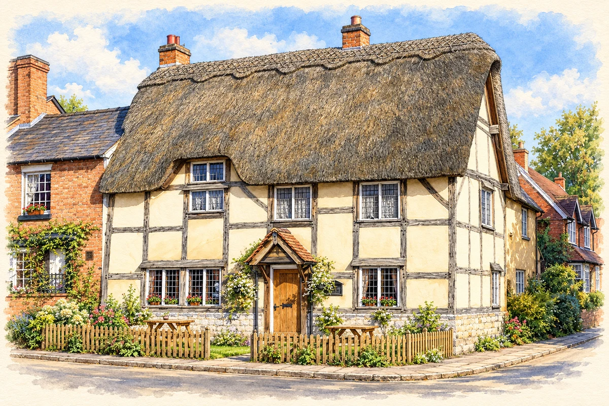
Watercolour and fine ink illustration of The Stag’s Head, Wellesbourne
Illustration · The Stag’s Head, Wellesbourne
History & heritage

Place & story

Two settlements beside the Dene

Wellesbourne grew from two settlements on opposite sides of the River Dene: Hastings and Mountford. Their names came from medieval lordships, but they shared St Peter’s Church. Separate parish councils survived until a merger in 1947. Farming sustained both the village and specialist trades around it, including saddlers, smiths and wheelwrights; a rural economy required skilled making and repair as well as labour in the fields. [3]

The yard that kept farming moving

Chedham’s Yard makes that interdependence unusually visible. Its family history dates Thomas Chedham’s arrival to 1816–17 and his tenancy of the Church Walk premises to 1823. Farming customers needed carts, wagons and implements repaired. By the 1860s his son Henry had added a corn-threshing service, linking workshop skills with machinery brought to the farms themselves. [4]

The business adapted as horses lost ground to engines. After 1922 paraffin-powered tractors replaced ageing steam engines for pulling threshing machines. The last machine returned to the yard for dismantling in 1964; the business closed after Albert Chedham’s death in 1965. His son Bill carried repair skills into farm employment elsewhere. The tools’ survival records a changing livelihood rather than a craft untouched by change. [4]

In September 2006 the yard won the BBC’s Restoration Village competition. County Council minutes describe a community-promoted project supported by museum staff, with potential Lottery investment dependent on meeting funding requirements. The work of preserving and interpreting the yard became a further use for a place once devoted to keeping agricultural equipment serviceable. [5]

Labourers organise, gardeners exhibit

In 1872 Joseph Arch addressed labourers beneath a tree in Wellesbourne. The County Record Office places the gathering at the beginning of the movement that formed the National Agricultural Labourers’ Union. Low pay and difficult working conditions gave the meeting its urgency. The location mattered because labourers could gather beyond their individual farms and recognise shared grievances. [6]

Cultivation also supported sociability and competition. The horticultural society traces its first public show to July 1857, with flowers and produce, a band and tea. Its 1924 programme distinguished amateurs, cottagers and allotment entries. After the Second World War, the two parish councils and the Women’s Institute discussed reviving the show, and an August 1947 event combined exhibits with sport, pony rides and dancing. Garden produce could thus become the centre of a wider village occasion. [7]

Arch’s connection remained something people enacted in the landscape. In February 2019 the Allotment Association announced a commemorative walk with Barford Heritage Group from his home village to Wellesbourne, with wreath-laying, music and festivities planned at the Stag’s Head. The Joseph Arch Way links the place where he lived with the place where he addressed the labourers. [2]

Training aircrews and researching crops

The airfield west of the village opened in April 1941. RAF training brought a changing population of aircrew, including Canadians, who learned their roles before joining operational squadrons. Southam Heritage’s account stresses the accidents associated with well-used training aircraft and the burials of Canadian personnel at Stratford-upon-Avon. The airfield’s story is therefore also one of temporary residence, risk and remembrance. [8] [9]

Post-war agriculture also acquired a new institutional form. The National Vegetable Research Station was established at Wellesbourne in 1949 in response to pressure to increase food production. Laboratories followed in 1959, and an Oxfam appeal helped support the vegetable gene bank built in 1980. Integration with the University of Warwick in 2004 continued the site’s research role. Local agriculture now included scientific experiments and conserved seed as well as the working traditions represented by Chedham’s Yard. [10]

Back to contents
Lives connected to this place

Notable people

Joseph Arch: a visitor who changed rural politics

Arch was born and lived in Barford, rather than Wellesbourne. He became a union leader and later Liberal MP for North West Norfolk, campaigning for agricultural workers and their political representation. The County Record Office preserves an 1896 letter about obtaining copies of smallholdings legislation. It connects his parliamentary work with the concerns over land and rural livelihoods that had drawn people to the Wellesbourne meeting. [6]

Back to contents
A chronology

Timeline

Wellesbourne through time

  1. 1823 — Thomas Chedham takes the tenancy of the Church Walk yard. [4]

  2. 1857 — The horticultural society holds its first recorded public show. [7]

  3. 1872 — Joseph Arch addresses agricultural labourers in Wellesbourne. [6]

  4. April 1941 — Wellesbourne Mountford airfield opens. [8]

  5. 1947 — The Hastings and Mountford parish councils merge. [3]

  6. 1949 — The National Vegetable Research Station is established. [10]

  7. 1980 — A vegetable gene bank is built at Wellesbourne. [10]

  8. 2006 — Chedham’s Yard wins Restoration Village. [5]

Back to contents

Population over time

Built-up area · Settlement · Census 2021

Wellesbourne

7,020people · 2021

Census 2021 population of the named settlement, using ONS built-up area boundaries.

Published census counts.

Sources: ONS: Towns and cities, characteristics of built-up areas, Census 2021 (Table 1c)

View population figures
Wellesbourne — census population
Census yearPopulation
20217,020
Sources and how to read this chart

Usual residents on 21 March 2021; published ONS count rounded to the nearest 5.. Boundary geography: December 2022 (E63003496).

Census 2021 population of the named settlement, using ONS built-up area boundaries.

ONS Table 1c rounds counts to the nearest 5 and suppresses counts below 10. Matched by exact settlement name or individually reviewed district-qualified name, with its coordinate strictly inside that same official BUA boundary. The 2022 BUA geography changed methodology and cannot be directly compared with 2011 BUAs. Contains OS data © Crown copyright and database right 2026. Contains National Statistics data © Crown copyright and database right 2026.

Source: ONS: Towns and cities, characteristics of built-up areas, Census 2021 (Table 1c). Open Government Licence v3.0. Retrieved 2026-10-26. Source: ONS and Ordnance Survey: Built Up Areas December 2022 GB BGG. Open Government Licence v3.0. Retrieved 2026-10-26.

Neighbourhood census context

These figures describe statistical neighbourhoods, which may cover part of a place or include neighbouring places.

Neighbourhood census area · 1971–2021

Stratford-on-Avon 008

Population of the area containing the recorded point for Wellesbourne, not the whole place. This area may cover part of the place or include neighbours.

05k10k15k20k1971: 6,668 people19711981: 6,983 people19811991: 8,315 people19912001: 9,008 people20012011: 9,161 people20112021: 10,656 people2021

Includes harmonised historical census estimates.

Sources: ONS · Paul Norman

View population figures
Stratford-on-Avon 008 — census population and harmonised historical estimates
Census yearPopulation
19716,668
19816,983
19918,315
20019,008
20119,161
202110,656
Sources and how to read this chart

Usual residents of the containing MSOA; this is local area context, not the population of the named settlement.. Boundary geography: 1 April 2022 (E02006511).

2011 and 2021 census counts harmonised by ONS to the same 1 April 2022 geography. Location matched to ONS 2021 MSOA polygons (full resolution, coastline clipped, V7). ONS exact-fit lookup marks this MSOA unchanged from 2011 (U); historical estimates use that same footprint.

1971–2011: Paul Norman harmonised historical estimates on 2011 MSOAs, rounded to whole residents (1971–1991 are modelled). 2021: ONS census count. The historical 2011 total can differ slightly from the ONS change-over-time 2011 total because of methodology and statistical disclosure controls. These are area estimates, not settlement totals.

Source: ONS Census change over time: usual resident population, 2011 and 2021. Open Government Licence v3.0. Retrieved 2026-10-26. Source: ONS MSOA December 2021 boundaries EW BFC V7. Open Government Licence v3.0. Retrieved 2026-10-26. Source: Paul Norman — Area characteristics: Great Britain 1971 to 2011. Creative Commons Attribution 4.0. Retrieved 2026-10-26. Source: ONS MSOA 2011 to MSOA 2021 exact-fit lookup for England and Wales. Open Government Licence v3.0. Retrieved 2026-10-26.

Recorded locationWellesbourne52.19627° N · 1.59269° WInteractive map loads when this area enters view.
Approximate recorded location · Geographic source

Geographic context

Place type
Village
Country / region
England · West Midlands
County group
Warwickshire
Current administration
Stratford-on-Avon
Current administration
Warwickshire
Recorded coordinates
52.19627, -1.59269
OS Open Names ID
osgb4000000074555493

County groups are browsing aids. Current administrative and historic areas are recorded separately.

Recorded names

  • Wellesbourne · en · official

Nearby heritage

Distances are from the recorded place point. Proximity does not establish that a site lies within the place boundary or belongs to its history.

Sources & further reading

  1. OS Open Names October 2026 · Source licence.
  2. Join a walk in footsteps of a local hero · Wellesbourne Allotment Association
  3. Wellesbourne and Walton Neighbourhood Development Plan · Wellesbourne and Walton Parish Council / Stratford-on-Avon District Council
  4. The Chedham Family Tree · Chedham’s Yard Trust
  5. Cabinet minutes: Chedham’s Yard investment and regeneration · Warwickshire County Council
  6. Letter from Joseph Arch to Miss Eleanor Archer · Warwickshire County Record Office / Heritage & Culture Warwickshire
  7. History of the Wellesbourne and Walton Horticultural Society · Wellesbourne and Walton Horticultural Society
  8. Wellesbourne Mountford · Airfields of Britain Conservation Trust
  9. Wellesbourne’s WW2 Airfield · Southam Heritage Collection
  10. Our History · University of Warwick / Warwick Crop Centre
  11. Illustration of The Stag’s Head, Wellesbourne, adapted from The Stags Head, Wellesbourne by David P Howard. CC BY-SA 2.0. AI-assisted watercolour and fine ink adaptation; cream paper margins, simplified fine detail and removal of incidental street clutter.

Geographic source retrieved 2026-10-26. History last researched 2026-10-27. How this page was prepared.