Town

Aldridge

Canals and mines transformed Aldridge’s agricultural economy; churches, a former airport and post-war rebuilding reveal further changes in its working and community life.

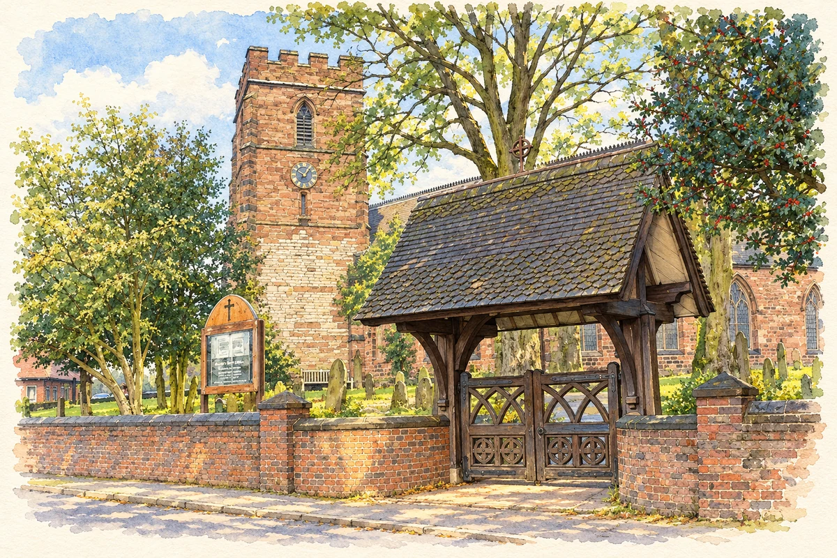
Watercolour and fine ink illustration of St Mary's Church and lychgate, Aldridge
Illustration · St Mary's Church and lychgate, Aldridge
History & heritage

Place & story

A farming settlement around a parish church

Medieval Aldridge’s farmers worked strips in shared open fields, including those remembered as Brantial, Daniel, Middlemore and Wetstone. The parish church was part of this rural settlement long before the later collieries. Its own history establishes that a church with a subsidiary chapel at Great Barr existed before 1257, while leaving its precise foundation uncertain. [2] [3]

St Mary the Virgin also records nineteenth-century rebuilding. The parish account says that, apart from the tower, the exterior walls were added or rebuilt between 1841 and 1853. Limestone in the foundations and tower may have been reused from an earlier church. Further changes in 1991 and 1995 replaced pews and choir stalls with chairs and movable chancel furniture, adapting an inherited building to modern worship. [3]

Transport and the mineral landscape

Poor roads had limited heavier industry. Canals opened between 1803 and 1847, followed by railways serving coal mines and brick and tile works. At Hay Head Wood, shafts, engine supports and five lime kilns preserve traces of works abandoned in 1870. The remains connect Aldridge’s minerals with the transport needed to move them. [2]

A contemporary industrial directory gives a sharper view of the mining workforce. The 1933 Colliery Year Book, transcribed by Durham Mining Museum, lists 786 underground and 236 surface employees at Aldridge No 1 pit. It also says No 2 was temporarily suspended under the coal quota system. Those figures describe a particular company and year, not the whole district’s workforce, but show how many livelihoods depended on a single operation. [4]

The council’s history records hardship when local mines closed during the 1930s. Industrial development had created employment, but dependence on coal also exposed households to the consequences of contraction. The suspended pit in the 1933 directory captures part of that insecurity while mining was still continuing. [2] [4]

An airfield with physical limits

Walsall Council bought Aldridge Lodge and 220 acres of its estate in 1930. An aerodrome followed and was licensed in 1938. Wet clay ground and the size of the site restricted its suitability for larger aircraft. It closed in 1956, leaving land subsequently used for public recreation. A venture in modern transport therefore became a substantial open space. [7]

The airfield was also a place of work. The Airfields of Britain Conservation Trust records Helliwells Ltd and the Walsall Aero Club among its associated organisations, alongside gliding units. The site combined the presence of a commercial firm with recreational flying and training. [8]

Building a congregation from a cinema lounge

Aldridge’s Catholic parish history begins its local campaign with twenty men meeting in 1939 and agreeing weekly contributions of a shilling. Permission was obtained to hold Sunday Mass in the upstairs lounge of the Avion Cinema on Anchor Road. The Franciscan logbook records the opening of the Mass centre on 8 October 1939. A commercial entertainment building temporarily supplied a religious community’s meeting place. [5]

The congregation later used a house and then a purpose-built church-hall opened in 1949. Taking Stock links the decision to build a larger church with Aldridge’s expected population and industrial growth. Eric Farmer designed St Mary of the Angels, built by local firm A J Downes & Sons; work began in 1961 and it was blessed in 1964. Its tall campanile became a new landmark in an expanding settlement. [6]

Rebuilding the centre

After the Second World War, housing and industrial estates accommodated people and businesses moving from Birmingham. A modern shopping centre replaced older High Street shops and cottages. Aldridge joined Brownhills administratively in 1966 and became part of Walsall Metropolitan Borough in 1974. The modern centre belongs to this period of suburban growth and reorganisation. [2]

Back to contents
Lives connected to this place

Notable people

Ellie Simmonds: an Aldridge upbringing

Ellie Simmonds grew up in Aldridge; in a first-person account she recalled moving with her mother to Swansea at eleven to train, returning to the family home at weekends. The swimmer won Paralympic gold medals at Beijing 2008, London 2012 and Rio 2016. Her connection is a childhood home, retained while elite training took her elsewhere, rather than a claim that all her sporting development happened locally. [10] [9]

Her success became a community occasion. In October 2012 High Street shopkeepers announced a homecoming celebration in Aldridge to raise money for the Dwarf Sports Association, following a separate parade in Walsall. The local response connected an international sporting career with the shops and streets of her home town. [11]

Back to contents
A chronology

Timeline

Aldridge through time

  1. Before 1257 — A parish church and its Great Barr chapel are documented. [3]

  2. 1870 — The lime works at Hay Head are abandoned. [2]

  3. 1930 — Walsall Council buys Aldridge Lodge and 220 acres of its estate for the airfield project. [7]

  4. 1933 — A mining directory records 1,022 employees at Aldridge No 1 pit. [4]

  5. 8 October 1939 — A Catholic Mass centre opens in the Avion Cinema. [5]

  6. 1956 — The airfield closes. [7]

  7. 1964 — St Mary of the Angels is blessed. [6]

  8. 1974 — Aldridge becomes part of Walsall Metropolitan Borough. [2]

Back to contents

Population over time

Built-up area · Settlement · Census 2021

Aldridge

15,835people · 2021

Census 2021 population of the named settlement, using ONS built-up area boundaries.

Published census counts.

Sources: ONS: Towns and cities, characteristics of built-up areas, Census 2021 (Table 1c)

View population figures
Aldridge — census population
Census yearPopulation
202115,835
Sources and how to read this chart

Usual residents on 21 March 2021; published ONS count rounded to the nearest 5.. Boundary geography: December 2022 (E63002681).

Census 2021 population of the named settlement, using ONS built-up area boundaries.

ONS Table 1c rounds counts to the nearest 5 and suppresses counts below 10. Matched by exact settlement name or individually reviewed district-qualified name, with its coordinate strictly inside that same official BUA boundary. The 2022 BUA geography changed methodology and cannot be directly compared with 2011 BUAs. Contains OS data © Crown copyright and database right 2026. Contains National Statistics data © Crown copyright and database right 2026.

Source: ONS: Towns and cities, characteristics of built-up areas, Census 2021 (Table 1c). Open Government Licence v3.0. Retrieved 2026-10-26. Source: ONS and Ordnance Survey: Built Up Areas December 2022 GB BGG. Open Government Licence v3.0. Retrieved 2026-10-26.

Neighbourhood census context

These figures describe statistical neighbourhoods, which may cover part of a place or include neighbouring places.

Neighbourhood census area · 1971–2021

Walsall 015

Population of the area containing the recorded point for Aldridge, not the whole place. This area may cover part of the place or include neighbours.

01.8k3.5k5.3k7k1971: 6,912 people19711981: 6,743 people19811991: 6,315 people19912001: 6,061 people20012011: 6,883 people20112021: 6,920 people2021

Includes harmonised historical census estimates.

Sources: ONS · Paul Norman

View population figures
Walsall 015 — census population and harmonised historical estimates
Census yearPopulation
19716,912
19816,743
19916,315
20016,061
20116,883
20216,920
Sources and how to read this chart

Usual residents of the containing MSOA; this is local area context, not the population of the named settlement.. Boundary geography: 1 April 2022 (E02002124).

2011 and 2021 census counts harmonised by ONS to the same 1 April 2022 geography. Location matched to ONS 2021 MSOA polygons (full resolution, coastline clipped, V7). ONS exact-fit lookup marks this MSOA unchanged from 2011 (U); historical estimates use that same footprint.

1971–2011: Paul Norman harmonised historical estimates on 2011 MSOAs, rounded to whole residents (1971–1991 are modelled). 2021: ONS census count. The historical 2011 total can differ slightly from the ONS change-over-time 2011 total because of methodology and statistical disclosure controls. These are area estimates, not settlement totals.

Source: ONS Census change over time: usual resident population, 2011 and 2021. Open Government Licence v3.0. Retrieved 2026-10-26. Source: ONS MSOA December 2021 boundaries EW BFC V7. Open Government Licence v3.0. Retrieved 2026-10-26. Source: Paul Norman — Area characteristics: Great Britain 1971 to 2011. Creative Commons Attribution 4.0. Retrieved 2026-10-26. Source: ONS MSOA 2011 to MSOA 2021 exact-fit lookup for England and Wales. Open Government Licence v3.0. Retrieved 2026-10-26.

Recorded locationAldridge52.60541° N · 1.91722° WInteractive map loads when this area enters view.
Approximate recorded location · Geographic source

Geographic context

Place type
Town
Country / region
England · West Midlands
County group
West Midlands
Current administration
Walsall
Recorded coordinates
52.60541, -1.91722
OS Open Names ID
osgb4000000074553876

County groups are browsing aids. Current administrative and historic areas are recorded separately.

Recorded names

  • Aldridge · en · official

Nearby heritage

Distances are from the recorded place point. Proximity does not establish that a site lies within the place boundary or belongs to its history.

Sources & further reading

  1. OS Open Names October 2026 · Source licence.
  2. Aldridge in history · Walsall Council
  3. History of the church · Aldridge Parish Church
  4. Aldridge Brick Tile and Coal Company,1933 · Durham Mining Museum, transcribing 1933 Colliery Year Book
  5. Parish History · St Mary of the Angels Parish
  6. Aldridge: St Mary of the Angels · Taking Stock / Catholic Bishops’ Conference of England and Wales
  7. Aldridge Central and South Ward Profile 2024 · Walsall Intelligence
  8. Walsall (Aldridge) · Airfields of Britain Conservation Trust
  9. Ellie Simmonds · British Paralympic Association
  10. Mr Doe and Mrs Evans by Ellie Simmonds · Ellie Simmonds / TES
  11. Ellie Simmonds excited about second homecoming parade · ITV News
  12. Illustration of St Mary's Church and lychgate, Aldridge, adapted from St Mary's Church Aldridge - geograph.org.uk - 296982.jpg by Edward Hunt. CC BY-SA 2.0. AI-assisted watercolour and fine ink adaptation; incidental clutter simplified, warm cream paper margins. Architectural forms follow the inspected reference.

Geographic source retrieved 2026-10-26. History last researched 2026-10-26. How this page was prepared.