Birmingham's history runs from a medieval market to metalworking, scientific exchange and chocolate manufacture. Its surviving houses and workshops also reveal the people who worked at home, sought better housing and brought new skills to the city.
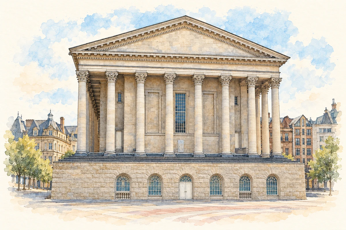
Illustration · Birmingham Town Hall
History & heritage
Place & story
Trade at the River Rea
Birmingham's early development depended on movement and exchange. Routes met at Deritend Ford across the River Rea, while water, timber, iron and coal were available to support settlement and manufacture. In 1166 Peter de Birmingham obtained a market charter from Henry II. Permission for a four-day Whitsun fair followed in 1250, giving trade another place in the town's calendar.[3]
Making goods developed alongside selling them. Craftsmen appear among Birmingham's taxpayers in 1327; when John Leland visited in 1538, he described smiths whose products travelled across England. During the Civil War, local manufacturers supplied Parliament with swords, pikes and armour. Birmingham's later industrial identity had roots in a trading town where small-scale metalworking already reached customers far beyond its streets.[3]
Soho: a home beside the works
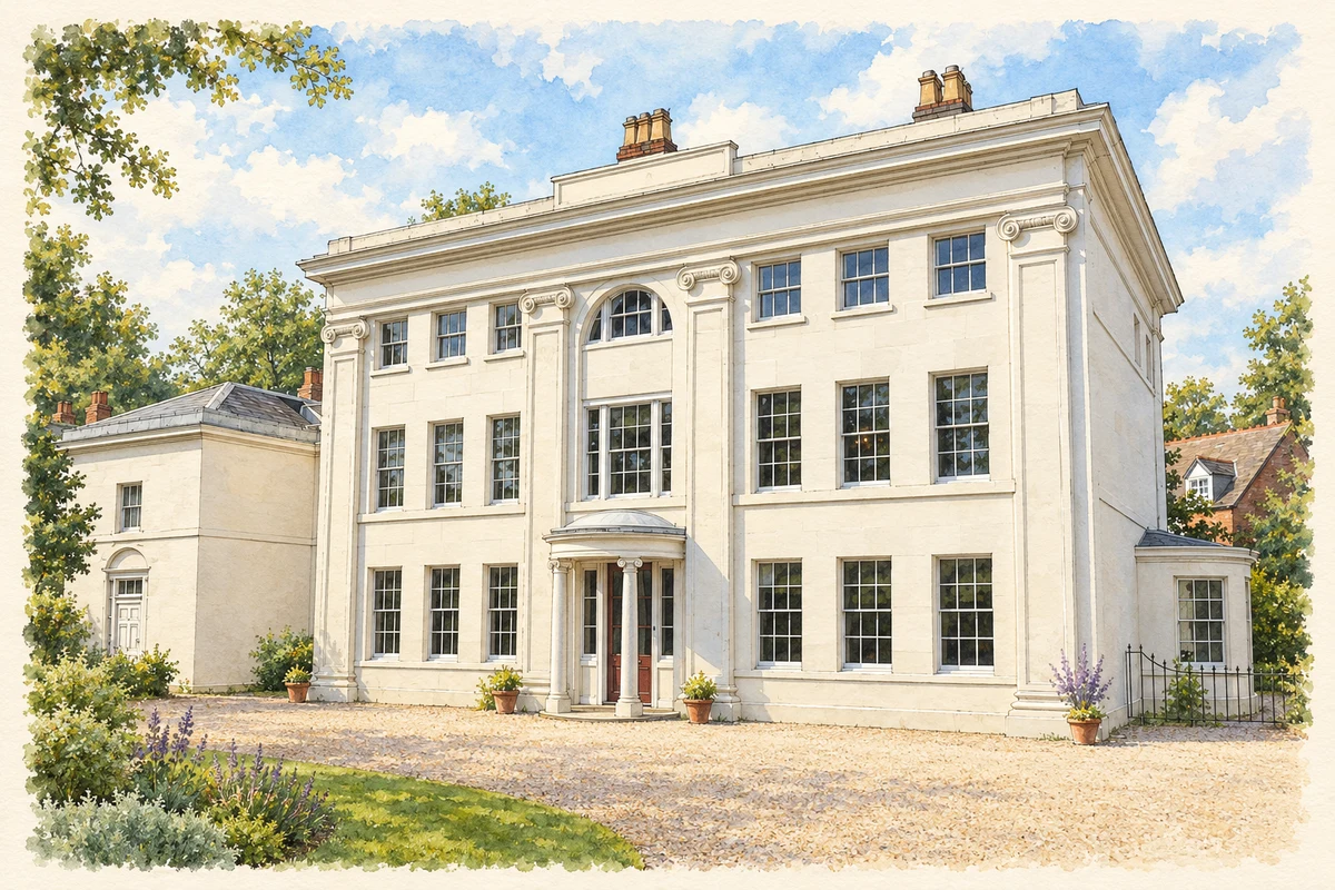
Soho House in Handsworth was Matthew Boulton's home from 1766 to 1809. He enlarged and improved an earlier farmhouse, creating a Georgian residence beside the Soho Manufactory. Birmingham Museums identifies buttons and buckles, clocks and vases, silver and Sheffield plate among the works' products. The variety matters: precision metalworking supplied everyday fastenings and fashionable tableware as well as the machinery associated with Boulton's partnership with James Watt.[2][4]
The household was also a meeting place for the Lunar Society. Its circle included Watt, Joseph Priestley, Erasmus Darwin, Josiah Wedgwood and William Withering. Meetings combined meals, experiments and discussion, making the dining room part of Birmingham's scientific history. The surviving house places intellectual exchange within a domestic setting closely connected to manufacturing.[2]
Illustration · Soho House, Handsworth
Coal by canal
A manufacturing town needed dependable supplies. The Birmingham Canal obtained its Act in 1768 after James Brindley's survey, with support from Boulton and other Lunar Society members. The first section opened in 1769, bringing coal into Birmingham from the Black Country. Completion to Aldersley in 1772 connected it with the Staffordshire & Worcestershire Canal. Waterways gave the town a working relationship with collieries and other industrial settlements.[5]
These connections were negotiated as well as engineered. The Worcester & Birmingham Canal, authorised in 1791 and completed in 1815, provided a shorter route to the Severn. At Birmingham, the two canals were initially separated by the Worcester Bar. An agreement in 1815 allowed a lock connection, with a compensating toll: access to water and the income from traffic helped determine the shape of the network.[6]
Small workplaces, close-packed homes
The Museum of the Jewellery Quarter preserves the former Smith & Pepper workshop. When the proprietors retired in 1981, they closed the business and left its equipment behind. Its survival makes a smaller scale of manufacture visible alongside Soho's more celebrated story: a particular firm's preserved workshop records the setting in which skilled hands made valuable objects.[7]
At Court 15 on Inge Street and Hurst Street, the Back to Backs bring domestic life into the industrial account. Homes were arranged around a shared courtyard, and many residents worked at home. The Heritage Fund identifies button making, glasswork, leatherwork, tailoring and the jewellery and small-metal trades among the occupations represented. More than 500 families are known to have lived around this court; its story is one of repeated occupation and adaptation, rather than a single household frozen in time.[8][13]
Moving the factory into the country
In September 1879 George and Richard Cadbury moved their cocoa and chocolate factory from central Birmingham to the Bournbrook estate, four miles away. Clean water, better air and transport connections made the location attractive. They named it Bournville. The move joined a practical need for factory space with a desire to improve the conditions in which employees worked and lived.[9]
Housing became a larger undertaking around the factory. Bournville Village Trust's history describes spacious houses with gardens and open space, followed by schools, recreation grounds, sports facilities and village halls. Homes were offered beyond the factory workforce. Alongside the crowded courts, this surviving landscape records another response to the conditions created by industrial growth: planning the spaces between home, work and recreation.[10][9]
A mill at the edge of the urban story
Sarehole Mill complicates any picture of Birmingham as an uninterrupted landscape of factories. Milling is recorded on the site from 1542, while the surviving building dates from the mid-eighteenth century. In the 1850s, a steam engine and the mill's distinctive chimney supplemented its older water-powered history. The building preserves successive ways of using energy within one workplace.[12]
Boulton's Birmingham connections extend beyond Soho House. Between 1756 and 1761 he leased Sarehole Mill to flatten metal for buttons. The link between this mill and his later Handsworth home makes his career tangible across different parts of the present city: a water-powered production site, a larger manufacturing enterprise and a household that welcomed scientific discussion.[12][2]
George Cadbury: business and housing reform
Born in Edgbaston in 1839, George Cadbury took over the cocoa business with his brother Richard in 1861. He joined Birmingham Town Council in 1877 and pursued housing reform alongside manufacture. The development of the Bournville estate and the establishment of its trust in 1900 gave that concern a lasting institutional form. His local significance includes the homes and public spaces around the works as well as the chocolate made inside them.[11]
George Saunders: a tailor on Hurst Street
George Saunders arrived in Britain from St Kitts in 1958, bringing tailoring skills learned from his father. Racial discrimination obstructed his search for work in Birmingham, and he initially worked in a biscuit factory. After returning to tailoring and running a business in Balsall Heath, he moved his shop to Court 15 in 1974. He worked there until 2001; donated clothes, materials and equipment preserve the relationship between migration, skilled work and this particular street.[13][14]
J. R. R. Tolkien: childhood beside Sarehole
Tolkien grew up across the road from Sarehole Mill and explored its grounds as a child. Birmingham Museums connects those rural surroundings with the imaginative landscape of his later fiction. His tie is a childhood association with this district of the present city; the mill provides a specific setting for it, without making every feature of Middle-earth a disguised Birmingham landmark.[12]
Birmingham 138 — census population and harmonised historical estimates
Census year
Population
1971
1,892
1981
1,695
1991
1,663
2001
1,503
2011
5,542
2021
6,145
Sources and how to read this chart
Usual residents of the containing MSOA; this is local area context, not the population of the named settlement.. Boundary geography: 1 April 2022 (E02006899).
2011 and 2021 census counts harmonised by ONS to the same 1 April 2022 geography. Location matched to ONS 2021 MSOA polygons (full resolution, coastline clipped, V7). ONS exact-fit lookup marks this MSOA unchanged from 2011 (U); historical estimates use that same footprint.
1971–2011: Paul Norman harmonised historical estimates on 2011 MSOAs, rounded to whole residents (1971–1991 are modelled). 2021: ONS census count. The historical 2011 total can differ slightly from the ONS change-over-time 2011 total because of methodology and statistical disclosure controls. These are area estimates, not settlement totals.
Illustration of Birmingham Town Hall, adapted from Birmingham Town Hall after refurbishment.jpg by Erebus555. CC BY-SA 3.0. AI-assisted watercolour and fine ink adaptation; cream paper margins, simplified fine detail and removal of incidental street clutter.
Illustration of Soho House, Handsworth, adapted from Soho House as seen in 2009 by Wehwalt. CC BY-SA 3.0. AI-assisted watercolour and fine ink adaptation; garden planting and fine surface detail simplified; incidental signs and benches omitted. Adaptation shared under CC BY-SA 3.0.
 place