Town

Bloxwich

Small metal workshops linked Bloxwich to the leather trades, while churches, fairs and later housing estates shaped a town beyond its industrial reputation.

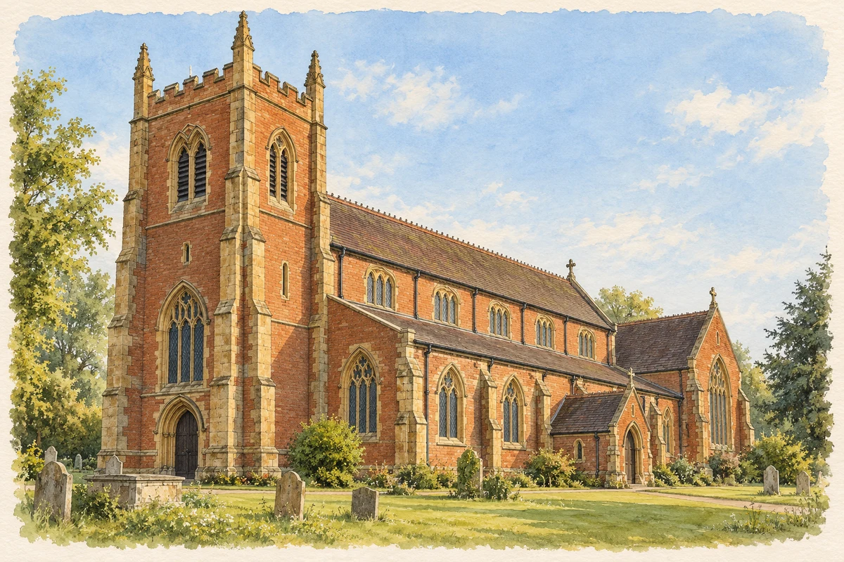
Watercolour and fine ink illustration of All Saints’ Church, Bloxwich
Illustration · All Saints’ Church, Bloxwich
Original illustration; researched sources
Research sources

Original architectural composition based on the cited building descriptions; incidental setting and fine details are interpretive.

Historic England: All Saints, Bloxwich; Bloxwich Parish: All Saints’ history

History & heritage

Place & story

A village of small producers

Bloxwich’s eighteenth-century growth combined coal mining with manufacture on a small scale. Workers made awls, nails, needles and saddle blades, and canals around the town helped move their products. Its industrial identity belonged partly to cottages and workshops rather than only to large factories. [2]

The heritage project Rediscover locates much of this work at Sandbank, where workshops stood behind cottages into the 1930s and 1940s. Bit makers, lock makers, stirrup makers and tack makers served related but distinct trades. The firm Thomas Somerfield & Sons in Clarendon Street made awl blades and needles. The tools supplied an economy in which leather had to be pierced, fastened and fitted to horses and vehicles. [3]

A church with several building dates

All Saints is a layered building. The parish dates its main predecessor to about 1791–94, followed by major alterations in 1875–77; the Historic Environment Record describes Victorian work encasing parts of the 1794 church. It had previously been dedicated to St Thomas of Canterbury. Calling the whole building simply Victorian conceals that earlier fabric. [4] [5]

The red sandstone churchyard cross has a different chronology. Its steps, socket and shaft are principally medieval, while the knop and ball at the top were added in the early twentieth century. This surviving feature offers evidence of the older religious landscape without proving the date of every part of the church beside it. [6]

Congregations beyond the parish church

Walsall Archives’ register guide records Wesleyan Methodist baptisms in High Street from 1827, Primitive Methodist baptisms at Pinfold from 1861, and United Methodist baptisms in New Street from 1902. Those are starting dates of surviving records, rather than necessarily foundation dates. Together they reveal several organised religious communities within the industrial town. [7]

Fairs become cinema

Entertainment also occupied permanent and temporary spaces. The Bloxwich Wakes brought rides and shows to the town; Pat Collins used travelling film exhibitions alongside the fairground attractions. Rediscover traces the High Street cinema from the Electric Palace to the much larger Grosvenor, opened on 11 December 1922. Collins’s business connected popular leisure with a permanent town-centre building. [8]

Bloxwich’s later expansion came through housing as well as industry. The council’s Town Investment Plan identifies successive large housing programmes between the 1920s and 1970s, much of it council housing. The area described by modern planners therefore extends well beyond the older High Street and workshop clusters. [9]

Back to contents
Lives connected to this place

Notable people

Pat Collins: a Bloxwich base for show business

Pat Collins was associated with Bloxwich through his home at Lime Tree House, the wakes and his cinema business, rather than through birth in the town. His fairground stood near his home. He died in Bloxwich in 1943, and a subscription-funded memorial clock followed in 1955. The clock was moved to the Promenade Gardens in 1991. [8]

Back to contents
A chronology

Timeline

Bloxwich through time

  1. Eighteenth century — Coal mining and small metal trades encourage growth. [2]

  2. About 1791–94 — The church preceding the Victorian alterations is built. [4]

  3. 1875–77 — Major extensions and alterations transform All Saints. [4]

  4. 11 December 1922 — The Grosvenor cinema opens. [8]

  5. 1920s–1970s — Successive housing programmes enlarge Bloxwich. [9]

  6. 1955 — A memorial clock commemorates Pat Collins. [8]

Back to contents

Population over time

Built-up area · Settlement · Census 2021

Bloxwich

51,875people · 2021

Census 2021 population of the named settlement, using ONS built-up area boundaries.

Published census counts.

Sources: ONS: Towns and cities, characteristics of built-up areas, Census 2021 (Table 1c)

View population figures
Bloxwich — census population
Census yearPopulation
202151,875
Sources and how to read this chart

Usual residents on 21 March 2021; published ONS count rounded to the nearest 5.. Boundary geography: December 2022 (E63002672).

Census 2021 population of the named settlement, using ONS built-up area boundaries.

ONS Table 1c rounds counts to the nearest 5 and suppresses counts below 10. Matched by exact settlement name or individually reviewed district-qualified name, with its coordinate strictly inside that same official BUA boundary. The 2022 BUA geography changed methodology and cannot be directly compared with 2011 BUAs. Contains OS data © Crown copyright and database right 2026. Contains National Statistics data © Crown copyright and database right 2026.

Source: ONS: Towns and cities, characteristics of built-up areas, Census 2021 (Table 1c). Open Government Licence v3.0. Retrieved 2026-10-26. Source: ONS and Ordnance Survey: Built Up Areas December 2022 GB BGG. Open Government Licence v3.0. Retrieved 2026-10-26.

Neighbourhood census context

These figures describe statistical neighbourhoods, which may cover part of a place or include neighbouring places.

Neighbourhood census area · 1971–2021

Walsall 008

Population of the area containing the recorded point for Bloxwich, not the whole place. This area may cover part of the place or include neighbours.

01.8k3.5k5.3k7k1971: 6,668 people19711981: 5,795 people19811991: 5,786 people19912001: 5,939 people20012011: 6,051 people20112021: 6,253 people2021

Includes harmonised historical census estimates.

Sources: ONS · Paul Norman

View population figures
Walsall 008 — census population and harmonised historical estimates
Census yearPopulation
19716,668
19815,795
19915,786
20015,939
20116,051
20216,253
Sources and how to read this chart

Usual residents of the containing MSOA; this is local area context, not the population of the named settlement.. Boundary geography: 1 April 2022 (E02002117).

2011 and 2021 census counts harmonised by ONS to the same 1 April 2022 geography. Location matched to ONS 2021 MSOA polygons (full resolution, coastline clipped, V7). ONS exact-fit lookup marks this MSOA unchanged from 2011 (U); historical estimates use that same footprint.

1971–2011: Paul Norman harmonised historical estimates on 2011 MSOAs, rounded to whole residents (1971–1991 are modelled). 2021: ONS census count. The historical 2011 total can differ slightly from the ONS change-over-time 2011 total because of methodology and statistical disclosure controls. These are area estimates, not settlement totals.

Source: ONS Census change over time: usual resident population, 2011 and 2021. Open Government Licence v3.0. Retrieved 2026-10-26. Source: ONS MSOA December 2021 boundaries EW BFC V7. Open Government Licence v3.0. Retrieved 2026-10-26. Source: Paul Norman — Area characteristics: Great Britain 1971 to 2011. Creative Commons Attribution 4.0. Retrieved 2026-10-26. Source: ONS MSOA 2011 to MSOA 2021 exact-fit lookup for England and Wales. Open Government Licence v3.0. Retrieved 2026-10-26.

Recorded locationBloxwich52.61659° N · 2.00437° WInteractive map loads when this area enters view.
Approximate recorded location · Geographic source

Geographic context

Place type
Town
Country / region
England · West Midlands
County group
West Midlands
Current administration
Walsall
Recorded coordinates
52.61659, -2.00437
OS Open Names ID
osgb4000000074560825

County groups are browsing aids. Current administrative and historic areas are recorded separately.

Recorded names

  • Bloxwich · en · official

Nearby heritage

Distances are from the recorded place point. Proximity does not establish that a site lies within the place boundary or belongs to its history.

Sources & further reading

  1. OS Open Names October 2026 · Source licence.
  2. Bloxwich in history · Walsall Council
  3. Industry · Rediscover Bloxwich heritage project
  4. All Saints’ history · Bloxwich Parish
  5. Church of All Saints: MBL1609 · Wolverhampton and Walsall Historic Environment Record
  6. Cross in All Saints churchyard: 1016435 · Historic England
  7. Bloxwich churches · Walsall Council
  8. Pat Collins Fair and Cinema · Rediscover Bloxwich heritage project
  9. Bloxwich Town Investment Plan, part 1 · Walsall Council
  10. Original illustration of All Saints’ Church, Bloxwich by PlaceHistory. Researched sources are linked beneath the illustration. Original composition from inspected architectural facts; no source photograph copied or used as an image-edit input. Fine detail is interpretive, not a measured survey.

Geographic source retrieved 2026-10-26. History last researched 2026-10-26. How this page was prepared.