Town

Darlaston

Gunlocks and fasteners connected Darlaston to distant customers, while canals, crowded housing and successive regeneration schemes changed the place where workers lived.

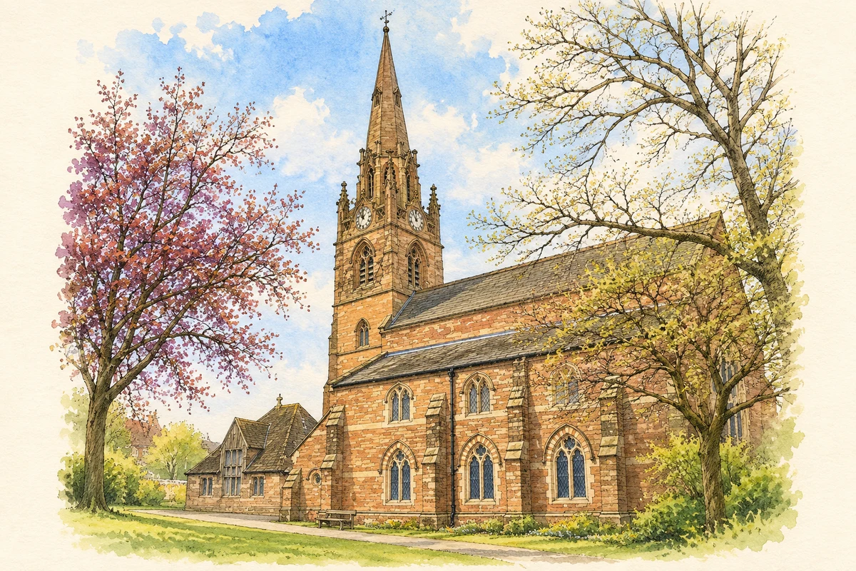
Watercolour and fine ink illustration of St Lawrence’s Church, Darlaston
Illustration · St Lawrence’s Church, Darlaston
History & heritage

Place & story

Fields beneath the workshops

Darlaston’s rural past remains legible in its street names. The Green recalls a village green, the Leys grazing land and Pinfold Street the enclosure for stray animals. King Street was a medieval route before becoming the principal shopping street, with substantial houses as well as shops. Industrial expansion reused an older settlement rather than creating every street afresh. [2]

Specialists in a manufacturing network

Darlaston’s early industry drew on an outcrop of the thirty-foot coal seam. Gunlock makers supplied firing mechanisms to Birmingham, where guns were assembled. Nuts and bolts became another specialism; by 1860 there were eight large manufacturers and many smaller concerns. The town’s importance rested on components needed by other manufacturers, linking its workshops to a wider production network. [5]

Transport enlarged the reach of those workshops. The regeneration baseline records the opening of the Walsall Canal in 1799, followed by the Grand Junction Railway in 1837 and a town railway station in 1863. Factories, homes and shops multiplied around the connections. Residential buildings on King Street became shops as the number of potential customers grew. [3]

Homes and a changing centre

Employment attracted newcomers, but housing, sanitation and amenities lagged behind. Slum clearance continued into the twentieth century. The urban district council subsequently built housing between the wars and after 1945, making the improvement of workers’ homes a major part of Darlaston’s industrial legacy. [2]

By 1979 the town’s prospects were being debated in Parliament. Bruce George, MP for Walsall South, described poor housing, declining employment and derelict factories. He also argued that moving households to estates at Moxley and Bentley had weakened town-centre trade. This was an advocate’s contemporary diagnosis, valuable for understanding local anxieties rather than a neutral measure of every resident’s experience. [4]

George saw the new ASDA store as a means of bringing customers back and pressed for improvements to King Street shops. Decades later, the 2009 regeneration framework again brought employment, housing, public space and town-centre renewal into one programme. These repeated efforts show how the fortunes of shops and neighbourhoods were bound up with the changing industrial economy. [4] [3]

Back to contents
Lives connected to this place

Notable people

F. W. Cotterill: expanding the Atlas Works

F. W. Cotterill inherited a local bolt-making business in 1870 and developed the nucleus of the Atlas Works. Guest, Keen & Nettlefolds acquired the works in 1919. His documented connection is as a manufacturer in Darlaston: the business helps explain how small specialist concerns became part of larger industrial companies. [2]

Bruce George: taking Darlaston to Parliament

Bruce George represented Walsall South, including Darlaston, and devoted an adjournment debate on 4 April 1979 to its industry and environment. His account linked jobs to housing, shopping and public services, giving a named political voice to the town’s struggle to renew its centre. [4]

Back to contents
A chronology

Timeline

Darlaston through time

  1. 1799 — The Walsall Canal opens, improving access to markets. [3]

  2. 1837 — The Grand Junction Railway brings a railway connection at James Bridge. [3]

  3. 1863 — A branch railway provides Darlaston with its town station. [3]

  4. 1870 — Cotterill inherits the business from which the Atlas Works develops. [2]

  5. 1919 — Guest, Keen & Nettlefolds acquires the Atlas Works. [2]

  6. 4 April 1979 — Parliament debates Darlaston’s industry and environment. [4]

  7. 2009 — A regeneration baseline brings together employment, housing and town-centre proposals. [3]

Back to contents

Population over time

Built-up area · Settlement · Census 2021

Darlaston

21,540people · 2021

Census 2021 population of the named settlement, using ONS built-up area boundaries.

Published census counts.

Sources: ONS: Towns and cities, characteristics of built-up areas, Census 2021 (Table 1c)

View population figures
Darlaston — census population
Census yearPopulation
202121,540
Sources and how to read this chart

Usual residents on 21 March 2021; published ONS count rounded to the nearest 5.. Boundary geography: December 2022 (E63002757).

Census 2021 population of the named settlement, using ONS built-up area boundaries.

ONS Table 1c rounds counts to the nearest 5 and suppresses counts below 10. Matched by exact settlement name or individually reviewed district-qualified name, with its coordinate strictly inside that same official BUA boundary. The 2022 BUA geography changed methodology and cannot be directly compared with 2011 BUAs. Contains OS data © Crown copyright and database right 2026. Contains National Statistics data © Crown copyright and database right 2026.

Source: ONS: Towns and cities, characteristics of built-up areas, Census 2021 (Table 1c). Open Government Licence v3.0. Retrieved 2026-10-26. Source: ONS and Ordnance Survey: Built Up Areas December 2022 GB BGG. Open Government Licence v3.0. Retrieved 2026-10-26.

Neighbourhood census context

These figures describe statistical neighbourhoods, which may cover part of a place or include neighbouring places.

Neighbourhood census area · 1971–2021

Walsall 033

Population of the area containing the recorded point for Darlaston, not the whole place. This area may cover part of the place or include neighbours.

02k4k6k8k1971: 5,266 people19711981: 6,209 people19811991: 6,352 people19912001: 6,090 people20012011: 6,813 people20112021: 7,550 people2021

Includes harmonised historical census estimates.

Sources: ONS · Paul Norman

View population figures
Walsall 033 — census population and harmonised historical estimates
Census yearPopulation
19715,266
19816,209
19916,352
20016,090
20116,813
20217,550
Sources and how to read this chart

Usual residents of the containing MSOA; this is local area context, not the population of the named settlement.. Boundary geography: 1 April 2022 (E02002142).

2011 and 2021 census counts harmonised by ONS to the same 1 April 2022 geography. Location matched to ONS 2021 MSOA polygons (full resolution, coastline clipped, V7). ONS exact-fit lookup marks this MSOA unchanged from 2011 (U); historical estimates use that same footprint.

1971–2011: Paul Norman harmonised historical estimates on 2011 MSOAs, rounded to whole residents (1971–1991 are modelled). 2021: ONS census count. The historical 2011 total can differ slightly from the ONS change-over-time 2011 total because of methodology and statistical disclosure controls. These are area estimates, not settlement totals.

Source: ONS Census change over time: usual resident population, 2011 and 2021. Open Government Licence v3.0. Retrieved 2026-10-26. Source: ONS MSOA December 2021 boundaries EW BFC V7. Open Government Licence v3.0. Retrieved 2026-10-26. Source: Paul Norman — Area characteristics: Great Britain 1971 to 2011. Creative Commons Attribution 4.0. Retrieved 2026-10-26. Source: ONS MSOA 2011 to MSOA 2021 exact-fit lookup for England and Wales. Open Government Licence v3.0. Retrieved 2026-10-26.

Recorded locationDarlaston52.56887° N · 2.03332° WInteractive map loads when this area enters view.
Approximate recorded location · Geographic source

Geographic context

Place type
Town
Country / region
England · West Midlands
County group
West Midlands
Current administration
Walsall
Recorded coordinates
52.56887, -2.03332
OS Open Names ID
osgb4000000074567794

County groups are browsing aids. Current administrative and historic areas are recorded separately.

Recorded names

  • Darlaston · en · official

Nearby heritage

Explore recorded heritage in Darlaston and the surrounding area. This selection is based on proximity to a recorded settlement point; it is not a complete inventory or evidence that a site lies within the settlement or belongs to its history.

Heritage locationsDarlaston & surrounding areaInteractive map loads when this area enters view. Source records are listed below.

Numbered markers match the source records below. Locations are recorded reference points, not site boundaries.

  1. WAR MEMORIAL · Listed building
  2. Former Police Station and attached railings · Listed building
  3. 1 and 2, Church Street · Listed building
  4. 3, CHURCH STREET · Listed building
  5. 35, KING STREET · Listed building
  6. THE WHITE LION PUBLIC HOUSE · Listed building
  7. CHURCH OF ST LAWRENCE · Listed building
  8. Church of All Saints, Darlaston · Listed building

Sources & further reading

  1. OS Open Names October 2026 · Source licence.
  2. Darlaston in history · Walsall Council
  3. Darlaston Strategic Regeneration Framework: Baseline Report (August 2009) · URBED and partners for Walsall Council and Walsall Housing Group
  4. Darlaston (Industry and Environment), 4 April 1979 · UK Parliament, Hansard
  5. Settlement; Darlaston (MBL1871) · Wolverhampton and Walsall Historic Environment Record
  6. Illustration of St Lawrence’s Church, Darlaston, adapted from St Lawrence by Gordon Griffiths. CC BY-SA 2.0. AI-assisted watercolour and fine ink adaptation; simplified fine detail and removal of incidental clutter.

Geographic source retrieved 2026-10-26. History last researched 2026-10-27. How this page was prepared.