Town

Halesowen

The Stour powered work, an abbey governed land and a poet transformed a dairy farm: Halesowen’s surviving places connect very different uses of the same landscape.

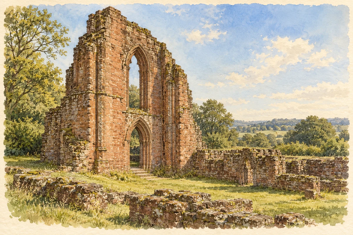
Watercolour and fine ink illustration of the surviving medieval stonework of Halesowen Abbey
Original illustration · the surviving medieval stonework of Halesowen Abbey
Original illustration; researched sources
Research sources

Original composition informed by the cited historical and architectural records. Fine detail and surrounding planting are simplified; this is an illustration, not a measured record.

English Heritage: Halesowen Abbey history; Historic England: Halesowen Abbey

History & heritage

Place & story

A religious estate and its neighbours

King John granted the manor of Hales to Peter des Roches, Bishop of Winchester, in 1214. The bishop established an abbey in 1218, bringing Premonstratensian canons from Welbeck. These were priests living communally, known as white canons from their undyed clothing. Their estate made the religious house a substantial local landowner. [2]

Its authority could provoke resistance: English Heritage records a local uprising against punitive taxes imposed by the abbot. The last abbot, William Taylor, surrendered the abbey in 1538. Partial demolition followed, but fragments of the church became incorporated in Manor Farm’s north barn. Agricultural reuse helped carry medieval masonry into another working life. [2]

A market town on the Stour

The abbey secured a Wednesday market charter in 1220. Later grants altered the trading calendar, linking the town’s commercial development to its religious lordship. The River Stour supplied another resource: waterpower supported cornmills and, by the seventeenth century, metal forging. Mills could serve the preparation of iron for the nail trade as well as the grinding of grain. [3]

The nail warehouse at Laurel Lane and Powell Street reveals the organisation behind small workshops. In 1901 it was occupied by James Heague, an iron nail and chain manufacturer. Intermediaries issued iron rod for nailers to turn into finished goods. Domestic manufacture depended on this network of supply and collection, rather than on workshop labour alone. [3]

A workshop preserved beyond the town

The Black Country Living Museum preserves the contents of a nail shop from behind 17 Chapel Street, Halesowen. The workshop dated from the 1880s and was last operated in the 1940s. Its tools give a particular local address to a trade that can otherwise seem anonymous; the museum identifies Halesowen among the main nailmaking centres of the wider Black Country. [4]

Poetry made into a working landscape

At the Leasowes, William Shenstone turned a dairy farm into an ornamental landscape. He moved there in 1739, initially boarding with his tenants, and began improvements in 1743. Seats, inscriptions, urns and cascades made the grounds a setting for pastoral ideas. Many features used inexpensive materials; the landscape grew from limited income as well as literary ambition. [5]

Later uses changed what visitors encountered. A golf course crossed the centre in 1906; Halesowen Council acquired the Leasowes in 1934 and part became a public recreation ground. Restoration began in the late 1990s. Its history includes loss and public adaptation as well as Shenstone’s eighteenth-century design. [5]

Reading the rebuilt centre

Large-scale redevelopment in the early 1960s removed many older buildings, including timber-framed examples. The council’s architectural trail nevertheless identifies surviving street patterns as part of the town’s historic character. Reading those routes alongside the river, the warehouse and the abbey makes different periods legible within the rebuilt centre. [3]

Back to contents
Lives connected to this place

Notable people

William Shenstone: a poet at the Leasowes

Shenstone’s connection to Halesowen was residence and landscape design at the Leasowes. His farm became a way to translate poetry into paths, water and carefully placed objects. Historic England identifies the landscape as influential in eighteenth-century gardening; the surviving grounds preserve the consequences of that local experiment. [5]

Peter des Roches: founding a local institution

Peter des Roches was Bishop of Winchester, but his lasting Halesowen connection was the abbey he founded on the manor granted by King John. That project introduced a community whose landholding and religious duties would shape the area for more than three centuries. [2]

Back to contents
A chronology

Timeline

Halesowen through time

  1. 1218 — The Premonstratensian abbey is established. [2]

  2. 1220 — The abbot secures a Wednesday market charter. [3]

  3. 1538 — William Taylor surrenders the abbey to the Crown. [2]

  4. 1743 — Shenstone begins improving his farm landscape. [5]

  5. Early 1960s — Redevelopment removes many older town-centre buildings. [3]

  6. Late 1990s — Restoration of the Leasowes landscape begins. [5]

Back to contents

Population over time

Built-up area · Settlement · Census 2021

Halesowen

60,110people · 2021

Census 2021 population of the named settlement, using ONS built-up area boundaries.

Published census counts.

Sources: ONS: Towns and cities, characteristics of built-up areas, Census 2021 (Table 1c)

View population figures
Halesowen — census population
Census yearPopulation
202160,110
Sources and how to read this chart

Usual residents on 21 March 2021; published ONS count rounded to the nearest 5.. Boundary geography: December 2022 (E63002941).

Census 2021 population of the named settlement, using ONS built-up area boundaries.

ONS Table 1c rounds counts to the nearest 5 and suppresses counts below 10. Matched by exact settlement name or individually reviewed district-qualified name, with its coordinate strictly inside that same official BUA boundary. The 2022 BUA geography changed methodology and cannot be directly compared with 2011 BUAs. Contains OS data © Crown copyright and database right 2026. Contains National Statistics data © Crown copyright and database right 2026.

Source: ONS: Towns and cities, characteristics of built-up areas, Census 2021 (Table 1c). Open Government Licence v3.0. Retrieved 2026-10-26. Source: ONS and Ordnance Survey: Built Up Areas December 2022 GB BGG. Open Government Licence v3.0. Retrieved 2026-10-26.

Neighbourhood census context

These figures describe statistical neighbourhoods, which may cover part of a place or include neighbouring places.

Neighbourhood census area · 1971–2021

Dudley 039

Population of the area containing the recorded point for Halesowen, not the whole place. This area may cover part of the place or include neighbours.

02.5k5k7.5k10k1971: 8,907 people19711981: 9,174 people19811991: 9,165 people19912001: 8,746 people20012011: 9,400 people20112021: 9,615 people2021

Includes harmonised historical census estimates.

Sources: ONS · Paul Norman

View population figures
Dudley 039 — census population and harmonised historical estimates
Census yearPopulation
19718,907
19819,174
19919,165
20018,746
20119,400
20219,615
Sources and how to read this chart

Usual residents of the containing MSOA; this is local area context, not the population of the named settlement.. Boundary geography: 1 April 2022 (E02002038).

2011 and 2021 census counts harmonised by ONS to the same 1 April 2022 geography. Location matched to ONS 2021 MSOA polygons (full resolution, coastline clipped, V7). ONS exact-fit lookup marks this MSOA unchanged from 2011 (U); historical estimates use that same footprint.

1971–2011: Paul Norman harmonised historical estimates on 2011 MSOAs, rounded to whole residents (1971–1991 are modelled). 2021: ONS census count. The historical 2011 total can differ slightly from the ONS change-over-time 2011 total because of methodology and statistical disclosure controls. These are area estimates, not settlement totals.

Source: ONS Census change over time: usual resident population, 2011 and 2021. Open Government Licence v3.0. Retrieved 2026-10-26. Source: ONS MSOA December 2021 boundaries EW BFC V7. Open Government Licence v3.0. Retrieved 2026-10-26. Source: Paul Norman — Area characteristics: Great Britain 1971 to 2011. Creative Commons Attribution 4.0. Retrieved 2026-10-26. Source: ONS MSOA 2011 to MSOA 2021 exact-fit lookup for England and Wales. Open Government Licence v3.0. Retrieved 2026-10-26.

Recorded locationHalesowen52.45341° N · 2.06091° WInteractive map loads when this area enters view.
Approximate recorded location · Geographic source

Geographic context

Place type
Town
Country / region
England · West Midlands
County group
West Midlands
Current administration
Dudley
Recorded coordinates
52.45341, -2.06091
OS Open Names ID
osgb4000000074566096

County groups are browsing aids. Current administrative and historic areas are recorded separately.

Recorded names

  • Halesowen · en · official

Nearby heritage

Distances are from the recorded place point. Proximity does not establish that a site lies within the place boundary or belongs to its history.

Sources & further reading

  1. OS Open Names October 2026 · Source licence.
  2. History of Halesowen Abbey · English Heritage
  3. Halesowen Architectural Heritage Trail · Dudley Metropolitan Borough Council / Discover Dudley
  4. Industrial Enthusiasts Trail · Black Country Living Museum
  5. The Leasowes, registered park1001204 · Historic England
  6. Original illustration of the surviving medieval stonework of Halesowen Abbey by PlaceHistory. Researched sources are linked beneath the illustration. AI-assisted original watercolour and fine ink composition from inspected factual research; no source photograph was supplied as an image-edit input.

Geographic source retrieved 2026-10-26. History last researched 2026-10-27. How this page was prepared.