Town

Kingswinford

Kingswinford’s old village stood within a much larger industrial parish. A mining-damaged church, an early locomotive and Broadfield House connect settlement, work and changing public institutions.

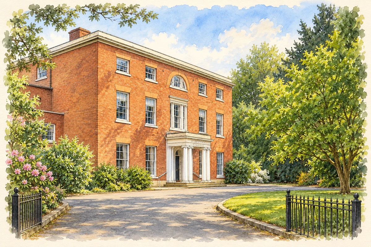
Watercolour and fine ink illustration of Broadfield House
Illustration · Broadfield House
History & heritage

Place & story

Village, manor and parish

The name Kingswinford has covered more than one geographical scale. The nineteenth-century parish contained numerous villages and hamlets involved in coal, iron, glass, brick and pottery production. The village around St Mary’s was only one part of it. Treating every industry in the old parish as a town-centre activity would obscure how this landscape worked. [3]

The manor was royal property under Edward the Confessor and William I. Domesday recorded a mill, but no church; King John sold the manor to Ralph de Somery in 1206. St Mary’s preserves a much later patchwork of construction, with medieval tower fabric and a reset Romanesque carving. The church site links the surviving village with a long history of ownership and worship. [3]

Industry beneath the church

Mining affected the village’s most prominent institution directly. Historic England attributes the rebuilding of St Mary’s in the 1830s and 1840s to subsidence caused by mining; the restored church reopened in 1846. The surviving tower and rebuilt body record the costs of extracting the ground below a settled community, as well as the community’s investment in maintaining a place of worship. [4]

Coal moves by steam

In 1829 Foster, Rastrick & Co of Stourbridge built Agenoria for the Earl of Dudley’s Shutt End Colliery Railway at Kingswinford. The locomotive hauled coal wagons, linking the local mining economy with early steam engineering. It was a working mineral engine, whose significance lay in moving industrial goods rather than providing a passenger service. [5]

Agenoria was withdrawn by about 1864. After neglect and dismantling, E. B. Marten secured its owner William Orme Foster’s permission to reassemble it for an exhibition in 1884. Foster then presented it to the Science Museum. An engine built for local work became a preserved object through deliberate recovery, rather than uninterrupted public display. [5]

Broadfield: farming, care and glass

Broadfield House began as an eighteenth-century farmhouse with a threshing barn. Enlargement in the early nineteenth century turned its principal front towards the north-east. Once set in extensive grounds, it now stands amid later development. The retained barn makes the agricultural origin legible beside the more imposing residence. [2]

Staffordshire County Council bought the house in 1949 as a Mothercraft hostel; in 1969 it became an elderly people’s care home. It opened as a glass museum in 1980 and closed in 2015. Successive adaptations placed welfare and the collection of industrial art within a former private house. [2]

Making a new parish

A Catholic Mass centre began during the Second World War in a doctor’s surgery. St Mary’s vicar subsequently offered the Anglican hall for worship. A dual-purpose chapel and hall followed in Summerhill, with its foundation stone laid in 1950; Kingswinford became an independent Catholic parish in 1962. These shared and improvised spaces preceded a permanent modern church. [6]

The present Our Lady of Lourdes was begun in 1980 and opened in July 1983. The previous worship building became the parish hall. This was another local instance of an institution growing through reused premises and new construction, while retaining an older building for community use. [6]

Back to contents
Lives connected to this place

Notable people

Brent Richards: glass as a building material

Architect Brent Richards of Design Antenna designed Broadfield House’s all-glass entrance pavilion, added in 1994 with structural engineers Dewhurst Macfarlane. His local connection was a specific museum commission: glass became part of the visitor’s architectural experience as well as the material collected inside. [2]

Back to contents
A chronology

Timeline

Kingswinford through time

  1. 1206 — King John sells the manor to Ralph de Somery. [3]

  2. 1829 — Agenoria is built for the Shutt End Colliery Railway. [5]

  3. 1846 — St Mary’s reopens after rebuilding following mining subsidence. [4]

  4. 1949 — Broadfield House is bought for a Mothercraft hostel. [2]

  5. 1962 — Kingswinford becomes an independent Catholic parish. [6]

  6. 1980–2015 — Broadfield House serves as a glass museum. [2]

Back to contents

Population over time

Built-up area · Settlement · Census 2021

Kingswinford

51,910people · 2021

Census 2021 population of the named settlement, using ONS built-up area boundaries.

Published census counts.

Sources: ONS: Towns and cities, characteristics of built-up areas, Census 2021 (Table 1c)

View population figures
Kingswinford — census population
Census yearPopulation
202151,910
Sources and how to read this chart

Usual residents on 21 March 2021; published ONS count rounded to the nearest 5.. Boundary geography: December 2022 (E63002884).

Census 2021 population of the named settlement, using ONS built-up area boundaries.

ONS Table 1c rounds counts to the nearest 5 and suppresses counts below 10. Matched by exact settlement name or individually reviewed district-qualified name, with its coordinate strictly inside that same official BUA boundary. The 2022 BUA geography changed methodology and cannot be directly compared with 2011 BUAs. Contains OS data © Crown copyright and database right 2026. Contains National Statistics data © Crown copyright and database right 2026.

Source: ONS: Towns and cities, characteristics of built-up areas, Census 2021 (Table 1c). Open Government Licence v3.0. Retrieved 2026-10-26. Source: ONS and Ordnance Survey: Built Up Areas December 2022 GB BGG. Open Government Licence v3.0. Retrieved 2026-10-26.

Neighbourhood census context

These figures describe statistical neighbourhoods, which may cover part of a place or include neighbouring places.

Neighbourhood census area · 1971–2021

Dudley 014

Population of the area containing the recorded point for Kingswinford, not the whole place. This area may cover part of the place or include neighbours.

01.8k3.5k5.3k7k1971: 5,597 people19711981: 6,587 people19811991: 6,758 people19912001: 6,818 people20012011: 6,676 people20112021: 6,572 people2021

Includes harmonised historical census estimates.

Sources: ONS · Paul Norman

View population figures
Dudley 014 — census population and harmonised historical estimates
Census yearPopulation
19715,597
19816,587
19916,758
20016,818
20116,676
20216,572
Sources and how to read this chart

Usual residents of the containing MSOA; this is local area context, not the population of the named settlement.. Boundary geography: 1 April 2022 (E02002013).

2011 and 2021 census counts harmonised by ONS to the same 1 April 2022 geography. Location matched to ONS 2021 MSOA polygons (full resolution, coastline clipped, V7). ONS exact-fit lookup marks this MSOA unchanged from 2011 (U); historical estimates use that same footprint.

1971–2011: Paul Norman harmonised historical estimates on 2011 MSOAs, rounded to whole residents (1971–1991 are modelled). 2021: ONS census count. The historical 2011 total can differ slightly from the ONS change-over-time 2011 total because of methodology and statistical disclosure controls. These are area estimates, not settlement totals.

Source: ONS Census change over time: usual resident population, 2011 and 2021. Open Government Licence v3.0. Retrieved 2026-10-26. Source: ONS MSOA December 2021 boundaries EW BFC V7. Open Government Licence v3.0. Retrieved 2026-10-26. Source: Paul Norman — Area characteristics: Great Britain 1971 to 2011. Creative Commons Attribution 4.0. Retrieved 2026-10-26. Source: ONS MSOA 2011 to MSOA 2021 exact-fit lookup for England and Wales. Open Government Licence v3.0. Retrieved 2026-10-26.

Recorded locationKingswinford52.49767° N · 2.16576° WInteractive map loads when this area enters view.
Approximate recorded location · Geographic source

Geographic context

Place type
Town
Country / region
England · West Midlands
County group
West Midlands
Current administration
Dudley
Recorded coordinates
52.49767, -2.16576
OS Open Names ID
osgb4000000074566401

County groups are browsing aids. Current administrative and historic areas are recorded separately.

Recorded names

  • Kingswinford · en · official

Nearby heritage

Distances are from the recorded place point. Proximity does not establish that a site lies within the place boundary or belongs to its history.

Sources & further reading

  1. OS Open Names October 2026 · Source licence.
  2. Broadfield House, list1076032 · Historic England
  3. St Mary, Kingswinford · Corpus of Romanesque Sculpture in Britain and Ireland
  4. Church of St Mary, list1228790 · Historic England
  5. Shutt End Colliery Railway steam locomotive Agenoria, object1884-92 · Science Museum Group
  6. Kingswinford – Our Lady of Lourdes · Catholic Bishops’ Conference of England and Wales / Taking Stock
  7. Illustration of Broadfield House, adapted from Broadfield House - geograph.org.uk - 930195.jpg by Gordon Griffiths. CC BY-SA 2.0. AI-assisted watercolour and fine ink adaptation; incidental clutter simplified, warm cream paper margins. Architectural forms follow the inspected reference.

Geographic source retrieved 2026-10-26. History last researched 2026-10-27. How this page was prepared.