Town

Rowley Regis

Cottage forges, stone quarries and an often-rebuilt parish church connect Rowley village with a wider district of distinct communities.

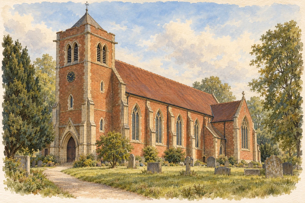
Watercolour and fine ink illustration of St Giles Church in Rowley Regis
Original illustration · St Giles Church in Rowley Regis
Original illustration; researched sources
Research sources

Original composition.

St Giles parish centenary brochure; Church of England: St Giles, Rowley Regis

History & heritage

Place & story

A village and a wider district

Rowley Regis has meant more than the village around St Giles. Historically its Staffordshire townships included Cradley Heath, Old Hill, Black Heath and Tividale. Sandwell’s present town grouping likewise brings several distinct communities together. The industrial histories of those places belong within the larger Rowley story, but should not be mistaken for events all occurring in Rowley village. [4] [3]

Work at home and beneath the hills

Handmade nails were already a substantial local trade in the sixteenth century. Some makers combined their work with smallholdings, so farming and industry occupied the same households. Later accounts describe cottage forges worked by women and children. Chainmaking developed in the early nineteenth century, particularly at Cradley Heath, using small workshops comparable to the nail shops. The district’s industrial growth therefore included work beside the home as well as the exploitation of coal, ironstone and clay. [4]

The hills supplied a different commodity: Rowley Rag, a hard rock quarried for roads, kerbs and setts. The Friends of Rowley Hills identify thirty named quarries of different ages and date the last active quarry’s closure to 2008. The rock could be awkward in use: cobbles became slippery under horses’ feet as traffic polished them. Coal was worked beneath it at Alston and Lye Cross, adding another layer of employment to the quarry landscape. [5]

A church rebuilt by successive generations

St Giles preserves continuity of place through repeated replacement. The Church of England records medieval documentary evidence, nineteenth-century rebuilding and a further reconstruction in 1904–06. Fire destroyed that church in 1913; another rebuilding followed in 1923. The modern building is thus the latest stage of an old parish institution, rather than a medieval church preserved intact. [8]

The parish’s 2023 centenary appeal linked commemoration to practical repairs. It proposed restoring two heritage lamp posts and burying photographs of people connected with Rowley in a time capsule. Earlier churchyard fundraising had sought safer access to family burials and Commonwealth war graves. These projects show remembrance being maintained through local gifts, events and work on the ground. [2] [9]

Private grounds and worked slopes become public places

At Haden Hill in Cradley Heath, the Old Hall and Victorian house tell a story of landed wealth within the wider district. The museum traces substantial Haden family records to seventeenth-century landowners who collected rents and owned mills. Their later house survives beside the Old Hall, now in a park, while museum activities and school visits give the former residence a public educational use. [7] [3]

At Portway Hill, quarrying has left exposed rock beside grassland. The Wildlife Trusts describe warm, sparsely vegetated slopes supporting butterflies, moths, beetles and nesting bees, with peregrines and kestrels overhead. A landscape shaped by extracting stone now also supports wildlife: the quarry face and the habitats around it make industrial and natural history visible together. [6]

Back to contents
Lives connected to this place

Notable people

George Alfred Haden Haden Best: an estate transformed

George Alfred Haden Haden Best inherited the Haden Hill estate in 1877 and began a new house rather than occupying the dilapidated Old Hall. The museum cautiously suggests he intended eventually to replace the older building, where his aunt lived; that enlargement never happened. His local connection is to Haden Hill in Cradley Heath, within the wider Rowley Regis district. [7]

Back to contents
A chronology

Timeline

Rowley Regis through time

  1. Sixteenth century — Nailmaking is established alongside a still partly rural economy. [4]

  2. 1877 — Haden Haden Best inherits the Haden Hill estate. [7]

  3. 1913 — Fire destroys St Giles after its early twentieth-century rebuilding. [8]

  4. 1923 — St Giles is rebuilt again. [8]

  5. 2008 — The Friends of Rowley Hills date the last active quarry’s closure to this year. [5]

  6. 2023 — St Giles marks its centenary with a restoration appeal. [2]

Back to contents

Population over time

Built-up area · Settlement · Census 2021

Rowley Regis

39,050people · 2021

Census 2021 population of the named settlement, using ONS built-up area boundaries.

Published census counts.

Sources: ONS: Towns and cities, characteristics of built-up areas, Census 2021 (Table 1c)

View population figures
Rowley Regis — census population
Census yearPopulation
202139,050
Sources and how to read this chart

Usual residents on 21 March 2021; published ONS count rounded to the nearest 5.. Boundary geography: December 2022 (E63002887).

Census 2021 population of the named settlement, using ONS built-up area boundaries.

ONS Table 1c rounds counts to the nearest 5 and suppresses counts below 10. Matched by exact settlement name or individually reviewed district-qualified name, with its coordinate strictly inside that same official BUA boundary. The 2022 BUA geography changed methodology and cannot be directly compared with 2011 BUAs. Contains OS data © Crown copyright and database right 2026. Contains National Statistics data © Crown copyright and database right 2026.

Source: ONS: Towns and cities, characteristics of built-up areas, Census 2021 (Table 1c). Open Government Licence v3.0. Retrieved 2026-10-26. Source: ONS and Ordnance Survey: Built Up Areas December 2022 GB BGG. Open Government Licence v3.0. Retrieved 2026-10-26.

Neighbourhood census context

These figures describe statistical neighbourhoods, which may cover part of a place or include neighbouring places.

Neighbourhood census area · 1971–2021

Sandwell 029

Population of the area containing the recorded point for Rowley Regis, not the whole place. This area may cover part of the place or include neighbours.

01.8k3.5k5.3k7k1971: 6,164 people19711981: 6,637 people19811991: 6,269 people19912001: 6,400 people20012011: 6,514 people20112021: 6,717 people2021

Includes harmonised historical census estimates.

Sources: ONS · Paul Norman

View population figures
Sandwell 029 — census population and harmonised historical estimates
Census yearPopulation
19716,164
19816,637
19916,269
20016,400
20116,514
20216,717
Sources and how to read this chart

Usual residents of the containing MSOA; this is local area context, not the population of the named settlement.. Boundary geography: 1 April 2022 (E02002071).

2011 and 2021 census counts harmonised by ONS to the same 1 April 2022 geography. Location matched to ONS 2021 MSOA polygons (full resolution, coastline clipped, V7). ONS exact-fit lookup marks this MSOA unchanged from 2011 (U); historical estimates use that same footprint.

1971–2011: Paul Norman harmonised historical estimates on 2011 MSOAs, rounded to whole residents (1971–1991 are modelled). 2021: ONS census count. The historical 2011 total can differ slightly from the ONS change-over-time 2011 total because of methodology and statistical disclosure controls. These are area estimates, not settlement totals.

Source: ONS Census change over time: usual resident population, 2011 and 2021. Open Government Licence v3.0. Retrieved 2026-10-26. Source: ONS MSOA December 2021 boundaries EW BFC V7. Open Government Licence v3.0. Retrieved 2026-10-26. Source: Paul Norman — Area characteristics: Great Britain 1971 to 2011. Creative Commons Attribution 4.0. Retrieved 2026-10-26. Source: ONS MSOA 2011 to MSOA 2021 exact-fit lookup for England and Wales. Open Government Licence v3.0. Retrieved 2026-10-26.

Recorded locationRowley Regis52.48421° N · 2.04508° WInteractive map loads when this area enters view.
Approximate recorded location · Geographic source

Geographic context

Place type
Town
Country / region
England · West Midlands
County group
West Midlands
Current administration
Sandwell
Recorded coordinates
52.48421, -2.04508
OS Open Names ID
osgb4000000074566392

County groups are browsing aids. Current administrative and historic areas are recorded separately.

Recorded names

  • Rowley Regis · en · official

Nearby heritage

Distances are from the recorded place point. Proximity does not establish that a site lies within the place boundary or belongs to its history.

Sources & further reading

  1. OS Open Names October 2026 · Source licence.
  2. St Giles centenary brochure: 1923–2023 · St Giles Church, Rowley Regis
  3. Cradley Heath and Old Hill Ward · Sandwell Council
  4. Hawes Lane: archaeological desk-based assessment (2022) · AJ Archaeology
  5. History of the Rowley Hills · Friends of Rowley Hills
  6. Geology highlights: Portway Hill · The Wildlife Trusts
  7. Haden Hill House Museum and Old Hall · Sandwell Museums / Visit Sandwell
  8. Rowley Regis: St Giles · Church of England
  9. Churchyard Restoration · St Giles Church
  10. Original illustration of St Giles Church in Rowley Regis by PlaceHistory. Researched sources are linked beneath the illustration. AI-assisted original watercolour and fine ink composition from inspected factual research; no source photograph was supplied as an image-edit input.

Geographic source retrieved 2026-10-26. History last researched 2026-10-27. How this page was prepared.