Town

Royal Sutton Coldfield

A shared park supported grazing, industry and charitable work before railways brought visitors and commuters to Sutton’s expanding streets.

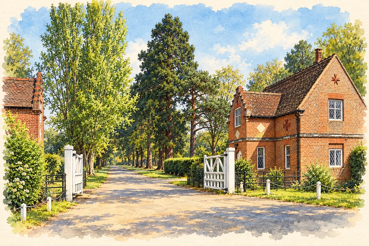
Watercolour and fine ink illustration of Sutton Park entrance lodge and gates
Illustration · Sutton Park entrance lodge and gates
History & heritage

Place & story

A charter and a resource held in common

Sutton’s 1528 royal charter connected self-government with rights in the landscape. Henry VIII placed administration under a warden and society and permitted enclosure of part of the hunting chase for inhabitants. Grazing, fishing and taking game made the park useful to local households. Residents later opposed encroachments, including a 1778 proposal to divide the waste among major landowners. The park’s survival was bound up with defending access to a shared resource. [2]

Common use required management. Historic England describes seven wooded areas, the Seven Hayes, enclosed to keep grazing animals out; timber income was intended to support charities and poor relief. The present mixture of wood, heath and grass should therefore be read as a worked landscape. Its boundaries and internal banks record efforts to accommodate livestock, timber and other uses together. [3]

Water power and provision for the poor

The pools were also places of production. The archaeological survey records a leather mill and later sawmill below Blackroot Pool, while Wyndley’s blade mill became a sawmill in 1840. At Powell’s Pool an experimental cotton-spinning venture preceded spade manufacture and later steel rolling. Sutton’s waters connected changing processes and trades; the attractive pools surviving in the park were part of an economy as well as scenery. [4]

Local government’s charitable obligations had a material presence in the streets. Research based on the Warden and Society’s minutes records the decision in 1737 to dismantle decayed almshouses and use their materials for a workhouse. A new management scheme in 1824 required ten almshouses in the town; further provision followed in outlying districts. Notices of vacancies appeared on church and Town Hall doors. Later municipal charities took over this responsibility, separating the management of relief from the changing corporation. [8]

Education as a lasting institution

Bishop Vesey’s Grammar School dates its foundation to 1527. Its first pupils were chiefly sons of local farmers and shopkeepers, studying grammar, rhetoric and logic. After the original premises deteriorated, the school moved to Lichfield Road in 1729. A changing curriculum gradually added sciences, languages and other subjects. In the twentieth century it became a state grammar school in 1944 and admitted girls to its sixth form in 1983. The institution connects Tudor endowment with later changes in access and education. [6]

Railways bring new residents and day visitors

The railway from Aston opened in 1862, carrying goods as well as passengers. Birmingham’s conservation-area history places it within a wider period of commuter migration from the industrial city. Streets and building plots were already being laid out in the 1850s; the railway added a new route into a town being reshaped for residents and visitors. Special excursion trains also brought people to Sutton Park for boating, swimming, donkey rides and refreshments. [5] [10]

The Royal Hotel, begun in 1863 and opened in 1865, embodied expectations of a prosperous visitor trade. It did not fulfil those hopes. After a period as a sanatorium, the Borough Council acquired the building in 1904 and added the Town Hall. Tourism investment thus became civic infrastructure; an extension also served as a fire station. The building’s successive uses show how one ambitious development could be adapted to different public needs. [5] [7]

A park and town within a larger city

During the First World War the park held military huts and convalescent camps for wounded Australians and New Zealanders. Recovery joined training among its wartime uses. [2]

In 1957 35,000 Scouts from 37 countries camped for the World Jubilee Jamboree. A commemorative stone marks the gathering, adding international fellowship to the park’s long record of public uses. [11]

Sutton became a municipal borough in 1886 and part of Birmingham in 1974. Those administrative changes should be distinguished from its older identity as a royal town. Building-plan registers covering 1887–1963 survive in the local history collection, recording owners, architects, builders and inspections. They make the expansion of streets and homes traceable at the scale of individual projects. [9]

Back to contents
Lives connected to this place

Notable people

John Harman, Bishop Vesey: patron in his home town

John Harman, known as Bishop Vesey, was a Sutton native who became Bishop of Exeter. His local significance rests on interventions in the town’s institutions: the royal charter and the grammar school. The school records his residence at Moor Hall and his burial at Holy Trinity, where it continues to hold Founder’s Day. Sutton’s connection is to his origins, residence and patronage, rather than to the seat of his bishopric. [6] [2]

Back to contents
A chronology

Timeline

Sutton Coldfield through time

  1. 1527 — Bishop Vesey founds the grammar school. [6]

  2. 1528 — The royal charter gives inhabitants common grazing and woodland rights in the park. [3]

  3. 1729 — The grammar school moves to Lichfield Road. [6]

  4. 1824 — A management scheme provides for ten town almshouses. [8]

  5. 1862 — The Aston railway opens to goods and passengers. [5]

  6. 1886 — Sutton becomes a municipal borough. [9]

  7. 1904 — The Borough Council takes over the former Royal Hotel. [7]

  8. 1957 — Sutton Park hosts the World Jubilee Jamboree. [11]

  9. 1974 — Sutton becomes part of Birmingham. [9]

Back to contents

Population over time

Built-up area · Settlement · Census 2021

Royal Sutton Coldfield

93,375people · 2021

Census 2021 population of the named settlement, using ONS built-up area boundaries.

Published census counts.

Sources: ONS: Towns and cities, characteristics of built-up areas, Census 2021 (Table 1c)

View population figures
Royal Sutton Coldfield — census population
Census yearPopulation
202193,375
Sources and how to read this chart

Usual residents on 21 March 2021; published ONS count rounded to the nearest 5.. Boundary geography: December 2022 (E63002760).

Census 2021 population of the named settlement, using ONS built-up area boundaries.

ONS Table 1c rounds counts to the nearest 5 and suppresses counts below 10. Matched by exact settlement name or individually reviewed district-qualified name, with its coordinate strictly inside that same official BUA boundary. The 2022 BUA geography changed methodology and cannot be directly compared with 2011 BUAs. Contains OS data © Crown copyright and database right 2026. Contains National Statistics data © Crown copyright and database right 2026.

Source: ONS: Towns and cities, characteristics of built-up areas, Census 2021 (Table 1c). Open Government Licence v3.0. Retrieved 2026-10-26. Source: ONS and Ordnance Survey: Built Up Areas December 2022 GB BGG. Open Government Licence v3.0. Retrieved 2026-10-26.

Neighbourhood census context

These figures describe statistical neighbourhoods, which may cover part of a place or include neighbouring places.

Neighbourhood census area · 1971–2021

Birmingham 009

Population of the area containing the recorded point for Royal Sutton Coldfield, not the whole place. This area may cover part of the place or include neighbours.

02.3k4.5k6.8k9k1971: 6,653 people19711981: 7,439 people19811991: 7,582 people19912001: 7,686 people20012011: 8,163 people20112021: 8,472 people2021

Includes harmonised historical census estimates.

Sources: ONS · Paul Norman

View population figures
Birmingham 009 — census population and harmonised historical estimates
Census yearPopulation
19716,653
19817,439
19917,582
20017,686
20118,163
20218,472
Sources and how to read this chart

Usual residents of the containing MSOA; this is local area context, not the population of the named settlement.. Boundary geography: 1 April 2022 (E02001835).

2011 and 2021 census counts harmonised by ONS to the same 1 April 2022 geography. Location matched to ONS 2021 MSOA polygons (full resolution, coastline clipped, V7). ONS exact-fit lookup marks this MSOA unchanged from 2011 (U); historical estimates use that same footprint.

1971–2011: Paul Norman harmonised historical estimates on 2011 MSOAs, rounded to whole residents (1971–1991 are modelled). 2021: ONS census count. The historical 2011 total can differ slightly from the ONS change-over-time 2011 total because of methodology and statistical disclosure controls. These are area estimates, not settlement totals.

Source: ONS Census change over time: usual resident population, 2011 and 2021. Open Government Licence v3.0. Retrieved 2026-10-26. Source: ONS MSOA December 2021 boundaries EW BFC V7. Open Government Licence v3.0. Retrieved 2026-10-26. Source: Paul Norman — Area characteristics: Great Britain 1971 to 2011. Creative Commons Attribution 4.0. Retrieved 2026-10-26. Source: ONS MSOA 2011 to MSOA 2021 exact-fit lookup for England and Wales. Open Government Licence v3.0. Retrieved 2026-10-26.

Recorded locationRoyal Sutton Coldfield52.56310° N · 1.82313° WInteractive map loads when this area enters view.
Approximate recorded location · Geographic source

Geographic context

Place type
Town
Country / region
England · West Midlands
County group
West Midlands
Current administration
Birmingham
Recorded coordinates
52.56310, -1.82313
OS Open Names ID
osgb4000000074540887

County groups are browsing aids. Current administrative and historic areas are recorded separately.

Recorded names

  • Royal Sutton Coldfield · en · official

Nearby heritage

Distances are from the recorded place point. Proximity does not establish that a site lies within the place boundary or belongs to its history.

Sources & further reading

  1. OS Open Names October 2026 · Source licence.
  2. Sutton Park: history · Birmingham City Council
  3. Sutton Park registered landscape · Historic England
  4. Sutton Park archaeological ground survey · Archaeological ground survey / Archaeology Data Service
  5. High Street Conservation Area: Detailed Development History · Birmingham City Council
  6. Our History · Bishop Vesey’s Grammar School
  7. Sutton Town Centre Heritage Trail · Royal Sutton Coldfield Town Council / Civic Society
  8. Almshouses/Mill Street [150] · Roger Lea / Sutton Coldfield Local History Research Group
  9. Sutton Coldfield: Availability of Building Plans · Janet Lillywhite / Sutton Coldfield Local History Research Group
  10. Sutton Park: Wyndley Pool archive photograph · Historic England Archive
  11. Sutton Park · Birmingham City Council
  12. Illustration of Sutton Park entrance lodge and gates, adapted from Gate and Lodge, Sutton Park - geograph.org.uk - 7480358.jpg by Des Blenkinsopp. CC BY-SA 2.0. AI-assisted watercolour and fine ink adaptation; incidental clutter simplified, warm cream paper margins. Architectural forms follow the inspected reference.

Geographic source retrieved 2026-10-26. History last researched 2026-10-27. How this page was prepared.