Town

Smethwick

Canal-side factories made Smethwick an engineering town. Its streets also tell a history of workers' housing, migration and resistance to racial exclusion.

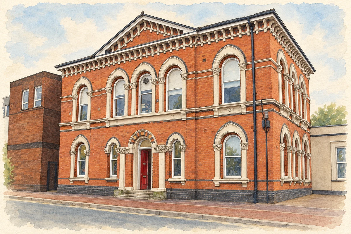
Watercolour and fine ink illustration of Smethwick Library
Illustration · Smethwick Library
History & heritage

Place & story

The canal creates a manufacturing town

Smethwick was within Harborne parish. The canal opened in 1769, attracting foundries, rolling mills and glassworks. Crowded terraces followed the factories. Proper sewage and drainage works began only in the 1880s: industrial growth and healthy housing did not advance together. [5]

Making complete steam engines

Soho Foundry was constructed around 1795–97 as an integrated engineering works. Furnaces and casting were combined with a steam-powered boring mill, engineering shops, stores, offices and workers' housing. Instead of treating the foundry as a single celebrated building, this arrangement shows the coordination of materials, machining and labour required to produce an engine. Foundry and engineering work continued on the site into the mid-twentieth century. [3]

The three famous Soho sites were geographically distinct. The Manufactory and Mint stood in Handsworth, now Birmingham; the Foundry stood in Smethwick. Historic England's research places the latter's establishment with the second generation of Boulton and Watt, especially James Watt junior. The prospect of competing engine makers and the loss of cylinder supplies helped make integrated manufacture urgent. [4]

Glass, casting and changing livelihoods

Smethwick's skills extended beyond engine manufacture. The Chance family acquired their Spon Lane glassworks in 1822 and supplied glazing for the Crystal Palace in 1851. When stained-glass production ceased in 1867, artists including Thomas Camm established independent businesses in the town. Industrial change could disperse skills as well as concentrate them inside a large works. [5]

A crossing over a new route

Thomas Telford's Galton Bridge, built in 1829, carried Roebuck Lane over the New Main Line canal cutting. Its single iron arch spans about 46 metres. The high roadway allowed people to cross a landscape substantially excavated for transport. Later conversion to pedestrian use gave this piece of canal engineering a different place in everyday movement. [2]

Housing and racial exclusion

In the 1960s, new residents from the Caribbean and Indian subcontinent arrived as industrial employment was beginning to contract. Smethwick's housing became the focus of a struggle over who could belong. Connecting Histories records attempts by local Conservatives to use council property purchases in Marshall Street to prevent Black and Asian people buying homes there, and the opposition that these plans provoked. [5] [6] [7]

This local conflict acquired an international witness in Malcolm X. His visit to Marshall Street expressed solidarity with people resisting racial discrimination in housing. The Connecting Histories exhibition places the episode within a struggle involving local residents and organisations, rather than presenting the visitor as the sole agent of change. [6]

Back to contents
Lives connected to this place

Notable people

William Murdoch: engineering and gas lighting

William Murdoch returned from Cornwall to Soho Foundry in 1798 to tackle vibration in the boring machinery. He introduced small engines dedicated to individual boring machines, and extended his experiments with gas lighting. A retort in his laboratory supplied gas to the main foundry building that December. His Smethwick connection combines practical production problems with a new way of lighting factory work. [4]

Malcolm X: a brief, documented visit

Malcolm X visited Marshall Street on 12 February 1965. MACE's catalogue of ATV news film describes him beside the street sign, looking at a house's sale notice and meeting reporters. The local connection is a particular visit to a contested housing area; it should not be confused with residence in Smethwick. [7]

Back to contents
A chronology

Timeline

Smethwick through time

  1. 1769 — The canal helps attract industrial works to Smethwick. [5]

  2. c.1795–97 — Soho Foundry is built for integrated engine production. [3]

  3. December 1798 — Murdoch lights the foundry with gas. [4]

  4. 1822 — The Chance family acquires the Spon Lane glassworks. [5]

  5. 1829 — Galton Bridge carries Roebuck Lane over Telford's canal cutting. [2]

  6. 12 February 1965 — Malcolm X visits Marshall Street. [7]

Back to contents

Population over time

Built-up area · Settlement · Census 2021

Smethwick

56,340people · 2021

Census 2021 population of the named settlement, using ONS built-up area boundaries.

Published census counts.

Sources: ONS: Towns and cities, characteristics of built-up areas, Census 2021 (Table 1c)

View population figures
Smethwick — census population
Census yearPopulation
202156,340
Sources and how to read this chart

Usual residents on 21 March 2021; published ONS count rounded to the nearest 5.. Boundary geography: December 2022 (E63002889).

Census 2021 population of the named settlement, using ONS built-up area boundaries.

ONS Table 1c rounds counts to the nearest 5 and suppresses counts below 10. Matched by exact settlement name or individually reviewed district-qualified name, with its coordinate strictly inside that same official BUA boundary. The 2022 BUA geography changed methodology and cannot be directly compared with 2011 BUAs. Contains OS data © Crown copyright and database right 2026. Contains National Statistics data © Crown copyright and database right 2026.

Source: ONS: Towns and cities, characteristics of built-up areas, Census 2021 (Table 1c). Open Government Licence v3.0. Retrieved 2026-10-26. Source: ONS and Ordnance Survey: Built Up Areas December 2022 GB BGG. Open Government Licence v3.0. Retrieved 2026-10-26.

Neighbourhood census context

These figures describe statistical neighbourhoods, which may cover part of a place or include neighbouring places.

Neighbourhood census area · 1971–2021

Sandwell 028

Population of the area containing the recorded point for Smethwick, not the whole place. This area may cover part of the place or include neighbours.

05k10k15k20k1971: 10,493 people19711981: 9,904 people19811991: 8,579 people19912001: 8,001 people20012011: 9,176 people20112021: 10,338 people2021

Includes harmonised historical census estimates.

Sources: ONS · Paul Norman

View population figures
Sandwell 028 — census population and harmonised historical estimates
Census yearPopulation
197110,493
19819,904
19918,579
20018,001
20119,176
202110,338
Sources and how to read this chart

Usual residents of the containing MSOA; this is local area context, not the population of the named settlement.. Boundary geography: 1 April 2022 (E02002070).

2011 and 2021 census counts harmonised by ONS to the same 1 April 2022 geography. Location matched to ONS 2021 MSOA polygons (full resolution, coastline clipped, V7). ONS exact-fit lookup marks this MSOA unchanged from 2011 (U); historical estimates use that same footprint.

1971–2011: Paul Norman harmonised historical estimates on 2011 MSOAs, rounded to whole residents (1971–1991 are modelled). 2021: ONS census count. The historical 2011 total can differ slightly from the ONS change-over-time 2011 total because of methodology and statistical disclosure controls. These are area estimates, not settlement totals.

Source: ONS Census change over time: usual resident population, 2011 and 2021. Open Government Licence v3.0. Retrieved 2026-10-26. Source: ONS MSOA December 2021 boundaries EW BFC V7. Open Government Licence v3.0. Retrieved 2026-10-26. Source: Paul Norman — Area characteristics: Great Britain 1971 to 2011. Creative Commons Attribution 4.0. Retrieved 2026-10-26. Source: ONS MSOA 2011 to MSOA 2021 exact-fit lookup for England and Wales. Open Government Licence v3.0. Retrieved 2026-10-26.

Recorded locationSmethwick52.49074° N · 1.96776° WInteractive map loads when this area enters view.
Approximate recorded location · Geographic source

Geographic context

Place type
Town
Country / region
England · West Midlands
County group
West Midlands
Current administration
Sandwell
Recorded coordinates
52.49074, -1.96776
OS Open Names ID
osgb4000000074577520

County groups are browsing aids. Current administrative and historic areas are recorded separately.

Recorded names

  • Smethwick · en · official

Nearby heritage

Distances are from the recorded place point. Proximity does not establish that a site lies within the place boundary or belongs to its history.

Sources & further reading

  1. OS Open Names October 2026 · Source licence.
  2. Galton Bridge, Smethwick · National Transport Trust
  3. Soho Foundry: Historic Buildings Report 124/1996 · RCHME / Historic England
  4. When Soho Led the World · Historic England / George Demidowicz
  5. History · Smethwick Local History Society
  6. Malcolm in Marshall Street (1965) · Connecting Histories / Paul Quigley
  7. Midlands News: 12.02.1965: Malcolm X · Media Archive for Central England
  8. Illustration of Smethwick Library, adapted from Smethwick Library - geograph.org.uk - 2816737.jpg by Stephen Rogerson. CC BY-SA 2.0. AI-assisted watercolour and fine ink adaptation; cream paper margins, simplified fine detail and removal of incidental street clutter.

Geographic source retrieved 2026-10-26. History last researched 2026-10-27. How this page was prepared.