Town

Solihull

A church and market served Solihull's rural hinterland. Rail commuting, motor manufacture and shopping redevelopment later changed both its livelihoods and its centre.

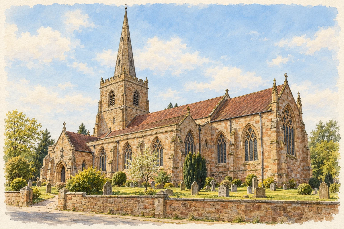
Watercolour and fine ink illustration of St Alphege’s Church, Solihull
Illustration · St Alphege’s Church, Solihull
Original illustration; researched sources
Research sources

Original architectural composition based on the cited building descriptions; incidental setting and fine details are interpretive.

Historic England: Church of Saint Alphege; Solihull Parish: St Alphege

History & heritage

Place & story

A centre among scattered settlements

Solihull is absent by name from Domesday Book, which records the manors of Ulverlei and Longdon. The council connects the town's formation with St Alphege's around 1220 and a weekly market by 1242. Farming and the making of agricultural implements and hunting weapons supported a settlement serving a wooded district. [2]

The market charter also authorised an annual three-day fair. Church and market square gave the medieval town its religious and commercial focus. Fourteenth-century High Street was called La Smythestret, suggesting its blacksmiths. The conservation appraisal describes later textile and leather work alongside carpenters, coopers, millers and other trades; the local economy was broader than farming alone. [3]

Building from the ground up

Solihull's buildings express the resources available to its inhabitants. Local Mercia Mudstone was unsuitable as good building stone, but its clay soils supported oak woodland and supplied material for bricks and tiles. Timber, brick and tile therefore dominated ordinary construction. St Alphege's was an exception, using sandstones brought in from further afield. [4]

The railway expanded that material range. After the station opened in 1852, stone could arrive more cheaply from distant quarries, including granite, gritstone and Portland stone. Brick nevertheless remained central to the growing town, helped by increasingly standardised mass production. Transport altered the appearance of buildings as well as the journeys of their occupants. [4]

Commuting and outward growth

Railway growth was gradual. The conservation appraisal notes that the station's early impact was limited; by the later nineteenth century, commuting between Solihull and Birmingham had increased considerably. New residential roads accommodated business owners and industrialists. The countryside increasingly became a place from which people travelled to work elsewhere. [3]

The council records villas around the old villages and larger houses beside main roads during the 1880s and 1890s. From 1920, estates, schools, factories and playing fields filled land between the Coventry, Warwick and Stratford roads. Solihull's expansion involved everyday services and workplaces as well as commuter homes. [2]

Lode Lane and motor manufacture

Rover occupied a factory in Lode Lane at the beginning of the Second World War, adding manufacturing to residential Solihull. [2]

In 1948, the Land Rover Series I entered full production at Solihull. The manufacturer's history links its aluminium bodywork to post-war steel shortages and the availability of aluminium. Conceived chiefly for farming and agricultural work by Spencer and Maurice Wilks, it became a long-running product: production of the original Defender line finally ended here in January 2016. This factory story gives Solihull a different relationship with the countryside, as a maker of vehicles used to work it. [6]

Saving one house, replacing another

The High Street's timber-framed Manor House never housed the lord of the manor. In 1945 a trust bought it with money raised by public subscription, and it became a community and educational centre. Its survival reflects organised local use, rather than simply the endurance of old timber. [2]

Town-centre shopping brought a different outcome in the 1960s. Mell Square redevelopment removed historic properties in Mill Lane and Drury Lane, including Touchwood Hall. The 2001 Touchwood shopping centre occupied former car parking and land behind High Street properties, including old burgage plots. Modern retailing reshaped the town's inherited land pattern. [3]

Back to contents
Lives connected to this place

Notable people

William de Odingsells: lordship and church patronage

Two generations called William de Odingsells helped shape medieval Solihull. The parish guide credits the elder with the 1242 market charter. His son, knighted in 1283 and later Chief Justiciar of Ireland, sponsored rebuilding at St Alphege's, beginning with the chancel and chantry chapels around 1277. His death in 1295 interrupted the scheme, and the church's rebuilding extended into the sixteenth century. Their local significance lies in patronage and lordship, rather than in a claimed birthplace. [7]

Back to contents
A chronology

Timeline

Solihull through time

  1. 1242 — The market charter provides for weekly trading and an annual fair. [7]

  2. c.1277 — Rebuilding begins with St Alphege's chancel and chantry chapels. [7]

  3. 1852 — Solihull railway station opens. [5]

  4. 1945 — Public subscription helps secure the Manor House for community use. [2]

  5. 1948 — Land Rover Series I production begins at Solihull. [6]

  6. 2001 — Touchwood shopping centre opens. [3]

  7. January 2016 — The original Defender production line ends at Solihull. [6]

Back to contents

Population over time

Built-up area · Settlement · Census 2021

Solihull

107,735people · 2021

Census 2021 population of the named settlement, using ONS built-up area boundaries.

Published census counts.

Sources: ONS: Towns and cities, characteristics of built-up areas, Census 2021 (Table 1c)

View population figures
Solihull — census population
Census yearPopulation
2021107,735
Sources and how to read this chart

Usual residents on 21 March 2021; published ONS count rounded to the nearest 5.. Boundary geography: December 2022 (E63003011).

Census 2021 population of the named settlement, using ONS built-up area boundaries.

ONS Table 1c rounds counts to the nearest 5 and suppresses counts below 10. Matched by exact settlement name or individually reviewed district-qualified name, with its coordinate strictly inside that same official BUA boundary. The 2022 BUA geography changed methodology and cannot be directly compared with 2011 BUAs. Contains OS data © Crown copyright and database right 2026. Contains National Statistics data © Crown copyright and database right 2026.

Source: ONS: Towns and cities, characteristics of built-up areas, Census 2021 (Table 1c). Open Government Licence v3.0. Retrieved 2026-10-26. Source: ONS and Ordnance Survey: Built Up Areas December 2022 GB BGG. Open Government Licence v3.0. Retrieved 2026-10-26.

Neighbourhood census context

These figures describe statistical neighbourhoods, which may cover part of a place or include neighbouring places.

Neighbourhood census area · 1971–2021

Solihull 019

Population of the area containing the recorded point for Solihull, not the whole place. This area may cover part of the place or include neighbours.

01.8k3.5k5.3k7k1971: 4,042 people19711981: 4,782 people19811991: 5,444 people19912001: 6,081 people20012011: 6,550 people20112021: 6,900 people2021

Includes harmonised historical census estimates.

Sources: ONS · Paul Norman

View population figures
Solihull 019 — census population and harmonised historical estimates
Census yearPopulation
19714,042
19814,782
19915,444
20016,081
20116,550
20216,900
Sources and how to read this chart

Usual residents of the containing MSOA; this is local area context, not the population of the named settlement.. Boundary geography: 1 April 2022 (E02002099).

2011 and 2021 census counts harmonised by ONS to the same 1 April 2022 geography. Location matched to ONS 2021 MSOA polygons (full resolution, coastline clipped, V7). ONS exact-fit lookup marks this MSOA unchanged from 2011 (U); historical estimates use that same footprint.

1971–2011: Paul Norman harmonised historical estimates on 2011 MSOAs, rounded to whole residents (1971–1991 are modelled). 2021: ONS census count. The historical 2011 total can differ slightly from the ONS change-over-time 2011 total because of methodology and statistical disclosure controls. These are area estimates, not settlement totals.

Source: ONS Census change over time: usual resident population, 2011 and 2021. Open Government Licence v3.0. Retrieved 2026-10-26. Source: ONS MSOA December 2021 boundaries EW BFC V7. Open Government Licence v3.0. Retrieved 2026-10-26. Source: Paul Norman — Area characteristics: Great Britain 1971 to 2011. Creative Commons Attribution 4.0. Retrieved 2026-10-26. Source: ONS MSOA 2011 to MSOA 2021 exact-fit lookup for England and Wales. Open Government Licence v3.0. Retrieved 2026-10-26.

Recorded locationSolihull52.41275° N · 1.77755° WInteractive map loads when this area enters view.
Approximate recorded location · Geographic source

Geographic context

Place type
Town
Country / region
England · West Midlands
County group
West Midlands
Current administration
Solihull
Recorded coordinates
52.41275, -1.77755
OS Open Names ID
osgb4000000074577980

County groups are browsing aids. Current administrative and historic areas are recorded separately.

Recorded names

  • Solihull · en · official

Nearby heritage

Explore recorded heritage in Solihull and the surrounding area. This selection is based on proximity to a recorded settlement point; it is not a complete inventory or evidence that a site lies within the settlement or belongs to its history.

Heritage locationsSolihull & surrounding areaInteractive map loads when this area enters view. Source records are listed below.

Numbered markers match the source records below. Locations are recorded reference points, not site boundaries.

  1. 116-120, HIGH STREET · Listed building
  2. 124, HIGH STREET · Listed building
  3. 126, HIGH STREET · Listed building
  4. 130 AND 134, HIGH STREET · Listed building
  5. THE MALT SHOVEL INN · Listed building
  6. 144, HIGH STREET · Listed building
  7. 165, HIGH STREET · Listed building
  8. 158, HIGH STREET · Listed building

Sources & further reading

  1. OS Open Names October 2026 · Source licence.
  2. Solihull town history · Solihull Metropolitan Borough Council
  3. Solihull Conservation Area Appraisal and Management Plan · Solihull Metropolitan Borough Council
  4. Solihull Trail: geology and building materials · Warwickshire Geological Conservation Group
  5. Solihull Station, Historic England Research Records · Historic England / Heritage Gateway
  6. Last of the Current Land Rover Defenders is Built in Solihull · Jaguar Land Rover
  7. St Alphege Church Guide, third edition 2019 · Solihull Parish
  8. Original illustration of St Alphege’s Church, Solihull by PlaceHistory. Researched sources are linked beneath the illustration. Original composition from inspected architectural facts; no source photograph copied or used as an image-edit input. Fine detail is interpretive, not a measured survey.

Geographic source retrieved 2026-10-26. History last researched 2026-10-27. How this page was prepared.