A river crossing became a market town, a centre of glassmaking and an exporter of railway engineering. Its schools, parks and public buildings tell a parallel story of learning, charity and civic life.
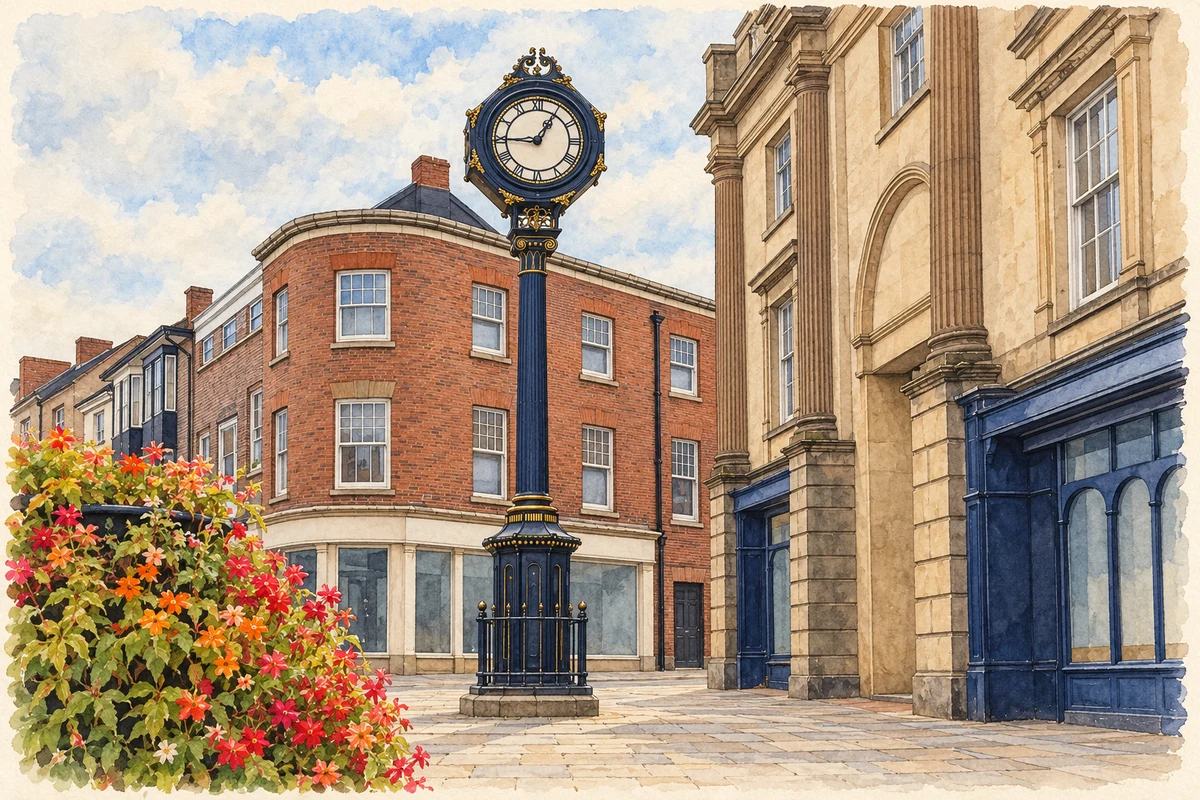
Illustration · Stourbridge Town Clock
History & heritage
Place & story
A market town beneath the industrial story
The name Stourbridge remembers the crossing of the River Stour. In his Worcestershire Place Names of 1905, W. H. Duignan recorded the fourteenth-century form Stourbrugge, explaining brugge as a Middle English word for bridge. The name points towards movement and exchange long before the canals and locomotives that would later make the town famous.[11]
Stourbridge has a history beyond its celebrated glassworks. Dudley Council identifies a surviving late medieval market-town character, with the market in Lower High Street receiving its charter around 1482. Shops, public buildings and places of worship offer another starting point for understanding a town better known for its furnaces.[3]
The glassmaking district extended into Wordsley, Amblecote and Brierley Hill: “Stourbridge glass” describes a manufacturing area extending beyond the town centre.[2]
Skills from Lorraine, fuel from the coalfield
Glassmakers from Lorraine in north-eastern France established the industry in the early seventeenth century, using local coal and fireclay. Dudley Council identifies Coleman’s Glasshouse at Lye, built in the early 1600s, as probably the district’s first glasshouse. The qualification leaves its precise beginnings open.[2]
Early glasshouses made bottles and window glass; lead-glass tableware followed towards the seventeenth century’s end. Later production included technical glass as well as decorative work. The industry served practical needs alongside the luxury market.[2]
Reading the Red House Glass Cone
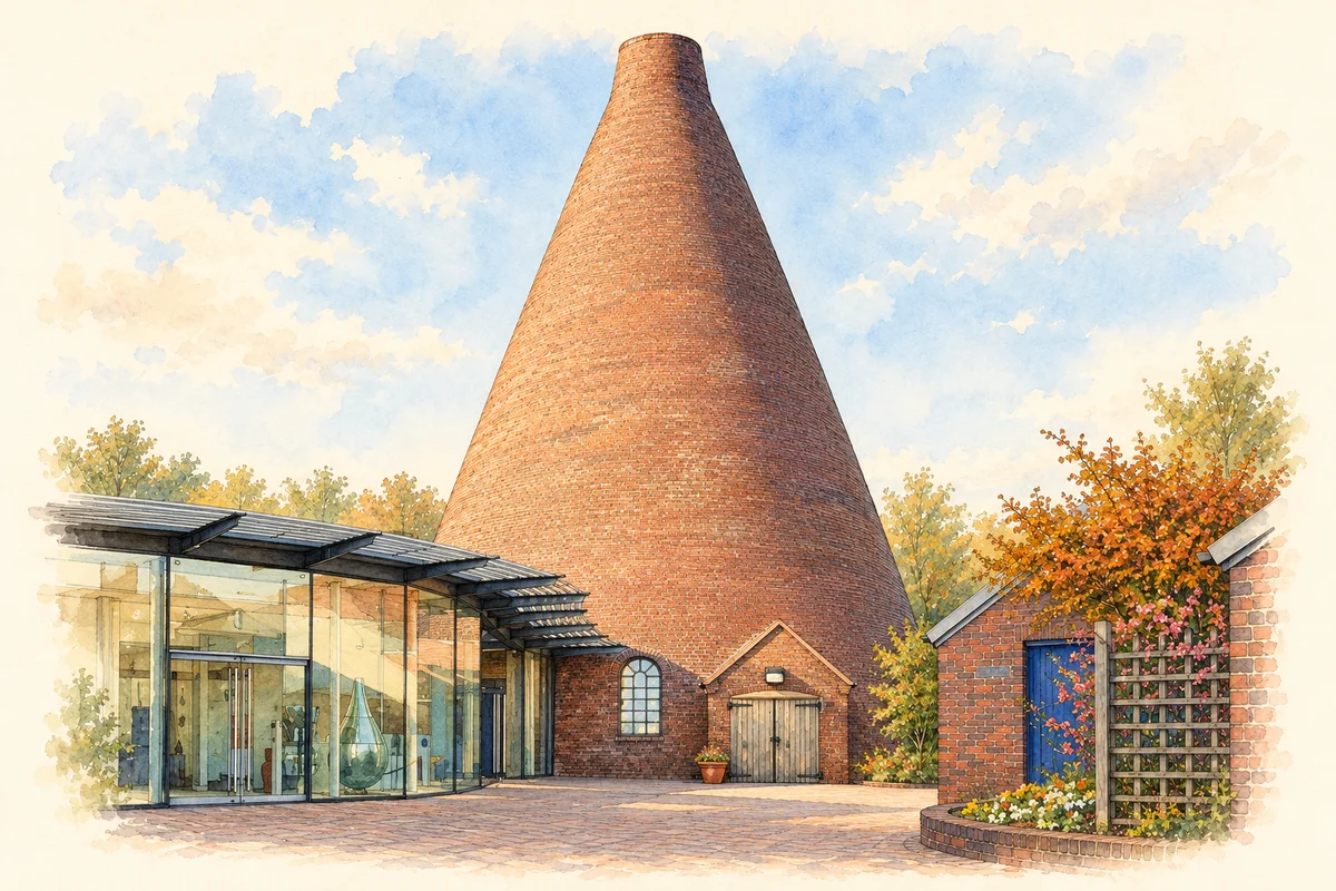
The Red House Glass Cone at Wordsley makes the scale of glassmaking visible. Historic England records that Richard Bradley purchased the site in 1788 and developed the works soon afterwards; the cone appears in documents following his death in 1796. Its surviving brick shell rises 22.4 metres. The architecture was part of the manufacturing equipment, rather than simply a roof over a workshop.[4]
A cone sheltered workers and furnace while drawing air through the fire like a chimney, increasing its heat.[2]
The cone was only one element of a much larger workplace. An 1827 inventory recorded a ten-pot furnace, twelve glassmakers’ chairs, a place for drying new melting pots, and two tunnel lehrs in which glass cooled gradually. Offices, showrooms and warehouses occupied the corner beside road and canal. Across Wordsley High Street, the Whitehouse and Newhouse works preserve further standing and buried remains. Together they reveal production, controlled cooling, storage and sale within a closely packed industrial landscape.[4]
Illustration · Red House Glass Cone, Wordsley
The canal as a working connection
Water transport had an unsuccessful early chapter here. According to the Canal & River Trust, Andrew Yarranton completed works to make the River Stour navigable by 1667, following an Act of 1662, but floods destroyed the undertaking three years later. The later Stourbridge Canal offered a more durable connection. Completed in 1779, it linked the Staffordshire & Worcestershire Canal at Stourton with the Dudley Canal, connecting local industry with the Severn and the wider canal network. Coal and other supplies could reach the glassworks by water.[5]
Glassmakers helped finance the canal, and surviving wharves show how closely factories depended on it. Manufacture, storage and transport occupied adjoining spaces rather than separate worlds.[4]
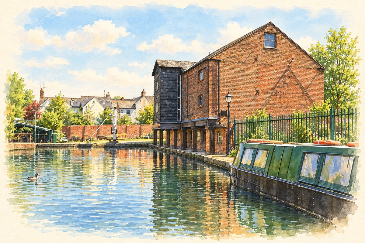
The council’s heritage trail contrasts canal transport with rough tracks and packhorse journeys for fragile glass. At the town end, the Bonded Warehouse was built in 1799 for taxable goods including tea, tobacco and spirits. Canal Street also served distribution and commerce.[6]
Illustration · Bonded Warehouse beside the Stourbridge Canal Town Arm
A locomotive crosses the Atlantic
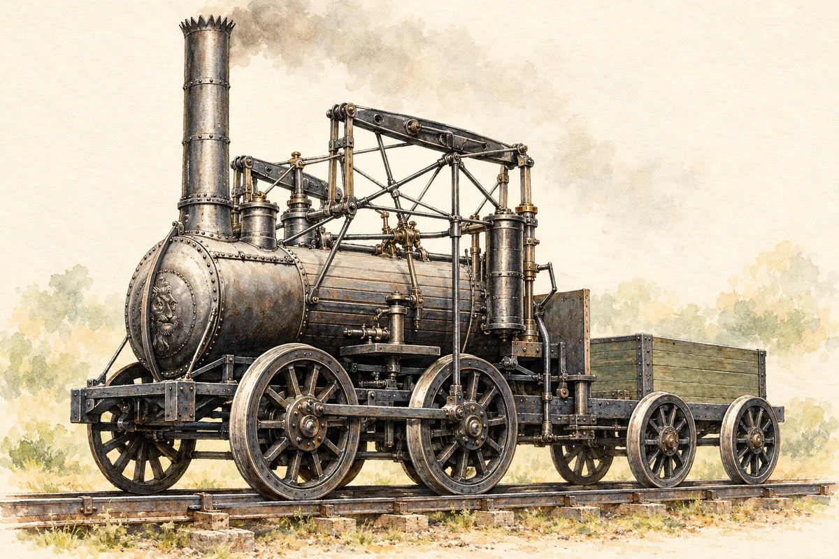
Foster, Rastrick & Co. built the Stourbridge Lion for the Delaware and Hudson Canal Company. Its railway at Honesdale, Pennsylvania, linked coal mines to a canal. The Smithsonian identifies the engine’s test on 8 August 1829 as the first steam-locomotive operation in the Western Hemisphere, connecting Stourbridge’s engineering with the early history of American railways.[7]
The seven-ton engine performed well but was too heavy for the track. Retired after a second test that September, its boiler later powered a stationary foundry engine before donation to the Smithsonian in 1890.[7]
Back in Stourbridge, the former Foster Rastrick foundry shell was incorporated into the Lion Medical Centre, retaining historic features within a new use. A surviving building can preserve evidence of engineering even after its original machinery and trade have gone.[8]
An artistic reconstruction based on historical drawings and museum research, showing how the Stourbridge Lion may have appeared in 1829. It is not a contemporary image or an engineering drawing.
Evidence and interpreted details
Uncertain details: Colours, fine pipework, small mechanical fittings and tender details are interpretive. The track and landscape do not reconstruct a particular location.
In Market Street, St Thomas’s Church offers an eighteenth-century counterpoint to the industrial sites. Historic England dates the red-brick church to 1726 and describes its stone dressings, western tower and round-headed windows. Inside, a richly panelled barrel vault gives the rectangular, aisled building a different character from a medieval parish church. The chancel was added in 1890 in a sympathetic style. The building is Grade I listed, making it a significant part of the town’s architectural inheritance in its own right.[9]
The Town Hall represents a later civic confidence. Designed by Thomas Robinson and dated 1887, it marked Queen Victoria’s Golden Jubilee. Its elaborate red brick, shaped gables and roof cupola reward a closer look from Market Street. Historic England’s description also records shops at ground level in the flanking pavilion blocks: commercial premises formed part of this public architectural composition. Church and hall place two distinct periods of urban building within the market-town centre.[10][3]
Learning, leisure and everyday life
Industry also left an educational inheritance. Thomas Foley, an ironmaster, MP and landowner, founded Old Swinford Hospital in 1667 to educate sixty boys from families nominated by particular parishes. Its trustees were called Feoffees, and included his sons. The school’s own account of its early pupils describes reading, writing, arithmetic and religious instruction, a day beginning at six in the morning and ending at eight in the evening, and blue suits and stockings. Such details reveal how charity shaped a child’s food, clothing and daily routine as well as his schooling.[12][13]
Education had roots in the town centre too. Dudley Council traces the history of King Edward VI College to 1430 and dates its surviving nineteenth-century buildings to 1861. Alongside the market and churches, this puts learning within the older town’s story. The glass district later developed its own ways of passing on specialist skills: in the 1960s Stourbridge Glass College at Brierley Hill employed experienced workers from the crystal firms as tutors. Factory knowledge could become the starting point for a new generation’s contemporary glass.[3][14]
Public spaces carried memories as well as recreation. Stourbridge’s war memorial was unveiled in 1923, designed by E. W. Pickford with sculpture by John Cassidy. A town-centre road scheme prompted its move to Mary Stevens Park in 1968. The park brings remembrance into a setting of pool, bandstand, gardens and games. Dudley Council’s account of its 2014–17 restoration records work on the gates, bandstand, memorial and Heath Pool, together with a café: care for this inheritance involves ordinary places to meet and spend time, alongside the conservation of monuments.[15][16]
What survives beyond the furnace
A 2014 excavation at the Ruskin Glass Centre and Glasshouse Heritage Centre site uncovered two seventeenth-century glasshouses. The council’s trail also identifies glassmakers’ graves at Holy Trinity, Wordsley, and those of Bohemian engravers Adolph Zinke and William Fritsche at Holy Trinity, Amblecote. Buried remains and memorials add individual working lives to the surviving industrial buildings.[6]
The canal fell into dereliction in the 1960s before restoration. The Bonded Warehouse escaped threatened demolition in the 1980s and became a community facility: survival required active rescue as well as a change of use.[5]
Together, the cone, workshops and wharves make it possible to read this history as a linked system of making, moving and selling goods. Their importance lies partly in their relationships: the glassworks needed transport, the canal carried the products, and commercial buildings connected manufacture to its customers.[4]
John Urpeth Rastrick came to Stourbridge with experience gained in Northumberland and Shropshire. Born at Morpeth in 1780, he worked with the Hazledines at Bridgnorth and helped construct Richard Trevithick’s Catch me who Can locomotive in 1808. His partnership with James Foster at Stourbridge followed around 1819. The Lion belongs within this longer career of bridges, machinery and railways, rather than standing as an isolated flash of invention.[17]
Foster, Rastrick & Co. made only four locomotives before the company was dissolved in June 1831. Rastrick subsequently worked on several railway schemes, including lines that became part of the London, Brighton & South Coast Railway. His surviving papers at Senate House Library contain correspondence, engineering drawings and calculations, some written in a private cipher. They offer a different view of engineering achievement: a working life of estimates, letters and problems to solve, behind the finished machine.[18][17]
Thomas Webb: a family firm in the wider glass district
Thomas Webb’s name is closely associated with Stourbridge glass, but the geography matters. Dudley Archives records the company’s formation in 1836, its establishment at the Platts in Amblecote in 1840 and its move to nearby Dennis Glassworks by 1855. Webb and his family lived at Dennis Hall. After his death in 1865, his son Thomas Wilkes Webb took over. The family’s place in this history is that of glass manufacturers in the surrounding district, with works and homes beyond the central market streets.[19]
The firm’s products won the Grand Prix at the Paris exhibitions of 1878 and 1889. Yet the name on the glass also stood for many other people’s skill. Brothers Thomas and George Woodall worked at Webb’s and helped develop its celebrated cameo production. The company archive preserves personnel records and design books alongside financial and administrative papers. Those records connect the finished objects with employment, design decisions and the day-to-day organisation of a successful factory.[19]
John Northwood: carving a new life for ancient glass
John Northwood’s replica of the Portland Vase turned an ancient object into a challenge for the Wordsley glass industry. The Corning Museum of Glass explains how Benjamin Richardson offered a substantial reward for a reproduction in cameo glass. Philip Pargeter supervised the making of a layered glass blank in 1873; Daniel Hancock blew it. Northwood then carved one of Pargeter’s blanks between 1873 and 1876. The result depended on collaboration between the people who made the vessel and the craftsman who cut away its surface.[20]
The replica, now in Corning’s collection, has a cobalt-blue body decorated with a carved cameo scene. It was not Northwood’s first experiment with cameo carving, but the museum identifies its public acclaim as a stimulus to commissions and a wider nineteenth-century fashion. That makes it a useful object through which to understand Stourbridge’s reputation: technical experiment, knowledge of older art and patient handwork could together create a new market.[20]
Ernest and Mary Stevens: industry and public care
Ernest Stevens’s wealth came from enamelled cookware, including Judge ware. Mary Stevens had her own record of public service: the council-hosted history of Mary Stevens Park describes her involvement in founding a Stourbridge health centre and her support for the Corbett Hospital. After she died in 1925, Ernest made further gifts to the community. Their story joins the fortunes made in local manufacture to concerns about health and the conditions in which people lived.[21]
Mary Stevens Park preserves her name. Its gift deed was dated 6 December 1929, and the park opened to the public in 1931 with tennis courts, a cricket pitch, bowling and croquet greens, a play area and ornamental flower beds. The dates mark different stages: the gift of the estate and the creation of a public park. What had been private grounds became part of the town’s shared daily life, with space for children, games and rest.[21]
Frank Foley: a retirement home and a public memorial
Frank Foley’s connection with Stourbridge belongs to the later part of his life. After retiring, he lived in Eveson Road until his death in 1958. His earlier work had taken place in Berlin, where he served as an MI6 officer under cover of a passport-control post. Dudley Council’s account describes his provision of visas and passports to help Jewish people escape Nazi persecution before the Second World War, as well as sheltering people in his home.[22]
In 2018 Prince William unveiled Foley’s statue in Mary Stevens Park. The bronze shows him seated on a bench, feeding a bird perched on his case. The council reported that members of his family and descendants of people he helped attended the unveiling. A public park thus became the setting for remembering a former resident whose most consequential work happened elsewhere, and whose association with Stourbridge began in retirement.[22]
The census boundaries changed. These are the totals published for each census area. Differences can reflect both population and boundary changes; the dots are not a like-for-like growth curve.
Each census uses its published settlement definition
Year
Population
Area counted
1991
55,624
Urban-area subdivision
2001
55,480
Urban-area subdivision
2011
63,298
Built-up-area subdivision
2021
56,950
Built-up area
Boundaries, sources and how to compare
1991 · Stourbridge — 1991 urban subdivision
This published census observation uses the 1991 urban subdivision. Its boundary has not been harmonised with later Stourbridge settlement definitions; differences do not establish like-for-like growth or decline.
Persons resident in the Stourbridge constituent subdivision, ONS 1991 urban-area tables Boundary reference: 1991 Census urban subdivision (ONS-1991-WestMidlands-Stourbridge). Original ONS constituent-parts page linked from the 1991 Top 50 Urban Areas page. Native numeric geography identifier not supplied on the archived page.
The published 2001 urban subdivision differs from the 2011 built-up area subdivision and 2022 built-up area. Boundaries have not been harmonised; changes between these observations do not measure like-for-like population growth or decline.
All usual residents in Census 2001, original ONS urban-area Table KS01, counts worksheet row 1342 Boundary reference: 2001 Census urban subdivision (G90709). Direct ONS published town count, retrieved from the archived original workbook. The workbook does not provide a 1991 urban-subdivision count.
2011 · Stourbridge — 2011 built-up area subdivision
The 2011 settlement boundary differs from the 2001 urban subdivision and 2022 built-up area. This observation cannot be used with those totals to calculate like-for-like growth or decline.
All usual residents on 27 March 2011, Census 2011 table KS101EW, published directly by ONS through Nomis Boundary reference: March 2011 built-up area subdivision (E35000427). Direct published count; no output-area aggregation or harmonisation. Geography and census definition change between observations.
Total persons reported for Stourbridge at each census in John Marshall’s 1835 tabulation, printed page 174, row reference 97. Boundary geography: Early nineteenth-century town as tabulated in 1835 (Marshall-1835-p174-row97).
These figures describe the historic town. They are not a population series on today’s built-up-area boundary; the areas have not been harmonised.
Original printed row and column headings visually checked independently twice. Only 1801, 1811 and 1821 are included. The 1831 entry is withheld pending resolution of conflicting published figures. Points are separate observations; no growth rate or connecting line is inferred.
These figures describe statistical neighbourhoods, which may cover part of a place or include neighbouring places.
Neighbourhood census area · 1971–2021
Dudley 035
Population of the area containing the recorded point for Stourbridge, not the whole place. This area may cover part of the place or include neighbours.
Dudley 035 — census population and harmonised historical estimates
Census year
Population
1971
8,301
1981
7,481
1991
7,979
2001
7,870
2011
8,109
2021
8,168
Sources and how to read this chart
Usual residents of the containing MSOA; this is local area context, not the population of the named settlement.. Boundary geography: 1 April 2022 (E02002034).
2011 and 2021 census counts harmonised by ONS to the same 1 April 2022 geography. Location matched to ONS 2021 MSOA polygons (full resolution, coastline clipped, V7). ONS exact-fit lookup marks this MSOA unchanged from 2011 (U); historical estimates use that same footprint.
1971–2011: Paul Norman harmonised historical estimates on 2011 MSOAs, rounded to whole residents (1971–1991 are modelled). 2021: ONS census count. The historical 2011 total can differ slightly from the ONS change-over-time 2011 total because of methodology and statistical disclosure controls. These are area estimates, not settlement totals.
Illustration of Bonded Warehouse beside the Stourbridge Canal Town Arm, adapted from Bonded Warehouse beside the Stourbridge Canal Town Arm by Christine Johnstone. CC BY-SA 2.0. AI-assisted watercolour and fine ink adaptation; landscape composition, warm cream margins, simplified incidental detail and interpreted lighting and foliage.
Illustration of Red House Glass Cone, Wordsley, adapted from Red House Glass Cone, Wordsley by Nozza (photograph; shadow adjustment by AxelHH). Public domain. AI-assisted watercolour and fine ink adaptation; landscape composition, warm cream margins, simplified incidental detail and interpreted lighting and foliage.
 place