Town

Tipton

Tipton's waterways connected mines and ironworks, but also shaped housing, worship and public life. Their surviving routes reveal both industrial growth and later reinvention.

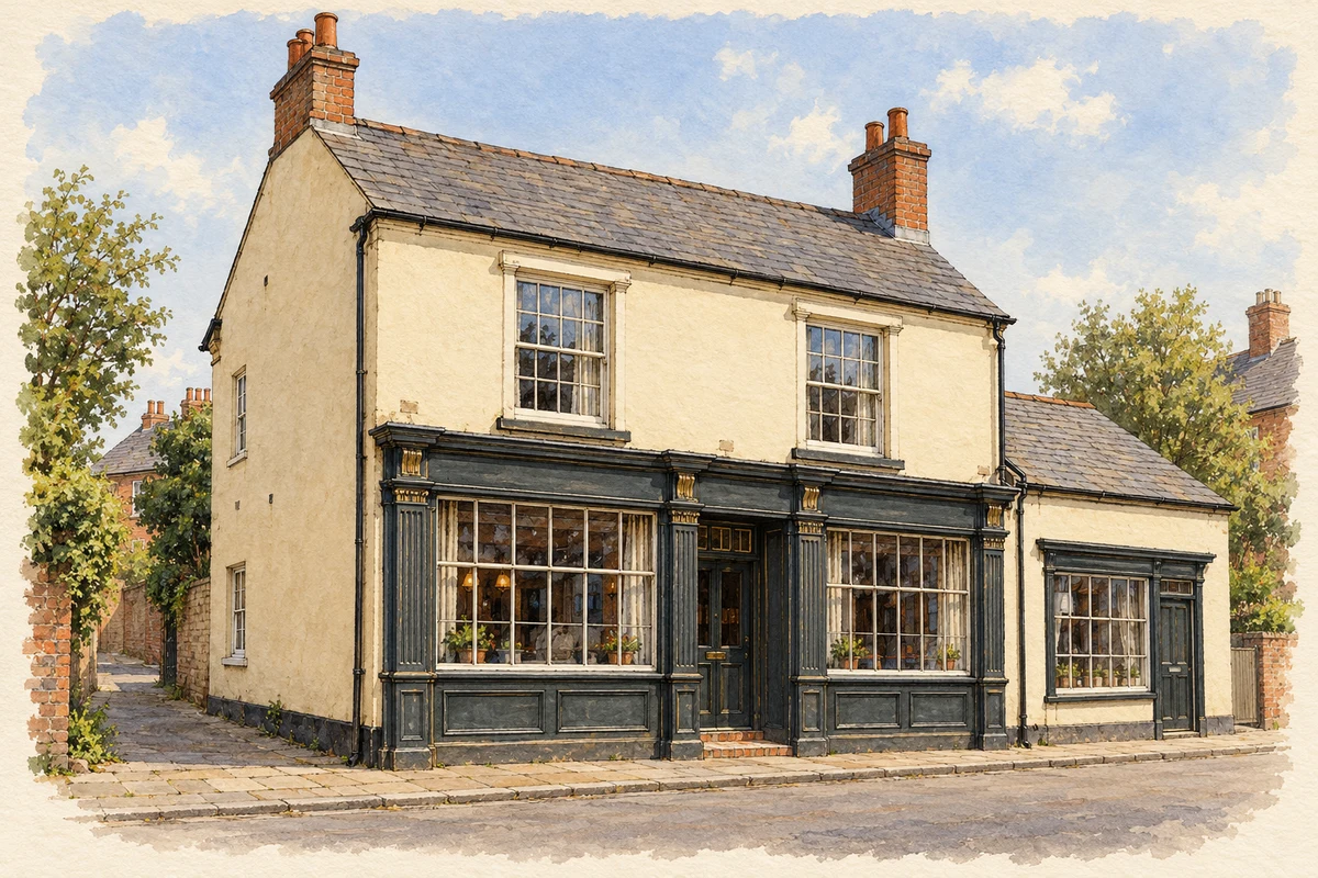
Watercolour and fine ink illustration of The Fountain Inn, Tipton
Illustration · The Fountain Inn, Tipton
Original illustration; researched sources
Research sources

Original architectural composition based on the cited building descriptions; incidental setting and fine details are interpretive.

Historic England: Fountain Inn; Sandwell Factory Locks conservation appraisal

History & heritage

Place & story

Pumping water to reach coal

Tipton's industrial story begins with the difficulty of keeping mines dry. The first successful Newcomen engine worked at Coneygree Coalworks in 1712; engineering historians have examined documentary evidence for this location near Tipton and Dudley. The Black Country Living Museum explains the engine's practical importance as a means of pumping water from increasingly deep mines. Its full-size replica is a reconstruction, since the original engine does not survive. [6] [7]

A town organised around waterways

Before the eighteenth-century transformation, Tipton consisted of small hamlets. Its canal network expanded to serve mines and factories, eventually extending for thirteen miles within the parish. The Factory Locks linked the older canal with Telford's New Line. Their name came from the neighbouring chemical works associated with James Keir, where alkali and soap were made. [3]

This industrial economy included engineering for customers far beyond Tipton. Horseley Ironworks built the iron steamship Aaron Manby in 1822. In the 1830s Joseph Hall developed an improved ironmaking process at Bloomfield. Such products connected local coal and ironworking to larger transport and manufacturing systems. [2]

Canal life required more than locks. The early-nineteenth-century Malthouse Stables accommodated canal horses, while a Boatmen's Mission built in 1892 provided for boatmen's spiritual welfare. These survivals put animals, families and religious provision into the same landscape as the large industrial sites. [3]

Creating institutions for an industrial community

The Civic Society records a severe cholera epidemic in 1832. In 1855 Tipton established a Local Board of Health, replacing the older arrangement of overseers meeting in the church vestry. Its officers included a medical officer and an inspector of nuisances. Public administration was acquiring specific responsibilities for the conditions in which people lived. [2]

Education and recreation followed through several institutions. A school board was formed in 1871. Victoria Park opened in 1901 with a procession of civic dignitaries and local organisations; Carnegie-funded libraries opened in 1906 and 1907. These were resources for learning and shared leisure within a community whose identity is often reduced to its mines. [2]

The industrial map changes

The Tipton Green and Toll End Communication offered boats an alternative to the busy route through Ryders Green. Its abandonment in the 1960s illustrates how the network contracted. Other branches served a power station and brickworks: canals were a web of specific working connections, rather than a single through-route. [4]

The council's conservation study traces this change on maps. By 1967, the Tipton Green Locks arm and several industrial basins had been filled. Coronation Gardens occupied land formerly used by a wharf, basin and commercial buildings. Former transport land could become public space, while the surviving canals acquired new roles for wildlife, walking and cycling. [3]

Back to contents
Lives connected to this place

Notable people

William Perry: the canal worker remembered as a boxer

William Perry, the Tipton Slasher, was born in Tipton and worked on local canals as a boy before becoming a bare-knuckle fighter. Sandwell's assessment of his memorial identifies him as Champion of England from 1850 to 1857. His connection with the Fountain Inn and the Bill Haynes statue erected in Coronation Gardens in 1993 make this a locally grounded sporting story, with canal work behind the celebrity. [5]

Back to contents
A chronology

Timeline

Tipton through time

  1. 1712 — The successful Newcomen pumping engine works at Coneygree Coalworks. [6]

  2. 1822 — Horseley Ironworks builds the iron steamship Aaron Manby. [3]

  3. 1855 — A Local Board of Health is established. [2]

  4. 1871 — Tipton's school board is formed. [2]

  5. 1892 — The Boatmen's Mission is built. [3]

  6. 1901 — Victoria Park opens. [2]

  7. 1906–07 — Carnegie funding provides two libraries. [2]

  8. 1960s — The Tipton Green and Toll End Communication is abandoned. [4]

  9. 1993 — The William Perry statue is erected in Coronation Gardens. [5]

Back to contents

Population over time

Built-up area · Settlement · Census 2021

Tipton

47,200people · 2021

Census 2021 population of the named settlement, using ONS built-up area boundaries.

Published census counts.

Sources: ONS: Towns and cities, characteristics of built-up areas, Census 2021 (Table 1c)

View population figures
Tipton — census population
Census yearPopulation
202147,200
Sources and how to read this chart

Usual residents on 21 March 2021; published ONS count rounded to the nearest 5.. Boundary geography: December 2022 (E63002812).

Census 2021 population of the named settlement, using ONS built-up area boundaries.

ONS Table 1c rounds counts to the nearest 5 and suppresses counts below 10. Matched by exact settlement name or individually reviewed district-qualified name, with its coordinate strictly inside that same official BUA boundary. The 2022 BUA geography changed methodology and cannot be directly compared with 2011 BUAs. Contains OS data © Crown copyright and database right 2026. Contains National Statistics data © Crown copyright and database right 2026.

Source: ONS: Towns and cities, characteristics of built-up areas, Census 2021 (Table 1c). Open Government Licence v3.0. Retrieved 2026-10-26. Source: ONS and Ordnance Survey: Built Up Areas December 2022 GB BGG. Open Government Licence v3.0. Retrieved 2026-10-26.

Neighbourhood census context

These figures describe statistical neighbourhoods, which may cover part of a place or include neighbouring places.

Neighbourhood census area · 1971–2021

Sandwell 009

Population of the area containing the recorded point for Tipton, not the whole place. This area may cover part of the place or include neighbours.

01.8k3.5k5.3k7k1971: 6,028 people19711981: 5,722 people19811991: 5,535 people19912001: 5,677 people20012011: 5,534 people20112021: 6,169 people2021

Includes harmonised historical census estimates.

Sources: ONS · Paul Norman

View population figures
Sandwell 009 — census population and harmonised historical estimates
Census yearPopulation
19716,028
19815,722
19915,535
20015,677
20115,534
20216,169
Sources and how to read this chart

Usual residents of the containing MSOA; this is local area context, not the population of the named settlement.. Boundary geography: 1 April 2022 (E02002051).

2011 and 2021 census counts harmonised by ONS to the same 1 April 2022 geography. Location matched to ONS 2021 MSOA polygons (full resolution, coastline clipped, V7). ONS exact-fit lookup marks this MSOA unchanged from 2011 (U); historical estimates use that same footprint.

1971–2011: Paul Norman harmonised historical estimates on 2011 MSOAs, rounded to whole residents (1971–1991 are modelled). 2021: ONS census count. The historical 2011 total can differ slightly from the ONS change-over-time 2011 total because of methodology and statistical disclosure controls. These are area estimates, not settlement totals.

Source: ONS Census change over time: usual resident population, 2011 and 2021. Open Government Licence v3.0. Retrieved 2026-10-26. Source: ONS MSOA December 2021 boundaries EW BFC V7. Open Government Licence v3.0. Retrieved 2026-10-26. Source: Paul Norman — Area characteristics: Great Britain 1971 to 2011. Creative Commons Attribution 4.0. Retrieved 2026-10-26. Source: ONS MSOA 2011 to MSOA 2021 exact-fit lookup for England and Wales. Open Government Licence v3.0. Retrieved 2026-10-26.

Recorded locationTipton52.54124° N · 2.03975° WInteractive map loads when this area enters view.
Approximate recorded location · Geographic source

Geographic context

Place type
Town
Country / region
England · West Midlands
County group
West Midlands
Current administration
Sandwell
Recorded coordinates
52.54124, -2.03975
OS Open Names ID
osgb4000000074566413

County groups are browsing aids. Current administrative and historic areas are recorded separately.

Recorded names

  • Tipton · en · official

Nearby heritage

Distances are from the recorded place point. Proximity does not establish that a site lies within the place boundary or belongs to its history.

Sources & further reading

  1. OS Open Names October 2026 · Source licence.
  2. History of Tipton · Tipton Civic Society
  3. Factory Locks Conservation Area: Appraisal and Boundary Review (2008) · Sandwell Historic Environment Team / Birmingham Archaeology Heritage Services
  4. History of the Walsall Canal · Canal & River Trust
  5. William Perry statue: local heritage assessment SD012 · Sandwell Council
  6. Location of the 1712 Newcomen Engine at Coneygree · J H Andrew and J S Allen, engineering history research
  7. Start in 1712 trail · Black Country Living Museum
  8. Original illustration of The Fountain Inn, Tipton by PlaceHistory. Researched sources are linked beneath the illustration. Original composition from inspected architectural facts; no source photograph copied or used as an image-edit input. Fine detail is interpretive, not a measured survey.

Geographic source retrieved 2026-10-26. History last researched 2026-10-27. How this page was prepared.